Chance of coastal snow looks near nil, but a nasty Nor'Easter next weekend?

Edit thread title from "Snow int. NE, then Plains, with TC in Gulf?" to Snow int. NE, then Plains, not a TC in Gulf?
Moderator: S2k Moderators
 The posts in this forum are NOT official forecast and should not be used as such. They are just the opinion of the poster and may or may not be backed by sound meteorological data. They are NOT endorsed by any professional institution or STORM2K.


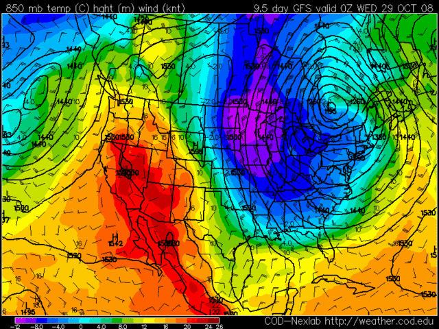
MED RANGE MODELS AGREE THAT POTENT MID LEVEL SHORTWAVE WILL AMPLIFY
AND EVOLVE INTO CLOSED LOW AS IT MOVES INTO NEW ENG TUE/TUE NIGHT
ALTHOUGH CONFIDENCE IN THE DETAILS IS LOW. ECMWF/UKMET SHOW MORE
AMPLIFICATION AND COASTAL LOW DEVELOPING JUST OFF THE COAST WHICH
WOULD BRING HEAVIER PRECIP TO EASTERN NEW ENG TUE NIGHT POSSIBLY
LINGERING INTO WED. GFS IS FURTHER NORTH WITH SFC LOW AND INDICATES
A BRIEF PERIOD OF SHOWERS WITH THE FRONT ON TUE. DUE TO UNCERTAINTY
WE JUST HAVE CHC POPS FOR TUE AND SLIGHT CHC TUE NIGHT INTO WED.
PARTIAL THICKNESSES INDICATE SNOW SHOWERS POSSIBLE IN THE INTERIOR
TUE NIGHT IF THERE IS PRECIP.


FOR TEMPS...DESPITE THE WIDE DISPARITY EARLY THIS MORNING...TEMPS
SHOULD STRATIFY RATHER QUICKLY BY MID MORNING...AS SW WINDS DEVELOP
AHEAD OF APPROACHING FRONT...ENHANCING MIXING AND DOWNSLOPING ACROSS
THE MID HUDSON VALLEY REGION. THUS...EXPECT MAXES TO RANGE FROM
55-60 ACROSS THE MID HUDSON VALLEY...WITH LOWER 50S FURTHER N WITHIN
THE HUDSON VALLEY AND PORTIONS OF THE MOHAWK VALLEY...INCLUDING THE
CAPITAL REGION. FURTHER N/W...WHERE CLOUDS AND LIGHT RAIN WILL BE
MOST PERSISTENT...EXPECT TEMPS TO BE MUCH COOLER...MAINLY HOLDING
BETWEEN 45-50. TEMPS SHOULD THEN START TO FALL OFF LATER
THIS AFTERNOON ONCE COLD AIR ADVECTION INTENSIFIES...
ESP ACROSS THE WESTERN ADIRONDACKS...WHERE TEMPS SHOULD FALL
INTO THE MID/UPPER 30S BY OR JUST AFTER SUNSET.
IN THESE AREAS...PARTICULARLY HIGHER
ELEVATIONS ABOVE 1800 FT...SOME WET SNOW MAY MIX IN AFTER
SUNSET...WITH PERHAPS A COATING POSSIBLE ON COLDER SURFACES.
&&
.SHORT TERM /6 PM THIS EVENING THROUGH WEDNESDAY NIGHT/...
TONIGHT...MID/UPPER LEVEL CLOSED LOW PASSES ACROSS THE SOUTHERN
PORTION OF REGION BEFORE MIDNIGHT. THIS PLACES AT LEAST THE NORTHERN
HALF OF THE REGION WITHIN DEFORMATION AREA. THUS...A PERIOD OF
STEADIER PRECIPITATION IS EXPECTED...WITH HIGHEST LIKELIHOOD FOR
AREAS N OF THE MOHAWK RIVER...AND ESP INTO SOUTHERN VT. AS COLDER
AIR SEEPS SE...EXPECT WET SNOW TO MIX IN ACROSS HIGHER
ELEVATIONS...WITH A CHANGE OVER TO ALL SNOW EXPECTED TOWARD OR JUST
AFTER MIDNIGHT FOR ELEVATIONS ABOVE 1500 FT. THIS COULD LEAD TO THE
FIRST ACCUMULATING SNOW OF THE SEASON FOR THE HIGHER TERRAIN WITHIN
THE DACKS...SUCH AS NORTHERN HERKIMER AND HAMILTON COS...AS WELL AS
IN EASTERN BENNINGTON CO AND WESTERN WINDHAM CO IN SOUTHERN VT. IN
THESE REGIONS...ACCUMS OF 1-3 INCHES ARE POSSIBLE IN THE HIGHER
TERRAIN... WITH LOCALLY HIGHER
AMOUNTS POSSIBLE FOR ELEVATIONS ABOVE 2000 FT
IN SOUTHERN VT. FOR VALLEY AREAS...MOSTLY LIGHT RAIN IS
EXPECTED...BUT SOME WET SNOW COULD EVEN MIX IN HERE TOWARD
DAYBREAK...ESP N OF THE MOHAWK RIVER. LITTLE OR NO ACCUM IS
EXPECTED...HOWEVER

THE ECMWF AND GFS SEEM IN GENERAL AGREEMENT WITH THIS ORDER OF
EVENTS WITH THE GLOBAL SIMILAR BUT A TAD FASTER. WE WILL STAY
CLOSER TO THE GFS-ECMWF CONSENSUS. THIS BRINGS INCREASING CLOUDS
DURING SATURDAY WITH PRECIP FOR SATURDAY NIGHT AND SUNDAY. TIMING
ON FROPA CURRENTLY LOOKS LIKE SUNDAY AFTERNOON...BUT THIS IS FIVE
DAYS IN THE FUTURE SO LOOK FOR THE TIMING TO SHIFT AROUND THE NEXT
FEW DAYS. SOUTH FLOW AHEAD OF THE COLD FRONT HAS PRECIPITABLE WATER
VALUES AROUND 1.5 INCHES. MAYBE NOT A TORRENTIAL RAIN...BUT HAS THE
POTENTIAL TO BE A SOAKER.
ALSO OF CONCERN WILL BE THE WINDS. THE GFS FORECASTS A 75 KNOT WIND
AT 950 MB...AND TWO RUNS OF THE EC HAVE HAD 65 KNOTS AT 925 MB. A
LOW LEVEL JET AT THIS STRENGTH POINTS TO A POTENTIAL WIND ADVISORY
OVER THE CAPE/ISLANDS AND PERHAPS INTO PARTS OF THE COASTAL PLAIN.
Current Weather Conditions:
GREATER BUFFALO INTERNATIONAL AIRPORT , NY, United States
(KBUF) 42-56N 078-44W 225M
--------------------------------------------------------------------------------
Conditions at Oct 21, 2008 - 09:54 PM EDTOct 21, 2008 - 08:54 PM CDTOct 21, 2008 - 07:54 PM MDTOct 21, 2008 - 06:54 PM PDTOct 21, 2008 - 05:54 PM ADTOct 21, 2008 - 04:54 PM HDT
2008.10.22 0154 UTC
Wind from the NW (320 degrees) at 8 MPH (7 KT)
Visibility 4 mile(s)
Sky conditions overcast
Weather Light snow
Mist
Precipitation last hour 0.02 inches
Temperature 34.0 F (1.1 C)
Windchill 26 F (-3 C)
Dew Point 32.0 F (0.0 C)
Relative Humidity 92%
Pressure (altimeter) 30.24 in. Hg (1024 hPa)
ob KBUF 220154Z 32007KT 4SM -SN BR BKN004 OVC009 01/00 A3024 RMK AO2 SLP247 P0002 T00110000
--------------------------------------------------------------------------------
Ed Mahmoud wrote: Posted: Tue Oct 21, 2008 4:44 pm Snow next Monday night into Northern suburbs NYC????
Users browsing this forum: No registered users and 150 guests