2009/2010 Snow Coverage Graphics
Moderator: S2k Moderators
Forum rules
 The posts in this forum are NOT official forecast and should not be used as such. They are just the opinion of the poster and may or may not be backed by sound meteorological data. They are NOT endorsed by any professional institution or STORM2K.

The posts in this forum are NOT official forecast and should not be used as such. They are just the opinion of the poster and may or may not be backed by sound meteorological data. They are NOT endorsed by any professional institution or STORM2K.
-
vbhoutex

- Storm2k Executive

- Posts: 28972
- Age: 72
- Joined: Wed Oct 09, 2002 11:31 pm
- Location: Spring Branch area, Houston, TX
- Contact:
2009/2010 Snow Coverage Graphics
http://espcgis.nesdis.noaa.gov/website/ssdsnow/viewer.htm is the link to the current interactive snow coverage graphics. If someone has some others please feel free to post also. Let's keep it in one thread please.
0 likes
Skywarn, C.E.R.T.
Please click below to donate to STORM2K to help with the expenses of keeping the site going:

Please click below to donate to STORM2K to help with the expenses of keeping the site going:

Re: 2009/2010 Snow Coverage graphics.
vbhoutex wrote:http://espcgis.nesdis.noaa.gov/website/ssdsnow/viewer.htm is the link to the current interactive snow coverage graphics. If someone has some others please feel free to post also. Let's keep it in one thread please.
The cold front that is coming this weekend actually looks like it's traveling down the narrow snow patch there is.
0 likes
-
Stormsfury

- Category 5

- Posts: 10549
- Age: 51
- Joined: Wed Feb 05, 2003 6:27 pm
- Location: Summerville, SC
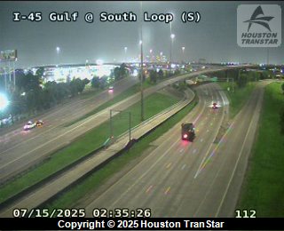
It's amazing to see live webcams of Houston Metro and snow covered ground with the palm trees ... nice touch...
Congratulations on the early season snow, and for the 2nd year in the row ... Houston sees snow before areas in more typical snow climbs again lol.
Guess Frick and Fracks' snow thread just took a little time to work it's mojo.
MIght be time sensitive but something else... A shot from South Loop
Congratulations on the early season snow, and for the 2nd year in the row ... Houston sees snow before areas in more typical snow climbs again lol.
Guess Frick and Fracks' snow thread just took a little time to work it's mojo.
MIght be time sensitive but something else... A shot from South Loop
0 likes
-
WeatherLovingDoc

- S2K Supporter

- Posts: 453
- Joined: Fri Sep 05, 2008 10:08 pm
- Location: Washington D.C.
Re: 2009/2010 Snow Coverage graphics.
vbhoutex wrote:http://espcgis.nesdis.noaa.gov/website/ssdsnow/viewer.htm is the link to the current interactive snow coverage graphics. If someone has some others please feel free to post also. Let's keep it in one thread please.
That's a great link/find! Thanks vbhoutex.
It looks like the Washington DC metro area snow is creeping down from the northeast.
0 likes

Re: 2009/2010 Snow Coverage graphics.
The northern tier and central plains are starting to get a nice snow cover. After this storm midweek, arctic air coming down after that should be fun to watch 
0 likes
The above post and any post by Ntxw is NOT an official forecast and should not be used as such. It is just the opinion of the poster and may or may not be backed by sound meteorological data. It is NOT endorsed by any professional institution including Storm2k. For official information, please refer to NWS products.
Help support Storm2K!
Re: 2009/2010 Snow Coverage graphics.
Just wondering, does anyone know any place we can compare sea ice (winter coverage) throughout the years including current vs last year and so on etc?
0 likes
The above post and any post by Ntxw is NOT an official forecast and should not be used as such. It is just the opinion of the poster and may or may not be backed by sound meteorological data. It is NOT endorsed by any professional institution including Storm2k. For official information, please refer to NWS products.
Help support Storm2K!
Help support Storm2K!


Re: 2009/2010 Snow Coverage graphics.
Try this one: http://igloo.atmos.uiuc.edu/cgi-bin/tes ... 01&sy=2009
0 likes
-
amawea

- S2K Supporter
- Posts: 385
- Age: 72
- Joined: Mon Aug 09, 2004 3:36 pm
- Location: Horseshoe Bend, Ar. but from Baytown, Tx
Re: 2009/2010 Snow Coverage graphics.
Sambucol wrote:Try this one: http://igloo.atmos.uiuc.edu/cgi-bin/tes ... 01&sy=2009
Good one Sambucol. Man! There is a big loss of sea ice compared to a year ago. I'm not a global warming believer and just think these weather patterns we are going through are just long term pattern changes but that sure is different from last year.
BTW, I did a September 1st,2009 compare to September first 2010.
0 likes
-
Tstormwatcher

- S2K Supporter
- Posts: 3086
- Joined: Thu Oct 20, 2005 7:31 pm
- Location: New Bern, NC

Who is online
Users browsing this forum: No registered users and 92 guests