NE Winter Storm / Blizzard
Moderator: S2k Moderators
Forum rules
 The posts in this forum are NOT official forecast and should not be used as such. They are just the opinion of the poster and may or may not be backed by sound meteorological data. They are NOT endorsed by any professional institution or STORM2K.

The posts in this forum are NOT official forecast and should not be used as such. They are just the opinion of the poster and may or may not be backed by sound meteorological data. They are NOT endorsed by any professional institution or STORM2K.
-
cycloneye

- Admin

- Posts: 139080
- Age: 67
- Joined: Thu Oct 10, 2002 10:54 am
- Location: San Juan, Puerto Rico
Re: NE Winter Storm / Blizzard
Here is the special thread only dedicated to the NE Winter Storm / Blizzard so peeps continue to post away. 
0 likes
Visit the Caribbean-Central America Weather Thread where you can find at first post web cams,radars
and observations from Caribbean basin members Click Here
and observations from Caribbean basin members Click Here
-
cycloneye
- Admin
- Posts: 139080
- Age: 67
- Joined: Thu Oct 10, 2002 10:54 am
- Location: San Juan, Puerto Rico
Re: NE Winter Storm / Blizzard
The Boston NWS update says things are evolving as they forecasted.
1 PM UPDATE...
NOT MANY CHANGES TO THE PREVIOUS DISCUSSION.
TRENDS REMAIN ON TRACK. HEAVIER SNOW BANDS BEGINNING TO PUSH INTO
SOUTHERN NEW ENGLAND AS THE NORTHERN-STREAM DISTURBANCE ACROSS THE
UPPER GREAT LAKES IS WEAKENING AS IT PHASES INTO THE SOUTHERN-
STREAM DISTURBANCE. ANTICIPATING BOMBOGENESIS TOWARDS THE 40N/70W
BENCHMARK INTO THE EVENING PERIOD AND ON INTO SATURDAY. WINDS TO
INCREASE ACROSS ALL OF SOUTHERN NEW ENGLAND. SNOWFALL RATES TO
INCREASE AND VISIBILITIES TO DROP TO A QUARTER MILE OR LESS. THE
ONSET OF WHITE-OUT CONDITIONS IS ANTICIPATED OVER THE NEXT HOUR OR
TWO AS THE STORM BEGINS TO TAKE SHAPE.
REPORTS ARE GREATLY APPRECIATED. FOLLOW US ON TWITTER...OR FRIEND
US ON FACEBOOK. PICTURES GREATLY WELCOMED. YOU CAN ALSO SUBMIT A
STORM REPORT VIA OUT WEBPAGE AT ERH.NOAA.GOV/BOX.
HEADLINES /HIGH CONFIDENCE/...
* A POTENTIAL HISTORIC WINTER STORM/BLIZZARD WILL IMPACT SOUTHERN
NEW ENGLAND INTO SATURDAY.
* THIS STORM WILL POSE SIGNIFICANT HAZARDS AND THREATS TO BOTH
LIFE AND PROPERTY!
* BLIZZARD WARNINGS IN EFFECT FOR ALL OF CT...RI...E/SE MA...AND
SE NH. WINTER STORM WARNINGS FOR ALL OTHER LOCALES.
* FOR THOSE AREAS WITHIN THE BLIZZARD WARNING...HIGH WIND WARNING
CRITERIA IS INCLUSIVE. HIGH WINDS SHOULD BE ANTICIPATED WITH GUSTS
OF AROUND 60 MPH.
* STORM SNOWFALL TOTALS BY STORMS END MAY BE IN THE ALL-TIME TOP
10 FOR VARIOUS CITIES...UP TO AROUND 2 FEET POSSIBLE. BLOWING
AND DRIFTING ANTICIPATING RESULTING IN HIGHER DRIFTS.
* TRAVEL CONDITIONS WILL DETERIORATE QUICKLY THROUGH TO...BECOMING
NEARLY IMPOSSIBLE BY THIS EVENINGS COMMUTE INTO SATURDAY.
*/MODEL CONSENSUS...
AM GOING TO STICK WITH THE LATEST ECMWF. THE NAM HAS WOBBLED THE
LAST COUPLE OF RUNS...AND IN FACT...0Z AND 6Z RUNS DID NOT
INITIALIZE WELL WITH ITS RESPECTIVE 6-HR FCST IN THE PLACEMENT OF
SFC AND H5 FEATURES. HPC HAS INCORPORATED SREF MEANS ALONG WITH
ECMWF ENSEMBLE MEANS...AND WILL LEAN WITH SUCH TRENDS ACCORDINGLY.
0 likes
Visit the Caribbean-Central America Weather Thread where you can find at first post web cams,radars
and observations from Caribbean basin members Click Here
and observations from Caribbean basin members Click Here

-
Caribwxgirl
- S2K Supporter

- Posts: 287
- Joined: Mon Aug 15, 2011 7:25 pm
- Location: Budapest, Hungary (from Kingston, Jamaica)
Thanks Cycloneye.
0 likes
Personal Forecast Disclaimer:
The posts in this forum are NOT official forecast. They are just the opinion of the poster and may or may not be backed by sound meteorological data. They are NOT endorsed by any professional institutions or storm2k.org. For official information refer to the NHC and NWS products.
The posts in this forum are NOT official forecast. They are just the opinion of the poster and may or may not be backed by sound meteorological data. They are NOT endorsed by any professional institutions or storm2k.org. For official information refer to the NHC and NWS products.
-
cycloneye
- Admin
- Posts: 139080
- Age: 67
- Joined: Thu Oct 10, 2002 10:54 am
- Location: San Juan, Puerto Rico
Re:
Caribwxgirl wrote:Thanks Cycloneye.
Ok my friend. If you look at the Time Square cams,sleet to snow is falling at 2:15 PM EST so the changover to all snow is getting closer to occur.
0 likes
Visit the Caribbean-Central America Weather Thread where you can find at first post web cams,radars
and observations from Caribbean basin members Click Here
and observations from Caribbean basin members Click Here
-
cycloneye
- Admin
- Posts: 139080
- Age: 67
- Joined: Thu Oct 10, 2002 10:54 am
- Location: San Juan, Puerto Rico
Re: NE Winter Storm / Blizzard
This is in Harlem,NYC.

0 likes
Visit the Caribbean-Central America Weather Thread where you can find at first post web cams,radars
and observations from Caribbean basin members Click Here
and observations from Caribbean basin members Click Here


-
cycloneye
- Admin
- Posts: 139080
- Age: 67
- Joined: Thu Oct 10, 2002 10:54 am
- Location: San Juan, Puerto Rico
Re: NE Winter Storm / Blizzard
AccuWeather.com@breakingweather
Snow so far: 3.8" in Darien, CT; 3.3" in Milford, CT; 2.8" Bridgeport, CT; 3.0" North Caldwell, NJ; 2.3 Bronx, NY.
Snow so far: 3.8" in Darien, CT; 3.3" in Milford, CT; 2.8" Bridgeport, CT; 3.0" North Caldwell, NJ; 2.3 Bronx, NY.
0 likes
Visit the Caribbean-Central America Weather Thread where you can find at first post web cams,radars
and observations from Caribbean basin members Click Here
and observations from Caribbean basin members Click Here
-
cycloneye
- Admin
- Posts: 139080
- Age: 67
- Joined: Thu Oct 10, 2002 10:54 am
- Location: San Juan, Puerto Rico
Re: NE Winter Storm / Blizzard
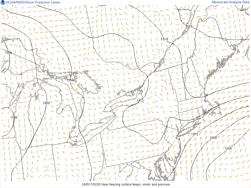
Pressure keeps going down.
0 likes
Visit the Caribbean-Central America Weather Thread where you can find at first post web cams,radars
and observations from Caribbean basin members Click Here
and observations from Caribbean basin members Click Here
-
vbhoutex

- Storm2k Executive
- Posts: 28974
- Age: 72
- Joined: Wed Oct 09, 2002 11:31 pm
- Location: Spring Branch area, Houston, TX
- Contact:
Re: NE Winter Storm / Blizzard
With the change over already occurring/having occurred and the pressure continuing to drop, I would think this will drive the snow totals way up. I haven't looked detailed enough to say that is a definite yes, but it sure looks likely to me.
0 likes
Skywarn, C.E.R.T.
Please click below to donate to STORM2K to help with the expenses of keeping the site going:

Please click below to donate to STORM2K to help with the expenses of keeping the site going:

Re: NE Winter Storm / Blizzard
Here are some before photos I just took from Hayward Landing in Douglas, MA. I will follow up with afterphotos tomorrow.


0 likes
-
Hybridstorm_November2001

- S2K Supporter
- Posts: 2802
- Joined: Sat Aug 21, 2004 2:50 pm
- Location: SW New Brunswick, Canada
- Contact:
Re: NE Winter Storm / Blizzard
I'll be tracking the storm all weekend via my weather blog -
http://hybridstorm-weatherblog.blogspot.ca
I however refuse to label it 'Nemo' lol.
http://hybridstorm-weatherblog.blogspot.ca
I however refuse to label it 'Nemo' lol.
0 likes
-
cycloneye
- Admin
- Posts: 139080
- Age: 67
- Joined: Thu Oct 10, 2002 10:54 am
- Location: San Juan, Puerto Rico
Re: NE Winter Storm / Blizzard
Good site to follow the updated snowfall totals.
http://www.erh.noaa.gov/hydromet/hydrom ... nteron=BOX
http://www.erh.noaa.gov/hydromet/hydrom ... nteron=BOX
0 likes
Visit the Caribbean-Central America Weather Thread where you can find at first post web cams,radars
and observations from Caribbean basin members Click Here
and observations from Caribbean basin members Click Here

Re: New England Winter 2012-2013-Web Cams from different areas
cycloneye wrote:Umm,that rain line has moved more north than expected?
http://images.intellicast.com/WxImages/ ... e_anim.gif
Hey Luis, can you go to the Interactive Weather Map on Intellicast and zoom in on an area of NYC or around there and take a screenshot then post it here? I'm asking because I can't actually view it and I'm curious to see how it is as none of my browsers are allowed to view it (Website stingy). I'm going to upgrade one to view it in the coming days but I won't be able to for this blizzard. Do it whenever tonight during the changeover and heavy snow in New England. Have it on the radar filter with some opacity. Thanks a lot if you can do this!!
0 likes
-
cycloneye
- Admin
- Posts: 139080
- Age: 67
- Joined: Thu Oct 10, 2002 10:54 am
- Location: San Juan, Puerto Rico
Re: New England Winter 2012-2013-Web Cams from different areas
Cyclenall wrote:cycloneye wrote:Umm,that rain line has moved more north than expected?
http://images.intellicast.com/WxImages/ ... e_anim.gif
Hey Luis, can you go to the Interactive Weather Map on Intellicast and zoom in on an area of NYC or around there and take a screenshot then post it here? I'm asking because I can't actually view it and I'm curious to see how it is as none of my browsers are allowed to view it (Website stingy). I'm going to upgrade one to view it in the coming days but I won't be able to for this blizzard. Do it whenever tonight during the changeover and heavy snow in New England. Have it on the radar filter with some opacity. Thanks a lot if you can do this!!
This is what you are looking for?
http://www.intellicast.com/Local/WxMap. ... 9999999999
0 likes
Visit the Caribbean-Central America Weather Thread where you can find at first post web cams,radars
and observations from Caribbean basin members Click Here
and observations from Caribbean basin members Click Here

Just about everyone from NYC north/northeastward has all gone over to heavy snow. Visibilities quarter mile or less

0 likes
The above post and any post by Ntxw is NOT an official forecast and should not be used as such. It is just the opinion of the poster and may or may not be backed by sound meteorological data. It is NOT endorsed by any professional institution including Storm2k. For official information, please refer to NWS products.
Help support Storm2K!
-
cycloneye
- Admin
- Posts: 139080
- Age: 67
- Joined: Thu Oct 10, 2002 10:54 am
- Location: San Juan, Puerto Rico
Re: NE Winter Storm / Blizzard
Latest Mesoscale discussion from SPC:
MESOSCALE DISCUSSION 0124
NWS STORM PREDICTION CENTER NORMAN OK
0351 PM CST FRI FEB 08 2013
AREAS AFFECTED...SRN NEW ENGLAND...LONG ISLAND AND SRN NY...FAR NERN
NJ
CONCERNING...HEAVY SNOW
VALID 082151Z - 090145Z
SUMMARY...SNOWFALL RATES ARE EXPECTED TO INCREASE MARKEDLY THIS
EVENING ...WITH RATES OF 1-2 INCHES PER HR OVER SRN NY/NERN NJ...TO
2-3 INCHES ACROSS SRN NEW ENGLAND. ADDITIONALLY...STRENGTHENING
WINDS MAY RESULT IN LOCALIZED BLIZZARD CONDITIONS...ESPECIALLY NEAR
THE COAST.
DISCUSSION...SFC OBS FROM 21Z CONTINUE TO REFLECT A RAPIDLY
DEEPENING OFFSHORE CYCLONE...WITH PRESSURE FALLS OF 3-4 MB/HR
OBSERVED. RADAR REFLECTIVITY MOSAIC SHOWS HIGHER PRECIPITATION RATES
ARE BEGINNING TO SPREAD INLAND ACROSS LONG ISLAND AND TOWARDS RI/SRN
MA/SRN CT. HOWEVER...SOME BRIGHT-BAND ENHANCEMENT MAY BE OCCURRING
AS MIXED P-TYPE OF RAIN AND/OR SNOW IS PREDOMINANT ACROSS LONG
ISLAND...WHERE SFC TEMPERATURES ARE CURRENTLY RANGING FROM 33-35 F.
INITIALLY...NEAR- OR ABOVE-FREEZING TEMPERATURES MAY SUPPRESS RATES
IMMEDIATELY ALONG THE COAST...BUT WITH LOW-LEVEL COLD ADVECTION
INCREASING AS THE CYCLONE TRACKS N-NE...A CHANGEOVER TO
PREDOMINANTLY SNOW IS EXPECTED WITHIN THE NEXT 2-3 HRS ACROSS MOST
OF THE HIGHLIGHTED AREA.
SNOWFALL RATES WILL BE INCREASING IN CONCERT WITH INTENSE ISENTROPIC
LIFT AND LOW-LEVEL FRONTOGENESIS WITHIN A DEFORMATION ZONE.
ADDITIONALLY...AN UPSTREAM SHORTWAVE UPPER TROUGH /LOCATED OVER THE
UPPER OH VALLEY PER 2130Z WATER VAPOR IMAGERY/ IS FORECAST TO PHASE
WITH THE OFFSHORE DEEP-LAYER CYCLONE. AS THIS OCCURS...THE
COMBINATION OF STRONG MIDLEVEL HEIGHT FALLS AND UPPER DIVERGENCE
WITHIN A COUPLED UPPER JET STRUCTURE WILL CONTRIBUTE TO INCREASING
DEEP-LAYER ASCENT. FORECAST MODEL SOUNDINGS SHOW A NEARLY SATURATED
COLUMN WITH A DEEP ISOTHERMAL LAYER LOCATED BENEATH THE DENDRITIC
GROWTH ZONE. THESE FACTORS WILL BE FAVORABLE FOR EXTREMELY HIGH
SNOWFALL RATES...ESPECIALLY FROM ERN LONG ISLAND INTO SRN NEW
ENGLAND...INCLUDING THE BOSTON METRO AREA...AS SUPPORTED BY THE
RECENT SUITE OF HIGH-RESOLUTION NUMERICAL GUIDANCE.
..ROGERS.. 02/08/2013
ATTN...WFO...GYX...BOX...OKX...ALY...PHI...
LAT...LON 41487041 41157173 40917237 40527347 40487426 40887445
41967427 42867373 43097258 43197147 43017087 42627073
42117042 41487041
0 likes
Visit the Caribbean-Central America Weather Thread where you can find at first post web cams,radars
and observations from Caribbean basin members Click Here
and observations from Caribbean basin members Click Here

Looks like NBC sides with King Euro. Don't let the GFS guys see this. 
http://video.today.msnbc.msn.com/today/ ... /#50742243
Maybe the media attention from Sandy and this will maybe pressure congress into upgrading the GFS.
http://video.today.msnbc.msn.com/today/ ... /#50742243
Maybe the media attention from Sandy and this will maybe pressure congress into upgrading the GFS.
0 likes
-
WacoWx
- Category 2

- Posts: 565
- Joined: Mon Dec 28, 2009 4:14 pm
- Location: NOT Waco, TX ----> Dallas, TX
Re: NE Winter Storm / Blizzard
Islip on LI is just getting hammered right now
http://www.intellicast.org/Local/WxMap. ... 9999999999
http://www.intellicast.org/Local/WxMap. ... 9999999999
0 likes
-
WacoWx
- Category 2
- Posts: 565
- Joined: Mon Dec 28, 2009 4:14 pm
- Location: NOT Waco, TX ----> Dallas, TX
Re: NE Winter Storm / Blizzard
anyone know of a good nemo blog that has locals involved, and not all Texas folk?
0 likes
Who is online
Users browsing this forum: No registered users and 221 guests