The posts in this forum are NOT official forecast and should not be used as such. They are just the opinion of the poster and may or may not be backed by sound meteorological data. They are NOT endorsed by any professional institution or

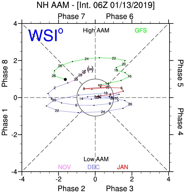
Ntxw wrote:Don't panic y'all there is plenty of cold for everybody. I like the ensembles look. Generally speaking everyone along and east of the Rockies should get cold and maybe storms. The ENS keeps the height rises off the west coast which is good for Texas as well as some -NAO.
My concern going forward is suppression more than not cold enough.
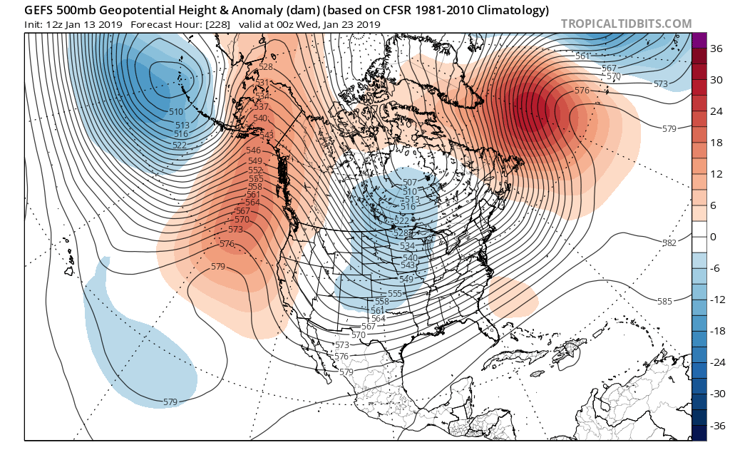
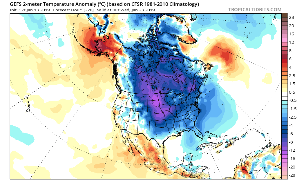
Agreed, this is Big League Cold that can overwhelm the continent....plenty of analogs proving that point (77/78 Jan/Feb keep on popping up)!! No reason to panic, the latest FV3 illustrates this...there's a 1060MB plus HP building behind this cold. In fact the 6Z would be record breaking for a lot of the country (including Texas) if it came to pass!!