Texas Summer 2017

U.S. & Caribbean Weather Discussions and Severe Weather Events

Moderator: S2k Moderators

Forum rules

The posts in this forum are NOT official forecast and should not be used as such. They are just the opinion of the poster and may or may not be backed by sound meteorological data. They are NOT endorsed by any professional institution or STORM2K.

Help Support Storm2K
Message
Author
Cpv17
Category 5
Category 5
Posts: 4313
Joined: Wed Dec 07, 2016 2:24 pm
Location: Wharton/El Campo, TX

Re: Texas Summer 2017

#1301 Postby Cpv17 » Fri Aug 18, 2017 11:40 pm

Brent wrote:
Cpv17 wrote:
Brent wrote:
It's still in the Gulf at the end of the run but its definitely on the northerly route and probably close to a cane

What did it show in its last run?


far weaker and much further south

Well that's an interesting trend then, no doubt.
0 likes   

User avatar
South Texas Storms
Professional-Met
Professional-Met
Posts: 4005
Joined: Thu Jun 24, 2010 12:28 am
Location: Houston, TX

Re: Texas Summer 2017

#1302 Postby South Texas Storms » Sat Aug 19, 2017 12:01 am

Can we please take the 0z GFS run to the bank? Shows widespread 2-4 inches of rain across much of the state, with parts of south central Texas seeing up to 6 inches of rainfall as Harvey tracks up the Rio Grande.
1 likes   

Cpv17
Category 5
Category 5
Posts: 4313
Joined: Wed Dec 07, 2016 2:24 pm
Location: Wharton/El Campo, TX

Re: Texas Summer 2017

#1303 Postby Cpv17 » Sat Aug 19, 2017 12:05 am

South Texas Storms wrote:Can we please take the 0z GFS run to the bank? Shows widespread 2-4 inches of rain across much of the state, with parts of south central Texas seeing up to 6 inches of rainfall as Harvey tracks up the Rio Grande.

Yeah, but I bet money it would be stronger than 1001 mb. GFS has done a terrible job with the strength of storms this year. The upgrade made it worse.
2 likes   

User avatar
Portastorm
Storm2k Moderator
Storm2k Moderator
Posts: 9787
Age: 61
Joined: Fri Jul 11, 2003 9:16 am
Location: South Austin, TX
Contact:

Re: Texas Summer 2017

#1304 Postby Portastorm » Sat Aug 19, 2017 7:38 am

:uarrow:

We'll see. As for now it looks like Harvey is a disheveled mess. He may have even lost his circulation at this point. But I suspect he may regain it IF he slows down in the WCARIB.

I'm more intrigued by the Euro's depiction of an actual front getting close to Central Texas by the middle of next week. Perhaps this "rain" thing that you North Texans keep crowing about it will reach us in the desert southlands. One can hope.
2 likes   
Any forecasts under my name are to be taken with a grain of salt. Get your best forecasts from the National Weather Service and National Hurricane Center.

I'm a certified Advanced SKYWARN-trained spotter and am active on Twitter at @TravisCOSW, a social media partner of the NWS Austin-San Antonio office.

weatherdude1108
Category 5
Category 5
Posts: 4172
Joined: Tue Dec 13, 2011 1:04 pm
Location: Northwest Austin/Cedar Park, TX

Re: Texas Summer 2017

#1305 Postby weatherdude1108 » Sat Aug 19, 2017 8:00 am

A little more encouraging post.


000
FXUS64 KEWX 190844
AFDEWX

Area Forecast Discussion
National Weather Service Austin/San Antonio TX
344 AM CDT Sat Aug 19 2017

.SHORT TERM (Today through Sunday)...
Continued influences of a stubborn hot air mass continue today and
tomorrow. Highs again right around 100 degrees for much of the I-35
corridor with heat indices ranging from 101-108.
The higher end of
these values will be seen again in the southeast zones. Surface winds
are expected to remain southerly and southeasterly today as a surface
high is located over the Louisiana coast.

Over the last couple days, isolated showers and storms have developed
despite all clear indications from CAMs and other short range models.
Again this morning the hi-res suite shows the area shower-less,
however GFS and ECWMF deterministic produce isolated showers again to
the northwest. Looking at forecast soundings across the area, parcels
will be struggling against a pretty dry column and an unfavorable
wind profile above 600 mb. As a result, still feel that a dry
forecast is the right call, but did include 10 PoPs along the
southeast and northwest zones for the afternoon.

&&

.LONG TERM (Sunday Night through Friday)...
A pattern change looks to be on the horizon beginning mid week as a
TUTT low traverses the Gulf of Mexico, moving west.
This will bring
at first, welcome relief of 2-3 degrees in Max T, then an uptick in
PoP chances as the low pushes west of the CWA. This pattern has been
pretty consistently advertised now in mid range models.

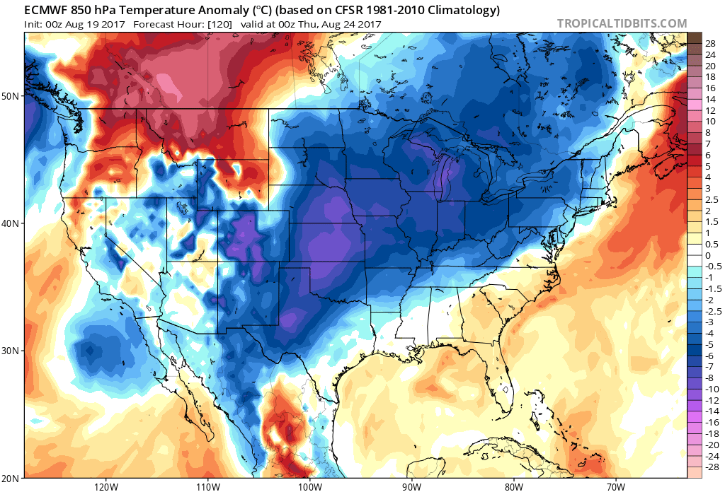
The more notable feature comes late week as a frontal passage is
progged to push south and into Texas Wednesday night through Friday.

At the moment, the 00Z GFS deterministic solution is significantly
more dry than its ECMWF counterpart. With the ridge centered over
northern Mexico, whatever convection occurs with the frontal passage
should be able to push far enough south to bring showers at least to
the northern zones late Wednesday night into Thursday morning. The
question will be how far south? The GFS solution stalls the front
along our northeast border with HGX/FWD but with 850 mb flow parallel
to the boundary, could result in some locally heavy rainfall.
Additionally, the nose of the 850 mb LLJ would intrude nicely into a
2+" PWAT environment along the stalled boundary...so if this solution
comes to fruition, could result in some meaningful rain for the
northern I-35 corridor, perhaps extending as far south as Williamson
County.


Come Friday, GFS/ECMWF/Canadian all develop some sort of tropical
disturbance off the Yucatan and pushes it quickly north along the
Mexican coastline, coming on shore just south of Brownsville. If so,
this would put the southern half of the state under a very rich
moisture regime for next weekend, possibly leading to more heavy
rainfall chances
. More to come on this with more model evolution.
1 likes   
The preceding post is NOT an official forecast, and should not be used as such. It is only the opinion of the poster and may or may not be backed by sound meteorological data. It is NOT endorsed by any professional institution including storm2k.org. For Official Information please refer to the NHC and NWS products.

User avatar
bubba hotep
S2K Supporter
S2K Supporter
Posts: 5456
Joined: Wed Dec 28, 2016 1:00 am
Location: Collin County Texas

Re: Texas Summer 2017

#1306 Postby bubba hotep » Sat Aug 19, 2017 8:03 am

Even the Euro solution would be acceptable, gets a huge slug of tropical moisture associated with Harvey up into most of Texas with widespread rainfall.
1 likes   
Winter time post are almost exclusively focused on the DFW area.

Ntxw
Storm2k Moderator
Storm2k Moderator
Posts: 21500
Joined: Wed Oct 21, 2009 6:34 pm
Location: DFW, Texas

Re: Texas Summer 2017

#1307 Postby Ntxw » Sat Aug 19, 2017 9:50 am

Portastorm wrote::uarrow:

We'll see. As for now it looks like Harvey is a disheveled mess. He may have even lost his circulation at this point. But I suspect he may regain it IF he slows down in the WCARIB.

I'm more intrigued by the Euro's depiction of an actual front getting close to Central Texas by the middle of next week. Perhaps this "rain" thing that you North Texans keep crowing about it will reach us in the desert southlands. One can hope.


It's going to run out of water before it gets its act together. Belize landfall looks likely as a TD or weak TS. It has more terrain to navigate hitting that far south. My eyes are more towards the front and trof than Harvey.

Image
2 likes   
The above post and any post by Ntxw is NOT an official forecast and should not be used as such. It is just the opinion of the poster and may or may not be backed by sound meteorological data. It is NOT endorsed by any professional institution including Storm2k. For official information, please refer to NWS products.

  Help support Storm2K!
Help Support Storm2K

User avatar
Texas Snowman
Storm2k Moderator
Storm2k Moderator
Posts: 6011
Joined: Fri Jan 25, 2008 11:29 am
Location: Denison, Texas

Re: Texas Summer 2017

#1308 Postby Texas Snowman » Sat Aug 19, 2017 11:44 am

So with Harvey threatening to fizzle, the Lone Star State weather question might be what happens first?

Does Texas get a major hurricane on the Gulf Coast?

Or

Does it snow in Austin?

EDIT: I certainly don't want a big hurricane to menance the coast, just noting that it's been a while.

My money is on Portastorm getting to play in the snow with Champ the Charger. Maybe even this winter.
2 likes   
The above post and any post by Texas Snowman is NOT an official forecast and should not be used as such. It is just the opinion of the poster and may or may not be backed by sound meteorological data. It is NOT endorsed by any professional institution including storm2k.org. For official information, please refer to NWS products.

User avatar
hriverajr
Professional-Met
Professional-Met
Posts: 786
Joined: Tue Jul 19, 2005 12:16 am

Re: Texas Summer 2017

#1309 Postby hriverajr » Sat Aug 19, 2017 11:53 am

Been a long time for both...
1 likes   

Brent
S2K Supporter
S2K Supporter
Posts: 37089
Age: 35
Joined: Sun May 16, 2004 10:30 pm
Location: Tulsa Oklahoma
Contact:

Re: Texas Summer 2017

#1310 Postby Brent » Sat Aug 19, 2017 12:40 pm

That's a tough decision :lol:
0 likes   
#neversummer

TexasBreeze
Tropical Depression
Tropical Depression
Posts: 79
Joined: Mon Jul 07, 2014 12:50 pm

Re: Texas Summer 2017

#1311 Postby TexasBreeze » Sat Aug 19, 2017 12:48 pm

Not so sure about getting Harvey effects, but the GFS is at least showing runs with more moisture around the state than it has been showing lately!
1 likes   

Ntxw
Storm2k Moderator
Storm2k Moderator
Posts: 21500
Joined: Wed Oct 21, 2009 6:34 pm
Location: DFW, Texas

Re: Texas Summer 2017

#1312 Postby Ntxw » Sat Aug 19, 2017 1:04 pm

GFS is definitely a good run. Good thing is with climo perhaps this is the stepping down process. Has mostly low 90s/80s mid to long range for highs which is more in tune with the change of seasons.

Image
3 likes   
The above post and any post by Ntxw is NOT an official forecast and should not be used as such. It is just the opinion of the poster and may or may not be backed by sound meteorological data. It is NOT endorsed by any professional institution including Storm2k. For official information, please refer to NWS products.


  Help support Storm2K!

Help Support Storm2K


User avatar
Portastorm
Storm2k Moderator
Storm2k Moderator
Posts: 9787
Age: 61
Joined: Fri Jul 11, 2003 9:16 am
Location: South Austin, TX
Contact:

Re: Texas Summer 2017

#1313 Postby Portastorm » Sat Aug 19, 2017 2:17 pm

Remember when we used to have legitimate tropical systems/threats in the western Gulf?

Yeah ... me too. :roll:
3 likes   
Any forecasts under my name are to be taken with a grain of salt. Get your best forecasts from the National Weather Service and National Hurricane Center.

I'm a certified Advanced SKYWARN-trained spotter and am active on Twitter at @TravisCOSW, a social media partner of the NWS Austin-San Antonio office.

User avatar
Rgv20
S2K Supporter
S2K Supporter
Posts: 2456
Age: 37
Joined: Wed Jan 05, 2011 5:42 pm
Location: Edinburg/McAllen Tx

Re: Texas Summer 2017

#1314 Postby Rgv20 » Sat Aug 19, 2017 2:43 pm

Let see how much rain we can squeeze out of Harvey by the end of next week. My thinking is that it will probably make a second landfall just north of Tampico.
Last edited by Rgv20 on Sat Aug 19, 2017 3:15 pm, edited 2 times in total.
0 likes   
The following post is NOT an official forecast and should not be used as such. It is just the opinion of the poster and may or may not be backed by sound meteorological data. It is NOT endorsed by any professional institution including storm2k.org For Official Information please refer to the NHC and NWS products.

User avatar
Tireman4
S2K Supporter
S2K Supporter
Posts: 5674
Age: 58
Joined: Fri Jun 30, 2006 1:08 pm
Location: Humble, Texas
Contact:

Re: Texas Summer 2017

#1315 Postby Tireman4 » Sat Aug 19, 2017 2:46 pm

Portastorm wrote:Remember when we used to have legitimate tropical systems/threats in the western Gulf?

Yeah ... me too. :roll:


That was the Elders said at Council last night
1 likes   

weatherdude1108
Category 5
Category 5
Posts: 4172
Joined: Tue Dec 13, 2011 1:04 pm
Location: Northwest Austin/Cedar Park, TX

Re: Texas Summer 2017

#1316 Postby weatherdude1108 » Sat Aug 19, 2017 3:06 pm

Ntxw wrote:GFS is definitely a good run. Good thing is with climo perhaps this is the stepping down process. Has mostly low 90s/80s mid to long range for highs which is more in tune with the change of seasons.

Image

:uarrow:
I'm LOVING that map! :D
1 likes   
The preceding post is NOT an official forecast, and should not be used as such. It is only the opinion of the poster and may or may not be backed by sound meteorological data. It is NOT endorsed by any professional institution including storm2k.org. For Official Information please refer to the NHC and NWS products.

Brent
S2K Supporter
S2K Supporter
Posts: 37089
Age: 35
Joined: Sun May 16, 2004 10:30 pm
Location: Tulsa Oklahoma
Contact:

Re: Texas Summer 2017

#1317 Postby Brent » Sat Aug 19, 2017 3:07 pm

Just hoping this modeled front and rain holds up because I have zero confidence in Harvey being a story for most of us
2 likes   
#neversummer

Cpv17
Category 5
Category 5
Posts: 4313
Joined: Wed Dec 07, 2016 2:24 pm
Location: Wharton/El Campo, TX

Re: Texas Summer 2017

#1318 Postby Cpv17 » Sat Aug 19, 2017 3:56 pm

The tropics just aren't what they used to be for the past several years now. Nothing but one boring season after another. Oh well, at least rain chances are looking good the next couple weeks.
2 likes   

Ntxw
Storm2k Moderator
Storm2k Moderator
Posts: 21500
Joined: Wed Oct 21, 2009 6:34 pm
Location: DFW, Texas

Re: Texas Summer 2017

#1319 Postby Ntxw » Sat Aug 19, 2017 4:13 pm

DFW airport hit 100 again today (10th time).

KAUS, like a broken record, tacked on another 100 degree day for millionth time...
0 likes   
The above post and any post by Ntxw is NOT an official forecast and should not be used as such. It is just the opinion of the poster and may or may not be backed by sound meteorological data. It is NOT endorsed by any professional institution including Storm2k. For official information, please refer to NWS products.


  Help support Storm2K!

Help Support Storm2K


aggiecutter
Category 5
Category 5
Posts: 1743
Joined: Thu Oct 14, 2004 9:22 pm
Location: Texarkana

Re: Texas Summer 2017

#1320 Postby aggiecutter » Sat Aug 19, 2017 6:44 pm

Image
3 likes   


Return to “USA & Caribbean Weather”

Who is online

Users browsing this forum: cycloneye and 63 guests