
A slightly slower frontal/dryline passage or slightly earlier intiation could certainly make a big difference for severe t'storm coverage in DFW today.
But that being said, I think the current SPC outlook covers the potential quite well since models have a tendency to be a bit too gung ho with firing off convection in these conditional setups. I'd definitely be keeping my eye to the sky (and I'd have my cars in the garage) if I were in Forney or Rockwall though.
Texas Spring 2024
Moderator: S2k Moderators
Forum rules

The posts in this forum are NOT official forecast and should not be used as such. They are just the opinion of the poster and may or may not be backed by sound meteorological data. They are NOT endorsed by any professional institution or STORM2K.
Re: Texas Spring 2024
1 likes
Re: Texas Spring 2024
snownado wrote:A slightly slower frontal/dryline passage or slightly earlier intiation could certainly make a big difference for severe t'storm coverage in DFW today.
But that being said, I think the current SPC outlook covers the potential quite well since models have a tendency to be a bit too gung ho with firing off convection in these conditional setups. I'd definitely be keeping my eye to the sky (and I'd have my cars in the garage) if I were in Forney or Rockwall though.
Tomorrow looks even worse for you guys up there.
0 likes
Re: Texas Spring 2024
Cpv17 wrote:snownado wrote:A slightly slower frontal/dryline passage or slightly earlier intiation could certainly make a big difference for severe t'storm coverage in DFW today.
But that being said, I think the current SPC outlook covers the potential quite well since models have a tendency to be a bit too gung ho with firing off convection in these conditional setups. I'd definitely be keeping my eye to the sky (and I'd have my cars in the garage) if I were in Forney or Rockwall though.
Tomorrow looks even worse for you guys up there.
I haven't even been paying attention to Thursday.
It will be also dependent on what happens today of course. If today overachieves, that would likely place the effective front further SE.
0 likes
-
cheezyWXguy

- Category 5

- Posts: 5556
- Joined: Mon Feb 13, 2006 12:29 am
- Location: Dallas, TX
Re: Texas Spring 2024
snownado wrote:Cpv17 wrote:snownado wrote:A slightly slower frontal/dryline passage or slightly earlier intiation could certainly make a big difference for severe t'storm coverage in DFW today.
But that being said, I think the current SPC outlook covers the potential quite well since models have a tendency to be a bit too gung ho with firing off convection in these conditional setups. I'd definitely be keeping my eye to the sky (and I'd have my cars in the garage) if I were in Forney or Rockwall though.
Tomorrow looks even worse for you guys up there.
I haven't even been paying attention to Thursday.
It will be also dependent on what happens today of course. If today overachieves, that would likely place the effective front further SE.
Agreed in concept but there is some potential for the southern half of dfw to be under risk both days. The HRRR has been one of the more aggressive models on today’s coverage and still shows cells firing tomorrow across the area. I will say that if coverage is notably higher today than what it is depicting we would probably luck out tomorrow
0 likes
-
rwfromkansas
- Category 5
- Posts: 2223
- Joined: Sat Aug 27, 2005 12:47 am
- Location: North Fort Worth
Re: Texas Spring 2024
There's a slight chance of maybe something in DFW today, but I'm more concerned about tomorrow, especially for me in Tarrant. I am too west for today likely.
0 likes
-
rwfromkansas
- Category 5
- Posts: 2223
- Joined: Sat Aug 27, 2005 12:47 am
- Location: North Fort Worth
Re: Texas Spring 2024
The latest HRRR is dropping the storm over DFW and only shows far NE TX.
0 likes
Re: Texas Spring 2024
rwfromkansas wrote:The latest HRRR is dropping the storm over DFW and only shows far NE TX.
Come again?
0 likes
-
rwfromkansas
- Category 5
- Posts: 2223
- Joined: Sat Aug 27, 2005 12:47 am
- Location: North Fort Worth
Re: Texas Spring 2024
It was further west earlier (NAM shows a lot still over DFW): https://www.pivotalweather.com/model.ph ... &dpdt=&mc=
1 likes
-
bubba hotep

- S2K Supporter

- Posts: 5527
- Joined: Wed Dec 28, 2016 1:00 am
- Location: Collin County Texas
Re: Texas Spring 2024
SPC update for tomorrow, primarily driven by wind and hail threat

1 likes
Winter time post are almost exclusively focused on the DFW area.
-
rwfromkansas
- Category 5
- Posts: 2223
- Joined: Sat Aug 27, 2005 12:47 am
- Location: North Fort Worth
Re: Texas Spring 2024
Wow, that goes pretty far south. I hate hail during the day since my car isn't at the garage.
0 likes
Re: Texas Spring 2024
It is disgustingly humid/hazy outside today in Longview. 83F/76F and 79% humidity at 1 pm.
2 likes
Re: Texas Spring 2024
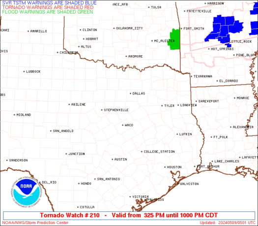
Tornado Watch incoming for parts of North and NE Texas...
https://www.spc.noaa.gov/products/md/md0701.html
https://www.spc.noaa.gov/products/md/md0701.html
0 likes
-
Brent
- S2K Supporter
- Posts: 37124
- Age: 35
- Joined: Sun May 16, 2004 10:30 pm
- Location: Tulsa Oklahoma
- Contact:
Re: Texas Spring 2024
First day it's felt like summer and I'm already over it. This humidity feels like the beach without the beach 
1 likes
#neversummer
-
WacoWx
- Category 2

- Posts: 587
- Joined: Mon Dec 28, 2009 4:14 pm
- Location: NOT Waco, TX ----> Dallas, TX
Re: Texas Spring 2024
Tornado watch issued for OK/AR.
Cell popping sw of DFW. Nothing significant, though...yet.
Cell popping sw of DFW. Nothing significant, though...yet.
1 likes
Re: Texas Spring 2024
18z HRRR smashes the DFW area tomorrow afternoon and portions of central/eastern Texas later on. This afternoon could be interesting for central/NE TX.
1 likes
-
rwfromkansas
- Category 5
- Posts: 2223
- Joined: Sat Aug 27, 2005 12:47 am
- Location: North Fort Worth
Re: Texas Spring 2024
Geez, 95 IMBY with a 68 dewpoint so the dryline is definitely still west of me even here in western Tarrant. So, there's a chance this could go further west still. Yikes if so.
Where can one see the "convective temperature" where the cap would break easily?
Where can one see the "convective temperature" where the cap would break easily?
0 likes
-
Edwards Limestone

- S2K Supporter
- Posts: 373
- Age: 35
- Joined: Tue Dec 28, 2021 11:05 am
- Location: Smithson Valley, TX
Re: Texas Spring 2024
CAPE pushing 5500+ over Bell County 
0 likes
The above post is NOT an official forecast and should not be used as such. It is just the opinion of the poster and may or may not be backed by sound meteorological data. It is NOT endorsed by any professional institution including Storm2k. For official information, please refer to NWS products.
-
rwfromkansas
- Category 5
- Posts: 2223
- Joined: Sat Aug 27, 2005 12:47 am
- Location: North Fort Worth
Re: Texas Spring 2024
Both the NAM and HRRR do look nasty tomorrow for DFW east. NAM has a ridiculously massive supercell in the middle of the day.
1 likes
Re: Texas Spring 2024
2 likes