Page 3 of 6
Re: Severe weather Jan 20-23,2017
Posted: Sun Jan 22, 2017 9:26 am
by EF-5bigj
Several tornado watches already issued.
Re: Severe weather Jan 20-23,2017
Posted: Sun Jan 22, 2017 9:28 am
by northjaxpro
New Tornado Warning for Camden County as radar is indicating possible tornado near the Okefenokee Swamp area.
Also, line of severe thunderstorms now about the cross the I-95 corridor, and will be moving through Brunswick (Glynn County)and the Sapelo Sound region of SE GA during the next 15 minutes.
Re: Severe weather Jan 20-23,2017
Posted: Sun Jan 22, 2017 9:31 am
by Hypercane_Kyle
Unreal, the first high risk of the year and it's almost right on top of my head.
Re: Severe weather Jan 20-23,2017
Posted: Sun Jan 22, 2017 9:38 am
by Bunkertor
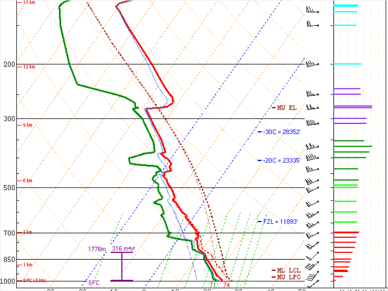
Sounding 12z TLH shows a nose in 10 km.
Re: Severe weather Jan 20-23,2017
Posted: Sun Jan 22, 2017 9:40 am
by northjaxpro

Be safe and stay on the alert today. I have lived here in this area all my life and other than the March 1993 Superstorm event, I can not ever recall such a deadly tornado outbreak occuring across this region of South Georgia and North Florida.
This type of dynamic set-up is definitely more like what you would see in the Central and Southern Plains. This is an extremely rare type of tornado event here in this area of the country. The tornadoes that are occuring are not just quick touchdowns. These are large EF3 type of grade tornadoes which have stayed on the ground apparently for minutes. There is discussion that the deadly tornado that occured in Brooks County Ga was actually tracked on the ground from Moultre to Adel GA northeast to Nashville, GA. Fascinating.
Re: Severe weather Jan 20-23,2017
Posted: Sun Jan 22, 2017 9:51 am
by Bunkertor
northjaxpro wrote::uarrow: Be safe and stay on the alert today. I have lived here in this area all my life and other than the March 1993 Superstorm event, I can not ever recall such a deadly tornado outbreak occuring across this region of South Georgia and North Florida.
This type of dynamic set-up is definitely more lie what you would see in the Plains. This is an extremely rare type of tornado event here in this area of the country. The tirnadies that are occuring are not just quick touchdowns. These are large EF3 type of grade tornadoes which have stayed on the ground apparently for minutes. There is discussion that the deadly tornado that occured in Brooks County Ga was actually tracked on the ground from Moultre to Adel GA northeast to Nashville, GA. Fascinating.
Parcels, that move in the area, will go up like a rocket.
Btw. tor:con is around 6. I reckon an upgrade here as well
Tallahassee
Re: Severe weather Jan 20-23,2017
Posted: Sun Jan 22, 2017 9:58 am
by EF-5bigj
Wow cells will explode with that kind of atmosphere

Re: Severe weather Jan 20-23,2017
Posted: Sun Jan 22, 2017 10:02 am
by northjaxpro
EF-5bigj wrote:Wow cells will explode with that kind of atmosphere
You are not kidding. That graph analysis is frightening.
BTW, looks like the worst of the weather will move into Northeast Florida this evening from 5 p.m. - 10 p.m.
Re: Severe weather Jan 20-23,2017
Posted: Sun Jan 22, 2017 10:09 am
by Hypercane_Kyle
A lot of sunshine here where I live in the Bay Area right now.
Re: Severe weather Jan 20-23,2017
Posted: Sun Jan 22, 2017 10:16 am
by northjaxpro
This is another unfortunate element because this record heat and sunshine is just going to add more fuel to the fire. It is just going to make this atmosphere even more dangerous for severe wx and large tornadoes!! Folks, this is really very dangerous situation which is going.to last well into the evening hours!!
Re: Severe weather Jan 20-23,2017
Posted: Sun Jan 22, 2017 10:24 am
by Bunkertor
northjaxpro wrote::uarrow: This is another unfortunate element because this record heat and sunshine is just going to add more fuel to the fire. It is just going to make this atmosphere even more dangerous for severe wx and large tornadoes!! Folks, this is really very dangerous situation which is going.to last well into the evening hours!!
What you think, is time for the second wave to fire ?
Re: Severe weather Jan 20-23,2017
Posted: Sun Jan 22, 2017 10:25 am
by EF-5bigj
I warned my brother about the second wave later today which are likely to produce violent tornadoes.
Re: Severe weather Jan 20-23,2017
Posted: Sun Jan 22, 2017 10:31 am
by northjaxpro
The damage reports in Adel, GA are some homes have been flattened and people trapped in rubble. Prayers to everyone there.
The death toll unfortunately may increase from the 11 total currently received.

Re: Severe weather Jan 20-23,2017
Posted: Sun Jan 22, 2017 10:37 am
by northjaxpro
Bunkertor wrote:northjaxpro wrote::uarrow: This is another unfortunate element because this record heat and sunshine is just going to add more fuel to the fire. It is just going to make this atmosphere even more dangerous for severe wx and large tornadoes!! Folks, this is really very dangerous situation which is going.to last well into the evening hours!!
What you think, is time for the second wave to fire ?
There is an strong upper level Low which is currently moving out of Northeast TX. As that ULL moves east, look for a potential squall line to develop across the region, likely timeframe from 3:00 p.m. - 9 p.m. tonight during the peak time. The areas across South Alabama, Central and South Georgia, and all of North Florida need to be on seious alert now later today and tonight. I would also include areas down into Central Florida later tonight.
Re: Severe weather Jan 20-23,2017
Posted: Sun Jan 22, 2017 10:40 am
by EF-5bigj
I'm looking at pictures from Abel,GA
just destruction all over it clearly was a violent tornado
Re: Severe weather Jan 20-23,2017
Posted: Sun Jan 22, 2017 10:44 am
by northjaxpro
EF-5bigj wrote:I'm looking at pictures from Abel,GA
just destruction all over it clearly was a violent tornado
Yes. I just saw those pictures that were sent by a viewer in that area on WJXT-TV 4 . Just utter devastation. My God...
Re: Severe weather Jan 20-23,2017
Posted: Sun Jan 22, 2017 10:48 am
by EF-5bigj
More bad news Torcon now a 9
Re: Severe weather Jan 20-23,2017
Posted: Sun Jan 22, 2017 10:49 am
by Bunkertor
northjaxpro wrote:Bunkertor wrote:northjaxpro wrote::uarrow: This is another unfortunate element because this record heat and sunshine is just going to add more fuel to the fire. It is just going to make this atmosphere even more dangerous for severe wx and large tornadoes!! Folks, this is really very dangerous situation which is going.to last well into the evening hours!!
What you think, is time for the second wave to fire ?
There is an strong upper level Low which is currently moving out of Northeast TX. As that ULL moves east, look for a potential squall line to develop across the region, likely timeframe from 3:00 p.m. - 9 p.m. tonight during the peak time. The areas across South Alabama, Central and South Georgia, and all of North Florida need to be on seious alert now later today and tonight. I would also include areas down into Central Florida later tonight.
Let´s see then. 3 pm would be early enough

Re: Severe weather Jan 20-23,2017
Posted: Sun Jan 22, 2017 10:54 am
by northjaxpro
Yes. Just be on heighened alert everyone. Storms can develop very quickly in this set-up and often without warnings. A very good day to have a weather radio with you for sure!!
Re: Severe weather Jan 20-23,2017
Posted: Sun Jan 22, 2017 10:56 am
by EF-5bigj
I sadly think we will see more pictures of destruction today
