


Moderator: S2k Moderators


cheezyWXguy wrote:Is anyone going to talk about severe potential for Saturday? Seems like up until this morning it would be a marginal event at worst, and now portions of ntx are in an enhanced risk in the d3 outlook. FWD’s discussion this morning mentioned the potential for rotating storms ahead of the front in the early evening, and the afternoon discussion suggests discrete supercells are possible along and ahead of the front


What is our window for severe storms for DFW?bubba hotep wrote:cheezyWXguy wrote:Is anyone going to talk about severe potential for Saturday? Seems like up until this morning it would be a marginal event at worst, and now portions of ntx are in an enhanced risk in the d3 outlook. FWD’s discussion this morning mentioned the potential for rotating storms ahead of the front in the early evening, and the afternoon discussion suggests discrete supercells are possible along and ahead of the front
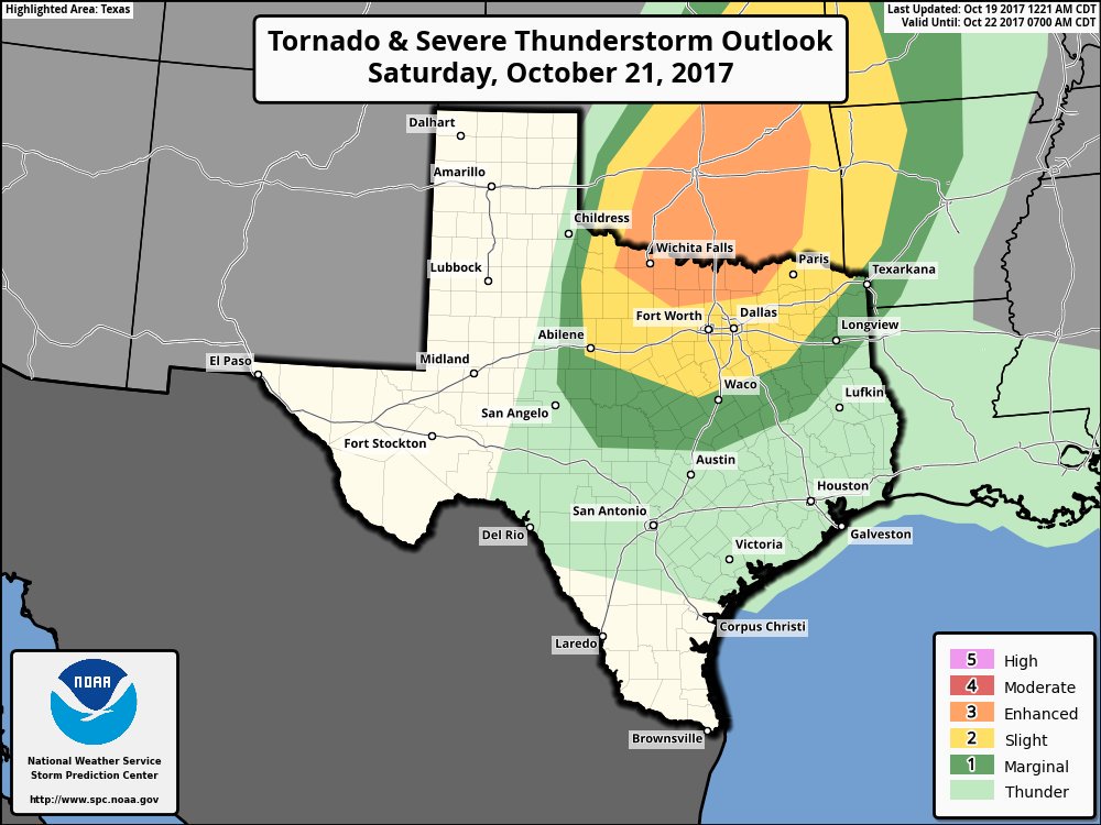
I've been keeping an eye on it but haven't really posted anything, it looks like there will be a window of time for some discrete cells before the main line of storms moves in later in the evening. I wouldn't be surprised to see SPC expand things southward a bit with the update this evening. Here is the current D3:
starsfan65 wrote:What is our window for severe storms for DFW?bubba hotep wrote:cheezyWXguy wrote:Is anyone going to talk about severe potential for Saturday? Seems like up until this morning it would be a marginal event at worst, and now portions of ntx are in an enhanced risk in the d3 outlook. FWD’s discussion this morning mentioned the potential for rotating storms ahead of the front in the early evening, and the afternoon discussion suggests discrete supercells are possible along and ahead of the front
I've been keeping an eye on it but haven't really posted anything, it looks like there will be a window of time for some discrete cells before the main line of storms moves in later in the evening. I wouldn't be surprised to see SPC expand things southward a bit with the update this evening. Here is the current D3:


bubba hotep wrote:12z GFS drops the hammer next Friday with temps falling into the 40s area wide by the afternoon!


bubba hotep wrote:12z GFS drops the hammer next Friday with temps falling into the 40s area wide by the afternoon!

