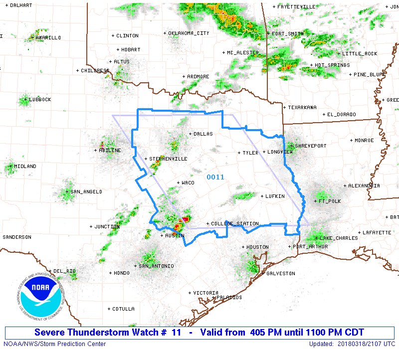
Pretty big watch covering much of Central & East Texas
URGENT - IMMEDIATE BROADCAST REQUESTED
Severe Thunderstorm Watch Number 11
NWS Storm Prediction Center Norman OK
405 PM CDT Sun Mar 18 2018
The NWS Storm Prediction Center has issued a
* Severe Thunderstorm Watch for portions of
North-central and East Texas
* Effective this Sunday afternoon and evening from 405 PM until
1100 PM CDT.
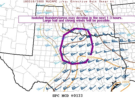
* Primary threats include...
Scattered large hail and isolated very large hail events to 3
inches in diameter possible
Isolated damaging wind gusts to 70 mph possible
A tornado or two possible
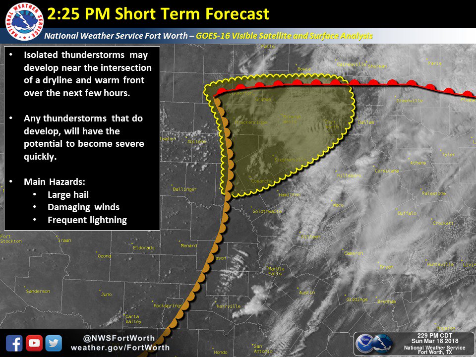
SUMMARY...At least isolated severe storms are expected to increase
initially across central Texas in the general vicinity of Interstate
35 this afternoon, and subsequently spread eastward toward East
Texas by evening. Large hail should be the most common hazard, but
locally damaging winds and/or a tornado cannot be ruled out,
particularly as low-level shear increases this evening.
The severe thunderstorm watch area is approximately along and 105
statute miles east and west of a line from 35 miles north of Fort
Worth TX to 25 miles southeast of Huntsville TX. For a complete
depiction of the watch see the associated watch outline update
(WOUS64 KWNS WOU1).
PRECAUTIONARY/PREPAREDNESS ACTIONS...
REMEMBER...A Severe Thunderstorm Watch means conditions are
favorable for severe thunderstorms in and close to the watch area.
Persons in these areas should be on the lookout for threatening
weather conditions and listen for later statements and possible
warnings. Severe thunderstorms can and occasionally do produce
tornadoes.
&&
AVIATION...A few severe thunderstorms with hail surface and aloft to
3 inches. Extreme turbulence and surface wind gusts to 60 knots. A
few cumulonimbi with maximum tops to 500. Mean storm motion vector
26025.
...Guyer