https://twitter.com/averytomascowx/status/1052208315214819329
Texas Fall 2018
Moderator: S2k Moderators
Forum rules

The posts in this forum are NOT official forecast and should not be used as such. They are just the opinion of the poster and may or may not be backed by sound meteorological data. They are NOT endorsed by any professional institution or STORM2K.
-
1900hurricane

- Category 5

- Posts: 6044
- Age: 32
- Joined: Fri Feb 06, 2015 12:04 pm
- Location: Houston, TX
- Contact:
Re: Texas Fall 2018
0 likes
Contract Meteorologist. TAMU & MSST. Fiercely authentic, one of a kind. We are all given free will, so choose a life meant to be lived. We are the Masters of our own Stories.
Opinions expressed are mine alone.
Follow me on Twitter at @1900hurricane : Read blogs at https://1900hurricane.wordpress.com/
Opinions expressed are mine alone.
Follow me on Twitter at @1900hurricane : Read blogs at https://1900hurricane.wordpress.com/
-
srainhoutx

- S2K Supporter

- Posts: 6919
- Age: 66
- Joined: Sun Jan 14, 2007 11:34 am
- Location: Haywood County, NC
- Contact:
Re: Texas Fall 2018
LCRA @LCRA · 24m24 minutes ago
LCRA is closing lakes Travis, Marble Falls, LBJ, Inks and Buchanan effective immediately, until further notice.
LCRA is closing lakes Travis, Marble Falls, LBJ, Inks and Buchanan effective immediately, until further notice.
0 likes
Carla/Alicia/Jerry(In The Eye)/Michelle/Charley/Ivan/Dennis/Katrina/Rita/Wilma/Ike/Harvey
Member: National Weather Association
Wx Infinity Forums
http://wxinfinity.com/index.php
Facebook.com/WeatherInfinity
Twitter @WeatherInfinity
Member: National Weather Association
Wx Infinity Forums
http://wxinfinity.com/index.php
Facebook.com/WeatherInfinity
Twitter @WeatherInfinity
-
Portastorm

- Storm2k Moderator

- Posts: 9787
- Age: 61
- Joined: Fri Jul 11, 2003 9:16 am
- Location: South Austin, TX
- Contact:
Re: Texas Fall 2018
Unfortunately some beautiful communities in the Hill Country are under the gun with major flooding ongoing in Llano, Kingsland, and Marble Falls. Y'all have the info about the FM 2900 bridge collapsing ... and folks that was a concrete bridge on concrete slats ... absolutely stunning!
Another round of heavy rain coming later this week ... a very dire situation for the Hill Country, I'm afraid.
Another round of heavy rain coming later this week ... a very dire situation for the Hill Country, I'm afraid.
2 likes
Any forecasts under my name are to be taken with a grain of salt. Get your best forecasts from the National Weather Service and National Hurricane Center.
I'm a certified Advanced SKYWARN-trained spotter and am active on Twitter at @TravisCOSW, a social media partner of the NWS Austin-San Antonio office.
I'm a certified Advanced SKYWARN-trained spotter and am active on Twitter at @TravisCOSW, a social media partner of the NWS Austin-San Antonio office.
-
weatherdude1108
- Category 5
- Posts: 4172
- Joined: Tue Dec 13, 2011 1:04 pm
- Location: Northwest Austin/Cedar Park, TX
Re: Texas Fall 2018
Portastorm wrote:Unfortunately some beautiful communities in the Hill Country are under the gun with major flooding ongoing in Llano, Kingsland, and Marble Falls. Y'all have the info about the FM 2900 bridge collapsing ... and folks that was a concrete bridge on concrete slats ... absolutely stunning!
Another round of heavy rain coming later this week ... a very dire situation for the Hill Country, I'm afraid.
Classic example of too much of a good thing.
0 likes
The preceding post is NOT an official forecast, and should not be used as such. It is only the opinion of the poster and may or may not be backed by sound meteorological data. It is NOT endorsed by any professional institution including storm2k.org. For Official Information please refer to the NHC and NWS products.
-
srainhoutx
- S2K Supporter
- Posts: 6919
- Age: 66
- Joined: Sun Jan 14, 2007 11:34 am
- Location: Haywood County, NC
- Contact:
Re: Texas Fall 2018
Concern growing for later in the work week when a surge of deep tropical moisture surges into the Southern/Central Texas Gulf Coast. Some of the models suggest a weak area of low pressure may develop and spread inland across S Central Texas Thursday into Friday. Very heavy rainfall and additional Flash Flooding remain a real possibility in areas already impacted.
4 likes
Carla/Alicia/Jerry(In The Eye)/Michelle/Charley/Ivan/Dennis/Katrina/Rita/Wilma/Ike/Harvey
Member: National Weather Association
Wx Infinity Forums
http://wxinfinity.com/index.php
Facebook.com/WeatherInfinity
Twitter @WeatherInfinity
Member: National Weather Association
Wx Infinity Forums
http://wxinfinity.com/index.php
Facebook.com/WeatherInfinity
Twitter @WeatherInfinity
-
Haris

- Category 5
- Posts: 1808
- Joined: Mon Nov 27, 2017 8:19 pm
- Location: ( Bee Cave) West Austin, Texas
Re: Texas Fall 2018

!!
0 likes
Weather geek and a storm spotter in West Austin. Not a degreed meteorologist. Big snow fan. Love rain and cold! Despise heat!


Re: Texas Fall 2018
Models are also starting to form a potent gulf low next week, with very heavy rain and gusty winds, the 0z Euro even produces tropical storm force wind gust in the Gulf and along the coast fwiw. And the GFS develops it into the first Nor'easter of the season down the road. But its just something to watch for now...
2 likes
-
weatherdude1108
- Category 5
- Posts: 4172
- Joined: Tue Dec 13, 2011 1:04 pm
- Location: Northwest Austin/Cedar Park, TX
Re: Texas Fall 2018
They're opening a floodgate on Mansfield Dam. Mansfield Dam Lake Travis is essentially saving downtown Austin from the flooding they're seeing up on LBJ.
0 likes
The preceding post is NOT an official forecast, and should not be used as such. It is only the opinion of the poster and may or may not be backed by sound meteorological data. It is NOT endorsed by any professional institution including storm2k.org. For Official Information please refer to the NHC and NWS products.
-
srainhoutx
- S2K Supporter
- Posts: 6919
- Age: 66
- Joined: Sun Jan 14, 2007 11:34 am
- Location: Haywood County, NC
- Contact:
Re: Texas Fall 2018
PUBLIC INFORMATION STATEMENT
NATIONAL WEATHER SERVICE AUSTIN/SAN ANTONIO TX
1059 AM CDT TUE OCT 16 2018
...PUBLIC INFORMATION STATEMENT...
THE FOLLOWING MESSAGE IS FROM THE CITY OF MARBLE FALLS... PLEASE
BE ADVISED THAT THE MARBLE FALLS WASTEWATER PLANT IS STRESSED DUE
TO FLOODING. ALL RESIDENTS AND BUSINESSES ARE ASKED TO MINIMIZE
USE OF ANY ACTIVITY THAT UTILIZES WASTEWATER. NO LAUNDRY, NO
WASHING DISHES, MINIMIZE TOILET FLUSHING, AND MINIMIZE SHOWERING.
0 likes
Carla/Alicia/Jerry(In The Eye)/Michelle/Charley/Ivan/Dennis/Katrina/Rita/Wilma/Ike/Harvey
Member: National Weather Association
Wx Infinity Forums
http://wxinfinity.com/index.php
Facebook.com/WeatherInfinity
Twitter @WeatherInfinity
Member: National Weather Association
Wx Infinity Forums
http://wxinfinity.com/index.php
Facebook.com/WeatherInfinity
Twitter @WeatherInfinity
-
weatherdude1108
- Category 5
- Posts: 4172
- Joined: Tue Dec 13, 2011 1:04 pm
- Location: Northwest Austin/Cedar Park, TX
Re: Texas Fall 2018
They said that Lake Travis has risen 7 FEET since midnight! The coastline of Lake Travis is 65 miles long, so that's a phenomenal amount of water to make a lake like that rise so quickly!

2 likes
The preceding post is NOT an official forecast, and should not be used as such. It is only the opinion of the poster and may or may not be backed by sound meteorological data. It is NOT endorsed by any professional institution including storm2k.org. For Official Information please refer to the NHC and NWS products.
-
weatherdude1108
- Category 5
- Posts: 4172
- Joined: Tue Dec 13, 2011 1:04 pm
- Location: Northwest Austin/Cedar Park, TX
Re: Texas Fall 2018
They said they're opening 4 floodgates on Mansfield Dam of Lake Travis. Most open since the flood of 2007.
I superimposed the radar over the streamflows. More bankful stages, with a new bankful stage above Lake Buchanan.

Here are the lake levels.

https://hydromet.lcra.org/
I superimposed the radar over the streamflows. More bankful stages, with a new bankful stage above Lake Buchanan.
Here are the lake levels.
https://hydromet.lcra.org/
2 likes
The preceding post is NOT an official forecast, and should not be used as such. It is only the opinion of the poster and may or may not be backed by sound meteorological data. It is NOT endorsed by any professional institution including storm2k.org. For Official Information please refer to the NHC and NWS products.
-
Haris
- Category 5
- Posts: 1808
- Joined: Mon Nov 27, 2017 8:19 pm
- Location: ( Bee Cave) West Austin, Texas
Re: Texas Fall 2018
Lake Travis to now rise to 695 feet!!!!!!
0 likes
Weather geek and a storm spotter in West Austin. Not a degreed meteorologist. Big snow fan. Love rain and cold! Despise heat!

Re: Texas Fall 2018
Frightening flooding in Hill Country. Lake Travis expected to rise 15-20 FEET in the next 48 hours.
Lake Travis
Floodgate Operations and Forecasts
Last Update: Oct 16 2018 11:27AM
Inflows: Inflows to Lake Travis from are high.
Gate Operations: Gate operations to pass floodwaters through Mansfield Dam will begin at noon on Oct. 16. Up to four floodgates may be opened by 6 p.m. on Oct. 16. Operations may change with additional rainfall or runoff upstream of downstream of Mansfield Dam.
Lake level forecast: The level of Lake Travis is expected to rise within a range of 690 to 695 feet msl within the next 48 hours. Dangerous fast moving water is flowing through Lake Travis.
Max Reading: 675.38 Oct 16 2018 11:30AM
Last Reading: 675.38 Oct 16 2018 11:30AM
0 likes
The above post and any post by dhweather is NOT an official forecast and should not be used as such. It is just the opinion of the poster and may or may not be backed by sound meteorological data. It is NOT endorsed by any professional institution including storm2k.org. For official information, please refer to NWS products.
Re: Texas Fall 2018
Three day rain totals - over a foot in locations.

1 likes
The above post and any post by dhweather is NOT an official forecast and should not be used as such. It is just the opinion of the poster and may or may not be backed by sound meteorological data. It is NOT endorsed by any professional institution including storm2k.org. For official information, please refer to NWS products.
-
weatherdude1108
- Category 5
- Posts: 4172
- Joined: Tue Dec 13, 2011 1:04 pm
- Location: Northwest Austin/Cedar Park, TX
Re: Texas Fall 2018
dhweather wrote:Frightening flooding in Hill Country. Lake Travis expected to rise 15-20 FEET in the next 48 hours.
Lake Travis
Floodgate Operations and Forecasts
Last Update: Oct 16 2018 11:27AM
Inflows: Inflows to Lake Travis from are high.
Gate Operations: Gate operations to pass floodwaters through Mansfield Dam will begin at noon on Oct. 16. Up to four floodgates may be opened by 6 p.m. on Oct. 16. Operations may change with additional rainfall or runoff upstream of downstream of Mansfield Dam.
Lake level forecast: The level of Lake Travis is expected to rise within a range of 690 to 695 feet msl within the next 48 hours. Dangerous fast moving water is flowing through Lake Travis.
Max Reading: 675.38 Oct 16 2018 11:30AM
Last Reading: 675.38 Oct 16 2018 11:30AM
Crazy!
They said the all-time high is 710 feet, back in 1991. That was also an El Nino year. It has never topped the spillway at 714 feet.
1 likes
The preceding post is NOT an official forecast, and should not be used as such. It is only the opinion of the poster and may or may not be backed by sound meteorological data. It is NOT endorsed by any professional institution including storm2k.org. For Official Information please refer to the NHC and NWS products.
Re: Texas Fall 2018
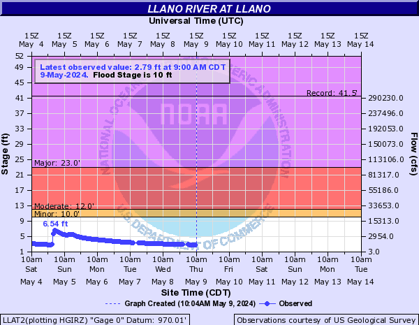
24 hour window - Llano river at Llano
October 15, 2018, 6:55 AM. 4.29 feet. 2,330 CFS flow
October 15, 2018, 6:55 PM. 13.92 feet. 32,046 CFS flow
October 16, 2018, 6:55 AM. 39.91 feet 283,117 CFS flow
October 15, 2018, 6:55 AM. 4.29 feet. 2,330 CFS flow
October 15, 2018, 6:55 PM. 13.92 feet. 32,046 CFS flow
October 16, 2018, 6:55 AM. 39.91 feet 283,117 CFS flow
0 likes
The above post and any post by dhweather is NOT an official forecast and should not be used as such. It is just the opinion of the poster and may or may not be backed by sound meteorological data. It is NOT endorsed by any professional institution including storm2k.org. For official information, please refer to NWS products.
-
1900hurricane
- Category 5
- Posts: 6044
- Age: 32
- Joined: Fri Feb 06, 2015 12:04 pm
- Location: Houston, TX
- Contact:
Re: Texas Fall 2018
Current inflows into Lake Travis are almost 100,000 cfs higher than they were in late June 2007.
0 likes
Contract Meteorologist. TAMU & MSST. Fiercely authentic, one of a kind. We are all given free will, so choose a life meant to be lived. We are the Masters of our own Stories.
Opinions expressed are mine alone.
Follow me on Twitter at @1900hurricane : Read blogs at https://1900hurricane.wordpress.com/
Opinions expressed are mine alone.
Follow me on Twitter at @1900hurricane : Read blogs at https://1900hurricane.wordpress.com/
-
rwfromkansas
- Category 5
- Posts: 2160
- Joined: Sat Aug 27, 2005 12:47 am
- Location: North Fort Worth
Re: Texas Fall 2018
Crazy to think this is not a record flood on the Llano River.
Historic Crests
(1) 41.50 ft on 06/14/1935
(2) 39.10 ft on 06/23/1997
(3) 32.60 ft on 09/10/1952
(4) 28.65 ft on 11/04/2000
(5) 22.07 ft on 11/17/2004
Historic Crests
(1) 41.50 ft on 06/14/1935
(2) 39.10 ft on 06/23/1997
(3) 32.60 ft on 09/10/1952
(4) 28.65 ft on 11/04/2000
(5) 22.07 ft on 11/17/2004
0 likes
The above post and any post by dhweather is NOT an official forecast and should not be used as such. It is just the opinion of the poster and may or may not be backed by sound meteorological data. It is NOT endorsed by any professional institution including storm2k.org. For official information, please refer to NWS products.
Re: Texas Fall 2018
dhweather wrote:Crazy to think this is not a record flood on the Llano River.
https://water.weather.gov/resources/hydrographs/llat2_record.png
Historic Crests
(1) 41.50 ft on 06/14/1935
(2) 39.10 ft on 06/23/1997
(3) 32.60 ft on 09/10/1952
(4) 28.65 ft on 11/04/2000
(5) 22.07 ft on 11/17/2004
I agree with you. I can’t believe it’s not.
0 likes
Return to “USA & Caribbean Weather”
Who is online
Users browsing this forum: Google Adsense [Bot], Iceresistance and 70 guests