Harold has the gold standard for TV mets, him along with Roy Leep of WTVT. I’m pretty sure WTVT recruited Roy from Florida State before he earned his degree, but he went on to build one of most pioneering TV Weather Offices in the nation, with many “firsts” in the industry, similar to KXAS.
Jeff Linder has his B.S. from A&M and is one of the most trusted mets out there. Here is his morning discussion:
Changes:
Few changes to the severe weather risk…this risk remains conditional on enough instability over the area to utilize favorable wind shear values.
Heavy rainfall threat has increased some…WPC has now included a slight risk of flash flooding over the coastal areas of SE TX.
Timing remains the same with the most active weather from 900am-400pm….although storms may linger south of I-10 into the evening hours.
Discussion:
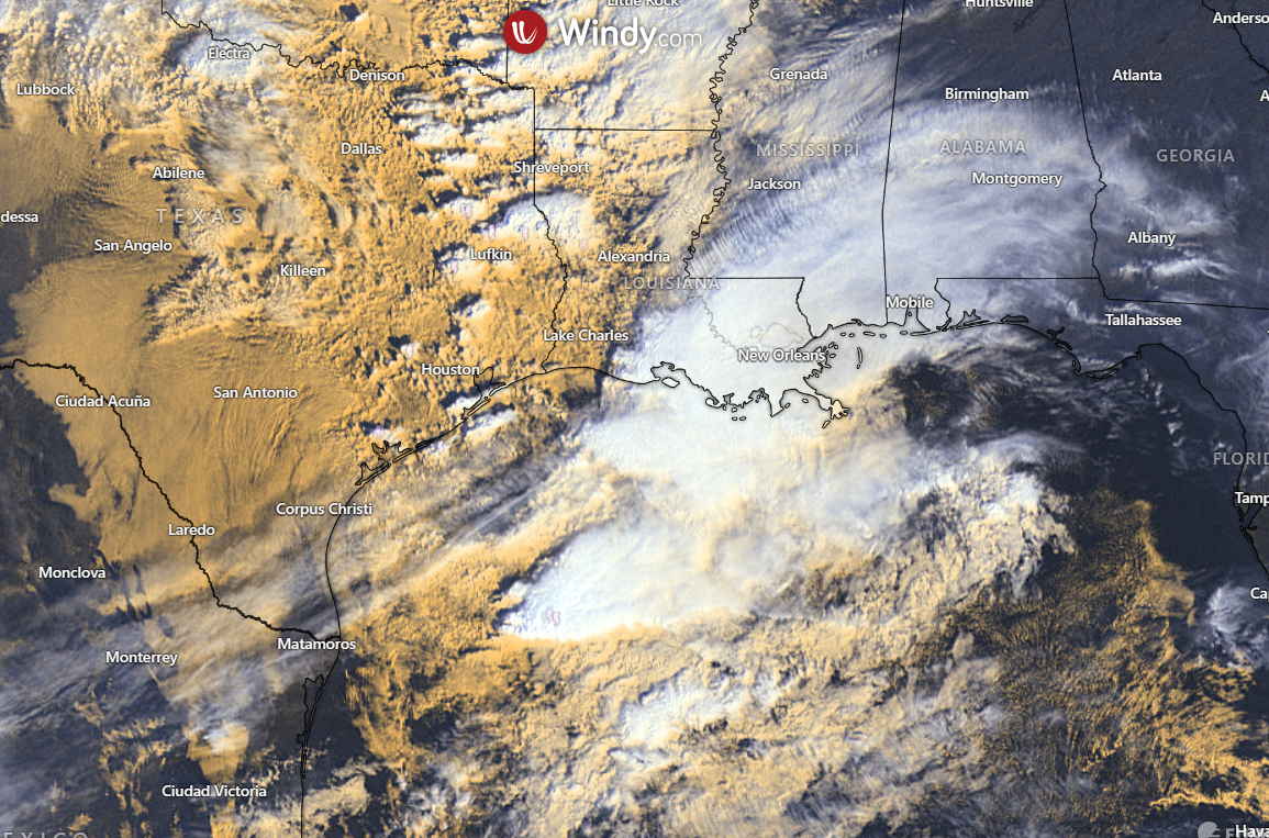
A strong upper level storm system will move across Texas today with low pressure forming over NW TX and moving eastward toward northern Louisiana. In response to the lowering surface pressures a strong low level jet of 40-50kts is currently developing over SE TX and will help transport copious moisture into the region. Low level winds veer and increase with height over the region and are supportive of rotating updrafts and supercell production from mid to late morning into the afternoon hours. There still remains questions on how much instability can work into the region along and behind the northeastward moving warm front. Additionally, the lapse rate or the rate at which an air parcel will rise vertically are not overly impressive and much of the area will likely be covered with clouds and ongoing showers/thunderstorms which may help to limit the destabilization. Also there has been a fairly large area of deep convection over the NW Gulf this morning which may “rob” the incoming instability some. However, you cannot ignore the highly sheared air mass over the region and if a few cells can take the full potential of that shear an isolated tornado is certainly possible. The overall setup looks more like a “usual” cool season severe weather event for the southern US/Gulf coast with any tornadoes likely being small, short lived and generally on the weaker side. SPC has maintained the enhanced risk area (3 out of 5) surrounded by a slight risk (2 out of 5) for the region today and the 5-14% tornado probabilities within 25 miles of a point.
While much focus has been on the tornado threat…there will also be a damaging wind and large hail potential with the hail potential likely the least of the threats. Given the wind energy aloft it will not take much to bring some of those stronger winds just off the surface down…so even a stronger shower may produce 40-50mph winds today. Additionally, gradient winds of 25-30mph with a few higher gusts will be common over the area for much of the day with the coastal locations seeing the stronger winds.
Heavy Rainfall:
Trend over the last 24 hours has been to increase rainfall amounts with the potential for storm clustering and cell training in southwest to northeast bands. Overall moisture profiles will be high for late November with PWS of 1.6-1.7 inches over the area and when combined with a strong onshore feed of moisture and favorable lift widespread showers and thunderstorms are likely. Some of the higher resolution guidance does show some banding and training of storms this afternoon into the evening hours for areas mainly south of I-10 and around Galveston Bay (SE Harris, Liberty, Chambers, Galveston, Brazoria Counties).
Rainfall amounts of 1-3 inches appear to be common today with higher isolated totals of 4-5 inches especially for areas south of I-10 where activity may linger into the evening hours.
Soils are generally dry over the area, but hourly rainfall rates of 1-2 inches per hour may result in some street flooding at the usual flood prone locations.
Surface front sags off the coast tonight into early Friday, but active southwest flow aloft looks to bring additional disturbances across the region on Friday with showers and thunderstorms expanding inland toward the I-10 corridor.


Jeff Lindner
Director Hydrologic Operations Division/Meteorologist
Harris County Flood Control District
9900 Northwest Freeway | Houston, Texas 77092
346-286-4000 (main) | 346-286-4165 (direct) | 281-924-2091 (cell)
jeff.lindner@hcfcd.org | Twitter: @jefflindner1