gatorcane wrote:This cloud cover over Florida looks stubborn to burn off as I loop satellite imagery this morning. I am actually in the Orlando area this weekend and it certainly feels chilly and winter-like in Central Florida not to mention it looks gloomy. But it certainly puts us in the “holiday” spirit. NWS Melbourne did mention in the latest discussion models may have a bias in clearing the cloud cover. I do think we will finally see some sun breaking through the clouds here in Orlando this afternoon but a high of 66F could be at risk if this cloud cover persists.
The other thing is the NNW wind flow has pushed the cool and gloomy weather all the way down the peninsula and through far south Southern Florida where that region saw 50s for the first time in a long time so really not much warmer than Central Florida.
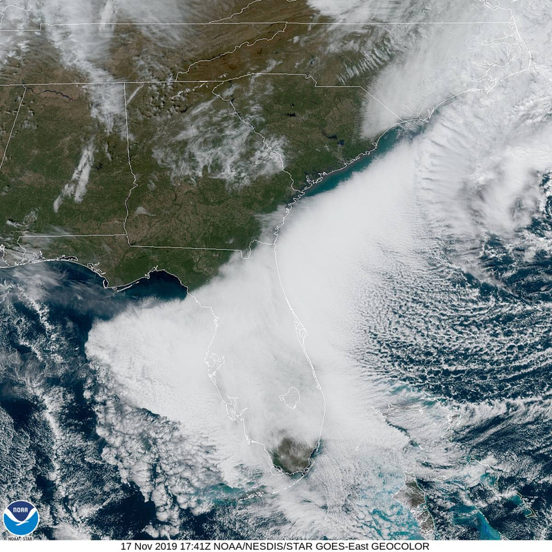
Yes, good post Gatorcane. Yeah the 997 mb Gale off the NC coast this morning has an expansive stratus deck on its backside and the strong cool air advection on the NNW flow is hindering the diurnal heating to quickly erode the cloud deck. The clearing that normally occurs with the passage of a upper trough axis has been offset across most of the peninsula up to current time just before noon. Eventually, drier air will win out and clearing will gradually take place from west to east the remainder of the day. Some areas won't clear until later this evening.
52.4 degrees currently with overcast conditions here at my locale, but observing visible satellite imagery, the sun is out bright and pretty just across the state line just north of me and the sun is out from Live Oak westward down I-10. It probably will be clearing here in Jax in the next couple of hours.
The clouds and brisk NNW are definitely helping in keeping it chilly with temps in the 50s across most of North Florida and even parts of Central Florida and the lower to mid 60s in South Florida as it is approaching noon at the time of this post.
Cool conditions will continue the next few days. Temps across inland North Florida locales may dip down into the upper 30s, by Tuesday morning, especially if the winds lay down to promote radiational cooling and possible frost formation in those areas. No freeze with this event though here.