42 degrees this morning with clear skies. We are sitting exactly on what our average minimum temperature for January 7 should be.
Temps will be at our seasonable averages for this coming week. A dry cold front moves through the peninsula mid week, but as I mentioned yesterday, the polar HP will move east, keeping the core of the arctic air well north of Florida.
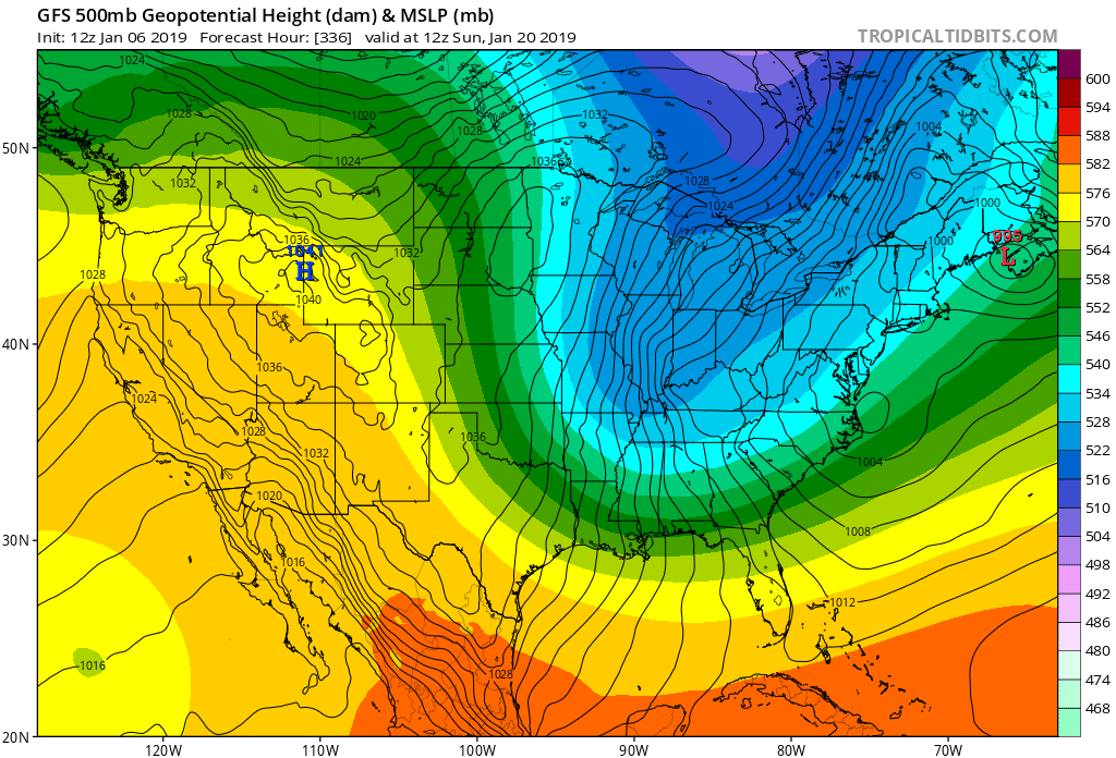
The long range models are still trying to grasp the large scale 500 mb pattern over North America over the next 10-14 days. However, since yesterday, the GFS, GFS FV3, UKMET, and EURO are gradually showing increasing heights over the Pacific/ U.S. West Coast/ Western Canada after 240 hours. This as far as I am concerned is among the biggest potential harbinger of Old Man Winter's return to the Central and Eastern CONUS down the road.
I am observing this very closely as the MJO phase cycle is nearing its apex currently, and we should be seeing a pattern change coming across the continent before this month ends. I am watching to see if a stronger +PNA materializes by week beginning January 20.
Teleconnections have to come together in a special alignment for those wanting a real good cold spell in this part of the country. + PNA , -AO, -NAO trifecta would really usher Old Man Winter in grand style.
I don't want it that harsh though for potential record breaking cold. I would be content with +PNA, -AO with a neutral NAO. This was the particular set-up we had during the January 3, 2018 winter storm we had just north of me up in Southeast GA just a year ago.
So keep an eye out in the long range to see if 500 mb ridging out west in the Pacific region keeps being hinted.
Well, since I have a track record of sticking my neck out at times on the forum here with some modest success LoL...

I will say this now: My gut tells me the week beginning January 20 will bring a potential very cold period across the CONUS east of the Rockies......
Well, I will see later if I will be left hanging precariously on the proverbial tree branch for this. Lol...


 The models didn’t get the pattern right for this weekend as it was supposed to be much colder. So we will see if the models continue to go with this solution as we get closer or back off: