#15598 Postby northjaxpro » Wed Jan 29, 2020 12:48 pm
Well, the verdict is in as far as I am concerned regarding the Feb. 6-9 period.
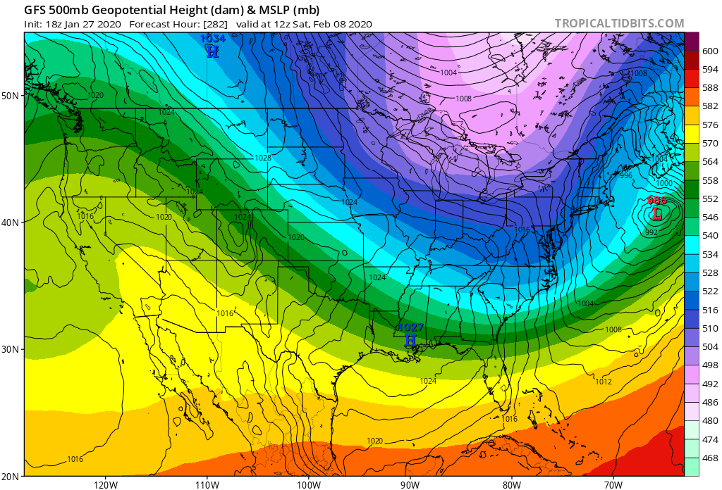
Earlier, 276 hours out, the GFS was hinting at the possibility of "The Greenland Block" taking shape, as I posted that image on this page a couple of days ago. However, looking at this morning's 12Z GFS 500 mb Northern Hemispheric analysis and last night's 00z EURO 500 mb analysis, the ridge that looked liked was setting up over Greenland is showing to be too transient, and even more prominently, we have a split flow pattern across North America, with the Southern Jet Stream really being very dominant into the long term. The Northern Polar Jet Stream dips down across the Great Lakes and as far south as the Mid- Atlantic region through the extended. However, it is the Southern Jet, which looks to remain dominant into at least the next 10 days , possibly even longer. There will likely be a series of shortwave disturbances traversing through the Southern Jet, similar to what we are seeing right now. Also, the teleconnections support an active Southern Stream Jet as a strong - PNA signal is now being forecast to transpire over at least the next ten days. Also, the NAO, which looked as if it was trying to go negative just a few days ago for early February, is now forecast to spike back into the positive phase once again, based on the latest GEFS teleconnections forecast. Thus, the chief reasons why the Greenland Block will not set-up.
So, it looks as if we will continue with these quick, glancing blow type cool spells , with the warm spells in between , with these fast moving Southern Stream systems traversing across the region every 3 days or so for the forseeable future. The Polar Jet looks to be staying relatively at bay across the Great Lakes, OH Valley and Northeast U.S., the coldest anomalies will likely stay locked across those regions, unless we see some phasing of the jet streams down the pike, which that is a possibility, especially a coastal Nor'easter potential over the Mid-Atlantic or New England.
We are about to get into February, and I can hear ole' Psyclone in my mind with the "clock is ticking on whatever left of winter" we can muster up down here. Psyclone is right. Generally, if we don't get any significant cold up to February 15, Spring will be just about on top of us after that point. Here in Jax, the average date each year of the last freeze is February 27. Heck in recent years, that has moved up a couple of weeks more into mid-February with our mild to warm winters over the past decade.
Last edited by
northjaxpro on Wed Jan 29, 2020 1:56 pm, edited 2 times in total.
0 likes
NEVER, EVER SAY NEVER in the tropics and weather in general, and most importantly, with life itself!!
________________________________________________________________________________________
Fay 2008 Beryl 2012 Debby 2012 Colin 2016 Hermine 2016 Julia 2016 Matthew 2016 Irma 2017 Dorian 2019