Florida Weather
Moderator: S2k Moderators
Forum rules

The posts in this forum are NOT official forecast and should not be used as such. They are just the opinion of the poster and may or may not be backed by sound meteorological data. They are NOT endorsed by any professional institution or STORM2K.

Re: Florida Weather
I don’t recall having this type of weather end of May going into June either. I am sure we have had it but it must have been quite a long time ago.
0 likes
Taffy-SW Florida
Re: Florida Weather
we had a stretch of weather like this back in 17...5 days at tampa where the high was 96-98. It's pretty common to get extreme heat immediately prior to persistent summer rains. If summer convection is dependent upon warm water...then nothing brings eventual buckets like hot sunny weather. the end is already in sight for this ridge per the cpc outlooks...the 8-14 day now shows normal to above normal precip when normal is quickly getting wet. It's gonnna rain. a lot. it always does. Just not this week. The problem with the southeast ridge isn't here...it's for those stuck in the battle zone getting day after day of svrwx and flooding. We've got it laughably easy while the plains and Midwest are getting skunked.
3 likes
Re: Florida Weather
I nod my head to you. You are absolutely right. This morning is nothing compared to what the NW and SW are going through. I really have nothing valid to mean lady about.
0 likes
Taffy-SW Florida
-
arekkusu
- Tropical Storm

- Posts: 106
- Age: 24
- Joined: Thu Feb 07, 2019 4:17 pm
- Location: Fleming Island, FL
Re: Florida Weather
856
WUUS52 KJAX 282000
SVRJAX
FLC031-282045-
/O.NEW.KJAX.SV.W.0061.190528T2000Z-190528T2045Z/
BULLETIN - IMMEDIATE BROADCAST REQUESTED
Severe Thunderstorm Warning
National Weather Service Jacksonville FL
400 PM EDT Tue May 28 2019
The National Weather Service in Jacksonville has issued a
* Severe Thunderstorm Warning for...
Central Duval County in northeastern Florida...
* Until 445 PM EDT.
* At 359 PM EDT, a severe thunderstorm was located over Jacksonville,
and is drifting south at near 5 mph.
HAZARD...60 mph wind gusts and nickel size hail.
SOURCE...Radar indicated.
IMPACT...Expect damage to roofs, siding, and trees.
* Locations impacted include...
Jacksonville, Arlington, Ortega, Craig Field, Normandy, Riverside,
San Marco and Tallyrand.
PRECAUTIONARY/PREPAREDNESS ACTIONS...
For your protection move to an interior room on the lowest floor of a
building.
Torrential rainfall is occurring with this storm, and may lead to
flash flooding. Do not drive your vehicle through flooded roadways.
&&
LAT...LON 3036 8182 3043 8166 3033 8149 3030 8150
3021 8176
TIME...MOT...LOC 1959Z 331DEG 3KT 3035 8168
HAIL...0.88IN
WIND...60MPH
--
I wasn't expecting this sort of thing to happen today at all, even on an isolated scale. Also, about 1.5 hours ago, we picked up some intense and continuous thunder where I am located, or about 30 minutes from Jacksonville, but those storms were much weaker and dissipated quickly.
The most ironic part of all of this (considering what has been going on in throughout the state recently) is that the storm is producing locally heavy rainfall, leading to the warned area simultaneously being under an areal flood advisory. Go figure. This is certainly a change of pace.
0 likes
-
gatorcane

- S2K Supporter

- Posts: 23499
- Age: 46
- Joined: Sun Mar 13, 2005 3:54 pm
- Location: Boca Raton, FL
Re: Florida Weather
The rains will come for South Florida but it’s hard to believe that there is not a cloud in the sky this afternoon and it is May 28th. It feels hot and dry and not very South-Florida-like. Fortunately closer to the coast an east wind is keeping the temps in check but this stretch of weather we are in is unusual. That said it was also unusual when we got the stretch of rainy season-like days in early May where it appeared the rainy season was going to start early. Maybe it is mother nature’s way of balancing things out.
0 likes
-
arekkusu
- Tropical Storm
- Posts: 106
- Age: 24
- Joined: Thu Feb 07, 2019 4:17 pm
- Location: Fleming Island, FL
Re: Florida Weather
718
WGUS52 KJAX 282045
FFWJAX
FLC031-282345-
/O.NEW.KJAX.FF.W.0001.190528T2045Z-190528T2345Z/
/00000.0.ER.000000T0000Z.000000T0000Z.000000T0000Z.OO/
BULLETIN - EAS ACTIVATION REQUESTED
Flash Flood Warning
National Weather Service Jacksonville FL
445 PM EDT Tue May 28 2019
The National Weather Service in Jacksonville has issued a
* Flash Flood Warning for...
Central Duval County in northeastern Florida...
* Until 745 PM EDT.
* At 444 PM EDT, Doppler radar indicated thunderstorms producing
heavy rain across the warned area. Up to three inches of rain have
already fallen. Flash flooding is expected to begin shortly.
* Some locations that will experience flooding include...
Arlington, Normandy, Riverside, San Marco and Tallyrand.
PRECAUTIONARY/PREPAREDNESS ACTIONS...
Excessive runoff from heavy rainfall will cause flooding of small
creeks and streams, urban areas, highways, streets and underpasses as
well as other drainage areas and low lying spots.
A Flash Flood Warning means that flooding is imminent or occurring.
If you are in the warned area move to higher ground immediately.
Residents living along streams and creeks should take immediate
precautions to protect life and property.
&&
LAT...LON 3030 8177 3037 8178 3039 8158 3031 8155
3027 8160
This is the first FFW issued for the area in a really long time, and look when it's taking place. Wow.
ETA: Just realized that this is happening during afternoon rush hour on a weekday the day after a holiday. In Jacksonville. Yikes.
0 likes
-
northjaxpro

- S2K Supporter
- Posts: 8900
- Joined: Mon Sep 27, 2010 11:21 am
- Location: Jacksonville, FL
Re: Florida Weather
The rain may have kept us from reaching or breaking the record max for a second straight day. I believe at the NWS JAX office, which today was 99 degrees. . I will double check.The highest I see it on my thermometer was 97.6 degrees, before the rain came in. It reached 101 degrees at my home station yesterday.
I agree with Psyclone in that we will see a gradual relinquishing of the Upper Ridge, which has had Florida in its grip for about 10 days now. Today is the best sign we have had to this juncture that moisture is creeping back in, and we are getting some seabreeze convergence storms firing now, at least here across the Northeast Florida area. We should see the rainy season kick into gear hopefully as we get into next week, as southerly flow will return to bring rich moisture back across the peninsula.
0 likes
NEVER, EVER SAY NEVER in the tropics and weather in general, and most importantly, with life itself!!
________________________________________________________________________________________
Fay 2008 Beryl 2012 Debby 2012 Colin 2016 Hermine 2016 Julia 2016 Matthew 2016 Irma 2017 Dorian 2019
________________________________________________________________________________________
Fay 2008 Beryl 2012 Debby 2012 Colin 2016 Hermine 2016 Julia 2016 Matthew 2016 Irma 2017 Dorian 2019
-
arekkusu
- Tropical Storm
- Posts: 106
- Age: 24
- Joined: Thu Feb 07, 2019 4:17 pm
- Location: Fleming Island, FL
Re: Florida Weather
I think that thunderstorm that you mentioned in west Duval is now severe-warned, and is now also affecting eastern Baker County and extreme southwest Nassau County.
Some other strong thunderstorms are affecting St. Johns, northern Clay, and Putnam.
Edit: Another severe thunderstorm has developed around the Alachua/Putnam border, and additional storms are firing up throughout the region.
Last edited by arekkusu on Tue May 28, 2019 4:35 pm, edited 2 times in total.
0 likes
-
northjaxpro
- S2K Supporter
- Posts: 8900
- Joined: Mon Sep 27, 2010 11:21 am
- Location: Jacksonville, FL
Re: Florida Weather
Also, I was among the extremely lucky ones today, being right under a developing thunderstorm as the seabreeze front penetrated inland. These storms are barely drifting to the west. So, areas where they are getting rain are certainly getting dumped on like it did at my home. But, the whole area hopefully will see more rainfall as we get into the next week or so as we get into our normal rainy season pattern.
0 likes
NEVER, EVER SAY NEVER in the tropics and weather in general, and most importantly, with life itself!!
________________________________________________________________________________________
Fay 2008 Beryl 2012 Debby 2012 Colin 2016 Hermine 2016 Julia 2016 Matthew 2016 Irma 2017 Dorian 2019
________________________________________________________________________________________
Fay 2008 Beryl 2012 Debby 2012 Colin 2016 Hermine 2016 Julia 2016 Matthew 2016 Irma 2017 Dorian 2019
-
northjaxpro
- S2K Supporter
- Posts: 8900
- Joined: Mon Sep 27, 2010 11:21 am
- Location: Jacksonville, FL
Re: Florida Weather
northjaxpro wrote::uarrow: I just received under 2 inches in a heavy thunderstorm during this past 45 minutes. This is the most rain I have measured here in nearly a month. I never have been so happy to see rainfall, given the intense heat we have been getting the past four days, and the extreme dry conditions which have brought about the wildfire concerns here across Northeast Florida. There is another heavy batch of storms across Western Duval County and out I-295 beltway around Normandy Blvd and out across Cecil Commerce.
The rain may have kept us from reaching or breaking the record max for a second straight day. I believe at the NWS JAX office, which today was 99 degrees. . I will double check.The highest I see it on my thermometer was 97.6 degrees, before the rain came in. It reached 101 degrees at my home station yesterday.
I agree with Psyclone in that we will see a gradual relinquishing of the Upper Ridge, which has had Florida in its grip for about 10 days now. Today is the best sign we have had to this juncture that moisture is creeping back in, and we are getting some seabreeze convergence storms firing now, at least here across the Northeast Florida area. We should see the rainy season kick into gear hopefully as we get into next week, as southerly flow will return to bring rich moisture back across the peninsula.
___________________________________________________________________________________________________________________________
EDIT: 97 degrees was the official max temp recorded at the Jax WFO. No record today.
Also, the NWS WFO missed the thunderstorm, which dumped on me and I live only about 4 miles from them. I received 1.6 inches of rain in a nearly stationary storm. This goes to show how these slow moving storms can drop a lot of rain in isolated areas before they dissipate.
0 likes
NEVER, EVER SAY NEVER in the tropics and weather in general, and most importantly, with life itself!!
________________________________________________________________________________________
Fay 2008 Beryl 2012 Debby 2012 Colin 2016 Hermine 2016 Julia 2016 Matthew 2016 Irma 2017 Dorian 2019
________________________________________________________________________________________
Fay 2008 Beryl 2012 Debby 2012 Colin 2016 Hermine 2016 Julia 2016 Matthew 2016 Irma 2017 Dorian 2019
Re: Florida Weather
Sure enough the forecasts show a gradual relaxing of the intense heat and the introduction of afternoon convection. it's painfully slow but baby steps are good. Congrats to our northeast florida friends that cashed a convective ticket today...hopefully it's the start of something good. Did any of that rain hit the wildfire that has shut down I-95 at times?
0 likes
-
northjaxpro
- S2K Supporter
- Posts: 8900
- Joined: Mon Sep 27, 2010 11:21 am
- Location: Jacksonville, FL
Re: Florida Weather
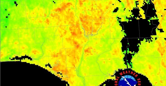
0 likes
NEVER, EVER SAY NEVER in the tropics and weather in general, and most importantly, with life itself!!
________________________________________________________________________________________
Fay 2008 Beryl 2012 Debby 2012 Colin 2016 Hermine 2016 Julia 2016 Matthew 2016 Irma 2017 Dorian 2019
________________________________________________________________________________________
Fay 2008 Beryl 2012 Debby 2012 Colin 2016 Hermine 2016 Julia 2016 Matthew 2016 Irma 2017 Dorian 2019
-
tropicwatch

- Category 5

- Posts: 3205
- Age: 60
- Joined: Sat Jun 02, 2007 10:01 am
- Location: Panama City Florida
- Contact:
Re: Florida Weather
northjaxpro wrote::uarrow: Most of the widely scattered rain and storms stayed confined across metro and West Jax and west into Baker, Bradford and Union Counties. Most areas north along Interstate 95 from downtown Jax north and areas northwest did not see a drop of.rain. Hopefully, the areas experiencing the wildfires will get some dire rain relief their way in the coming days.
We have seen quite a few wildfires here in the Panhandle the past couple of weeks. The barometric pressure has been coming down the past couple of days and hopefully we will start to see our afternoon showers. Also the ground here is heating up quicker due to all the tree's that were lost during Hurricane Michael. This should present some interesting summer showers I would think.
1 likes
Tropicwatch
Agnes 72', Eloise 75, Elena 85', Kate 85', Charley 86', Florence 88', Beryl 94', Dean 95', Erin 95', Opal 95', Earl 98', Georges 98', Ivan 2004', Arlene 2005', Dennis 2005', Ida 2009' Debby 2012' Irma 2017' Michael 2018'
Agnes 72', Eloise 75, Elena 85', Kate 85', Charley 86', Florence 88', Beryl 94', Dean 95', Erin 95', Opal 95', Earl 98', Georges 98', Ivan 2004', Arlene 2005', Dennis 2005', Ida 2009' Debby 2012' Irma 2017' Michael 2018'
Re: Florida Weather
I don't know, I think that SE Florida is going to be losing out on rainfall for many weeks to come. Even in the extended forecast NWS Miami is not sounding very bullish. Low 20% chance SE flow regime with any storms far away in the interior and west.
0 likes
Re: Florida Weather
Near shore waters in the Gulf are already in the mid to upper 80's thanks to this crazy heat. I've never seen it so warm so early. Of course the offshore waters are cooler but still in the low 80's. When the atmosphere becomes more hospitable to convection it's going to have plenty of ammo
1 likes
-
gatorcane
- S2K Supporter
- Posts: 23499
- Age: 46
- Joined: Sun Mar 13, 2005 3:54 pm
- Location: Boca Raton, FL
Re: Florida Weather
Looks like dew points are creeping up tonight across SE Florida into the low 70s. They have been in the mid to upper 60s for a while. The SE flow is bringing in some moisture gradually. Looks like rain chances go up a little this weekend though only up to about 30-40% but that is close to climo norms.
1 likes
Re: Florida Weather
A random little cell just rained on me in Lehigh Acres, Fl. Lee county. Barely measurable but it was glorious 10:30 PM. Wednesday
0 likes
Taffy-SW Florida

Re: Florida Weather
This rainy season is certainly beginning hotter and dryer then I recollect from recent years.
0 likes
Personal Forecast Disclaimer:
The posts in this forum are NOT official forecast and should not be used as such. They are just the opinion of the poster and may or may not be backed by sound meteorological data. They are NOT endorsed by any professional institution or storm2k.org. For official information, please refer to the NHC and NWS products.
The posts in this forum are NOT official forecast and should not be used as such. They are just the opinion of the poster and may or may not be backed by sound meteorological data. They are NOT endorsed by any professional institution or storm2k.org. For official information, please refer to the NHC and NWS products.
Re: Florida Weather
Not a cloud in the sky yesterday at noon. extraordinary for late May. We've got a couple bits of cotton so far today.
0 likes
Re: Florida Weather
There was some cotton in the SFL sky yesterday too as the dewpoints got above 70 again. The cumulus clouds have that thin, wispy and flattened look to them, though, that makes me think it's highly unlikely that anything will get going. NWS Miami has 20% chances after 2AM tonight, though.....maybe they think some streamers off the Bahamas will develop?
0 likes
Return to “USA & Caribbean Weather”
Who is online
Users browsing this forum: ElectricStorm, Google Adsense [Bot], Majestic-12 [Bot] and 142 guests