Florida Weather

U.S. & Caribbean Weather Discussions and Severe Weather Events

Moderator: S2k Moderators

Forum rules

The posts in this forum are NOT official forecast and should not be used as such. They are just the opinion of the poster and may or may not be backed by sound meteorological data. They are NOT endorsed by any professional institution or STORM2K.

Help Support Storm2K
Message
Author
User avatar
NDG
S2K Supporter
S2K Supporter
Posts: 14933
Joined: Sun Jul 09, 2006 10:14 pm
Location: Orlando, FL

Re: Florida Weather

#11661 Postby NDG » Thu Jun 01, 2017 4:40 pm

psyclone wrote::uarrow: while it's not perfectly clear I interpreted this to reference incoming conditions rather than current but it is a bit unclear. Nevertheless the large takeaway is wetter conditions seem likely which is urgently needed.


Got it.
I have always said that our start to the rainy season always starts with something to spark it, not all the times does it start or stays with a traditional set up of summertime pattern, heck we have seen UL troughs get close to FL in the middle of the summer, not all the time does our pattern is the Bermuda ridge on top of us. The most important thing is that daytime heating along with dewpoints well into the 70s is the main fuel for our rainy season to start it, and it is here to stay most of the summer.

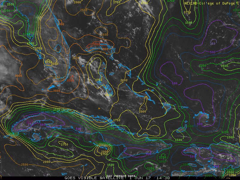
Image below cannot get anymore summer looking than that :)

Image
2 likes   

psyclone
S2K Supporter
S2K Supporter
Posts: 4487
Joined: Wed Aug 24, 2005 9:04 pm
Location: palm harbor fl

Re: Florida Weather

#11662 Postby psyclone » Thu Jun 01, 2017 5:31 pm

we're kind of getting shafted here on the west coast so far....earlier this week it looked like the focus may shift our way but now that looks less likely. At any rate, someone is getting heavy rain everyday and that is a big plus. the concentrated heavy rain threat (if it materializes) is still a good ways out, probably mid next week as a front edges down from the north and a plume of deep tropical moisture advects up from the southwest. As a bonus the added cloud cover should hold maxes below normal which will provide a respite from some of the excessive heat we've had to contend with in recent weeks.
0 likes   

Patrick99
Category 5
Category 5
Posts: 1752
Joined: Mon May 24, 2004 3:43 pm
Location: Miami, FL

Re: Florida Weather

#11663 Postby Patrick99 » Fri Jun 02, 2017 8:03 am

Wow. This is the first time this "rainy season" I've heard a rumble of thunder and am receiving more than just a little "dusting" of rain. Pouring in Miami now, and I say bring it on!
0 likes   

User avatar
TheStormExpert
Category 5
Category 5
Posts: 8487
Age: 30
Joined: Wed Feb 16, 2011 5:38 pm
Location: Palm Beach Gardens, FL

Re: Florida Weather

#11664 Postby TheStormExpert » Fri Jun 02, 2017 10:44 am

Currently as I am typing it is pouring rain outside! Hallelujah!! Much more hopefully to come too.
:woo:

Image

Image
1 likes   
The following post is NOT an official forecast and should not be used as such. It is just the opinion of the poster and may or may not be backed by sound meteorological data. It is NOT endorsed by storm2k.org.

User avatar
gatorcane
S2K Supporter
S2K Supporter
Posts: 23499
Age: 46
Joined: Sun Mar 13, 2005 3:54 pm
Location: Boca Raton, FL

Re: Florida Weather

#11665 Postby gatorcane » Fri Jun 02, 2017 1:52 pm

the thing about these setups is that all the cloud cover can limit thunderstorm activity due to more limited daytime heating making the forecast trickier than usual. It appears that so far today that has kept a cap on thunderstorm development across most of South Florida despite the 60% rain chances area wide. I am optimistic that there will be enough daytime heating that later on today some convection will start to finally get going.
0 likes   

User avatar
AdamFirst
S2K Supporter
S2K Supporter
Posts: 2487
Age: 34
Joined: Thu Aug 14, 2008 10:54 am
Location: Port Saint Lucie, FL

Re: Florida Weather

#11666 Postby AdamFirst » Sun Jun 04, 2017 8:55 pm

50% or above rain chances every day here until next Sunday. We've gotten various degrees of rain for most of the day every day since Friday. The atmospheric river is in full effect.
1 likes   
Dolphins Marlins Canes Golden Panthers HEAT
Andrew 1992 - Irene 1999 - Frances 2004 - Jeanne 2004 - Wilma 2005 - Fay 2008 - Isaac 2012 - Matthew 2016 - Irma 2017 - Dorian 2019 - Ian 2022 - Nicole 2022

User avatar
TheStormExpert
Category 5
Category 5
Posts: 8487
Age: 30
Joined: Wed Feb 16, 2011 5:38 pm
Location: Palm Beach Gardens, FL

Re: Florida Weather

#11667 Postby TheStormExpert » Sun Jun 04, 2017 9:06 pm

A local met. here in West Palm Beach said on Facebook today the official start of the 2017 Rainy Season was May 29th.
0 likes   
The following post is NOT an official forecast and should not be used as such. It is just the opinion of the poster and may or may not be backed by sound meteorological data. It is NOT endorsed by storm2k.org.

User avatar
Tampa Bay Hurricane
Category 5
Category 5
Posts: 5594
Age: 36
Joined: Fri Jul 22, 2005 7:54 pm
Location: St. Petersburg, FL

Re: Florida Weather

#11668 Postby Tampa Bay Hurricane » Mon Jun 05, 2017 3:25 am

FWIW SPC has put much of the peninsula in marginal risk of Severe Storms on Tue/Wed due to high shear potentially overcoming the low buoyancy and low instability due to the widespread rain and cloud cover. It should also be windy on Tue/Wed due to a tight pressure gradient out ahead of the frontal low genesis that will occur over the EGOM. The biggest impact will be rain, with some of the local mets saying several inches possible over the next 3 days.
0 likes   

psyclone
S2K Supporter
S2K Supporter
Posts: 4487
Joined: Wed Aug 24, 2005 9:04 pm
Location: palm harbor fl

Re: Florida Weather

#11669 Postby psyclone » Mon Jun 05, 2017 8:59 am

Our drought is destined to be disassembled in a matter of days if the current forecast materializes. We're off to a great start.
1 likes   

AutoPenalti
Category 5
Category 5
Posts: 3949
Age: 27
Joined: Mon Aug 17, 2015 4:16 pm
Location: Ft. Lauderdale, Florida

Re: Florida Weather

#11670 Postby AutoPenalti » Mon Jun 05, 2017 6:24 pm

Southeast Broward under a tornado warning. Looks like a hook echo was seen on radar.
0 likes   
The posts in this forum are NOT official forecasts and should not be used as such. They are just the opinion of the poster and may or may not be backed by sound meteorological data. They are NOT endorsed by any professional institution or STORM2K. For official information, please refer to products from the NHC and NWS.


Model Runs Cheat Sheet:
GFS (5:30 AM/PM, 11:30 AM/PM)
HWRF, GFDL, UKMET, NAVGEM (6:30-8:00 AM/PM, 12:30-2:00 AM/PM)
ECMWF (1:45 AM/PM)

TCVN
is a weighted averaged

User avatar
TheStormExpert
Category 5
Category 5
Posts: 8487
Age: 30
Joined: Wed Feb 16, 2011 5:38 pm
Location: Palm Beach Gardens, FL

Re: Florida Weather

#11671 Postby TheStormExpert » Mon Jun 05, 2017 9:47 pm

It's a never ending stream of moisture! 8-)

Image

Image
0 likes   
The following post is NOT an official forecast and should not be used as such. It is just the opinion of the poster and may or may not be backed by sound meteorological data. It is NOT endorsed by storm2k.org.

User avatar
TheStormExpert
Category 5
Category 5
Posts: 8487
Age: 30
Joined: Wed Feb 16, 2011 5:38 pm
Location: Palm Beach Gardens, FL

Re: Florida Weather

#11672 Postby TheStormExpert » Mon Jun 05, 2017 10:41 pm

AutoPenalti wrote:Southeast Broward under a tornado warning. Looks like a hook echo was seen on radar.

Definitely not something you see everyday here in South Florida.

Image
0 likes   
The following post is NOT an official forecast and should not be used as such. It is just the opinion of the poster and may or may not be backed by sound meteorological data. It is NOT endorsed by storm2k.org.

User avatar
NDG
S2K Supporter
S2K Supporter
Posts: 14933
Joined: Sun Jul 09, 2006 10:14 pm
Location: Orlando, FL

Re: Florida Weather

#11673 Postby NDG » Tue Jun 06, 2017 10:05 pm

Something to watch out for, the HRRR forecasts more than a foot of rain for parts of S FL through tomorrow afternoon, this is on top of what has already fallen.

Image
0 likes   

AutoPenalti
Category 5
Category 5
Posts: 3949
Age: 27
Joined: Mon Aug 17, 2015 4:16 pm
Location: Ft. Lauderdale, Florida

Re: Florida Weather

#11674 Postby AutoPenalti » Wed Jun 07, 2017 1:21 pm

Looks like the sun has peaked through in Broward, we might get some sort of instability along with the 14th round of rain coming in during the next couple of hours.
1 likes   
The posts in this forum are NOT official forecasts and should not be used as such. They are just the opinion of the poster and may or may not be backed by sound meteorological data. They are NOT endorsed by any professional institution or STORM2K. For official information, please refer to products from the NHC and NWS.


Model Runs Cheat Sheet:
GFS (5:30 AM/PM, 11:30 AM/PM)
HWRF, GFDL, UKMET, NAVGEM (6:30-8:00 AM/PM, 12:30-2:00 AM/PM)
ECMWF (1:45 AM/PM)

TCVN
is a weighted averaged

User avatar
TheStormExpert
Category 5
Category 5
Posts: 8487
Age: 30
Joined: Wed Feb 16, 2011 5:38 pm
Location: Palm Beach Gardens, FL

Re: Florida Weather

#11675 Postby TheStormExpert » Wed Jun 07, 2017 2:12 pm

I hope you guys in South Florida have finished constructing your arcs because it looks like you'll are in for YET another round of rough weather. Lost track of what day we are on of receiving rainfall. :lol:

Btw, I'm in Man-O-War Cay, Abaco, Bahamas praying this plume of rains misses me just to the north.

Image
0 likes   
The following post is NOT an official forecast and should not be used as such. It is just the opinion of the poster and may or may not be backed by sound meteorological data. It is NOT endorsed by storm2k.org.

User avatar
gatorcane
S2K Supporter
S2K Supporter
Posts: 23499
Age: 46
Joined: Sun Mar 13, 2005 3:54 pm
Location: Boca Raton, FL

Re: Florida Weather

#11676 Postby gatorcane » Wed Jun 07, 2017 2:22 pm

With some sun breaking through across SE Florida today out ahead of this band. curious if this band intensifies even more with added instability. Could get ugly across parts of SE Florida later today.
0 likes   

AutoPenalti
Category 5
Category 5
Posts: 3949
Age: 27
Joined: Mon Aug 17, 2015 4:16 pm
Location: Ft. Lauderdale, Florida

Re: Florida Weather

#11677 Postby AutoPenalti » Wed Jun 07, 2017 2:54 pm

TheStormExpert wrote:I hope you guys in South Florida have finished constructing your arcs because it looks like you'll are in for YET another round of rough weather. Lost track of what day we are on of receiving rainfall. :lol:

Btw, I'm in Man-O-War Cay, Abaco, Bahamas praying this plume of rains misses me just to the north.

Image


Is that moving south east to north east?
0 likes   
The posts in this forum are NOT official forecasts and should not be used as such. They are just the opinion of the poster and may or may not be backed by sound meteorological data. They are NOT endorsed by any professional institution or STORM2K. For official information, please refer to products from the NHC and NWS.


Model Runs Cheat Sheet:
GFS (5:30 AM/PM, 11:30 AM/PM)
HWRF, GFDL, UKMET, NAVGEM (6:30-8:00 AM/PM, 12:30-2:00 AM/PM)
ECMWF (1:45 AM/PM)

TCVN
is a weighted averaged

User avatar
NDG
S2K Supporter
S2K Supporter
Posts: 14933
Joined: Sun Jul 09, 2006 10:14 pm
Location: Orlando, FL

Re: Florida Weather

#11678 Postby NDG » Thu Jun 08, 2017 7:37 am

Warmer MDR is making it even more humid.


 https://twitter.com/EricBlake12/status/872496949810925569


1 likes   

Patrick99
Category 5
Category 5
Posts: 1752
Joined: Mon May 24, 2004 3:43 pm
Location: Miami, FL

Re: Florida Weather

#11679 Postby Patrick99 » Thu Jun 08, 2017 8:37 am

For a second I thought those were hurricane tracks. lol....come to think of it, I'm surprised that we rarely get hurricane tracks that look kinda like that.

The sun has been out for much of this morning. Maybe that will add some heating into the mix that hasn't really been present the last couple days.
0 likes   

HURRICANELONNY
Category 5
Category 5
Posts: 1381
Joined: Wed May 07, 2003 6:48 am
Location: HOLLYWOOD.FL

Re: Florida Weather

#11680 Postby HURRICANELONNY » Thu Jun 08, 2017 3:19 pm

Yea... Should get back to more of an east flow by next week. Normal summer time pattern. Getting sick of all day rains. :D

This
should allow for a more typical sometime pattern to begin to
emerge over the next several days, with showers developing over
the eastern side of South Florida, and progressing to the interior
and Gulf Coast by Sunday afternoon.

Once this pattern gets established on Sunday, models are
indicating it will continue through at least most of the week, if
not through next weekend.
0 likes   
hurricanelonny


Return to “USA & Caribbean Weather”

Who is online

Users browsing this forum: No registered users and 72 guests