Ok folks,A new thread is now open for the area the models are showing some kind of development if it does so.
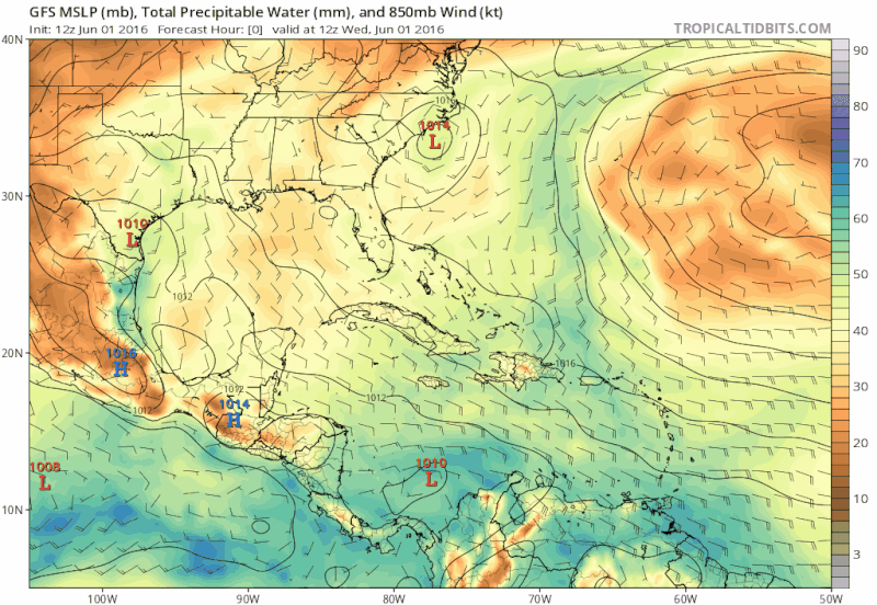
TROPICAL WEATHER OUTLOOK
NWS NATIONAL HURRICANE CENTER MIAMI FL
200 PM EDT WED JUN 1 2016
For the North Atlantic...Caribbean Sea and the Gulf of Mexico:
The NOAA Weather Prediction Center is issuing advisories on
Post-Tropical Cyclone Bonnie, located about 90 miles southeast of
Wilmington, North Carolina.
A broad low pressure area may form over the southern Gulf of Mexico
by early next week. Additional development of the low should be
slow to occur as the low moves slowly north-northeastward.
* Formation chance through 48 hours...low...near 0 percent
* Formation chance through 5 days...low...20 percent
Area of disturbed weather in NW Caribbean (Is Invest 93L)
Moderator: S2k Moderators
Forum rules

The posts in this forum are NOT official forecasts and should not be used as such. They are just the opinion of the poster and may or may not be backed by sound meteorological data. They are NOT endorsed by any professional institution or STORM2K. For official information, please refer to products from the National Hurricane Center and National Weather Service.
-
cycloneye

- Admin

- Posts: 149410
- Age: 69
- Joined: Thu Oct 10, 2002 10:54 am
- Location: San Juan, Puerto Rico
Area of disturbed weather in NW Caribbean (Is Invest 93L)
0 likes
Visit the Caribbean-Central America Weather Thread where you can find at first post web cams,radars
and observations from Caribbean basin members Click Here
and observations from Caribbean basin members Click Here

-
gatorcane

- S2K Supporter

- Posts: 23708
- Age: 48
- Joined: Sun Mar 13, 2005 3:54 pm
- Location: Boca Raton, FL
Re: Tropical development in NW Caribbean / SGOM?
UKMET finally picking up on the low now showing a 1005MB low moving NE in the Gulf:

0 likes
-
TheStormExpert
-
tropicwatch

- Category 5

- Posts: 3426
- Age: 62
- Joined: Sat Jun 02, 2007 10:01 am
- Location: The Villages, Florida
- Contact:
Re: Tropical development in Southern Gulf of Mexico?
Surprised they went ahead and lemoned it 
0 likes
Tropicwatch
Agnes 72', Eloise 75, Elena 85', Kate 85', Charley 86', Florence 88', Beryl 94', Dean 95', Erin 95', Opal 95', Earl 98', Georges 98', Ivan 2004', Arlene 2005', Dennis 2005', Ida 2009' Debby 2012' Irma 2017' Michael 2018'
Agnes 72', Eloise 75, Elena 85', Kate 85', Charley 86', Florence 88', Beryl 94', Dean 95', Erin 95', Opal 95', Earl 98', Georges 98', Ivan 2004', Arlene 2005', Dennis 2005', Ida 2009' Debby 2012' Irma 2017' Michael 2018'
-
WYNweather
- Tropical Depression

- Posts: 65
- Joined: Wed Jul 20, 2011 1:14 pm
Re: Tropical development in Southern Gulf of Mexico?
Not shocked with the NHC post. The local weather had a short mention at 11:00 news last night.
0 likes
-
gatorcane
- S2K Supporter
- Posts: 23708
- Age: 48
- Joined: Sun Mar 13, 2005 3:54 pm
- Location: Boca Raton, FL
Re: Tropical development in Southern Gulf of Mexico?
12Z ECMWF rolling now agrees closely with the 12Z UKMET and NHC lemon on a broad low developing in the southern Gulf and moving slowly NE. Looks like a big time rain event for peninsula Florida as it would be on the wet side:

0 likes
-
gatorcane
- S2K Supporter
- Posts: 23708
- Age: 48
- Joined: Sun Mar 13, 2005 3:54 pm
- Location: Boca Raton, FL
Re: Tropical development in Southern Gulf of Mexico?
ECMWF 168 hours as the low turns ENE and looks to maybe merge with a front over Florida:

0 likes
-
gatorcane
- S2K Supporter
- Posts: 23708
- Age: 48
- Joined: Sun Mar 13, 2005 3:54 pm
- Location: Boca Raton, FL
Re: Tropical development in Southern Gulf of Mexico?
Snippet from NWS Tampa discussion just released:
As we move into next week, an area of low pressure is expected to move from the
Caribbean into the southern Gulf of Mexico. Long range models have been fairly
consistent over the last several runs in showing this feature,
though exact locations and intensities of the low are quite
different amongst model members and model runs. Regardless, it does
appear a surface low will move into the southern Gulf of Mexico
early next week. With an upper trough to the north and mid-level
ridge to the east, steering flow would generally point to a slow
northward or northeastward movement for the first half of next week.
The low looks to bring with it deep tropical moisture, and may lead
to an increased risk of heavy rainfall and flooding across portions
of the Florida peninsula early next week. We will need to keep an
eye on this feature as we head into the weekend. From the weekend
into early next week, The increased moisture should lead to greater
cloud cover during the day, which may keep temperatures from rising
much above the upper 80s to near 90 degrees. Lows look to hold in
the 70s
http://forecast.weather.gov/product.php ... glossary=1
0 likes
-
cycloneye
- Admin
- Posts: 149410
- Age: 69
- Joined: Thu Oct 10, 2002 10:54 am
- Location: San Juan, Puerto Rico
Re: Tropical development in Southern Gulf of Mexico?
Wow,regardlesss of what occurs if it develops or not, what a river of moisture pooling to South Florida if it pans out that way.GEFS ensembles.

0 likes
Visit the Caribbean-Central America Weather Thread where you can find at first post web cams,radars
and observations from Caribbean basin members Click Here
and observations from Caribbean basin members Click Here
-
floridasun78
- Category 5
- Posts: 3755
- Joined: Sun May 17, 2009 10:16 pm
- Location: miami fl
Re: Tropical development in Southern Gulf of Mexico?
000
FXUS62 KMFL 011933
AFDMFL
Area Forecast Discussion
National Weather Service Miami FL
333 PM EDT WED JUN 1 2016
By Monday, an area of low pressure will move north, from over the
Yucatan, into the Gulf. This low will mainly advect deep tropical
moisture into the area. Currently, models are indicating the most
likely scenario is a heavy rain event. It is a little too early to
pin point who will get the brunt of the heavy rain, but models
have begun to indicate it may be up in central Florida. However,
South Florida will still have abundant rain and possibly some
embedded thunderstorms with this activity. So, have kept likely
PoPs in the forecast for Monday and Tuesday.
0 likes

Re: Tropical development in Southern Gulf of Mexico?
Tropical wave tracking through Venezuela along with energy/moisture from the EPAC area looks to be the main area models are forecasting to develop in the NW Caribbean/Southern GOM late weekend into early next week.
http://tropic.ssec.wisc.edu/real-time/m ... /main.html
http://www.nhc.noaa.gov/tafb/USA_12Z.gif
http://tropic.ssec.wisc.edu/real-time/m ... /main.html
http://www.nhc.noaa.gov/tafb/USA_12Z.gif
0 likes
-
tarheelprogrammer

- S2K Supporter
- Posts: 1793
- Joined: Mon Mar 28, 2016 9:25 pm
- Location: Raleigh, NC area (Garner, NC)
Re: Tropical development in Southern Gulf of Mexico?
GFS coming in MUCH stronger it appears.

0 likes
My posts are not official forecasts. They are just my opinion and may or may not be backed by sound meteorological data. They are NOT endorsed by any professional institution or storm2k.org. For official information, please refer to the NHC and NWS products.
-
Hurricaneman

- Category 5
- Posts: 7404
- Age: 45
- Joined: Tue Aug 31, 2004 3:24 pm
- Location: central florida
Re: Tropical development in Southern Gulf of Mexico?
Debby in 2012 might be a good analog for this as a realistic possibility based on model consensus but another possibility is something similar to Andrea in 2013 but that would be my high end guess
Then new 18zGFS is exactly like Debby in 2012 with the landfall being exactly the same and same structure, but this will change may time before go time
The posts in this forum are NOT official forecast and should not be used as such. They are just the opinion of the poster and may or may not be backed by sound meteorological data. They are NOT endorsed by any professional institution or storm2k.org. For official information, please refer to the NHC and NWS products
0 likes
-
Florida1118
Re: Tropical development in Southern Gulf of Mexico?
18Z makes two storms out of the monsoonal area; first on is a weak lopsided system goes over FL around 132; Next system forms at the tip of the Yucatan as a closed low at 138; System #2 moves slowly from and eventually makes landfall in the big bend area around 198. This was a "different" run, that's for sure 
0 likes
-
tarheelprogrammer
- S2K Supporter
- Posts: 1793
- Joined: Mon Mar 28, 2016 9:25 pm
- Location: Raleigh, NC area (Garner, NC)
Re: Tropical development in Southern Gulf of Mexico?
Florida1118 wrote:18Z makes two storms out of the monsoonal area; first on is a weak lopsided system goes over FL around 132; Next system forms at the tip of the Yucatan as a closed low at 138; System #2 moves slowly from and eventually makes landfall in the big bend area around 198. This was a "different" run, that's for sure
Yeah let us see how the other models handle it.
0 likes
My posts are not official forecasts. They are just my opinion and may or may not be backed by sound meteorological data. They are NOT endorsed by any professional institution or storm2k.org. For official information, please refer to the NHC and NWS products.
-
Hurricaneman
- Category 5
- Posts: 7404
- Age: 45
- Joined: Tue Aug 31, 2004 3:24 pm
- Location: central florida
Re: Tropical development in Southern Gulf of Mexico?
Florida1118 wrote:18Z makes two storms out of the monsoonal area; first on is a weak lopsided system goes over FL around 132; Next system forms at the tip of the Yucatan as a closed low at 138; System #2 moves slowly from and eventually makes landfall in the big bend area around 198. This was a "different" run, that's for sure
Looks like the GFS is still having convective feedback issues making 2 storms instead of 1 which I think is more plausible
The posts in this forum are NOT official forecast and should not be used as such. They are just the opinion of the poster and may or may not be backed by sound meteorological data. They are NOT endorsed by any professional institution or storm2k.org. For official information, please refer to the NHC and NWS products
0 likes


Re: Tropical development in Southern Gulf of Mexico?
This is precisely the type of system I'll happily "wishcast" to my backyard. We are very dry here and in need of a swamping to break the dry spell... and an unusually wet period provides a welcome break from the heat too. fingers crossed. While TC development is (at least at this point) unlikely, it looks like a surge of deep moisture is likely (from the I-4 corridor south)...needless to say interesting times are ahead.
0 likes
-
floridasun78
- Category 5
- Posts: 3755
- Joined: Sun May 17, 2009 10:16 pm
- Location: miami fl
Re: Tropical development in Southern Gulf of Mexico?
SFLcane wrote:Oh nogaps...
this nogap this NAVGEM?
0 likes
Who is online
Users browsing this forum: Kingarabian and 238 guests