


NWS NATIONAL HURRICANE CENTER MIAMI FL
800 PM EDT TUE JUL 2 2013
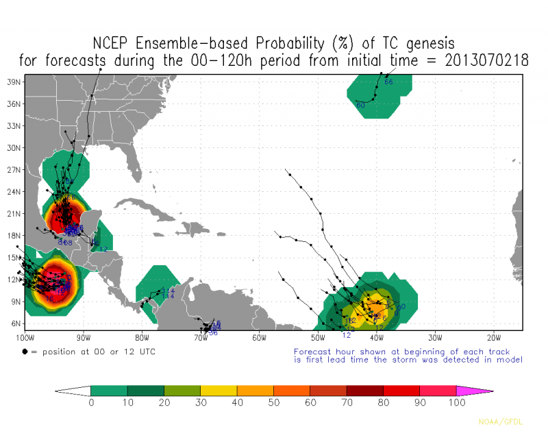
FOR THE NORTH ATLANTIC...CARIBBEAN SEA AND THE GULF OF MEXICO...
A SURFACE TROUGH PRODUCING AN AREA OF CLOUDINESS AND THUNDERSTORMS
OVER MUCH OF THE YUCATAN PENINSULA AND THE EASTERN BAY OF CAMPECHE
IS EXPECTED TO MOVE INTO THE SOUTHERN AND WESTERN GULF OF MEXICO
DURING THE NEXT SEVERAL DAYS. UPPER-LEVEL WINDS ARE CURRENTLY
UNFAVORABLE FOR DEVELOPMENT...BUT THEY COULD BECOME MARGINALLY
CONDUCIVE OVER THE NEXT FEW DAYS AS THE DISTURBANCE MOVES
WEST-NORTHWESTWARD TO NORTHWESTWARD AT ABOUT 10 MPH. THIS SYSTEM
HAS A LOW CHANCE...NEAR 10 PERCENT...OF BECOMING A TROPICAL
CYCLONE DURING THE NEXT 48 HOURS.
ELSEWHERE...TROPICAL CYCLONE FORMATION IS NOT EXPECTED DURING THE
NEXT 48 HOURS.
$$
FORECASTER STEWART


