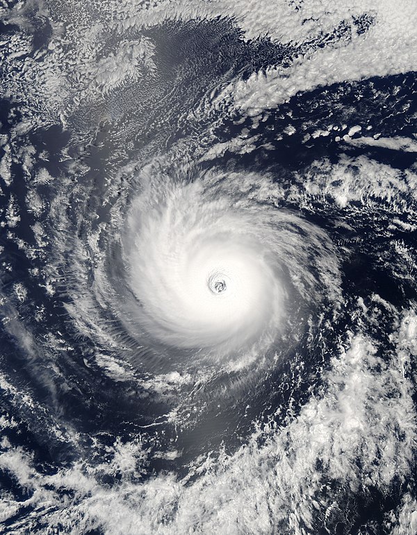
euro6208 wrote:It's incredible to see such a large typhoon with a classic pinhole eye...Registered 8.0 on the dvorak scale for nine consecutive hours...
Not a pinhole eye lol

Moderator: S2k Moderators


euro6208 wrote:It's incredible to see such a large typhoon with a classic pinhole eye...Registered 8.0 on the dvorak scale for nine consecutive hours...
supercane4867 wrote:euro6208 wrote:It's incredible to see such a large typhoon with a classic pinhole eye...Registered 8.0 on the dvorak scale for nine consecutive hours...
Not a pinhole eye lol

euro6208 wrote:That was before the peak intensity...


supercane4867 wrote:Gay along with Angela and Zeb are known as the top three typhoons of 1990s
It's a hard decision to tell which one was the strongest
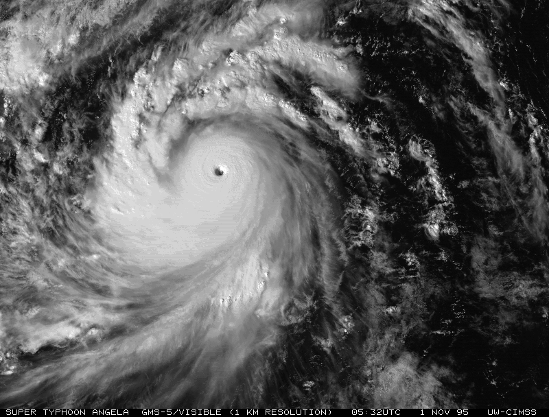
http://tropic.ssec.wisc.edu/storm_archive/1995/storms/angela/ANGELA.GIF
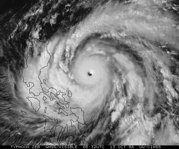
http://tropic.ssec.wisc.edu/storm_archive/1998/storms/zeb/ZEB2.GIF
Hurricane_Luis wrote:3 1990s Typhoon Peaks.
Super Typhoon Angela – 910 hPa (mbar), 215 km/h (130 mph)
Super Typhoon Zeb - 900 hPa (mbar), 205 km/h (125 mph)
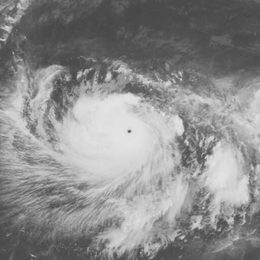
Super Typhoon Gay - 900 hPa (mbar), 205 km/h (125 mph)
The Pacific usually has the best looking cyclones. And Angela was the strongest of the 3.
supercane4867 wrote:Hurricane_Luis wrote:3 1990s Typhoon Peaks.
Super Typhoon Angela – 910 hPa (mbar), 215 km/h (130 mph)
Super Typhoon Zeb - 900 hPa (mbar), 205 km/h (125 mph)
Super Typhoon Gay - 900 hPa (mbar), 205 km/h (125 mph)
The Pacific usually has the best looking cyclones. And Angela was the strongest of the 3.
The JTWC disagrees
Angela - 155kt
Zeb - 155kt
Gay - 160kt
I rarely put JMA's estimate into consideration in terms of intensity, they are way outlandish sometimes
However I do agree Angela is a good competitor with Gay


euro6208 wrote:supercane4867 wrote:Hurricane_Luis wrote:3 1990s Typhoon Peaks.
Super Typhoon Angela – 910 hPa (mbar), 215 km/h (130 mph)
Super Typhoon Zeb - 900 hPa (mbar), 205 km/h (125 mph)
Super Typhoon Gay - 900 hPa (mbar), 205 km/h (125 mph)
The Pacific usually has the best looking cyclones. And Angela was the strongest of the 3.
The JTWC disagrees
Angela - 155kt
Zeb - 155kt
Gay - 160kt
I rarely put JMA's estimate into consideration in terms of intensity, they are way outlandish sometimes
However I do agree Angela is a good competitor with Gay
why even use JMA estimates aka 10 min winds...They are low biased and their dvorak scale makes our typhoons and seasons look weaker...
Hurricane_Luis wrote:They should do it Australian style. Measure a cyclones intensity by its highest wind gusts.


euro6208 wrote:Super Typhoon Zeb making landfall. (155 knots)


euro6208 wrote:I really like this kind of topic. Why isn't it popular nowadays? I'm pretty sure there are other ones like this lost in this forum...


Users browsing this forum: chaser1 and 36 guests