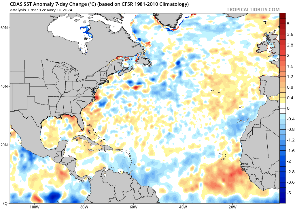
Could the image below explain why the Atlantic has been cooler than normal for so long? The atmosphere has been in a +NAO state going back to January this year. There are some small dips into - territory but as a whole for the last 4 months or so it has been mostly positive. I learned that +NAO tends to have a stronger Azored High...which causes stronger trades and thus cooler than normal Atlantic SST. Could this also explain why some think we may be switching to a -AMO...but it is actually the +NAO responsible? Any thoughts on this??

Sent from my iPhone using Tapatalk