2020 Indicators: SST's / SAL / MSLP / Steering / Shear / Instability / Sat Images
Moderator: S2k Moderators
Forum rules

The posts in this forum are NOT official forecasts and should not be used as such. They are just the opinion of the poster and may or may not be backed by sound meteorological data. They are NOT endorsed by any professional institution or STORM2K. For official information, please refer to products from the National Hurricane Center and National Weather Service.
-
Aric Dunn
- Category 5

- Posts: 21238
- Age: 43
- Joined: Sun Sep 19, 2004 9:58 pm
- Location: Ready for the Chase.
- Contact:
Re: 2020 Indicators: SST's / SAL / MSLP / Steering / Shear / Instability / Sat Images
to be fair.. we are probably going to get Isaias before August first..
0 likes
Note: If I make a post that is brief. Please refer back to previous posts for the analysis or reasoning. I do not re-write/qoute what my initial post said each time.
If there is nothing before... then just ask
Space & Atmospheric Physicist, Embry-Riddle Aeronautical University,
I believe the sky is falling...
If there is nothing before... then just ask
Space & Atmospheric Physicist, Embry-Riddle Aeronautical University,
I believe the sky is falling...

Re: 2020 Indicators: SST's / SAL / MSLP / Steering / Shear / Instability / Sat Images
There’s a ton of shear currently present in the Caribbean, a full meat grinder of 30-40+ kt eastward winds. Is that expected to change in the coming days? If 92L doesn’t turn north and this shear pattern is still in place, it’ll be ripped to shreds.
1 likes
Irene '11 Sandy '12 Hermine '16 5/15/2018 Derecho Fay '20 Isaias '20 Elsa '21 Henri '21 Ida '21
I am only a meteorology enthusiast who knows a decent amount about tropical cyclones. Look to the professional mets, the NHC, or your local weather office for the best information.
I am only a meteorology enthusiast who knows a decent amount about tropical cyclones. Look to the professional mets, the NHC, or your local weather office for the best information.
-
TheStormExpert
Re: 2020 Indicators: SST's / SAL / MSLP / Steering / Shear / Instability / Sat Images
aspen wrote:There’s a ton of shear currently present in the Caribbean, a full meat grinder of 30-40+ kt eastward winds. Is that expected to change in the coming days? If 92L doesn’t turn north and this shear pattern is still in place, it’ll be ripped to shreds.
Could be why the Euro doesn’t do much much with 92L.
0 likes
-
gatorcane

- S2K Supporter

- Posts: 23703
- Age: 47
- Joined: Sun Mar 13, 2005 3:54 pm
- Location: Boca Raton, FL
Re: 2020 Indicators: SST's / SAL / MSLP / Steering / Shear / Instability / Sat Images
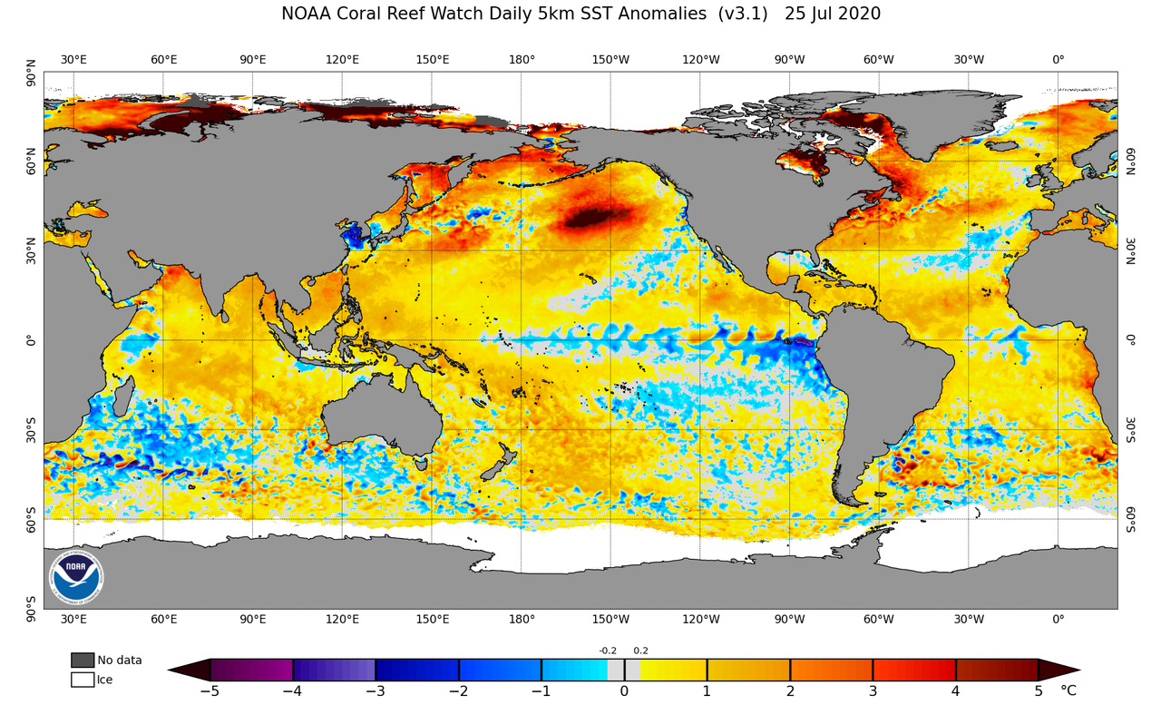
Anybody have any thoughts how/if the much warmer than normal pocket of water in the northern Pacific might impact potentially any steering in the Atlantic? One thought I have is maybe it causes a more progressive pattern as lows that track over the area might get stronger than normal which might cause perturbations in the jet stream across North America and Atlantic especially in the fall as mid-latitude lows traverse the Pacific. This progressive pattern might in turn impact the strength and and location of the Bermuda high causing it to be a bit weaker and more transient than normal?
1 likes

Re: 2020 Indicators: SST's / SAL / MSLP / Steering / Shear / Instability / Sat Images
Latest CFS shows little to nothing from here to the third week of August, followed by moderate activity for most of September and essentially shutting down in the MDR once we hit October, though there are quite a few systems in the subtropics in October that are hard to tell on that model if they're tropical or not.
1 likes
The above post is not official and should not be used as such. It is the opinion of the poster and may or may not be backed by sound meteorological data. It is not endorsed by any professional institution or storm2k.org. For official information, please refer to the NHC and NWS products.
-
WeatherEmperor
- S2K Supporter
- Posts: 4806
- Age: 41
- Joined: Thu Sep 04, 2003 2:54 pm
- Location: South Florida
Re: 2020 Indicators: SST's / SAL / MSLP / Steering / Shear / Instability / Sat Images
Hammy wrote:Latest CFS shows little to nothing from here to the third week of August, followed by moderate activity for most of September and essentially shutting down in the MDR once we hit October, though there are quite a few systems in the subtropics in October that are hard to tell on that model if they're tropical or not.
Is the CFS showing any development in the SW Caribbean in October? Thats usually an area to watch with La Nina conditions such as this year
Sent from my iPhone using Tapatalk
0 likes
-
CFLHurricane

- Category 1

- Posts: 349
- Joined: Thu Mar 27, 2014 5:56 pm
- Location: Floriduh
Re: 2020 Indicators: SST's / SAL / MSLP / Steering / Shear / Instability / Sat Images
Hammy wrote:Latest CFS shows little to nothing from here to the third week of August, followed by moderate activity for most of September and essentially shutting down in the MDR once we hit October, though there are quite a few systems in the subtropics in October that are hard to tell on that model if they're tropical or not.
Do you think the CFS likes powdered or cracked?
6 likes
I'm not a meteorologist, but I did stay at a motel 8.
-
toad strangler

- S2K Supporter
- Posts: 4546
- Joined: Sun Jul 28, 2013 3:09 pm
- Location: Earth
- Contact:
Re: 2020 Indicators: SST's / SAL / MSLP / Steering / Shear / Instability / Sat Images
Hammy is wetting the 'ol Season Cancel whistle
1 likes
My Weather Station
https://www.wunderground.com/dashboard/pws/KFLPORTS603
https://www.wunderground.com/dashboard/pws/KFLPORTS603
Re: 2020 Indicators: SST's / SAL / MSLP / Steering / Shear / Instability / Sat Images
Hammy wrote:Latest CFS shows little to nothing from here to the third week of August, followed by moderate activity for most of September and essentially shutting down in the MDR once we hit October, though there are quite a few systems in the subtropics in October that are hard to tell on that model if they're tropical or not.
I’m not trusting any model predictions that are weeks to months out. If the Atlantic can pump out two AEW-based systems in the same week in July while SAL is still an issue, and has been producing storms at a record pace despite still being in a less active part of the season, then why would it suddenly revert to average levels of activity during peak months?
11 likes
Irene '11 Sandy '12 Hermine '16 5/15/2018 Derecho Fay '20 Isaias '20 Elsa '21 Henri '21 Ida '21
I am only a meteorology enthusiast who knows a decent amount about tropical cyclones. Look to the professional mets, the NHC, or your local weather office for the best information.
I am only a meteorology enthusiast who knows a decent amount about tropical cyclones. Look to the professional mets, the NHC, or your local weather office for the best information.
Re: 2020 Indicators: SST's / SAL / MSLP / Steering / Shear / Instability / Sat Images
CFLHurricane wrote:Hammy wrote:Latest CFS shows little to nothing from here to the third week of August, followed by moderate activity for most of September and essentially shutting down in the MDR once we hit October, though there are quite a few systems in the subtropics in October that are hard to tell on that model if they're tropical or not.
Do you think the CFS likes powdered or cracked?
Well this seems like a good laugh. Let's believe a 3 month forecast when models couldn't see a hurricane in the gulf a day out!
7 likes
Re: 2020 Indicators: SST's / SAL / MSLP / Steering / Shear / Instability / Sat Images
aspen wrote:Hammy wrote:Latest CFS shows little to nothing from here to the third week of August, followed by moderate activity for most of September and essentially shutting down in the MDR once we hit October, though there are quite a few systems in the subtropics in October that are hard to tell on that model if they're tropical or not.
I’m not trusting any model predictions that are weeks to months out. If the Atlantic can pump out two AEW-based systems in the same week in July while SAL is still an issue, and has been producing storms at a record pace despite still being in a less active part of the season, then why would it suddenly revert to average levels of activity during peak months?
Similar to the last two years it's showing the waves coming off much further north during August than they normally do along with a lot of shear based on what the seasonal model is showing. And it's been fairly accurate the last few seasons that I've been checking, at least regarding the general direction of the season. It was similarly correct last year that we'd see a lower hurricane count.
And the MDR is clearly less favorable than most here have been thinking given the otherwise favorable background state elsewhere--all the models are trending downward with 92L and Gonzalo under-performed practically all of the guidance.
2 likes
The above post is not official and should not be used as such. It is the opinion of the poster and may or may not be backed by sound meteorological data. It is not endorsed by any professional institution or storm2k.org. For official information, please refer to the NHC and NWS products.
-
AxaltaRacing24
- Category 5
- Posts: 1774
- Age: 25
- Joined: Wed Jul 27, 2016 11:14 am
- Location: Jupiter, FL
Re: 2020 Indicators: SST's / SAL / MSLP / Steering / Shear / Instability / Sat Images
Hammy wrote:aspen wrote:Hammy wrote:Latest CFS shows little to nothing from here to the third week of August, followed by moderate activity for most of September and essentially shutting down in the MDR once we hit October, though there are quite a few systems in the subtropics in October that are hard to tell on that model if they're tropical or not.
I’m not trusting any model predictions that are weeks to months out. If the Atlantic can pump out two AEW-based systems in the same week in July while SAL is still an issue, and has been producing storms at a record pace despite still being in a less active part of the season, then why would it suddenly revert to average levels of activity during peak months?
Similar to the last two years it's showing the waves coming off much further north during August than they normally do along with a lot of shear based on what the seasonal model is showing. And it's been fairly accurate the last few seasons that I've been checking, at least regarding the general direction of the season. It was similarly correct last year that we'd see a lower hurricane count.
And the MDR is clearly less favorable than most here have been thinking given the otherwise favorable background state elsewhere--all the models are trending downward with 92L and Gonzalo under-performed practically all of the guidance.
Hammy, it's July....
Just because this wave might not become a major, it does not mean that in 3 weeks, things will change as we head into the peak.
plus, Gonzalo and this even wave being there in the first place is already an overpeformance for this part of the season.
4 likes
-
toad strangler
- S2K Supporter
- Posts: 4546
- Joined: Sun Jul 28, 2013 3:09 pm
- Location: Earth
- Contact:
Re: 2020 Indicators: SST's / SAL / MSLP / Steering / Shear / Instability / Sat Images
Hammy wrote:aspen wrote:Hammy wrote:Latest CFS shows little to nothing from here to the third week of August, followed by moderate activity for most of September and essentially shutting down in the MDR once we hit October, though there are quite a few systems in the subtropics in October that are hard to tell on that model if they're tropical or not.
I’m not trusting any model predictions that are weeks to months out. If the Atlantic can pump out two AEW-based systems in the same week in July while SAL is still an issue, and has been producing storms at a record pace despite still being in a less active part of the season, then why would it suddenly revert to average levels of activity during peak months?
Similar to the last two years it's showing the waves coming off much further north during August than they normally do along with a lot of shear based on what the seasonal model is showing. And it's been fairly accurate the last few seasons that I've been checking, at least regarding the general direction of the season. It was similarly correct last year that we'd see a lower hurricane count.
And the MDR is clearly less favorable than most here have been thinking given the otherwise favorable background state elsewhere--all the models are trending downward with 92L and Gonzalo under-performed practically all of the guidance.
Gonzalo under performed? It shouldn't have even been there lol. Get a hold of yourself Hammy!
11 likes
My Weather Station
https://www.wunderground.com/dashboard/pws/KFLPORTS603
https://www.wunderground.com/dashboard/pws/KFLPORTS603
Re: 2020 Indicators: SST's / SAL / MSLP / Steering / Shear / Instability / Sat Images
AxaltaRacing24 wrote:Hammy wrote:aspen wrote:I’m not trusting any model predictions that are weeks to months out. If the Atlantic can pump out two AEW-based systems in the same week in July while SAL is still an issue, and has been producing storms at a record pace despite still being in a less active part of the season, then why would it suddenly revert to average levels of activity during peak months?
Similar to the last two years it's showing the waves coming off much further north during August than they normally do along with a lot of shear based on what the seasonal model is showing. And it's been fairly accurate the last few seasons that I've been checking, at least regarding the general direction of the season. It was similarly correct last year that we'd see a lower hurricane count.
And the MDR is clearly less favorable than most here have been thinking given the otherwise favorable background state elsewhere--all the models are trending downward with 92L and Gonzalo under-performed practically all of the guidance.
Hammy, it's July....
Just because this wave might not become a major, it does not mean that in 3 weeks, things will change as we head into the peak.
plus, Gonzalo and this even wave being there in the first place is already an overpeformance for this part of the season.
The model is not forecasting a quiet season, nor am I--I'm updating from time to time the changing trends with the model as it tends to give an idea of how the season will go. But there seems like there's suddenly this tendency to jump on everything that forms as if it'll become a major hurricane--this wave is being treated as such, several posters with Gonzalo, with Hanna as well, and the conditions are not there to support major hurricane after major hurricane like 2017 as the shear is higher.
Regarding the model (and this is a bit subjective as the model is low resolution) a rundown of the latest run:
13/5/3 between now and mid-October (when the model ends) which would put the season at 21/6/3 and is also forecasting a lull in activity (as often happens) during the first two weeks or so of August, as well as a second in the first half of October.
There are a few caveats: There did not appear to be any Gulf activity and the generally low pressure blends in with any storm that the model might be forming over the southern Gulf, because of the resolution I'd put the number of hurricanes between 5-8 on this particular run, and I did not include anything that started north of 35 because it's impossible on this resolution to tell if those are tropical or not.
toad strangler wrote:Gonzalo under performed? It shouldn't have even been there lol. Get a hold of yourself Hammy!
Forecast to 80 mph and only making it to 65 and rapidly weakening is certainly not over-performing, which everything outside of the MDR has done.
3 likes
The above post is not official and should not be used as such. It is the opinion of the poster and may or may not be backed by sound meteorological data. It is not endorsed by any professional institution or storm2k.org. For official information, please refer to the NHC and NWS products.
-
CyclonicFury

- Category 5
- Posts: 2030
- Age: 27
- Joined: Sun Jul 02, 2017 12:32 pm
- Location: NC
- Contact:
Re: 2020 Indicators: SST's / SAL / MSLP / Steering / Shear / Instability / Sat Images
Hammy wrote:AxaltaRacing24 wrote:Hammy wrote:
Similar to the last two years it's showing the waves coming off much further north during August than they normally do along with a lot of shear based on what the seasonal model is showing. And it's been fairly accurate the last few seasons that I've been checking, at least regarding the general direction of the season. It was similarly correct last year that we'd see a lower hurricane count.
And the MDR is clearly less favorable than most here have been thinking given the otherwise favorable background state elsewhere--all the models are trending downward with 92L and Gonzalo under-performed practically all of the guidance.
Hammy, it's July....
Just because this wave might not become a major, it does not mean that in 3 weeks, things will change as we head into the peak.
plus, Gonzalo and this even wave being there in the first place is already an overpeformance for this part of the season.
The model is not forecasting a quiet season, nor am I--I'm updating from time to time the changing trends with the model as it tends to give an idea of how the season will go. But there seems like there's suddenly this tendency to jump on everything that forms as if it'll become a major hurricane--this wave is being treated as such, several posters with Gonzalo, with Hanna as well, and the conditions are not there to support major hurricane after major hurricane like 2017 as the shear is higher.
Regarding the model (and this is a bit subjective as the model is low resolution) a rundown of the latest run:
13/5/3 between now and mid-October (when the model ends) which would put the season at 21/6/3 and is also forecasting a lull in activity (as often happens) during the first two weeks or so of August, as well as a second in the first half of October.
There are a few caveats: There did not appear to be any Gulf activity and the generally low pressure blends in with any storm that the model might be forming over the southern Gulf, because of the resolution I'd put the number of hurricanes between 5-8 on this particular run, and I did not include anything that started north of 35 because it's impossible on this resolution to tell if those are tropical or not.toad strangler wrote:Gonzalo under performed? It shouldn't have even been there lol. Get a hold of yourself Hammy!
Forecast to 80 mph and only making it to 65 and rapidly weakening is certainly not over-performing, which everything outside of the MDR has done.
To be fair, Gonzalo was initially only expected to peak at 65 mph, which is exactly how strong it became. Intensity guidance seems to have a high bias in tiny storms in low shear environments. For instance, TD 6 in July 2003 was initially expected to reach hurricane strength in the MDR, but failed to even get named. Despite TD 6 significantly underperforming, the MDR produced two powerful long trackers in 2003: Fabian and Isabel.
MDR hurricanes east of the Antilles during July are also quite rare to begin with, I only know of Bertha 1996/2008, Emily 2005 and Beryl 2018. 92L may not exceed TS strength in the MDR but I still think it is an ominous sign for peak that we have potentially two MDR named storms before August 1. Most of the strongest MDR hurricanes don't form until late August or September.
11 likes
NCSU B.S. in Meteorology Class of 2021. Tropical weather blogger at http://www.cyclonicfury.com. My forecasts and thoughts are NOT official, for official forecasts please consult the National Hurricane Center.
-
toad strangler
- S2K Supporter
- Posts: 4546
- Joined: Sun Jul 28, 2013 3:09 pm
- Location: Earth
- Contact:
Re: 2020 Indicators: SST's / SAL / MSLP / Steering / Shear / Instability / Sat Images
Hammy wrote:AxaltaRacing24 wrote:Hammy wrote:
Forecast to 80 mph and only making it to 65 and rapidly weakening is certainly not over-performing, which everything outside of the MDR has done.
IMO it's elementary to understand that a deep tropics MDR system has no place there in mid July. THAT comes first. Before any model forecast of said very early deep tropics MDR system. I could never see eye to eye with you on this. God BLess America!

4 likes
My Weather Station
https://www.wunderground.com/dashboard/pws/KFLPORTS603
https://www.wunderground.com/dashboard/pws/KFLPORTS603
Re: 2020 Indicators: SST's / SAL / MSLP / Steering / Shear / Instability / Sat Images
CyclonicFury wrote:To be fair, Gonzalo was initially only expected to peak at 65 mph, which is exactly how strong it became. Intensity guidance seems to have a high bias in tiny storms in low shear environments. For instance, TD 6 in July 2003 was initially expected to reach hurricane strength in the MDR, but failed to even get named. Despite TD 6 significantly underperforming, the MDR produced two powerful long trackers in 2003: Fabian and Isabel.
MDR hurricanes east of the Antilles during July are also quite rare to begin with, I only know of Bertha 1996/2008, Emily 2005 and Beryl 2018. 92L may not exceed TS strength in the MDR but I still think it is an ominous sign for peak that we have potentially two MDR named storms before August 1. Most of the strongest MDR hurricanes don't form until late August or September.
That is essentially consistent with what the CFS has been showing. I just get the impression lately that a lot of people here are now expecting every model storm to turn into a major hurricane, hence feeling it'll be less favorable than a lot think. And there does seem like there's evidence for a lull, and that conditions may be in the process of flipping to that, at least in the MDR, something that's also been consistent with a lot of active seasons--even 2005 had nothing form for almost 20 days preceding Katrina.
On a side note does anybody know where I can find a higher resolution version that goes out all the way, it's not easy trying to guess the intensity while having to use four different maps
4 likes
The above post is not official and should not be used as such. It is the opinion of the poster and may or may not be backed by sound meteorological data. It is not endorsed by any professional institution or storm2k.org. For official information, please refer to the NHC and NWS products.
-
toad strangler
- S2K Supporter
- Posts: 4546
- Joined: Sun Jul 28, 2013 3:09 pm
- Location: Earth
- Contact:
Re: 2020 Indicators: SST's / SAL / MSLP / Steering / Shear / Instability / Sat Images
Hammy wrote:CyclonicFury wrote:To be fair, Gonzalo was initially only expected to peak at 65 mph, which is exactly how strong it became. Intensity guidance seems to have a high bias in tiny storms in low shear environments. For instance, TD 6 in July 2003 was initially expected to reach hurricane strength in the MDR, but failed to even get named. Despite TD 6 significantly underperforming, the MDR produced two powerful long trackers in 2003: Fabian and Isabel.
MDR hurricanes east of the Antilles during July are also quite rare to begin with, I only know of Bertha 1996/2008, Emily 2005 and Beryl 2018. 92L may not exceed TS strength in the MDR but I still think it is an ominous sign for peak that we have potentially two MDR named storms before August 1. Most of the strongest MDR hurricanes don't form until late August or September.
That is essentially consistent with what the CFS has been showing. I just get the impression lately that a lot of people here are now expecting every model storm to turn into a major hurricane, hence feeling it'll be less favorable than a lot think. And there does seem like there's evidence for a lull, and that conditions may be in the process of flipping to that, at least in the MDR, something that's also been consistent with a lot of active seasons--even 2005 had nothing form for almost 20 days preceding Katrina.
On a side note does anybody know where I can find a higher resolution version that goes out all the way, it's not easy trying to guess the intensity while having to use four different maps
Every model storm to turn into a major? I haven't seen anybody do that
1 likes
My Weather Station
https://www.wunderground.com/dashboard/pws/KFLPORTS603
https://www.wunderground.com/dashboard/pws/KFLPORTS603
-
BYG Jacob
Re: 2020 Indicators: SST's / SAL / MSLP / Steering / Shear / Instability / Sat Images
Hugging the CFS is a weird hill to die on.
4 likes
-
TheHurricaneGod
- Tropical Storm

- Posts: 165
- Age: 23
- Joined: Thu Apr 16, 2020 6:19 pm
- Location: Fort Lauderdale
Re: 2020 Indicators: SST's / SAL / MSLP / Steering / Shear / Instability / Sat Images
Lol, CFS. Like a screen door on a submarine. useless. next.
4 likes
Who is online
Users browsing this forum: gib and 77 guests