


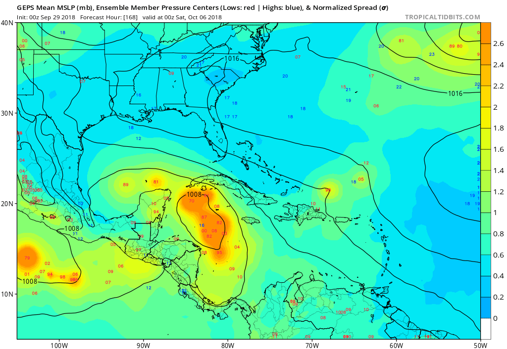
Hurricaneman wrote:TheStormExpert wrote:How todays 12z Euro ends with a 1007mb broad low sitting and slowly deepening between Cuba and Jamaica.
https://i.imgur.com/2omJfOX.png
That setup on the Euro would have the same results as the GFS but the GFS is faster with ejecting the Caribbean feature than the Euro by like 2 to 3 days
Yeah the 12 GFS has it barely SW of Bermuda by day 10, the 12z FV3-GFS is between the 12z GFS and Euro at day 10 with it just NE of the SE Bahamas and the Turks and Caicos Islands.
Consensus though is growing that this will take one of the many typical October tracks seen from Western Caribbean tropical cyclones, forms in the Western Caribbean and immediately heads NE across Eastern Cuba through the SE Bahamas and OTS. Still too soon if that though will be the ultimate outcome but that seems most likely right now.


