Tropical Wave SW of the Cabo Verde Islands (Is Invest 90L)

This is the general tropical discussion area. Anyone can take their shot at predicting a storms path.

Moderator: S2k Moderators

Forum rules

The posts in this forum are NOT official forecasts and should not be used as such. They are just the opinion of the poster and may or may not be backed by sound meteorological data. They are NOT endorsed by any professional institution or STORM2K. For official information, please refer to products from the National Hurricane Center and National Weather Service.

Help Support Storm2K
Message
Author
User avatar
abajan
S2K Supporter
S2K Supporter
Posts: 4175
Joined: Sun Sep 07, 2003 5:10 am
Location: Barbados

Re: Tropical Wave to emerge from West Africa on Wednesday

#41 Postby abajan » Tue Sep 19, 2023 7:02 am

8AM:
A tropical wave is expected to move off the west coast of Africa by
Wednesday. Environmental conditions are forecast to be conducive
for gradual development of the wave thereafter, and a tropical
depression is likely to form late this week or this weekend while
the system moves generally westward across the eastern and central
tropical Atlantic.
* Formation chance through 48 hours...low...near 0 percent.
* Formation chance through 7 days...high...70 percent.
0 likes   

User avatar
cycloneye
Admin
Admin
Posts: 139409
Age: 67
Joined: Thu Oct 10, 2002 10:54 am
Location: San Juan, Puerto Rico

Re: Tropical Wave to emerge from West Africa on Wednesday

#42 Postby cycloneye » Tue Sep 19, 2023 8:51 am

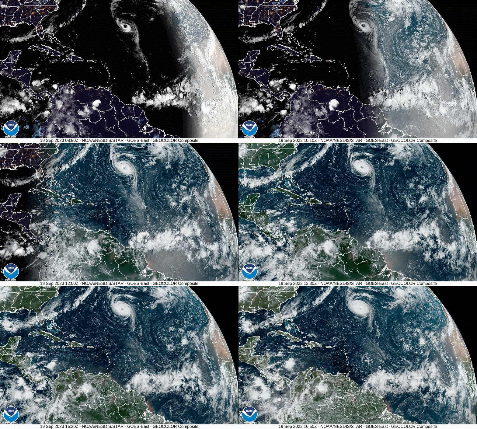
Wave close to emerging West Africa. You can see a weak turning of the clouds.

Image
0 likes   
Visit the Caribbean-Central America Weather Thread where you can find at first post web cams,radars
and observations from Caribbean basin members Click Here

User avatar
cycloneye
Admin
Admin
Posts: 139409
Age: 67
Joined: Thu Oct 10, 2002 10:54 am
Location: San Juan, Puerto Rico

Re: Tropical Wave to emerge from West Africa on Wednesday

#43 Postby cycloneye » Tue Sep 19, 2023 12:13 pm

Wow, UKMET develops this wave.

Image
2 likes   
Visit the Caribbean-Central America Weather Thread where you can find at first post web cams,radars
and observations from Caribbean basin members Click Here

User avatar
abajan
S2K Supporter
S2K Supporter
Posts: 4175
Joined: Sun Sep 07, 2003 5:10 am
Location: Barbados

Re: Tropical Wave to emerge from West Africa on Wednesday update: ICON, GFS, UKMET develop

#44 Postby abajan » Tue Sep 19, 2023 12:35 pm

2PM:
A tropical wave is expected to move off the west coast of Africa by
Wednesday. Environmental conditions are forecast to be conducive
for gradual development of the wave thereafter, and a tropical
depression is likely to form late this week or this weekend while
the system moves generally westward across the eastern and central
tropical Atlantic.
* Formation chance through 48 hours...low...near 0 percent.
* Formation chance through 7 days...high...70 percent.
0 likes   

Sciencerocks
Category 5
Category 5
Posts: 7291
Age: 38
Joined: Thu Jul 06, 2017 1:51 am

Re: Tropical Wave to emerge from West Africa on Wednesday

#45 Postby Sciencerocks » Tue Sep 19, 2023 12:49 pm

Image
0 likes   

User avatar
cycloneye
Admin
Admin
Posts: 139409
Age: 67
Joined: Thu Oct 10, 2002 10:54 am
Location: San Juan, Puerto Rico

Re: Tropical Wave emerging from West Africa

#46 Postby cycloneye » Tue Sep 19, 2023 4:53 pm

Splashing to the water.

Image

Image
2 likes   
Visit the Caribbean-Central America Weather Thread where you can find at first post web cams,radars
and observations from Caribbean basin members Click Here

IcyTundra
Category 3
Category 3
Posts: 889
Joined: Mon Jun 07, 2021 9:32 pm
Location: Dickinson, Texas

Re: Tropical Wave emerging from West Africa

#47 Postby IcyTundra » Tue Sep 19, 2023 5:39 pm

GFS has been taking this into the Caribbean the past 2 runs. Lesser and Greater Antilles have to watch this.
0 likes   

User avatar
Landy
Category 1
Category 1
Posts: 310
Joined: Wed Aug 11, 2021 7:43 pm
Location: Port Orange, FL

Re: Tropical Wave to emerge from West Africa

#48 Postby Landy » Tue Sep 19, 2023 6:01 pm

IcyTundra wrote:GFS has been taking this into the Caribbean the past 2 runs. Lesser and Greater Antilles have to watch this.

Seems like it's amping something in the ITCZ up which then interacts with this wave, causing whatever's left to stay south. Could be a messy system at first but definitely not as cut-and-dry for recurve chances as before. Euro still north for now.
4 likes   

User avatar
abajan
S2K Supporter
S2K Supporter
Posts: 4175
Joined: Sun Sep 07, 2003 5:10 am
Location: Barbados

Re: Tropical Wave emerging from West Africa

#49 Postby abajan » Tue Sep 19, 2023 7:19 pm

8PM:
A tropical wave is expected to move off the west coast of Africa by
Wednesday. Environmental conditions are forecast to be conducive
for gradual development of the wave thereafter, and a tropical
depression is likely to form late this week or this weekend while
the system moves generally westward at 10 to 15 mph across the
eastern and central tropical Atlantic.
* Formation chance through 48 hours...low...near 0 percent.
* Formation chance through 7 days...high...70 percent.
0 likes   

Ianswfl
Category 1
Category 1
Posts: 482
Joined: Thu Mar 23, 2023 11:11 pm

Re: Tropical Wave off the African Coast

#50 Postby Ianswfl » Tue Sep 19, 2023 11:35 pm

GFS 00z way west so far! :eek:

Image
0 likes   

Ianswfl
Category 1
Category 1
Posts: 482
Joined: Thu Mar 23, 2023 11:11 pm

2023 Global Model Runs Discussion (Out thru day 16)

#51 Postby Ianswfl » Tue Sep 19, 2023 11:41 pm

Still chucking west hitting Jamica as a major!

:eek:

Image
1 likes   

User avatar
Teban54
Category 5
Category 5
Posts: 1977
Joined: Sat May 19, 2018 1:19 pm

2023 Global Model Runs Discussion (Out thru day 16)

#52 Postby Teban54 » Tue Sep 19, 2023 11:44 pm

IcyTundra wrote:
Ianswfl wrote:
ThunderForce wrote:That's the thing though, anything after forecast hour 180/200 on the operational GFS should be taken with a grain of salt because of how wildly things can fluctuate between them. Compare how the current tropical wave storm was way further west before recurving in the last 12z run compared to the current 18z one. The further into the run you get, the less accurate the forecast is. They can be useful for certain data and trends though, of course.

I know how problematic Gulf storms are considering I directly went through Michael back in 2018 and had my entire hometown nearly wiped out. Letting my guard down is the last thing I plan on doing.


The GFS and ensembles did snuff out Ian and Idalia though long range. Of course landfall points vary each run but they give hints something will form. Seems last year and this year less phantom storms on the models.


Operational GFS performed poorly with the genesis of Idalia compared to the Euro. GFS refused to show Idalia developing until it became clear that there would be development. Can’t remember how the GEFS did.

With Idalia, while GEFS didn't wake up as embarrassingly late as the operational GFS did, it was still trailing behind EPS in showing development.
0 likes   

Ianswfl
Category 1
Category 1
Posts: 482
Joined: Thu Mar 23, 2023 11:11 pm

2023 Global Model Runs Discussion (Out thru day 16)

#53 Postby Ianswfl » Tue Sep 19, 2023 11:45 pm

This run is way west moving wsw now but big trof should pick this up.
0 likes   

Ianswfl
Category 1
Category 1
Posts: 482
Joined: Thu Mar 23, 2023 11:11 pm

Re: 2023 Global Model Runs Discussion (Out thru day 16)

#54 Postby Ianswfl » Tue Sep 19, 2023 11:55 pm

927mb and starting to turn nw while getting stronger. Runs the channel? Someone in the Gulf is going to get smoked by this.

Image
1 likes   

Ianswfl
Category 1
Category 1
Posts: 482
Joined: Thu Mar 23, 2023 11:11 pm

Re: 2023 Global Model Runs Discussion (Out thru day 16)

#55 Postby Ianswfl » Wed Sep 20, 2023 12:00 am

Path so far reminding me of Wilma, tick east maybe :eek:

Image
1 likes   

User avatar
Landy
Category 1
Category 1
Posts: 310
Joined: Wed Aug 11, 2021 7:43 pm
Location: Port Orange, FL

Re: 2023 Global Model Runs Discussion (Out thru day 16)

#56 Postby Landy » Wed Sep 20, 2023 12:18 am

Hall of fame run between the Allen/Gilbert/Ivan mashup and a Sandy repeat out in the open Atlantic.
Image
2 likes   

Ianswfl
Category 1
Category 1
Posts: 482
Joined: Thu Mar 23, 2023 11:11 pm

Re: 2023 Global Model Runs Discussion (Out thru day 16)

#57 Postby Ianswfl » Wed Sep 20, 2023 12:20 am

Landy wrote:Hall of fame run between the Allen/Gilbert/Ivan mashup and a Sandy repeat out in the open Atlantic.
https://media.discordapp.net/attachments/733552978572869632/1153922715200270418/1695187011363840566.gif?width=967&height=684


Ensembles lookign more active too so far! I think it will adjust back east a bit though. Still think Tampa on South at biggest risk from a CAG or something else.
0 likes   

MSUDawg
Tropical Storm
Tropical Storm
Posts: 100
Joined: Fri Jan 07, 2011 11:07 pm
Location: Centerport DFW

Re: Tropical Wave off the African Coast

#58 Postby MSUDawg » Wed Sep 20, 2023 12:28 am

Ianswfl wrote:GFS 00z way west so far! :eek:

Image


For once. Let's please not let this happen...
Leaving on a cruise to Jamaica and grand Cayman on the 30th. Would rather not meet up with this in the gulf...
0 likes   

User avatar
ThunderForce
Tropical Storm
Tropical Storm
Posts: 158
Age: 25
Joined: Tue Sep 27, 2022 6:20 pm
Location: Florida Panhandle

Re: 2023 Global Model Runs Discussion (Out thru day 16)

#59 Postby ThunderForce » Wed Sep 20, 2023 12:34 am

Safe to say I absolutely hate this run. Not only is this literally the largest hurricane force wind radius I've ever seen in the Atlantic basin, but the hurricane force winds seem to stretch out all the way from Bay St. Louis, MS to near Perry, FL. Absolute devastation for the FL Panhandle, Southern Alabama and Southern Mississippi.
2 likes   
Please refer to the NWS, NHC, SPC or a professional meteorologist for information and decision making during storms.

Ianswfl
Category 1
Category 1
Posts: 482
Joined: Thu Mar 23, 2023 11:11 pm

Re: 2023 Global Model Runs Discussion (Out thru day 16)

#60 Postby Ianswfl » Wed Sep 20, 2023 12:39 am

ThunderForce wrote:Safe to say I absolutely hate this run. Not only is this literally the largest hurricane force wind radius I've ever seen in the Atlantic basin, but the hurricane force winds seem to stretch out all the way from Bay St. Louis, MS to near Perry, FL. Absolute devastation for the FL Panhandle, Southern Alabama and Southern Mississippi.


Yep. Personally i think it shifts back east in future runs due to time of the year climo wise
0 likes   


Return to “Talkin' Tropics”

Who is online

Users browsing this forum: No registered users and 20 guests