2015 Global model runs discussion
Moderator: S2k Moderators
Forum rules

The posts in this forum are NOT official forecasts and should not be used as such. They are just the opinion of the poster and may or may not be backed by sound meteorological data. They are NOT endorsed by any professional institution or STORM2K. For official information, please refer to products from the National Hurricane Center and National Weather Service.
-
WPBWeather

- S2K Supporter

- Posts: 535
- Age: 65
- Joined: Thu Jul 18, 2013 12:33 pm
Re: Global model runs discussion
Actually, the last run shows an area where a front will stall (east of the BI) and then who knows. If a model "works" then it should work in two basins with not many degrees of longitude between the "ghosts."
0 likes
-
gatorcane

- S2K Supporter
- Posts: 23499
- Age: 46
- Joined: Sun Mar 13, 2005 3:54 pm
- Location: Boca Raton, FL
12Z GFS back to showing a Caribbean storm that gets pulled north and into Florida after showing the system in the EPAC or not developing that past couple of runs. Climatology would agree with this type of scenario.
Development timeframe has come into to around 252 hours in the NW Caribbean but note that timeframe is still very far out.

Development timeframe has come into to around 252 hours in the NW Caribbean but note that timeframe is still very far out.
0 likes
-
Hurricaneman

- Category 5

- Posts: 7284
- Age: 43
- Joined: Tue Aug 31, 2004 3:24 pm
- Location: central florida
Re: Global model runs discussion
And we need to watch the area around 35N 45W as the GFS has been sending this towards the Bahamas for several runs and has it off and on developing but currently shows a sharp trough heading that way so something else to watch and was kind of mentioned a few posts ago
The posts in this forum are NOT official forecast and should not be used as such. They are just the opinion of the poster and may or may not be backed by sound meteorological data. They are NOT endorsed by any professional institution or storm2k.org. For official information, please refer to the NHC and NWS products
The posts in this forum are NOT official forecast and should not be used as such. They are just the opinion of the poster and may or may not be backed by sound meteorological data. They are NOT endorsed by any professional institution or storm2k.org. For official information, please refer to the NHC and NWS products
0 likes
-
HURRICANELONNY
- Category 5
- Posts: 1381
- Joined: Wed May 07, 2003 6:48 am
- Location: HOLLYWOOD.FL
Re: Global model runs discussion
I see the Get Florida Soon (gfs) is at it right out of the gate. One of these years it will get it right and nobody will care. 
0 likes
hurricanelonny
-
MiamiensisWx
Global model runs discussion
^Gatorcane, that system in the Bay of Campeche is too far out for me to be interested/worried. I would look for consensus in the short range.
Regarding the potential system near S FL:
I wouldn’t get too excited about this potential system. First, both the GFS and the ECMWF have terrible records at predicting tropical genesis. Even within the very short range, they have often failed rather spectacularly. Case in point: for several of the recent INVESTs in the Eastern Pacific, both models showed development of at least weak tropical storms…two to three days out. What actually happened was a steaming pile of nothing. No development at all. If these models–one supposedly highly upgraded, another the very best in the world–can miss the bus in such a short time frame, imagine how great their errors are likely to be 120+ hours (five or more days) out. Frankly, even with fairly good consensus between the two models, I wouldn’t pay attention to anything more than three days out. I wouldn’t pay attention even with decent agreement on the timing and area of formation. Why? The reason(s) will become clear shortly.
Take a good look at the environment on the 12Z GFS. The set-up at 500 mb (that is, the mid levels) shows a well-defined cutoff low in the southern jet stream that pinches off over the northern Gulf Coast by day 7. At about the same time, the surface winds show a broad trough developing over the NW Caribbean and the SE Gulf, with a weak, ill-defined, elongated low developing somewhere near S FL (whether east or west of the peninsula is unimportant for illustration). Notice how the low-level circulation doesn’t really get going until the mid- to upper-level cutoff low fully establishes itself nearby. That is a big clue that the system shown on the GFS and ECMWF runs is not fully tropical, but rather a hybrid-type or even subtropical cyclone. Hybrid systems this time of year often start out as sheared, weak lows within a broad area of low environmental pressures and weak surface winds. In these cases, the system is often so broad and disorganized that it takes many, many days to organize, if indeed it does so at all. During much of its life, the system will often feature the strongest winds/heaviest rainfall displaced hundreds of miles from the center, with little if any meaningful “weather” closer to the center.
That is exactly what the GFS shows. The system by days 7-8 is so broad that all the heavy rain occurs well east of the center, thanks in part to strong vertical wind shear due to the mid-/upper-level trough nearby. Even if the system, as is favored by early-June climatology, were to track west of FL, almost all of the meaningful rainfall would be displaced to the east of the peninsula. Also, due to low environmental pressures and the disorganized nature of the low, almost all of the strong winds (30 kt/35 mph or greater) would be in association with the convection east of FL. Areas over the peninsula itself would see much weaker winds, not much different than what is often seen in an average, diurnally-driven, summertime rainy season. Basically, FL would see an ordinary day, with plenty of sunshine due to mid-level dry air wrapping around the system (thanks, mid-level trough!).
In a nutshell, this detailed discussion boils down to some key bullet points:
*The models are forecasting a weak, disorganized low to form in the long range somewhere over the NW Caribbean or near S FL. The key words are “weak,” “disorganized,” and “long range.” When have the models ever nailed such early-season development? Almost never.
*Even if the models were to verify, the mid-/upper-level trough would need to be substantially weaker or weaken faster. Only then would a tropical, as opposed to hybrid, system be able to become vertically stacked, thereby generating a core of stronger winds and high precipitation nearer to the center.
*If the trough verifies as forecast, even a system that tracks well west of FL would be so disorganized that the state would experience almost no meaningful impacts.
Here is what I would look for before getting excited/worried about a potential system:
*A weaker/filling mid-/upper-level trough, with substantially reduced vertical wind shear nearby. Even if the trough only weakens somewhat, a negative tilt from NW to SE could allow better ventilation of a potential system and also reduce net/overall shear somewhat.
*Less mid-level dry air surrounding the system. (The above would help in that regard.)
*Models trend toward a stronger, more consolidated system with tropical characteristics, such as stronger winds and high precipitation closer to the center.
*Models show at least a strong tropical storm (55 kt/65 mph) or an exceptional rainfall event with widespread flood potential. A storm typically begins to produce consequential wind damage once sustained winds reach 65 mph or higher. Shifting the heavy rains west over the FL peninsula would increase the flood threat.
*All these trends must happen within three days, not farther out in the medium to long range.
*Short-range model consensus must be strong.
Cheers and glad to be back,
Miami
0 likes
-
WPBWeather
- S2K Supporter
- Posts: 535
- Age: 65
- Joined: Thu Jul 18, 2013 12:33 pm
Re: Global model runs discussion
Lots of good thoughts here. But, did you see Ana coming a few weeks back? Things look much more conducive to something developing in the near future than they did when Ana appeared.
Miami said...
Regarding the potential system near S FL:
I wouldn’t get too excited about this potential system. First, both the GFS and the ECMWF have terrible records at predicting tropical genesis. Even within the very short range, they have often failed rather spectacularly. Case in point: for several of the recent INVESTs in the Eastern Pacific, both models showed development of at least weak tropical storms…two to three days out. What actually happened was a steaming pile of nothing. No development at all. If these models–one supposedly highly upgraded, another the very best in the world–can miss the bus in such a short time frame, imagine how great their errors are likely to be 120+ hours (five or more days) out. Frankly, even with fairly good consensus between the two models, I wouldn’t pay attention to anything more than three days out. I wouldn’t pay attention even with decent agreement on the timing and area of formation. Why? The reason(s) will become clear shortly.
Take a good look at the environment on the 12Z GFS. The set-up at 500 mb (that is, the mid levels) shows a well-defined cutoff low in the southern jet stream that pinches off over the northern Gulf Coast by day 7. At about the same time, the surface winds show a broad trough developing over the NW Caribbean and the SE Gulf, with a weak, ill-defined, elongated low developing somewhere near S FL (whether east or west of the peninsula is unimportant for illustration). Notice how the low-level circulation doesn’t really get going until the mid- to upper-level cutoff low fully establishes itself nearby. That is a big clue that the system shown on the GFS and ECMWF runs is not fully tropical, but rather a hybrid-type or even subtropical cyclone. Hybrid systems this time of year often start out as sheared, weak lows within a broad area of low environmental pressures and weak surface winds. In these cases, the system is often so broad and disorganized that it takes many, many days to organize, if indeed it does so at all. During much of its life, the system will often feature the strongest winds/heaviest rainfall displaced hundreds of miles from the center, with little if any meaningful “weather” closer to the center.
That is exactly what the GFS shows. The system by days 7-8 is so broad that all the heavy rain occurs well east of the center, thanks in part to strong vertical wind shear due to the mid-/upper-level trough nearby. Even if the system, as is favored by early-June climatology, were to track west of FL, almost all of the meaningful rainfall would be displaced to the east of the peninsula. Also, due to low environmental pressures and the disorganized nature of the low, almost all of the strong winds (30 kt/35 mph or greater) would be in association with the convection east of FL. Areas over the peninsula itself would see much weaker winds, not much different than what is often seen in an average, diurnally-driven, summertime rainy season. Basically, FL would see an ordinary day, with plenty of sunshine due to mid-level dry air wrapping around the system (thanks, mid-level trough!).
In a nutshell, this detailed discussion boils down to some key bullet points:
*The models are forecasting a weak, disorganized low to form in the long range somewhere over the NW Caribbean or near S FL. The key words are “weak,” “disorganized,” and “long range.” When have the models ever nailed such early-season development? Almost never.
*Even if the models were to verify, the mid-/upper-level trough would need to be substantially weaker or weaken faster. Only then would a tropical, as opposed to hybrid, system be able to become vertically stacked, thereby generating a core of stronger winds and high precipitation nearer to the center.
*If the trough verifies as forecast, even a system that tracks well west of FL would be so disorganized that the state would experience almost no meaningful impacts.
Here is what I would look for before getting excited/worried about a potential system:
*A weaker/filling mid-/upper-level trough, with substantially reduced vertical wind shear nearby. Even if the trough only weakens somewhat, a negative tilt from NW to SE could allow better ventilation of a potential system and also reduce net/overall shear somewhat.
*Less mid-level dry air surrounding the system. (The above would help in that regard.)
*Models trend toward a stronger, more consolidated system with tropical characteristics, such as stronger winds and high precipitation closer to the center.
*Models show at least a strong tropical storm (55 kt/65 mph) or an exceptional rainfall event with widespread flood potential. A storm typically begins to produce consequential wind damage once sustained winds reach 65 mph or higher. Shifting the heavy rains west over the FL peninsula would increase the flood threat.
*All these trends must happen within three days, not farther out in the medium to long range.
*Short-range model consensus must be strong.
Cheers and glad to be back,
Miami[/quote]
0 likes
-
gatorcane
- S2K Supporter
- Posts: 23499
- Age: 46
- Joined: Sun Mar 13, 2005 3:54 pm
- Location: Boca Raton, FL
Thanks MiamiensisWx for that excellent analysis and glad to see you back. You make some good points particularly how lousy the models can be trying to predict genesis even in the medium range. More than likely we will see some kind of trough or weak low that lifts north out of the Caribbean but given climatology and the fact models are flirting with the possibility of development, it does bear watching.
I think the area of disturbed weather approaching the Leewards are what the models are latching onto for some possible development towards the end of next week. This area should move west and may flare up even more with the shear screaming through the Central Caribbean. Environment will probably be pretty hostile still though as none of the models are overly enthusiastic besides a run of the GFS yesterday which brought the low down to 998MB approaching the SE US Coastline:

12Z GFS ensembles have the lowest pressures centered over Florida:

I think the area of disturbed weather approaching the Leewards are what the models are latching onto for some possible development towards the end of next week. This area should move west and may flare up even more with the shear screaming through the Central Caribbean. Environment will probably be pretty hostile still though as none of the models are overly enthusiastic besides a run of the GFS yesterday which brought the low down to 998MB approaching the SE US Coastline:
12Z GFS ensembles have the lowest pressures centered over Florida:
0 likes
-
floridasun78
- Category 5
- Posts: 3755
- Joined: Sun May 17, 2009 10:16 pm
- Location: miami fl
 this lastest
-
TheStormExpert

- Category 5
- Posts: 8487
- Age: 30
- Joined: Wed Feb 16, 2011 5:38 pm
- Location: Palm Beach Gardens, FL
Re: Global model runs discussion
floridasun78 wrote:http://www.emc.ncep.noaa.gov/gmb/tpm/emchurr/tcgen/tcgif/genprob.aeperts.2015052712.altg.120_240.png this lastest
Where did you get this graphic from, could I have the link?
0 likes
The following post is NOT an official forecast and should not be used as such. It is just the opinion of the poster and may or may not be backed by sound meteorological data. It is NOT endorsed by storm2k.org.
-
floridasun78
- Category 5
- Posts: 3755
- Joined: Sun May 17, 2009 10:16 pm
- Location: miami fl
Re: Global model runs discussion
/
http://www.emc.ncep.noaa.gov/gmb/tpm/emchurr/tcgen/TheStormExpert wrote:floridasun78 wrote:http://www.emc.ncep.noaa.gov/gmb/tpm/emchurr/tcgen/tcgif/genprob.aeperts.2015052712.altg.120_240.png this lastest
Where did you get this graphic from, could I have the link?
0 likes
-
Dean4Storms
- S2K Supporter
- Posts: 6355
- Age: 61
- Joined: Sun Aug 31, 2003 1:01 pm
- Location: Miramar Bch. FL
I know this is global model run discussions but the MCS that moved offshore the central Gulf Coast this afternoon sure is looking convective this evening south of Mobile, AL
http://www.ssd.noaa.gov/goes/east/gmex/flash-vis.html
http://www.ssd.noaa.gov/goes/east/gmex/flash-vis.html
0 likes
-
MiamiensisWx
Re: Global model runs discussion
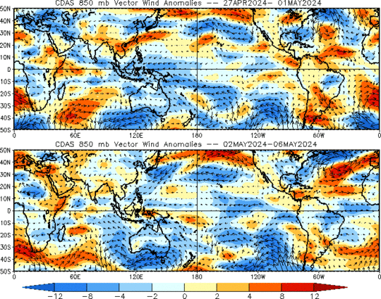
The GEFS (Global Ensemble Forecast System) clearly indicates the formation of an inverted "V"-type low-level trough (see 850-mb vorticity and winds) over the west-central Caribbean in six days/144 hours, with an axis extending NE to SW from the SE Bahamas to Central America. You can also see the gradual northward migration of a monsoonal circulation over the Eastern Pacific south of El Salvador. This happens as a strong westerly wind burst migrates east across the Pacific, meaning enhanced low-level convergence as 200-mb height rises promote upper-level divergence over the west-central Caribbean and the Eastern Pacific. The overall MJO signal would thus hint at the potential for development in the NW Caribbean beginning in about six days. However, as I have mentioned, models struggle to get a handle on the development of systems that form from a combination of an inverted trough, a broad monsoonal circulation, and a mid-/upper-level cutoff low. Namely, models will struggle with the timing, location, and intensity of a developing low, and usually (but not always) overdevelop a system too soon.
Anyway, if a system does indeed form, climatology suggests that it would track west of the FL peninsula and head toward the FL Panhandle. Out of 33 storms that have formed in the NW Caribbean in June since 1851, at least 12 (≈37%, a higher percentage than that of the storms that hit elsewhere) hit the FL Panhandle. Seven (≈21%) hit the FL peninsula, while six (≈18%) hit Mexico or TX. My source: http://coast.noaa.gov/hurricanes/.
Anyway, if a system does indeed form, climatology suggests that it would track west of the FL peninsula and head toward the FL Panhandle. Out of 33 storms that have formed in the NW Caribbean in June since 1851, at least 12 (≈37%, a higher percentage than that of the storms that hit elsewhere) hit the FL Panhandle. Seven (≈21%) hit the FL peninsula, while six (≈18%) hit Mexico or TX. My source: http://coast.noaa.gov/hurricanes/.
0 likes
-
floridasun78
- Category 5
- Posts: 3755
- Joined: Sun May 17, 2009 10:16 pm
- Location: miami fl
Re: Global model runs discussion
MiamiensisWx wrote:The GEFS (Global Ensemble Forecast System) clearly indicates the formation of an inverted "V"-type low-level trough (see 850-mb vorticity and winds) over the west-central Caribbean in six days/144 hours, with an axis extending NE to SW from the SE Bahamas to Central America. You can also see the gradual northward migration of a monsoonal circulation over the Eastern Pacific south of El Salvador. This happens as a strong westerly wind burst migrates east across the Pacific, meaning enhanced low-level convergence as 200-mb height rises promote upper-level divergence over the west-central Caribbean and the Eastern Pacific. The overall MJO signal would thus hint at the potential for development in the NW Caribbean beginning in about six days. However, as I have mentioned, models struggle to get a handle on the development of systems that form from a combination of an inverted trough, a broad monsoonal circulation, and a mid-/upper-level cutoff low. Namely, models will struggle with the timing, location, and intensity of a developing low, and usually (but not always) overdevelop a system too soon.
Anyway, if a system does indeed form, climatology suggests that it would track west of the FL peninsula and head toward the FL Panhandle. Out of 33 storms that have formed in the NW Caribbean in June since 1851, at least 12 (≈37%, a higher percentage than that of the storms that hit elsewhere) hit the FL Panhandle. Seven (≈21%) hit the FL peninsula, while six (≈18%) hit Mexico or TX. My source: http://coast.noaa.gov/hurricanes/.
we likely know more next week
0 likes
-
floridasun78
- Category 5
- Posts: 3755
- Joined: Sun May 17, 2009 10:16 pm
- Location: miami fl
 this lastest one


-
HURRICANELONNY
- Category 5
- Posts: 1381
- Joined: Wed May 07, 2003 6:48 am
- Location: HOLLYWOOD.FL
Maybe some rain next week sometime:
A
weak to elongated area of low pressure may also try and develop
over the southeastern Gulf and move off to the north and northeast
sometime between Tuesday and Friday...as shown by the operational
runs of the GFS and European model (ecmwf) and most of the GFS ensemble members.
A
weak to elongated area of low pressure may also try and develop
over the southeastern Gulf and move off to the north and northeast
sometime between Tuesday and Friday...as shown by the operational
runs of the GFS and European model (ecmwf) and most of the GFS ensemble members.
0 likes
hurricanelonny

Re: Global model runs discussion
Possibly another early season sheared system developing late next week as suggested by some models, if it finds a break from the UL winds might become another Ana, if at all.
Hopefully it all would at least mean some higher chances of rain for east central FL, persistent easterly winds have kept the rains towards the FL west coast for the past week.
The posts in this forum are NOT official forecast and should not be used as such. They are just the opinion of the poster and may or may not be backed by sound meteorological data. They are NOT endorsed by any professional institution or storm2k.org. For official information, please refer to the NHC and NWS products.
0 likes
Who is online
Users browsing this forum: cycloneye, gib, Google Adsense [Bot], NDG, skyline385, TheHurricaneGod, weatherSnoop and 44 guests