
Atlantic Sea Surface Temperatures and Anomalies
Moderator: S2k Moderators
Forum rules

The posts in this forum are NOT official forecasts and should not be used as such. They are just the opinion of the poster and may or may not be backed by sound meteorological data. They are NOT endorsed by any professional institution or STORM2K. For official information, please refer to products from the National Hurricane Center and National Weather Service.
-
'CaneFreak

- Category 5

- Posts: 1475
- Joined: Mon Jun 05, 2006 10:50 am
- Location: New Bern, NC
Re: Atlantic Sea Surface Temperatures and Anomalies
While we are waiting for activity in the basin to pick up, clearly the western Atlantic is beginning to warm up substantially. 

0 likes
-
cycloneye

- Admin

- Posts: 139025
- Age: 67
- Joined: Thu Oct 10, 2002 10:54 am
- Location: San Juan, Puerto Rico
Re: Atlantic Sea Surface Temperatures and Anomalies
Look how the Caribbean look as of August 7 with this very warm TCHP.

0 likes
Visit the Caribbean-Central America Weather Thread where you can find at first post web cams,radars
and observations from Caribbean basin members Click Here
and observations from Caribbean basin members Click Here
-
gatorcane

- S2K Supporter

- Posts: 23499
- Age: 46
- Joined: Sun Mar 13, 2005 3:54 pm
- Location: Boca Raton, FL
Waters off Africa in the Indian Ocean are still relatively cool (top graphic) but look how they are starting to warm up (bottom graphic) when you look at the 5-day SST change. Maybe this will allow more waves and disturbances to generate over Africa?
Notice also SSTs across the Caribbean are still warming:

Notice also SSTs across the Caribbean are still warming:
0 likes
-
'CaneFreak
- Category 5
- Posts: 1475
- Joined: Mon Jun 05, 2006 10:50 am
- Location: New Bern, NC
Re: Atlantic Sea Surface Temperatures and Anomalies
Good catch. This will definitely be something to watch for in the coming days.
0 likes
-
TropicalAnalystwx13

- Category 5
- Posts: 2109
- Age: 26
- Joined: Tue Jul 19, 2011 8:20 pm
- Location: Wilmington, NC
- Contact:
Re:
gatorcane wrote:Waters off Africa in the Indian Ocean are still relatively cool (top graphic) but look how they are starting to warm up (bottom graphic) when you look at the 5-day SST change. Maybe this will allow more waves and disturbances to generate over Africa?
Notice also SSTs across the Caribbean are still warming:
http://img823.imageshack.us/img823/5260/8m2.gif
Warming waters in the Indian Ocean are a bad sign. The Indian Ocean Dipole is currently negative, meaning cooler waters. This enhances the African monsoon and puts the atmosphere in a La Nina-like state. During a positive IOD, when the waters are warm, the monsoon is weakened. The upper-level axis of the subtropical ridge is shunted farther south than normal as well, creating a lid for convective activity => less vertical instability. This was the problem in 2007 and 2011.
0 likes
-
'CaneFreak
- Category 5
- Posts: 1475
- Joined: Mon Jun 05, 2006 10:50 am
- Location: New Bern, NC
Re: Re:
Yes but don't you need tropical waves to go over warmer than normal waters in order for them to grow BEFORE going over the African continent? It sure seems that if they went over cooler than normal waters, they would be less potent tropical waves and they might die before they could even get to the AEJ. I think I know what you are saying in an overall sense though.
TropicalAnalystwx13 wrote:Warming waters in the Indian Ocean are a bad sign. The Indian Ocean Dipole is currently negative, meaning cooler waters. This enhances the African monsoon and puts the atmosphere in a La Nina-like state. During a positive IOD, when the waters are warm, the monsoon is weakened. The upper-level axis of the subtropical ridge is shunted farther south than normal as well, creating a lid for convective activity => less vertical instability. This was the problem in 2007 and 2011.
0 likes
-
Kingarabian

- S2K Supporter
- Posts: 15432
- Joined: Sat Aug 08, 2009 3:06 am
- Location: Honolulu, Hawaii
Re: Re:
'CaneFreak wrote:Yes but don't you need tropical waves to go over warmer than normal waters in order for them to grow BEFORE going over the African continent? It sure seems that if they went over cooler than normal waters, they would be less potent tropical waves and they might die before they could even get to the AEJ. I think I know what you are saying in an overall sense though.TropicalAnalystwx13 wrote:Warming waters in the Indian Ocean are a bad sign. The Indian Ocean Dipole is currently negative, meaning cooler waters. This enhances the African monsoon and puts the atmosphere in a La Nina-like state. During a positive IOD, when the waters are warm, the monsoon is weakened. The upper-level axis of the subtropical ridge is shunted farther south than normal as well, creating a lid for convective activity => less vertical instability. This was the problem in 2007 and 2011.
You need a balance, really.
0 likes
RIP Kobe Bryant
-
TropicalAnalystwx13
- Category 5
- Posts: 2109
- Age: 26
- Joined: Tue Jul 19, 2011 8:20 pm
- Location: Wilmington, NC
- Contact:
Re: Re:
'CaneFreak wrote:Yes but don't you need tropical waves to go over warmer than normal waters in order for them to grow BEFORE going over the African continent? It sure seems that if they went over cooler than normal waters, they would be less potent tropical waves and they might die before they could even get to the AEJ. I think I know what you are saying in an overall sense though.TropicalAnalystwx13 wrote:Warming waters in the Indian Ocean are a bad sign. The Indian Ocean Dipole is currently negative, meaning cooler waters. This enhances the African monsoon and puts the atmosphere in a La Nina-like state. During a positive IOD, when the waters are warm, the monsoon is weakened. The upper-level axis of the subtropical ridge is shunted farther south than normal as well, creating a lid for convective activity => less vertical instability. This was the problem in 2007 and 2011.
Tropical waves form over East Africa as a result of instability created by the Sahara Desert and the Guinean Forest. The potency of the waves depend on the amount of instability, which depends on the difference in moisture and temperature between the two aforementioned locations. That's why a cool Gulf of Guinea is favorable as well...it creates a higher difference in temperature => higher instability. During a positive IOD, we get enhanced convection over the Indian Ocean. Rising air here means it's sinking over Africa. Sinking air over Africa => less waves => more dry air in the East Atlantic.
0 likes
-
TropicalAnalystwx13
- Category 5
- Posts: 2109
- Age: 26
- Joined: Tue Jul 19, 2011 8:20 pm
- Location: Wilmington, NC
- Contact:
This is a composite of the sea surface temperatures observed across the Indian Ocean during the top 10 ACE hurricane seasons (2005, 1950, 1995, 2004, 1961, 1955, 1998, 1999, 2003, 1964). Note the overwhelmingly cool signature:

Excerpt from The 2011 North Atlantic Hurricane Season: A Climate Perspective:
"Historically, there have been eight significant positive IOD events since reliable global
OLR data became available in 1979. While these
events have occurred during all phases of ENSO,
they are typically associated with reduced Atlantic
hurricane activity..."
0 likes


Re: Re:
TropicalAnalystwx13 wrote:Tropical waves form over East Africa as a result of instability created by the Sahara Desert and the Guinean Forest. The potency of the waves depend on the amount of instability, which depends on the difference in moisture and temperature between the two aforementioned locations. That's why a cool Gulf of Guinea is favorable as well...it creates a higher difference in temperature => higher instability. During a positive IOD, we get enhanced convection over the Indian Ocean. Rising air here means it's sinking over Africa. Sinking air over Africa => less waves => more dry air in the East Atlantic.
This is interesting. I wonder why it conflicts with the research that states there is a strong correlation between convection firing in the IO (MJO related phases 2-3) and significantly increasing Atlantic activity. The IO monsoon plays an important role in feeding the ITCZ through Africa thus increasing moisture downstream over the Atlantic (rise in Instability). Sinking air over Africa itself is better correlated with convection near the Maritimes and definitely the WPAC, I'm not familiar with the IOD though so I'm uncertain if it's a whole different ballgame but it just seems to conflict.
Last edited by Ntxw on Sat Aug 10, 2013 10:23 pm, edited 1 time in total.
0 likes
The above post and any post by Ntxw is NOT an official forecast and should not be used as such. It is just the opinion of the poster and may or may not be backed by sound meteorological data. It is NOT endorsed by any professional institution including Storm2k. For official information, please refer to NWS products.
Help support Storm2K!
-
TheStormExpert

- Category 5
- Posts: 8487
- Age: 30
- Joined: Wed Feb 16, 2011 5:38 pm
- Location: Palm Beach Gardens, FL
-
hurricanetrack

- HurricaneTrack.com
- Posts: 1774
- Joined: Tue Dec 02, 2003 10:46 pm
- Location: Wilmington, NC
- Contact:
I'm throwing a flag on the Florida sea surface temp graphic posted above...there's certainly corrupt data for those gulf temps...the only way you get temps in the 60's is a brief instance where someone dumped their beer cooler. uniformly warm temps are the rule this time of year. I can attest to the bath water depicted around the tampa bay area... our beaches feature temps in the upper 80's to near 90...typical for August.
0 likes
-
TropicalAnalystwx13
- Category 5
- Posts: 2109
- Age: 26
- Joined: Tue Jul 19, 2011 8:20 pm
- Location: Wilmington, NC
- Contact:
Re: Re:
Ntxw wrote:TropicalAnalystwx13 wrote:Tropical waves form over East Africa as a result of instability created by the Sahara Desert and the Guinean Forest. The potency of the waves depend on the amount of instability, which depends on the difference in moisture and temperature between the two aforementioned locations. That's why a cool Gulf of Guinea is favorable as well...it creates a higher difference in temperature => higher instability. During a positive IOD, we get enhanced convection over the Indian Ocean. Rising air here means it's sinking over Africa. Sinking air over Africa => less waves => more dry air in the East Atlantic.
This is interesting. I wonder why it conflicts with the research that states there is a strong correlation between convection firing in the IO (MJO related phases 2-3) and significantly increasing Atlantic activity. The IO monsoon plays an important role in feeding the ITCZ through Africa thus increasing moisture downstream over the Atlantic (rise in Instability). Sinking air over Africa itself is better correlated with convection near the Maritimes and definitely the WPAC, I'm not familiar with the IOD though so I'm uncertain if it's a whole different ballgame but it just seems to conflict.
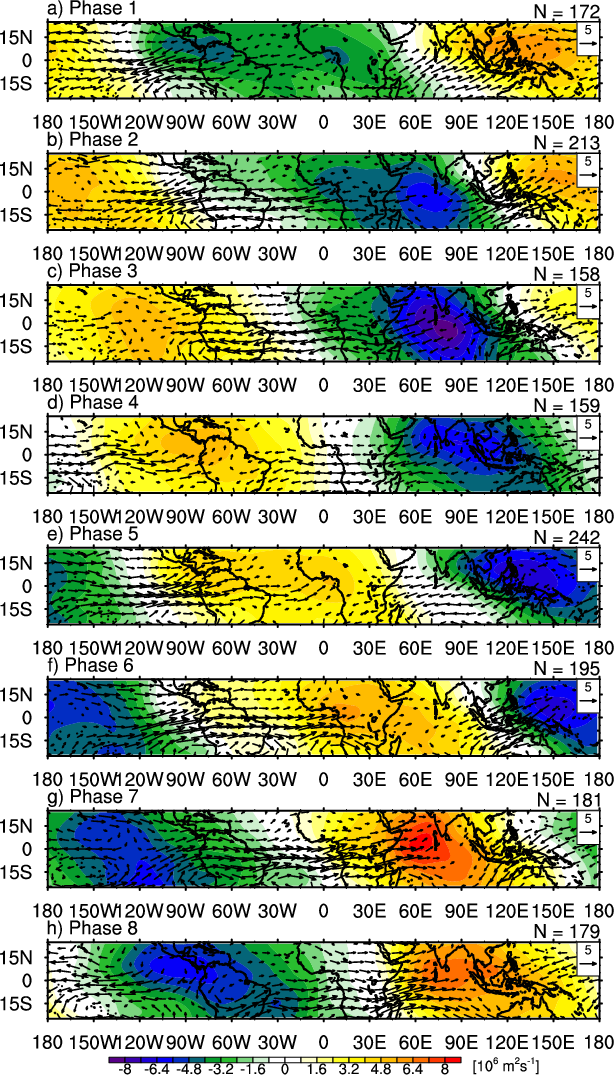
The MJO still has a profound positive influence over Africa during octants 2/3. It's not really until 4-5 when it starts to become unfavorable.
0 likes

Re: Re:
'CaneFreak wrote:Yes but don't you need tropical waves to go over warmer than normal waters in order for them to grow BEFORE going over the African continent? It sure seems that if they went over cooler than normal waters, they would be less potent tropical waves and they might die before they could even get to the AEJ. I think I know what you are saying in an overall sense though.TropicalAnalystwx13 wrote:Warming waters in the Indian Ocean are a bad sign. The Indian Ocean Dipole is currently negative, meaning cooler waters. This enhances the African monsoon and puts the atmosphere in a La Nina-like state. During a positive IOD, when the waters are warm, the monsoon is weakened. The upper-level axis of the subtropical ridge is shunted farther south than normal as well, creating a lid for convective activity => less vertical instability. This was the problem in 2007 and 2011.
As TropicalAnalyst already said, these waves feed off baroclinic instability. In other words, they require a density (pressure) gradient (which is created by temperature and moisture gradients). Thus, the cooler the Indian Ocean is, the higher pressures will be over the Indian ocean, creating a stronger gradient. The cooler the Indian Ocean is the less moisture it will have as well. Less moisture means less rising air (higher surface pressures), and again we see the pressure gradient is enhanced between the Saharan heat low and the relatively higher pressures over the Indian Ocean.
So the cooler the Indian Ocean (-IOD), the more baroclinic energy the waves will have to feed off. This is no different than how we like to see the Gulf of Guinea cooler than normal. Furthermore, while it would appear logical to think waves will have more moisture available to them when the Indian ocean is warm, that is not entirely true. When the ocean is warmer, more air rises over the ocean, reducing the sea-breeze effect. As a result, less moisture is advected across the continent to the Sahel region (where waves form).
0 likes
Re: Re:
TropicalAnalystwx13 wrote:The MJO still has a profound positive influence over Africa during octants 2/3. It's not really until 4-5 when it starts to become unfavorable.

Correct, which is why in my post I stated Maritime Continent is when Africa starts getting dry (phases 4-5) not the Indian Ocean phases (2+3) conflicting with the idea of IO convection (rising air) creating subsidence in Africa that you mentioned in the previous post.
0 likes
The above post and any post by Ntxw is NOT an official forecast and should not be used as such. It is just the opinion of the poster and may or may not be backed by sound meteorological data. It is NOT endorsed by any professional institution including Storm2k. For official information, please refer to NWS products.
Help support Storm2K!
Help support Storm2K!
Re: Re:
There's a difference. When the MJO is in phases 2 and 3, you still have rising air over the African continent. When the IOD is positive (or just the Indian ocean is warm as a whole), you favor less convection over the African continent.Ntxw wrote:TropicalAnalystwx13 wrote:The MJO still has a profound positive influence over Africa during octants 2/3. It's not really until 4-5 when it starts to become unfavorable.
Correct, which is why in my post I stated Maritime Continent is when Africa starts getting dry (phases 4-5) not the Indian Ocean phases (2+3) conflicting with the idea of IO convection (rising air) creating subsidence in Africa that you mentioned in the previous post.
0 likes
Who is online
Users browsing this forum: cajungal, Emmett_Brown, USTropics, wwizard and 121 guests