Atlantic Sea Surface Temperatures and Anomalies

This is the general tropical discussion area. Anyone can take their shot at predicting a storms path.

Moderator: S2k Moderators

Forum rules

The posts in this forum are NOT official forecasts and should not be used as such. They are just the opinion of the poster and may or may not be backed by sound meteorological data. They are NOT endorsed by any professional institution or STORM2K. For official information, please refer to products from the National Hurricane Center and National Weather Service.

Help Support Storm2K
Message
Author
User avatar
cycloneye
Admin
Admin
Posts: 139053
Age: 67
Joined: Thu Oct 10, 2002 10:54 am
Location: San Juan, Puerto Rico

Atlantic Sea Surface Temperatures and Anomalies

#1 Postby cycloneye » Tue Jan 13, 2009 10:34 am

This thread is all about how are the waters in the Atlantic basin doing on a daily basis.However,lets remember that this is only one of the factors that lead to how a hurricane season will be in terms of activity.There are other important factors but the sst and anomalies are one of the most important ones.

Image

Image

Image

Image

Image

Image

Image

Image

Image

Image

http://www.nhc.noaa.gov/aboutsst.shtml

Image

http://www.aoml.noaa.gov/phod/cyclone/data/at.html

Image

http://www.getaforecast.com/weatherpix-seatemp.htm

Image
0 likes   

User avatar
cycloneye
Admin
Admin
Posts: 139053
Age: 67
Joined: Thu Oct 10, 2002 10:54 am
Location: San Juan, Puerto Rico

Re: Atlantic Sea Surface Temperatures and Anomalies

#2 Postby cycloneye » Sun Jan 25, 2009 3:52 pm

Here are a couple of the best known graphics of sst,s around.These also update every day.If any member has other graphics,dont hesitate to post them here.

Image

Image
0 likes   

JonathanBelles
Professional-Met
Professional-Met
Posts: 11430
Age: 33
Joined: Sat Dec 24, 2005 9:00 pm
Location: School: Florida State University (Tallahassee, FL) Home: St. Petersburg, Florida
Contact:

#3 Postby JonathanBelles » Sun Jan 25, 2009 4:58 pm

SST's are in the mid-upper 50's here. Not to often that you get SST's near Tampa Bay that cold.
0 likes   

User avatar
cycloneye
Admin
Admin
Posts: 139053
Age: 67
Joined: Thu Oct 10, 2002 10:54 am
Location: San Juan, Puerto Rico

Re: Atlantic Sea Surface Temperatures and Anomalies

#4 Postby cycloneye » Mon Jan 26, 2009 3:20 pm

Its early in the year,but lets follow those cooler waters just off Africa to see if they will last for many months,or it will be only a few weeks having those cooler anomalies.
0 likes   

User avatar
cycloneye
Admin
Admin
Posts: 139053
Age: 67
Joined: Thu Oct 10, 2002 10:54 am
Location: San Juan, Puerto Rico

Re: Atlantic Sea Surface Temperatures and Anomalies

#5 Postby cycloneye » Thu Jan 29, 2009 7:41 pm

Daily Loop of sst,s in Atlantic.

Image

Gulf of Mexico sst,s daily loop.

Image

Caribbean Sea sst,s daily loop.

Image

You can find the above loops and much more from other basins at link below:

http://www.aoml.noaa.gov/phod/cyclone/data/at.html
0 likes   

User avatar
Tampa Bay Hurricane
Category 5
Category 5
Posts: 5594
Age: 36
Joined: Fri Jul 22, 2005 7:54 pm
Location: St. Petersburg, FL

#6 Postby Tampa Bay Hurricane » Sat Jan 31, 2009 2:39 pm

Waters are very cold off the florida west coast...
0 likes   

User avatar
cycloneye
Admin
Admin
Posts: 139053
Age: 67
Joined: Thu Oct 10, 2002 10:54 am
Location: San Juan, Puerto Rico

Re:

#7 Postby cycloneye » Sat Jan 31, 2009 2:43 pm

Tampa Bay Hurricane wrote:Waters are very cold off the florida west coast...


Yes,in the mid 60,s.Lets see how much they warm this summer.
0 likes   

User avatar
gatorcane
S2K Supporter
S2K Supporter
Posts: 23499
Age: 46
Joined: Sun Mar 13, 2005 3:54 pm
Location: Boca Raton, FL

#8 Postby gatorcane » Sat Jan 31, 2009 6:59 pm

Reynold's loop of Atlantic SSTs shows a general cooling of SSTs across the entire North Atlantic with a gradually slowing rate of cooling towards the end of the loop.

That is telling me that the North Atlantic SSTs have reached a perigee and are likely not going down much more --- afterall it is nearly Feb. and we are about 6 weeks past the winter solstice. Over the next couple of months, SSTs should gradually start to rise with a more dramatic rise in March and April -- of course this is of no surprise at all but its neat to watch the graphic animate over time especially in Spring and fall...where rises and falls are more dramatic.

http://www.ssd.noaa.gov/PS/TROP/DATA/RT ... -loop.html
0 likes   

User avatar
gatorcane
S2K Supporter
S2K Supporter
Posts: 23499
Age: 46
Joined: Sun Mar 13, 2005 3:54 pm
Location: Boca Raton, FL

#9 Postby gatorcane » Tue Feb 10, 2009 11:11 am

I don't know if anybody has noticed but the SSTs across a large chunk of the Atlantic basin (including the Mean Development Region or MDR) are trending a bit above normal so far. Farther north in the Northern Atlantic, temps are quite a bit above normal. We'll have to watch this trend as it could indicate an active Atlantic season.

Image
0 likes   

User avatar
cycloneye
Admin
Admin
Posts: 139053
Age: 67
Joined: Thu Oct 10, 2002 10:54 am
Location: San Juan, Puerto Rico

Re: Atlantic Sea Surface Temperatures and Anomalies

#10 Postby cycloneye » Wed Feb 11, 2009 2:08 pm

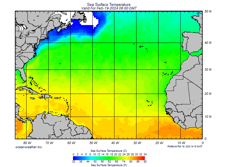
cycloneye wrote:Daily Loop of sst,s in Atlantic.

Image

Gulf of Mexico sst,s daily loop.

Image

Caribbean Sea sst,s daily loop.

Image

You can find the above loops and much more from other basins at link below:

http://www.aoml.noaa.gov/phod/cyclone/data/at.html


Very interesting to see the sudden cooldown in the Caribbean.I guess its because of the cold front that moved thru and strong high pressure gradient to the north causing the waters to cool.
0 likes   

User avatar
cycloneye
Admin
Admin
Posts: 139053
Age: 67
Joined: Thu Oct 10, 2002 10:54 am
Location: San Juan, Puerto Rico

Re: Atlantic Sea Surface Temperatures and Anomalies

#11 Postby cycloneye » Sun Feb 15, 2009 2:01 pm

2008

Image

2009

Image

You can see the difference between 2008 and 2009 at mid Febuary.2008 was warmer in the Eastern Atlantic and in parts of the Western Atlantic than in 2009 so far.For sure warming will take place in the comming months,but how fast it does so will be interesting to see.
0 likes   

User avatar
x-y-no
Category 5
Category 5
Posts: 8359
Age: 63
Joined: Wed Aug 11, 2004 12:14 pm
Location: Fort Lauderdale, FL

#12 Postby x-y-no » Tue Feb 17, 2009 8:38 am

Well that's interesting. The strong warm anomaly that had been there on the west African coast for the last couple of years is completely reversed. If that continues into the season I guess we can expect less early development.
0 likes   

jinftl
Category 5
Category 5
Posts: 4312
Joined: Tue Aug 31, 2004 4:47 pm
Location: fort lauderdale, fl

Re: Atlantic Sea Surface Temperatures and Anomalies

#13 Postby jinftl » Tue Feb 17, 2009 11:52 am

Cold fronts can have an impact in the short-term but once the cold fronts stop dropping down into the tropical atlantic....and that is in the not too distant future....there is no reason why temps won't quickly rise to typical values in a short amount of time. Not sure any implications can be drawn for the season ahead based on a cold front clearing the northern caribbean in february. Let's see what a month of low temps above 75 deg does to water temps in the area come april or may.

Watch how in 1 week the temps below 20C (68F) warm off the west coast of florida and temps rebound above 26C (78F) in the western caribbean...again, factor in the steady ramp up that temps will take in less than a month, and water temps will be plenty warm come June 1.

http://www.aoml.noaa.gov/phod/dataphod1/work/HHP/NEW/atsst.gif
0 likes   

User avatar
cycloneye
Admin
Admin
Posts: 139053
Age: 67
Joined: Thu Oct 10, 2002 10:54 am
Location: San Juan, Puerto Rico

Re: Atlantic Sea Surface Temperatures and Anomalies

#14 Postby cycloneye » Tue Feb 17, 2009 12:13 pm

Image
0 likes   

jinftl
Category 5
Category 5
Posts: 4312
Joined: Tue Aug 31, 2004 4:47 pm
Location: fort lauderdale, fl

Re: Atlantic Sea Surface Temperatures and Anomalies

#15 Postby jinftl » Tue Feb 17, 2009 4:46 pm

Be interested to know if the area around loop current is warmer than normal given the time of year....that may be of most interest and significance overall than short-term cooling caused by fronts or rain in the tropical atlantic. Something to keep an eye on in the current months to see if the heat 'bubble' persists around 25N/85W.

cycloneye wrote:Image
0 likes   

User avatar
gatorcane
S2K Supporter
S2K Supporter
Posts: 23499
Age: 46
Joined: Sun Mar 13, 2005 3:54 pm
Location: Boca Raton, FL

#16 Postby gatorcane » Thu Feb 19, 2009 4:33 pm

Much of the Northern Atlantic is running above normal with about 3 months and 10 days until the start of the season. Of particular interest are the warm waters ESE of the leewards and into waters just north of the ITCZ mean position for the primary months of hurrican season. That is where many of storms tend to get going and where we see a fairly higher frequency of those storms making it more westward rather than recurving.

These trends do concern me, however, there are still several months left for the situation to perhaps go back to normal or even below normal:

Image
0 likes   

jinftl
Category 5
Category 5
Posts: 4312
Joined: Tue Aug 31, 2004 4:47 pm
Location: fort lauderdale, fl

Re: Atlantic Sea Surface Temperatures and Anomalies

#17 Postby jinftl » Fri Mar 06, 2009 6:01 pm

Sea surface temps on the rise across the Caribbean....

Image
0 likes   

Ed Mahmoud

Re: Atlantic Sea Surface Temperatures and Anomalies

#18 Postby Ed Mahmoud » Sat Mar 07, 2009 12:49 am

cycloneye wrote:2008

Image

2009

Image

You can see the difference between 2008 and 2009 at mid Febuary.2008 was warmer in the Eastern Atlantic and in parts of the Western Atlantic than in 2009 so far.For sure warming will take place in the comming months,but how fast it does so will be interesting to see.


The Pacific is more interesting in that image than the Atlantic- much below temps replaced by near normal.


Playing with the URLs


Image

2009

Image
0 likes   

jinftl
Category 5
Category 5
Posts: 4312
Joined: Tue Aug 31, 2004 4:47 pm
Location: fort lauderdale, fl

Re: Atlantic Sea Surface Temperatures and Anomalies

#19 Postby jinftl » Fri Mar 13, 2009 1:48 pm

Gulf waters definitely starting the climb up in temperature during this past week...

Image
0 likes   

JonathanBelles
Professional-Met
Professional-Met
Posts: 11430
Age: 33
Joined: Sat Dec 24, 2005 9:00 pm
Location: School: Florida State University (Tallahassee, FL) Home: St. Petersburg, Florida
Contact:

#20 Postby JonathanBelles » Fri Mar 13, 2009 2:04 pm

SST's have risen 8-9 degrees in a little more than a week here.
0 likes   


Return to “Talkin' Tropics”

Who is online

Users browsing this forum: cycloneye, JetFuel_SE, kenayers, Pas_Bon, TheAustinMan, tolakram and 115 guests