2014 EPAC Season
Moderator: S2k Moderators
Forum rules

The posts in this forum are NOT official forecasts and should not be used as such. They are just the opinion of the poster and may or may not be backed by sound meteorological data. They are NOT endorsed by any professional institution or STORM2K. For official information, please refer to products from the National Hurricane Center and National Weather Service.
-
tolakram
- Admin

- Posts: 19167
- Age: 60
- Joined: Sun Aug 27, 2006 8:23 pm
- Location: Florence, KY (name is Mark)
Re: 2014 EPAC Season
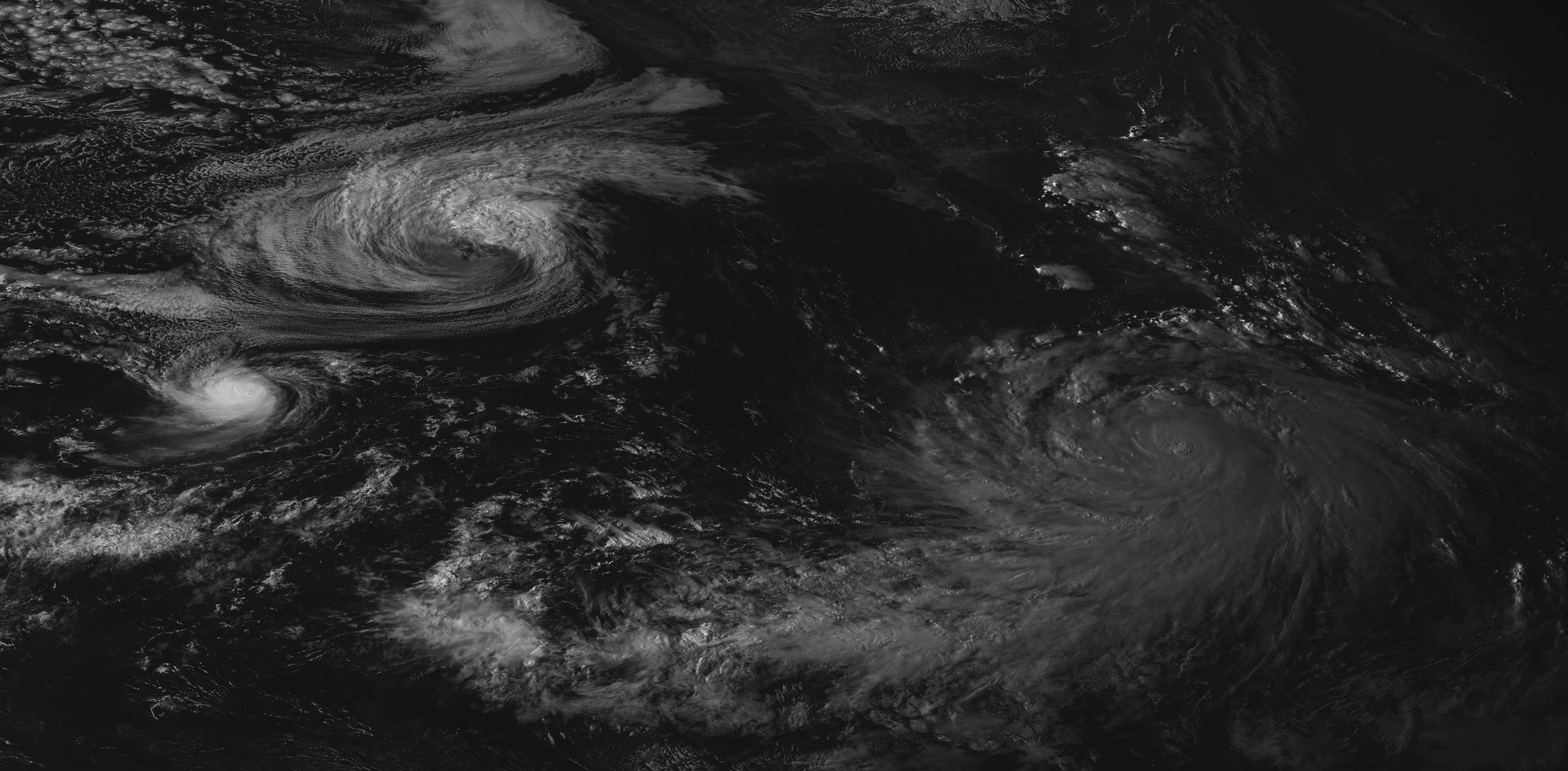
Family Photo

0 likes
M a r k
- - - - -
Join us in chat: Storm2K Chatroom Invite. Android and IOS apps also available.
The posts in this forum are NOT official forecasts and should not be used as such. Posts are NOT endorsed by any professional institution or STORM2K.org. For official information and forecasts, please refer to NHC and NWS products.
-
Yellow Evan

- Professional-Met

- Posts: 15956
- Age: 25
- Joined: Fri Jul 15, 2011 12:48 pm
- Location: Henderson, Nevada/Honolulu, HI
- Contact:

-
xtyphooncyclonex

- Category 5

- Posts: 3688
- Age: 22
- Joined: Sat Dec 08, 2012 9:07 am
- Location: Cebu City
- Contact:
Last year's EPAC thread had 17 pages only; THIS year has already 49 pages and it is still the peak of the season! AMAZING
0 likes
REMINDER: My opinions that I, or any other NON Pro-Met in this forum, are unofficial. Please do not take my opinions as an official forecast and warning. I am NOT a meteorologist. Following my forecasts blindly may lead to false alarm, danger and risk if official forecasts from agencies are ignored.
-
mrbagyo

- Category 5
- Posts: 3615
- Age: 31
- Joined: Thu Apr 12, 2012 9:18 am
- Location: 14.13N 120.98E
- Contact:
Re: 2014 EPAC Season

0 likes
The posts in this forum are NOT official forecast and should not be used as such. They are just the opinion of the poster and may or may not be backed by sound meteorological data. They are NOT endorsed by any professional institution or storm2k.org. For official information, please refer to RSMC, NHC and NWS products.
-
Yellow Evan
- Professional-Met
- Posts: 15956
- Age: 25
- Joined: Fri Jul 15, 2011 12:48 pm
- Location: Henderson, Nevada/Honolulu, HI
- Contact:
-
HurricaneRyan
- Category 2

- Posts: 712
- Age: 30
- Joined: Sun Dec 05, 2010 3:05 pm
-
Yellow Evan
- Professional-Met
- Posts: 15956
- Age: 25
- Joined: Fri Jul 15, 2011 12:48 pm
- Location: Henderson, Nevada/Honolulu, HI
- Contact:
Re:
HurricaneRyan wrote:The EPAC has been amazing this season. Which is why we have gotten to 49 pages. It's actually the best EPAC season we've gotten in over a decade.
Since 1997 or 1992 probs. Best season I've tracked so far.
0 likes
-
HurricaneRyan
- Category 2
- Posts: 712
- Age: 30
- Joined: Sun Dec 05, 2010 3:05 pm
-
Yellow Evan
- Professional-Met
- Posts: 15956
- Age: 25
- Joined: Fri Jul 15, 2011 12:48 pm
- Location: Henderson, Nevada/Honolulu, HI
- Contact:
Re:
HurricaneRyan wrote:Btw Andrew92 said Marie would be a big one. In terms of intensity, he was right!
I think we all knew it. Models were blowing it up weeks in advance.
0 likes
-
cycloneye

- Admin
- Posts: 139210
- Age: 67
- Joined: Thu Oct 10, 2002 10:54 am
- Location: San Juan, Puerto Rico
Re: 2014 EPAC Season
Yellow Even,is there anything new that may form in the next two weeks?
0 likes
Visit the Caribbean-Central America Weather Thread where you can find at first post web cams,radars
and observations from Caribbean basin members Click Here
and observations from Caribbean basin members Click Here
-
Yellow Evan
- Professional-Met
- Posts: 15956
- Age: 25
- Joined: Fri Jul 15, 2011 12:48 pm
- Location: Henderson, Nevada/Honolulu, HI
- Contact:
Re: 2014 EPAC Season
cycloneye wrote:Yellow Even,is there anything new that may form in the next two weeks?
Nothing major yet. GFS for a while is trying to close stuff off. It'll depend on the ATL like it always does in September. Area with lowest shear interestingly enough is off the west coast of Baja. We still have a 30-32C warm pool that Marie tapped the western part of.
0 likes
-
somethingfunny

- ChatStaff

- Posts: 3926
- Age: 35
- Joined: Thu May 31, 2007 10:30 pm
- Location: McKinney, Texas

Marie becomes Category 5, first since Celia and strongest since Rick in the Whem (info check?) Just fitting for a season like this.
0 likes
The above post and any post by Ntxw is NOT an official forecast and should not be used as such. It is just the opinion of the poster and may or may not be backed by sound meteorological data. It is NOT endorsed by any professional institution including Storm2k. For official information, please refer to NWS products.
Help support Storm2K!
-
Yellow Evan
- Professional-Met
- Posts: 15956
- Age: 25
- Joined: Fri Jul 15, 2011 12:48 pm
- Location: Henderson, Nevada/Honolulu, HI
- Contact:
Re:
Ntxw wrote:Marie becomes Category 5, first since Celia and strongest since Rick in the Whem (info check?) Just fitting for a season like this.
Yes. Strongest since Rick 09 in WHEM. The season has had everything.
0 likes
-
Yellow Evan
- Professional-Met
- Posts: 15956
- Age: 25
- Joined: Fri Jul 15, 2011 12:48 pm
- Location: Henderson, Nevada/Honolulu, HI
- Contact:
Re:
somethingfunny wrote:Is Marie likely to upwell that region?
Yes, but these waters generally recover and should in time for the second half of September.
0 likes
SST's isn't going to be a problem this year in the EPAC running well above normal. Even after upwelling it will recover quickly like Yellow Evan mentioned. Just need the seeds to spawn, lets see what can survive the west track from Atlantic. Waters along the western Mexican coast is ripe. We certainly don't wish a Kenna type scenario but potential can be had, especially later into Sept and Oct. No reason to believe it won't.
0 likes
The above post and any post by Ntxw is NOT an official forecast and should not be used as such. It is just the opinion of the poster and may or may not be backed by sound meteorological data. It is NOT endorsed by any professional institution including Storm2k. For official information, please refer to NWS products.
Help support Storm2K!
Help support Storm2K!
-
somethingfunny
- ChatStaff
- Posts: 3926
- Age: 35
- Joined: Thu May 31, 2007 10:30 pm
- Location: McKinney, Texas
Re:
Ntxw wrote:SST's isn't going to be a problem this year in the EPAC running well above normal. Even after upwelling it will recover quickly like Yellow Evan mentioned. Just need the seeds to spawn, lets see what can survive the west track from Atlantic. Waters along the western Mexican coast is ripe. We certainly don't wish a Kenna type scenario but potential can be had, especially later into Sept and Oct. No reason to believe it won't.
Even if there is a quiet period following Marie (far from certain) I would actually be surprised if Marie ends up being the only Category 5 in the EPAC this year.
0 likes
I am not a meteorologist, and any posts made by me are not official forecasts or to be interpreted as being intelligent. These posts are just my opinions and are probably silly opinions.
Re: Re:
somethingfunny wrote:Even if there is a quiet period following Marie (far from certain) I would actually be surprised if Marie ends up being the only Category 5 in the EPAC this year.
EPAC is still benefiting from strong CCKW that will last about another week. Then the suppressed phase will arrive from the WPAC and probably nudge things down though it's forecasted to be most unfavorable over in the Atlantic than EPAC. So rogue development in the EPAC can't be ruled out. I would be surprised if Marie was the only as well, though one wouldn't say another is expected. Greater than normal chance of more majors and cat 4's probably a sure bet.
0 likes
The above post and any post by Ntxw is NOT an official forecast and should not be used as such. It is just the opinion of the poster and may or may not be backed by sound meteorological data. It is NOT endorsed by any professional institution including Storm2k. For official information, please refer to NWS products.
Help support Storm2K!
Help support Storm2K!
-
Yellow Evan
- Professional-Met
- Posts: 15956
- Age: 25
- Joined: Fri Jul 15, 2011 12:48 pm
- Location: Henderson, Nevada/Honolulu, HI
- Contact:
Re:
Ntxw wrote:SST's isn't going to be a problem this year in the EPAC running well above normal. Even after upwelling it will recover quickly like Yellow Evan mentioned. Just need the seeds to spawn, lets see what can survive the west track from Atlantic. Waters along the western Mexican coast is ripe. We certainly don't wish a Kenna type scenario but potential can be had, especially later into Sept and Oct. No reason to believe it won't.
Agreed something like Kenna/59 MX is possible as we get towards the later half of the season. SST's look like the Philippines prior to Haiyan out there. Marie just tapped the W end of it.
The posts in this forum are NOT official forecast and should not be used as such. They are just the opinion of the poster and may or may not be backed by sound meteorological data. They are NOT endorsed by any professional institution or storm2k.org. For official information, please refer to the NHC and NWS products
0 likes
-
Yellow Evan
- Professional-Met
- Posts: 15956
- Age: 25
- Joined: Fri Jul 15, 2011 12:48 pm
- Location: Henderson, Nevada/Honolulu, HI
- Contact:
Re: 2014 EPAC Season
Here's a graph that someone posted on another forum
Warmest EPAC SST's on record since 1959.

Warmest EPAC SST's on record since 1959.
0 likes
Who is online
Users browsing this forum: AlwaysLovedPancakes, Cpv17, Google Adsense [Bot], hurricanes1234, jconsor, KirbyDude25, randge, SFLcane, StPeteMike and 201 guests