Tropical Wave in Eastern Atlantic

This is the general tropical discussion area. Anyone can take their shot at predicting a storms path.

Moderator: S2k Moderators

Forum rules

The posts in this forum are NOT official forecasts and should not be used as such. They are just the opinion of the poster and may or may not be backed by sound meteorological data. They are NOT endorsed by any professional institution or STORM2K. For official information, please refer to products from the National Hurricane Center and National Weather Service.

Help Support Storm2K
Message
Author
bamajammer4eva
Category 4
Category 4
Posts: 907
Joined: Sun Apr 18, 2010 3:21 am
Location: Ozark, AL

Tropical Wave in Eastern Atlantic

#1 Postby bamajammer4eva » Sat Jul 26, 2014 2:07 am

NHC gives it a shout out

Image

TROPICAL WEATHER OUTLOOK
NWS NATIONAL HURRICANE CENTER MIAMI FL
200 AM EDT SAT JUL 26 2014

For the North Atlantic...Caribbean Sea and the Gulf of Mexico:

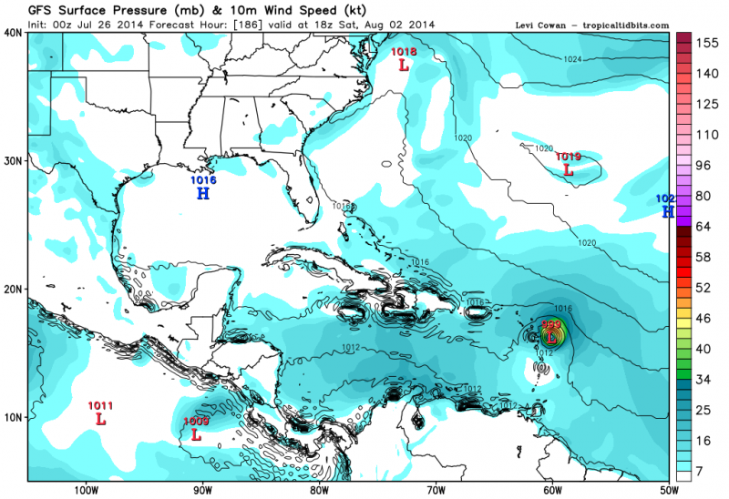
1. A tropical wave located south of the Cape Verde Islands could
develop into an area of low pressure by early next week over
the central tropical Atlantic. Environmental conditions are
expected to be marginally conducive for gradual development of
this system through midweek as it moves westward.
* Formation chance through 48 hours...low...near 0 percent
* Formation chance through 5 days...low...20 percent

Forecaster Stewart
0 likes   

User avatar
cycloneye
Admin
Admin
Posts: 143863
Age: 68
Joined: Thu Oct 10, 2002 10:54 am
Location: San Juan, Puerto Rico

Re: Tropical Wave in Eastern Atlantic

#2 Postby cycloneye » Sat Jul 26, 2014 5:04 am

I made a new thread as there was none for the highlighted area that NHC has so I moved your post from the models thread.

This wave may be a little bit different from the TD2 one as the MJO may arrive in Atlantic.
0 likes   
Visit the Caribbean-Central America Weather Thread where you can find at first post web cams,radars
and observations from Caribbean basin members Click Here

User avatar
cycloneye
Admin
Admin
Posts: 143863
Age: 68
Joined: Thu Oct 10, 2002 10:54 am
Location: San Juan, Puerto Rico

Re: Tropical Wave in Eastern Atlantic

#3 Postby cycloneye » Sat Jul 26, 2014 6:34 am

TROPICAL WEATHER OUTLOOK
NWS NATIONAL HURRICANE CENTER MIAMI FL
800 AM EDT SAT JUL 26 2014

For the North Atlantic...Caribbean Sea and the Gulf of Mexico:

A tropical wave located south of the Cape Verde Islands could
develop into an area of low pressure over the central tropical
Atlantic in a few days. Some slow development of this system
is possible by the middle of next week while it moves westward.
* Formation chance through 48 hours...low...near 0 percent
* Formation chance through 5 days...low...20 percent

$$
Forecaster Cangialosi
0 likes   
Visit the Caribbean-Central America Weather Thread where you can find at first post web cams,radars
and observations from Caribbean basin members Click Here

User avatar
NDG
S2K Supporter
S2K Supporter
Posts: 15444
Joined: Sun Jul 09, 2006 10:14 pm
Location: Orlando, FL

Re: Tropical Wave in Eastern Atlantic

#4 Postby NDG » Sat Jul 26, 2014 7:15 am

0z GFS was very bullish with this tropical wave.


Image
0 likes   

User avatar
gatorcane
S2K Supporter
S2K Supporter
Posts: 23689
Age: 47
Joined: Sun Mar 13, 2005 3:54 pm
Location: Boca Raton, FL

#5 Postby gatorcane » Sat Jul 26, 2014 7:53 am

The GFS shows a low shear environment across the MDR next week where the tropical wave will be traversing which would allow some slow development.

For example, here is what it shows 5 days from now:

Image
0 likes   

WilmingtonSandbar
S2K Supporter
S2K Supporter
Posts: 505
Joined: Sun Aug 29, 2010 12:11 pm
Location: Southport, NC

Re: Tropical Wave in Eastern Atlantic

#6 Postby WilmingtonSandbar » Sat Jul 26, 2014 8:05 am

:uarrow: Shear may be low, but how does the dry air in front of it look?
0 likes   
Diana X2 (look it up), Bertha, Fran, Bonnie, Floyd, Dennis, Charley, Ophelia, Ernesto, Irene, Matthew, And Florence

User avatar
Blown Away
S2K Supporter
S2K Supporter
Posts: 10140
Joined: Wed May 26, 2004 6:17 am

Re: Tropical Wave in Eastern Atlantic

#7 Postby Blown Away » Sat Jul 26, 2014 8:46 am

NDG wrote:0z GFS was very bullish with this tropical wave.


http://i20.photobucket.com/albums/b245/ ... ddace1.png


It just seems like a long time since a model has shown a decent low in the MDR...
0 likes   
Hurricane Eye Experience: David 79, Irene 99, Frances 04, Jeanne 04, Wilma 05... EYE COMING MY WAY IN 2024…
Hurricane Brush Experience: Andrew 92, Erin 95, Floyd 99, Matthew 16, Irma 17, Ian 22, Nicole 22…

User avatar
somethingfunny
ChatStaff
ChatStaff
Posts: 3926
Age: 36
Joined: Thu May 31, 2007 10:30 pm
Location: McKinney, Texas

#8 Postby somethingfunny » Sat Jul 26, 2014 8:56 am

What did the overnight ECMWF run depict?
0 likes   
I am not a meteorologist, and any posts made by me are not official forecasts or to be interpreted as being intelligent. These posts are just my opinions and are probably silly opinions.

Alyono
Professional-Met
Professional-Met
Posts: 6961
Joined: Fri Apr 26, 2013 3:52 pm
Location: Texas Coast

#9 Postby Alyono » Sat Jul 26, 2014 9:32 am

best to not waste your time looking at an EC run. It cannot see MDR development
0 likes   

User avatar
TheAustinMan
Category 5
Category 5
Posts: 1046
Age: 25
Joined: Mon Jul 08, 2013 4:26 pm
Location: United States
Contact:

Re: Tropical Wave in Eastern Atlantic

#10 Postby TheAustinMan » Sat Jul 26, 2014 9:47 am

WilmingtonSandbar wrote::uarrow: Shear may be low, but how does the dry air in front of it look?

Conditions aren't exactly favorable in the dry air department over the central Atlantic right this very moment, but according to the GFS this system may do the same as 02L and attain a bubble of moisture to work with in the future.

Current conditions -
Image
0 likes   
ImageImageImage
Treat my opinions with a grain of salt. For official information see your local weather service.

User avatar
tropicwatch
Category 5
Category 5
Posts: 3364
Age: 61
Joined: Sat Jun 02, 2007 10:01 am
Location: Panama City Florida
Contact:

#11 Postby tropicwatch » Sat Jul 26, 2014 10:03 am

Still massive dry air. Hardly a break in it all the way to Puerto Rico.
0 likes   
Tropicwatch


Agnes 72', Eloise 75, Elena 85', Kate 85', Charley 86', Florence 88', Beryl 94', Dean 95', Erin 95', Opal 95', Earl 98', Georges 98', Ivan 2004', Arlene 2005', Dennis 2005', Ida 2009' Debby 2012' Irma 2017' Michael 2018'

Dean4Storms
S2K Supporter
S2K Supporter
Posts: 6358
Age: 62
Joined: Sun Aug 31, 2003 1:01 pm
Location: Miramar Bch. FL

#12 Postby Dean4Storms » Sat Jul 26, 2014 10:42 am

06z GFS run not as bullish and much further southward into the Carib. Sea.
0 likes   

User avatar
gatorcane
S2K Supporter
S2K Supporter
Posts: 23689
Age: 47
Joined: Sun Mar 13, 2005 3:54 pm
Location: Boca Raton, FL

#13 Postby gatorcane » Sat Jul 26, 2014 11:26 am

GFS coming alive on the 12Z. You can see the low moving towards the leewards (what we are discussing this thread) and another one behind it at 168 hours:

Image
0 likes   

User avatar
cycloneye
Admin
Admin
Posts: 143863
Age: 68
Joined: Thu Oct 10, 2002 10:54 am
Location: San Juan, Puerto Rico

Re: Tropical Wave in Eastern Atlantic

#14 Postby cycloneye » Sat Jul 26, 2014 12:08 pm

HWRF joins on development.

Image
0 likes   
Visit the Caribbean-Central America Weather Thread where you can find at first post web cams,radars
and observations from Caribbean basin members Click Here

User avatar
blp
Category 5
Category 5
Posts: 2840
Age: 46
Joined: Thu Sep 09, 2004 7:51 pm
Location: Miami, FL
Contact:

Re: Tropical Wave in Eastern Atlantic

#15 Postby blp » Sat Jul 26, 2014 12:09 pm

CMC is on board but keeps it a little while longer in the eastern atlantic than gfs.

http://www.tropicaltidbits.com/analysis/models/gem/2014072612/gem_mslp_pcpn_atltropics_20.png
0 likes   
The following post is NOT an official forecast and should not be used as such. It is just the opinion of the poster and may or may not be backed by sound meteorological data. It is NOT endorsed by any professional institution including storm2k.org For Official Information please refer to the NHC and NWS products.

User avatar
blp
Category 5
Category 5
Posts: 2840
Age: 46
Joined: Thu Sep 09, 2004 7:51 pm
Location: Miami, FL
Contact:

Re: Tropical Wave in Eastern Atlantic

#16 Postby blp » Sat Jul 26, 2014 12:14 pm

cycloneye wrote:HWRF joins on development.

[]http://oi57.tinypic.com/2ppj9yf.jpg[/img]


Several models now coming on board. The Navgem also has it. The Hwrf latching onto this is something to notice since it has improved a good deal and is a hurricane model.
0 likes   
The following post is NOT an official forecast and should not be used as such. It is just the opinion of the poster and may or may not be backed by sound meteorological data. It is NOT endorsed by any professional institution including storm2k.org For Official Information please refer to the NHC and NWS products.

User avatar
cycloneye
Admin
Admin
Posts: 143863
Age: 68
Joined: Thu Oct 10, 2002 10:54 am
Location: San Juan, Puerto Rico

Re: Tropical Wave in Eastern Atlantic

#17 Postby cycloneye » Sat Jul 26, 2014 12:36 pm

TROPICAL WEATHER OUTLOOK
NWS NATIONAL HURRICANE CENTER MIAMI FL
200 PM EDT SAT JUL 26 2014

For the North Atlantic...Caribbean Sea and the Gulf of Mexico:

A tropical wave located to the southwest of the Cape Verde Islands
could develop into an area of low pressure over the central tropical
Atlantic in a few days. Some slow development of this system
is possible by the middle of next week while it moves westward.
* Formation chance through 48 hours...low...near 0 percent
* Formation chance through 5 days...low...20 percent

$$
Forecaster Cangialosi
0 likes   
Visit the Caribbean-Central America Weather Thread where you can find at first post web cams,radars
and observations from Caribbean basin members Click Here

User avatar
gatorcane
S2K Supporter
S2K Supporter
Posts: 23689
Age: 47
Joined: Sun Mar 13, 2005 3:54 pm
Location: Boca Raton, FL

#18 Postby gatorcane » Sat Jul 26, 2014 1:12 pm

Image
0 likes   

User avatar
cycloneye
Admin
Admin
Posts: 143863
Age: 68
Joined: Thu Oct 10, 2002 10:54 am
Location: San Juan, Puerto Rico

Re: Tropical Wave in Eastern Atlantic

#19 Postby cycloneye » Sat Jul 26, 2014 1:14 pm

The folks that do the Pouch analysis have designated it as Pouch 09L. But as the analysis was made at 00:00z,that initial position not corresponds to where it is now.

SYNOPSIS 2014072600

P09L
8N, 15W
700 hPa

ECMWF: Tracked for 84 hours, but most of the time, the position is very uncertain. Only at 36 hours is there something close to a pouch with a CL-trough intersection; otherwise, P09L is just an OW max. The first day is most uncertain. This feature is tracked in today’s ECMWF because it is a distinct pouch in GFS and UKMET (not because ECMWF has a distinct pouch).

GFS: Strongest eventual depiction. One could argue that GFS depicts P09L in the analysis as just an OW max on the southeastern side of P07L.

UKMET: Eventually depicts a distinct pouch between dissipating P07L to the west and stronger P08L to the east, but not until 96 hours. It ends up being stronger than in ECMWF and NAVGEM, but weaker than the GFS depiction. One could argue that P09L in the analysis is just an OW max on the western side of P08L (rather than near P07L as in GFS). All positions for the first three days before the pouch develops are based upon interpolation rather than an actual pouch position.

NAVGEM: Like ECMWF, NAVGEM is tracked simply because GFS and UKMET depict the development of P09L. A pouch in the analysis quickly dissipates. After a few days, an OW is depicted in the ITCZ, and it is pulled eastward on Day 5 by the approaching strong P08L.

Image

http://www.met.nps.edu/~mtmontgo/storms2014/P09L.html
0 likes   
Visit the Caribbean-Central America Weather Thread where you can find at first post web cams,radars
and observations from Caribbean basin members Click Here

User avatar
cycloneye
Admin
Admin
Posts: 143863
Age: 68
Joined: Thu Oct 10, 2002 10:54 am
Location: San Juan, Puerto Rico

Re: Tropical Wave in Eastern Atlantic

#20 Postby cycloneye » Sat Jul 26, 2014 1:53 pm

Here is the 72 hour TAFB position.

Image
0 likes   
Visit the Caribbean-Central America Weather Thread where you can find at first post web cams,radars
and observations from Caribbean basin members Click Here


Return to “Talkin' Tropics”

Who is online

Users browsing this forum: No registered users and 103 guests