


Full Index:
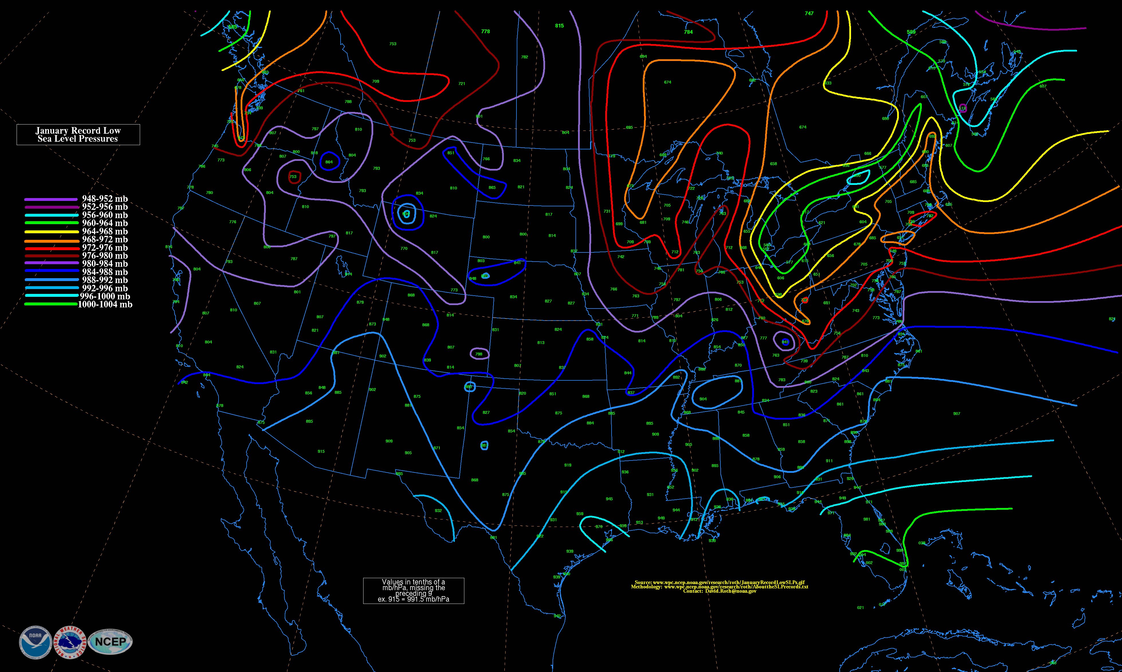
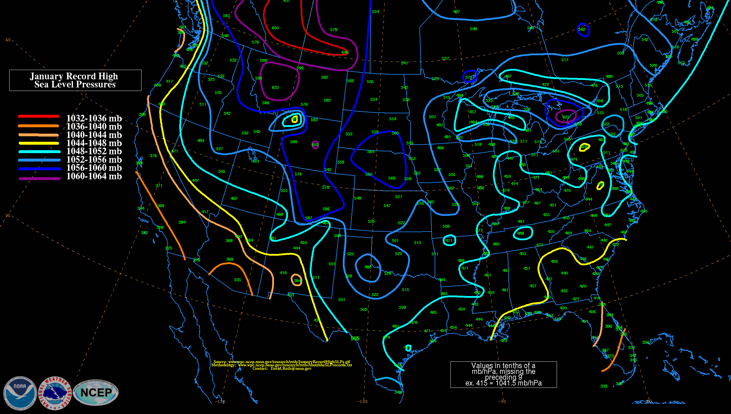
- Jan. (Low / High)
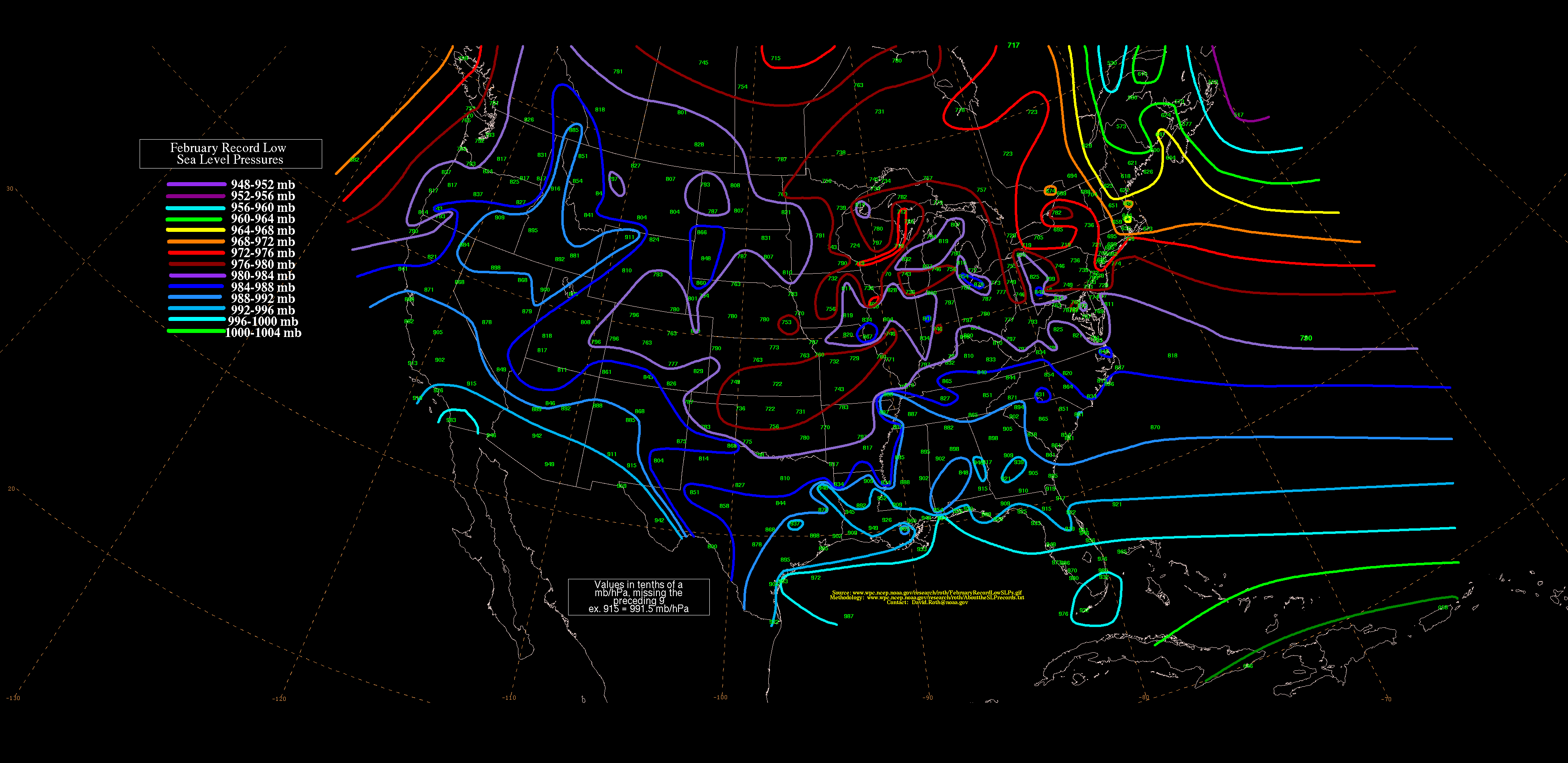
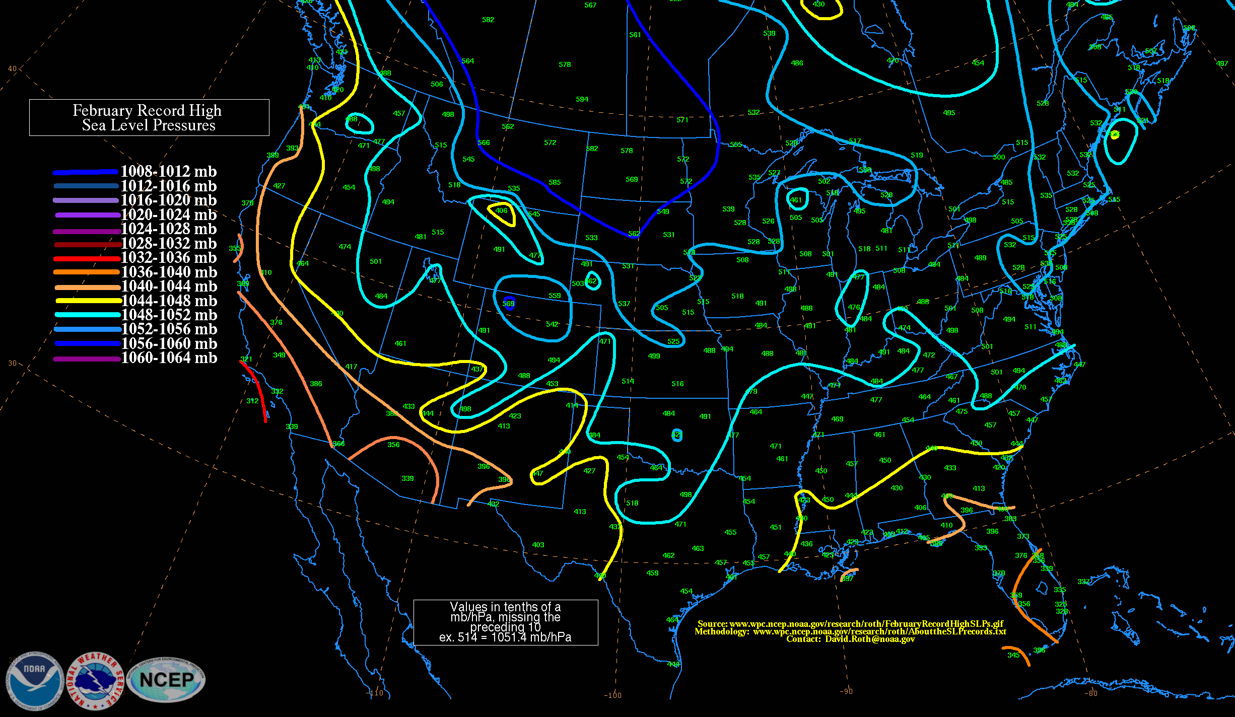
- Feb. (Low / High)
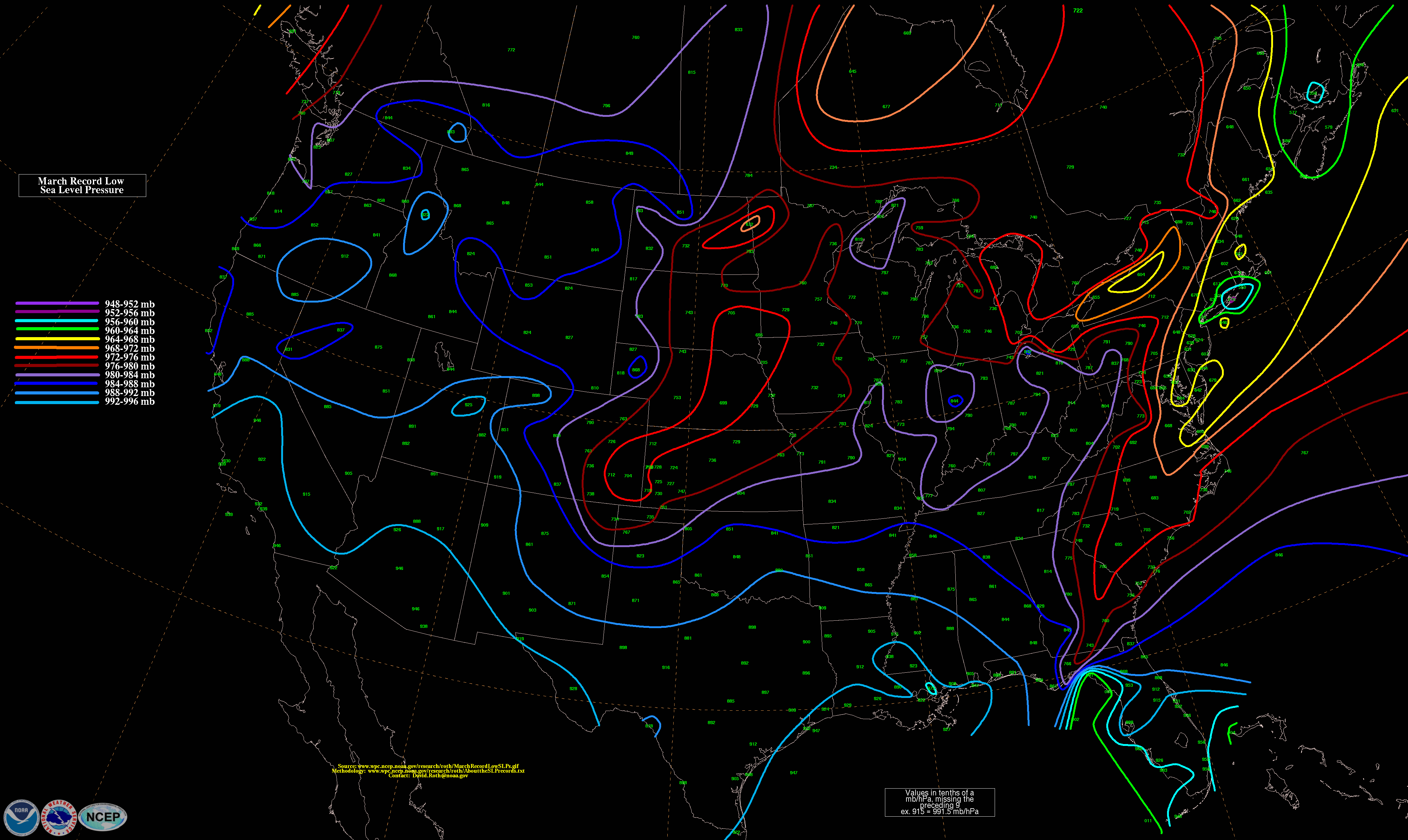
- Mar. (Low / High)
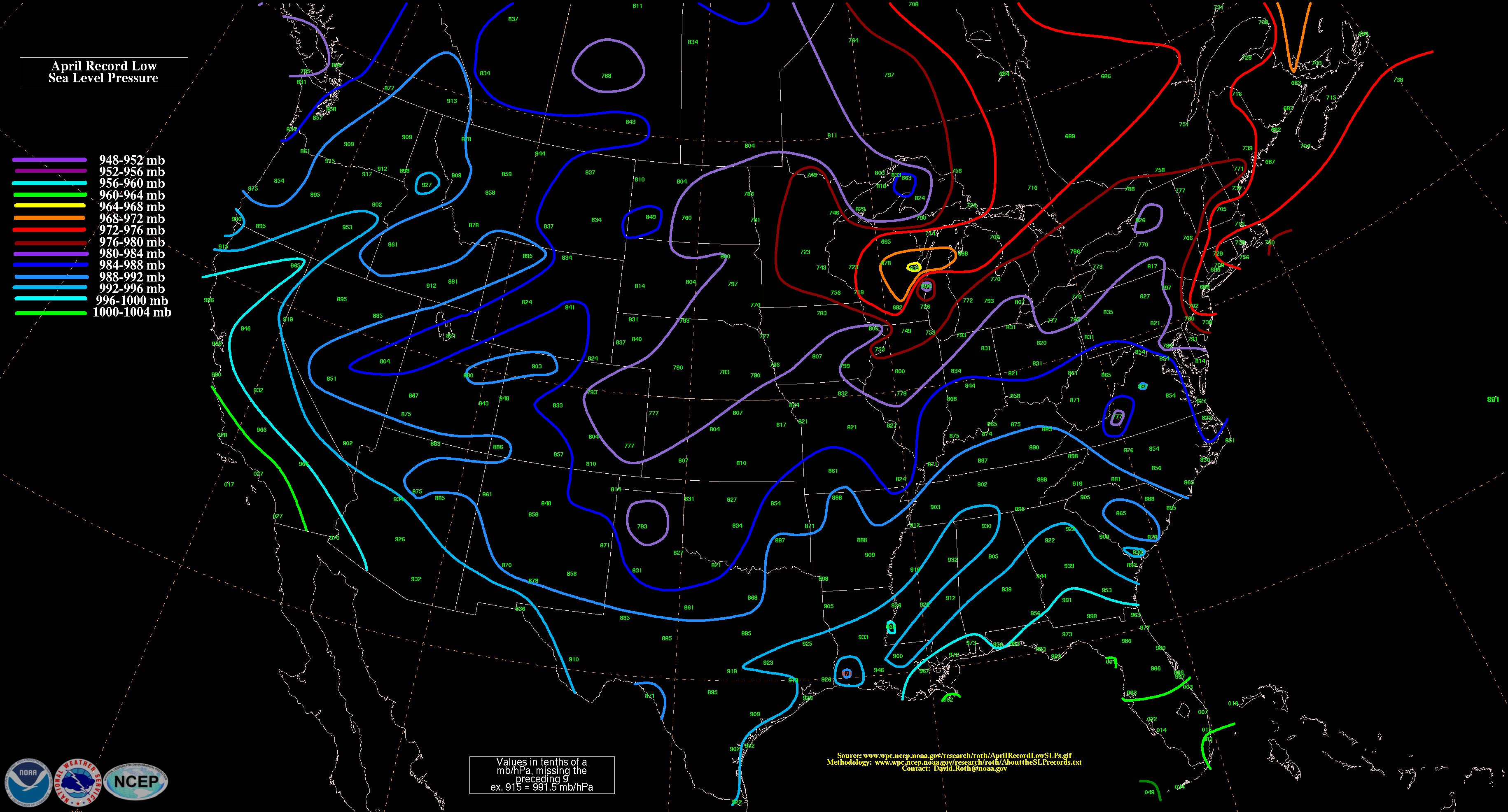
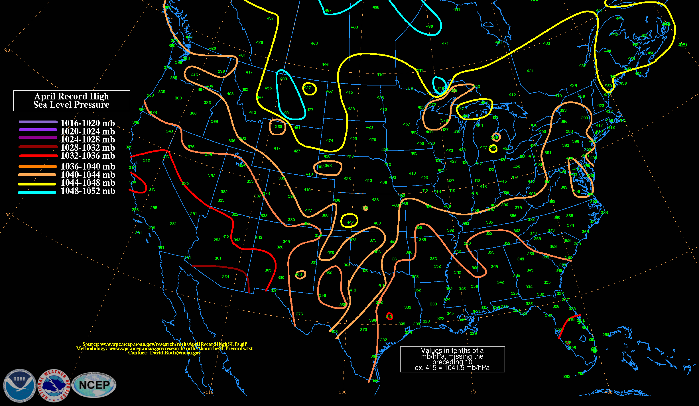
- Apr. (Low / High)
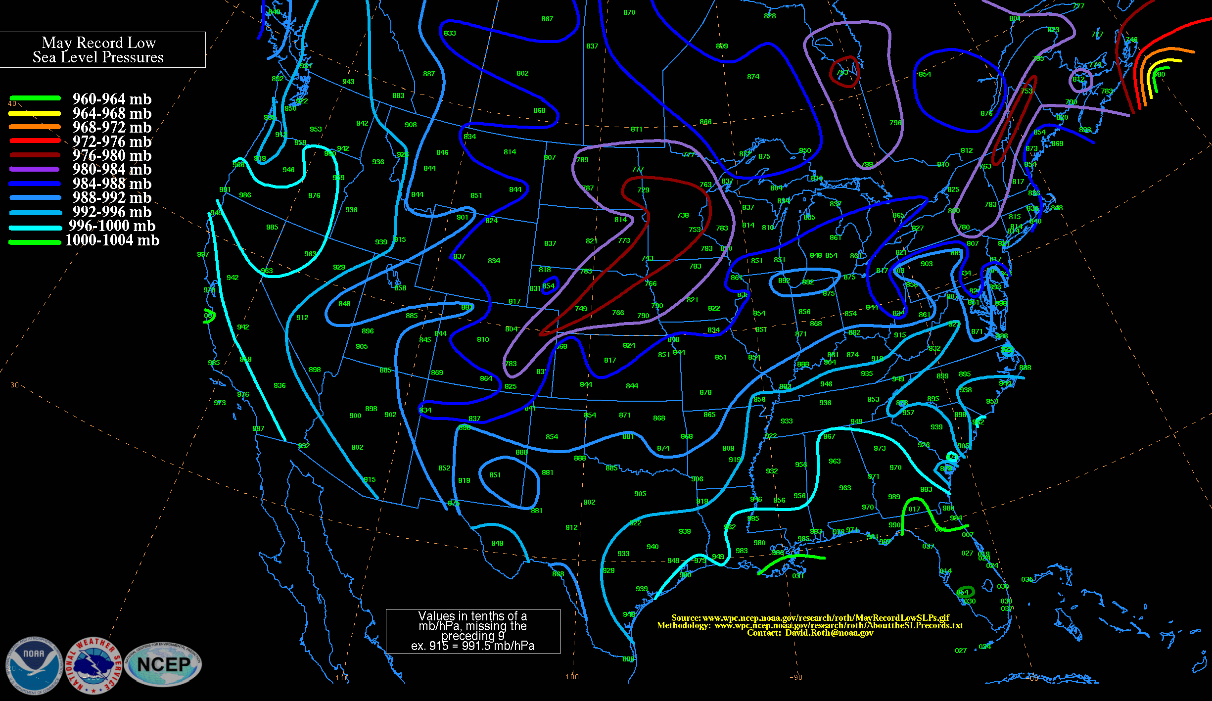
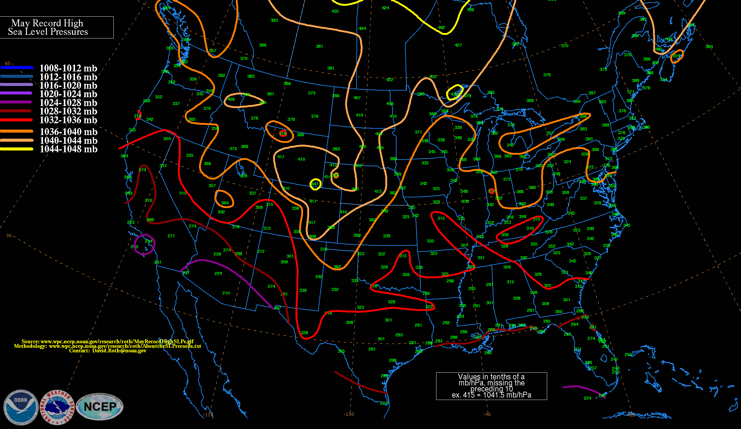
- May. (Low / High)
- Jun. (Low / High)
- Jul. (Low / High)
- Aug. (Low / High)
- Sep (Low / High)
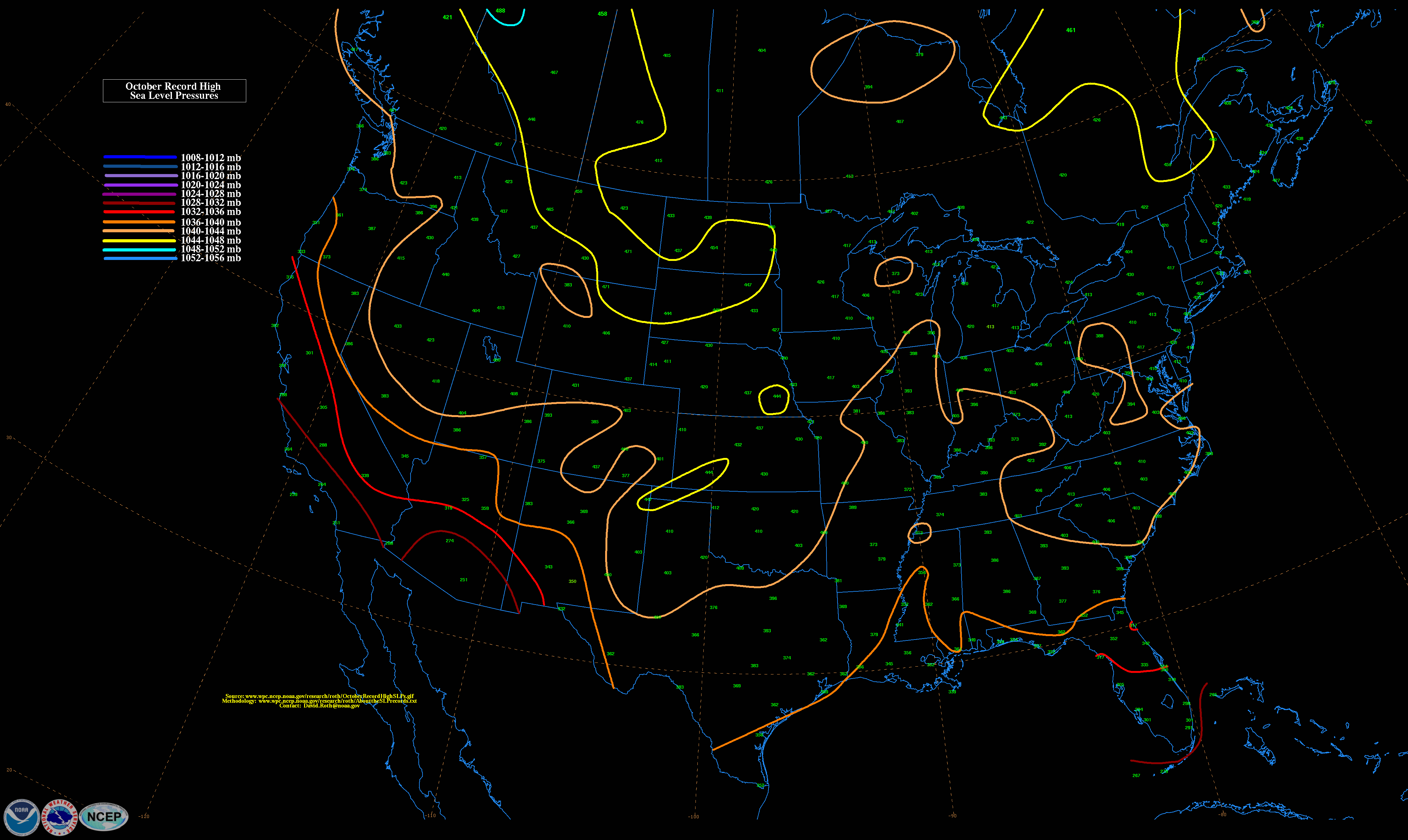
- Oct. (Low / High)
- Nov. (Low / High)
- Dec. (Low / High)
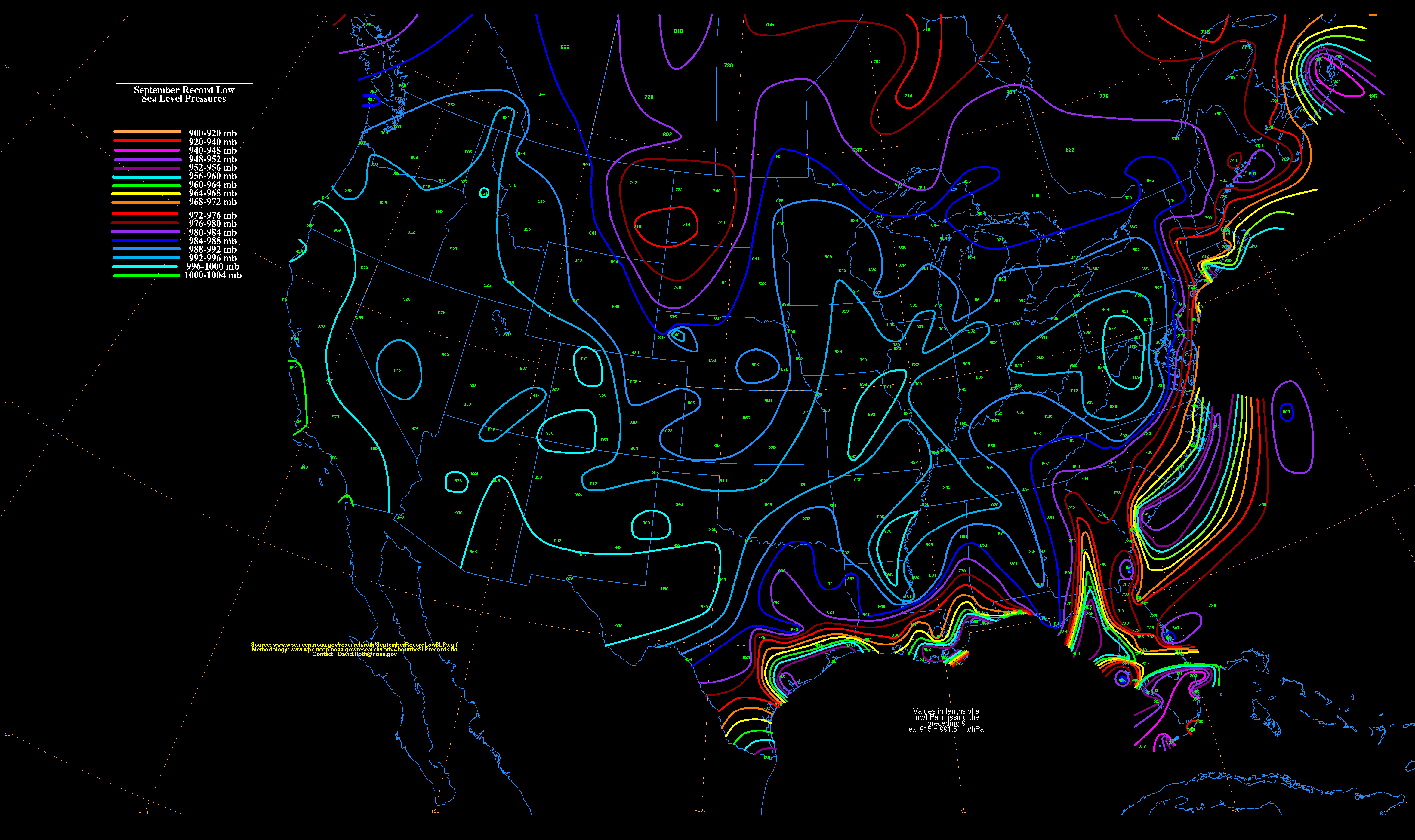
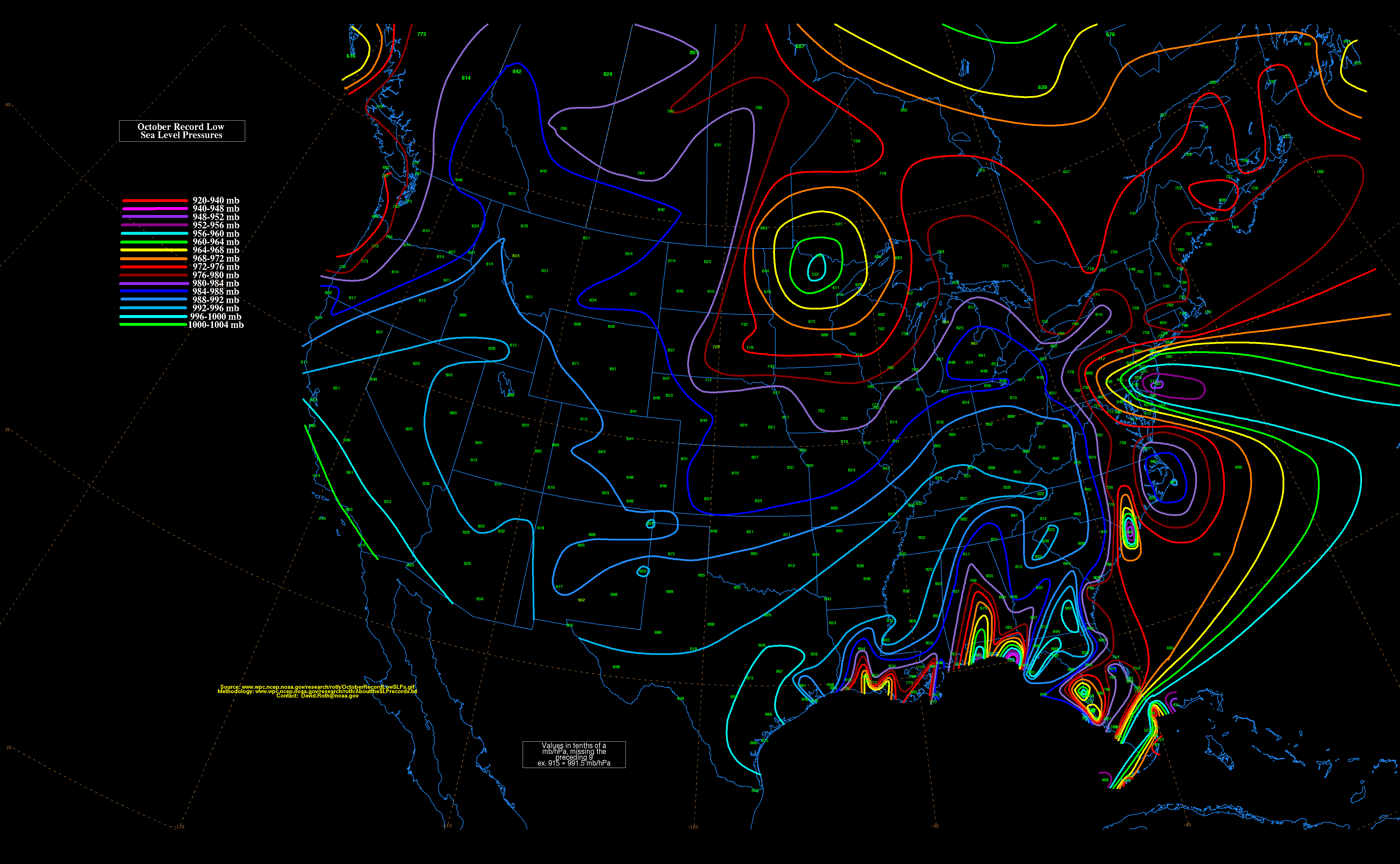
September record low surface level pressures for the contiguous US


