#1 Postby TheAustinMan » Sun Oct 26, 2014 11:55 am
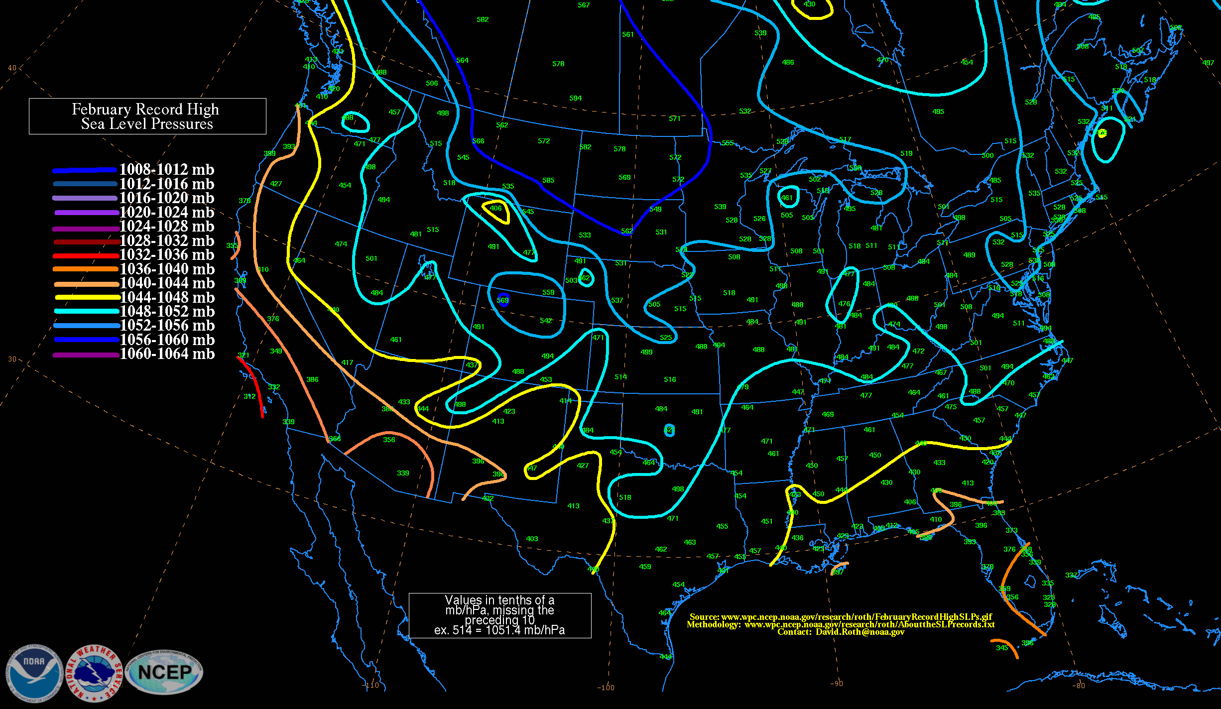
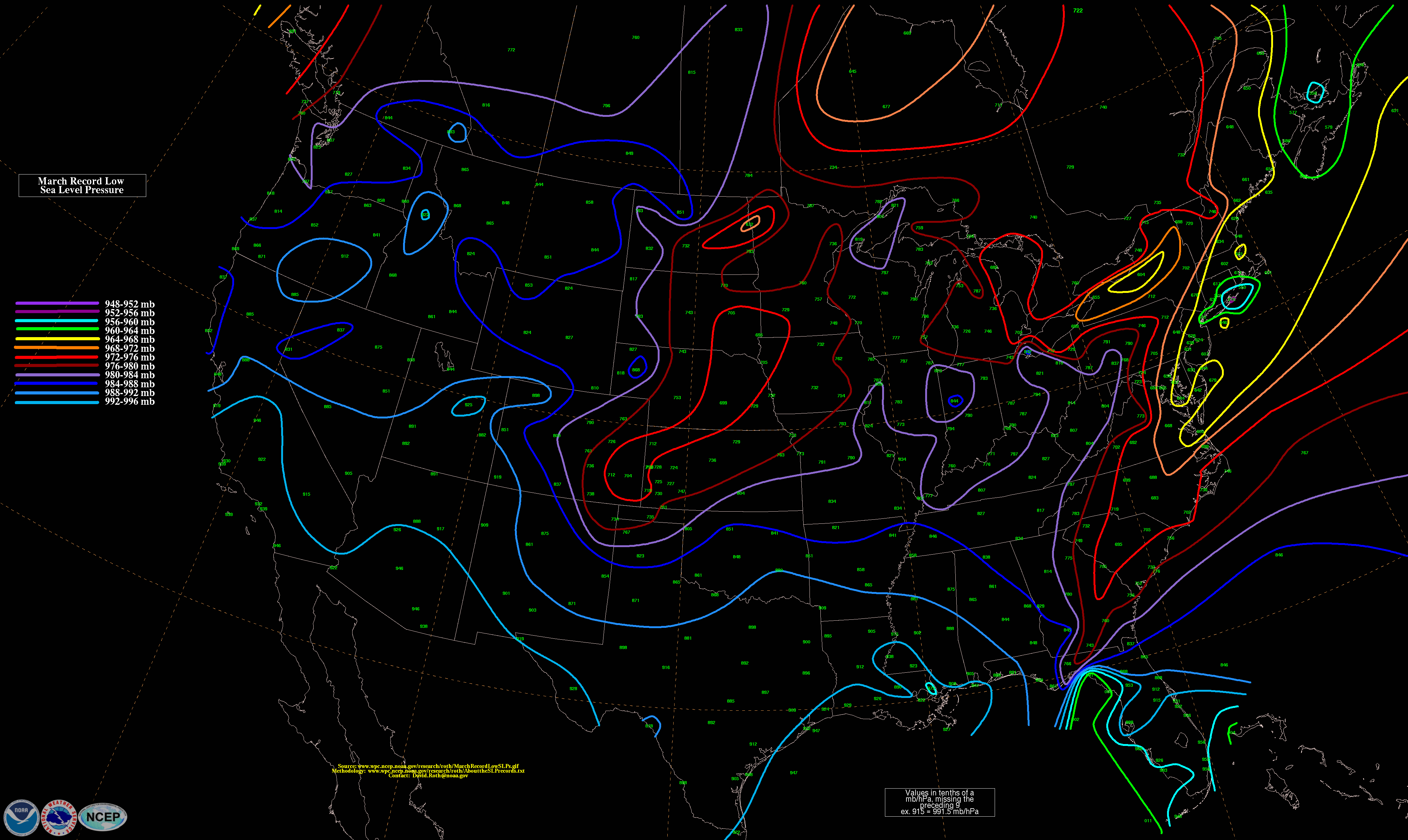
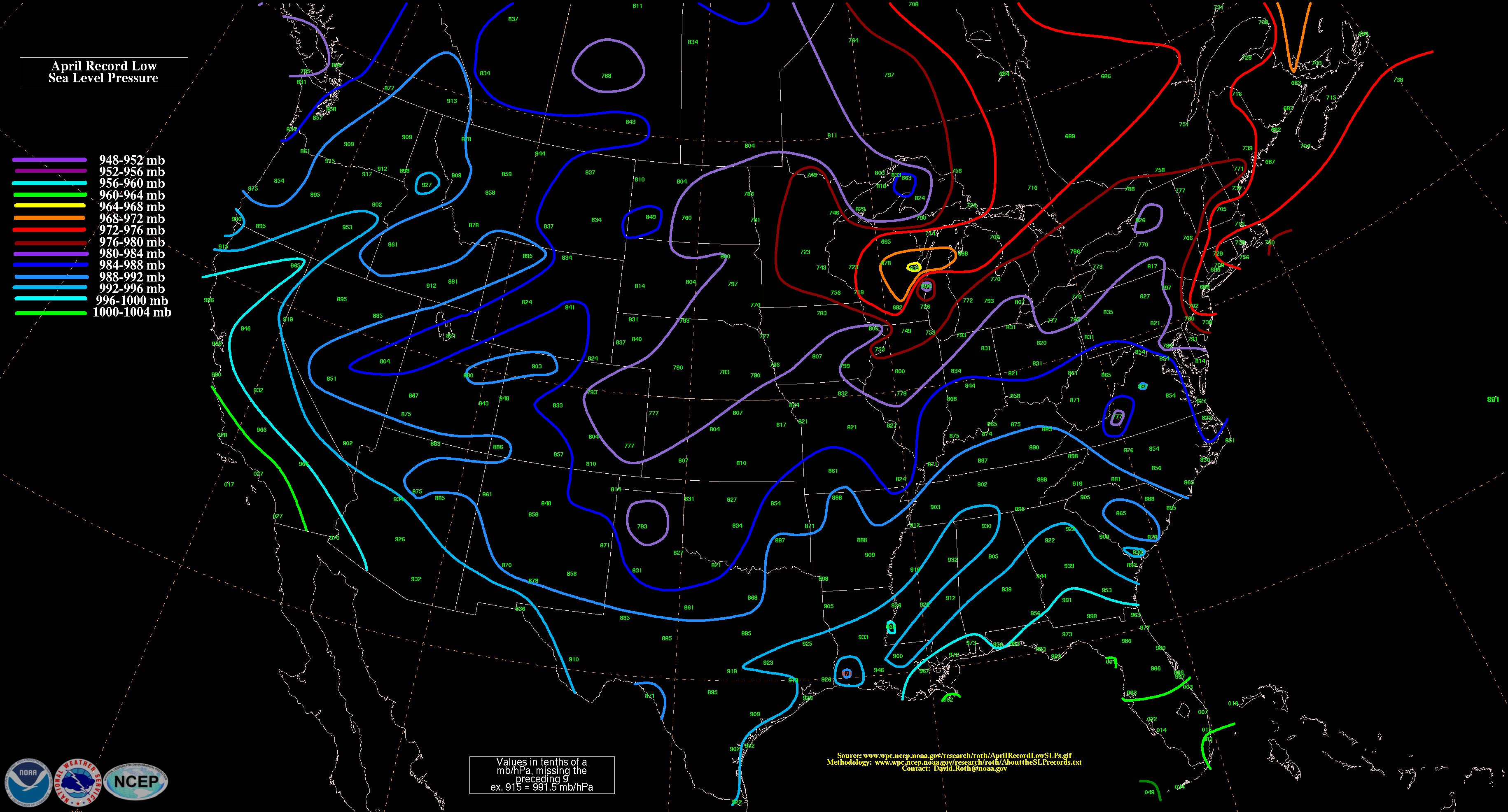
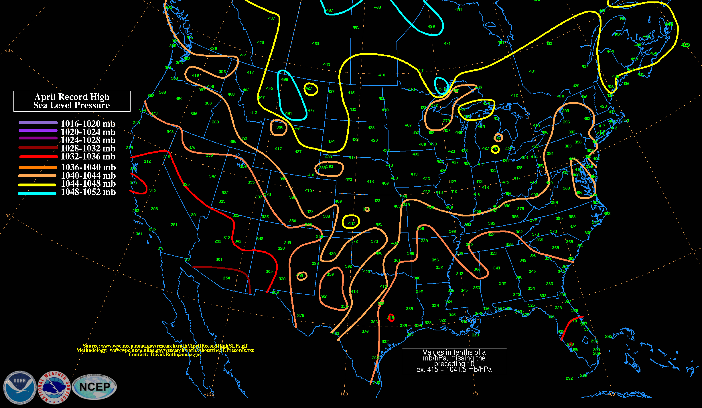
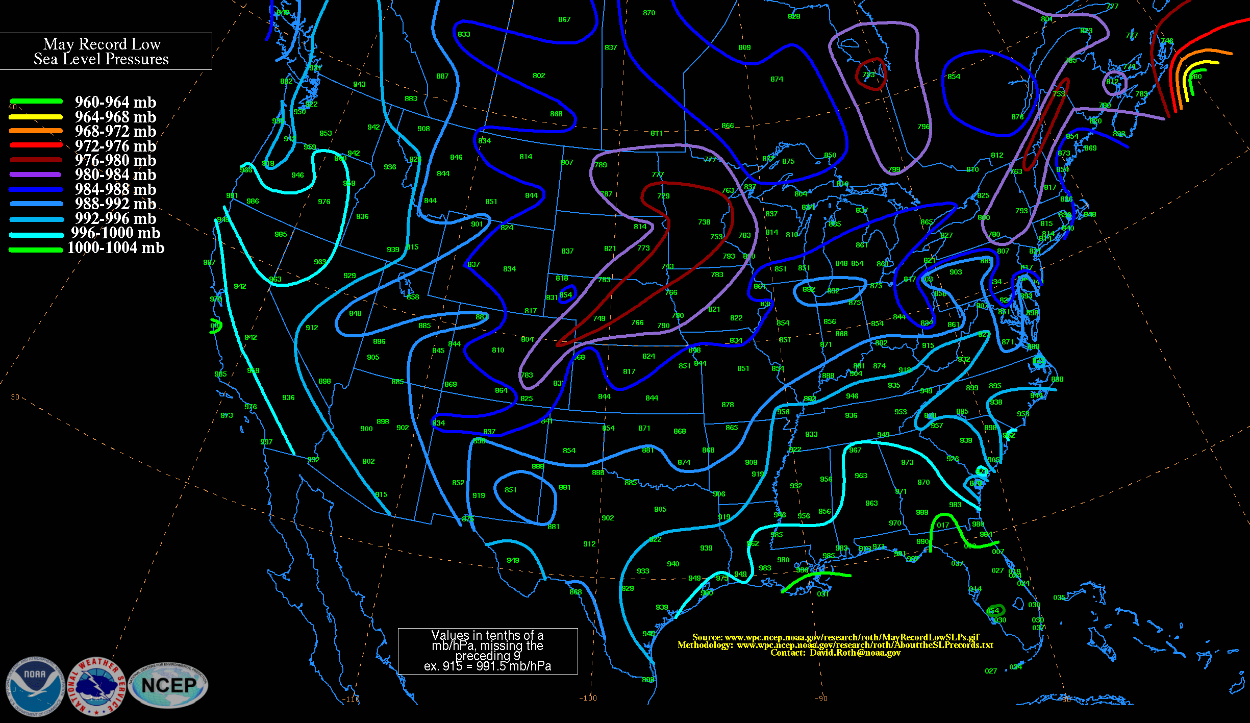
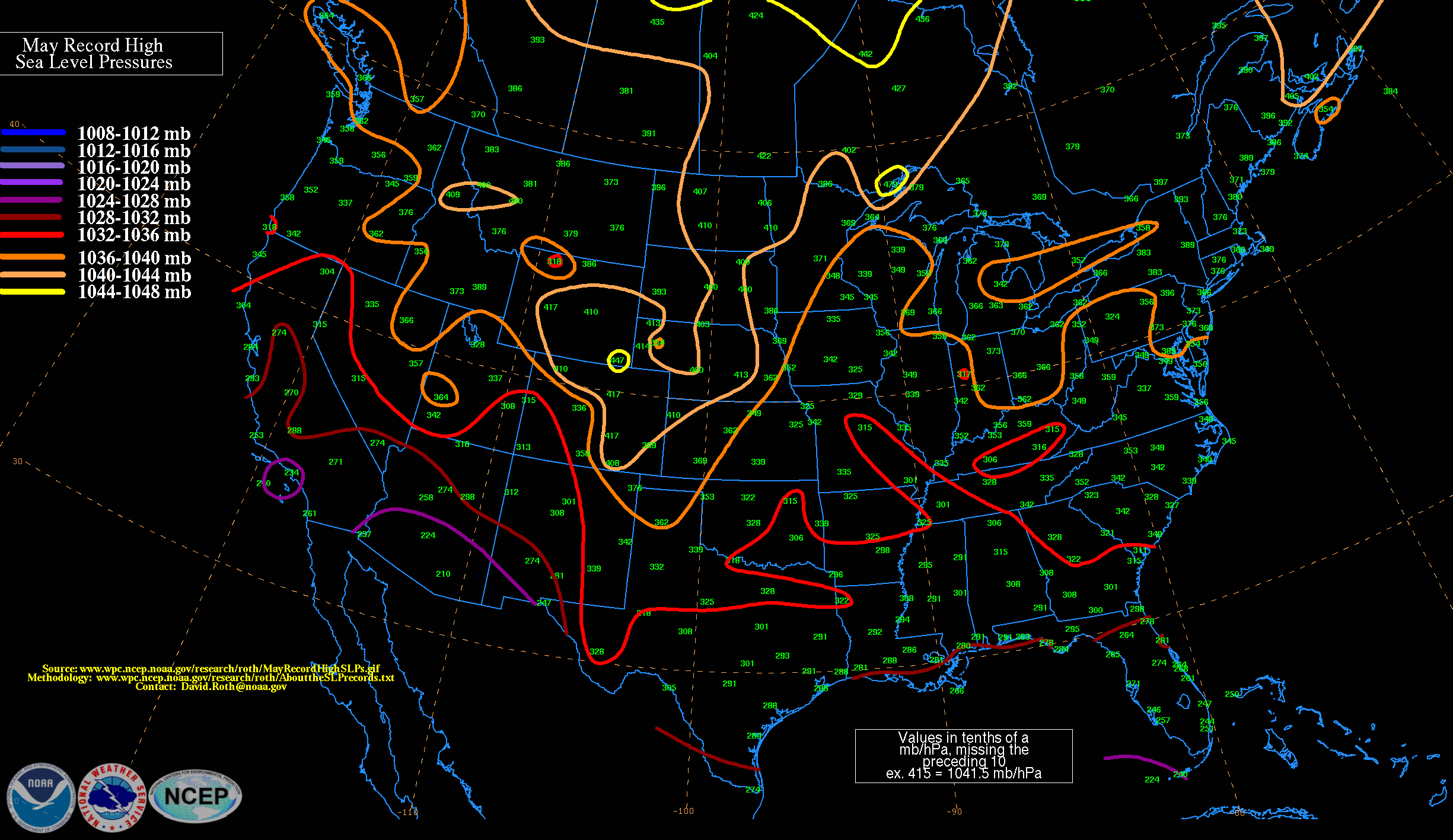
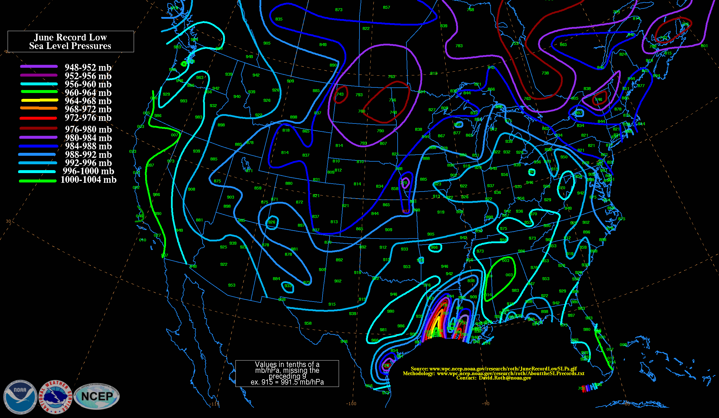
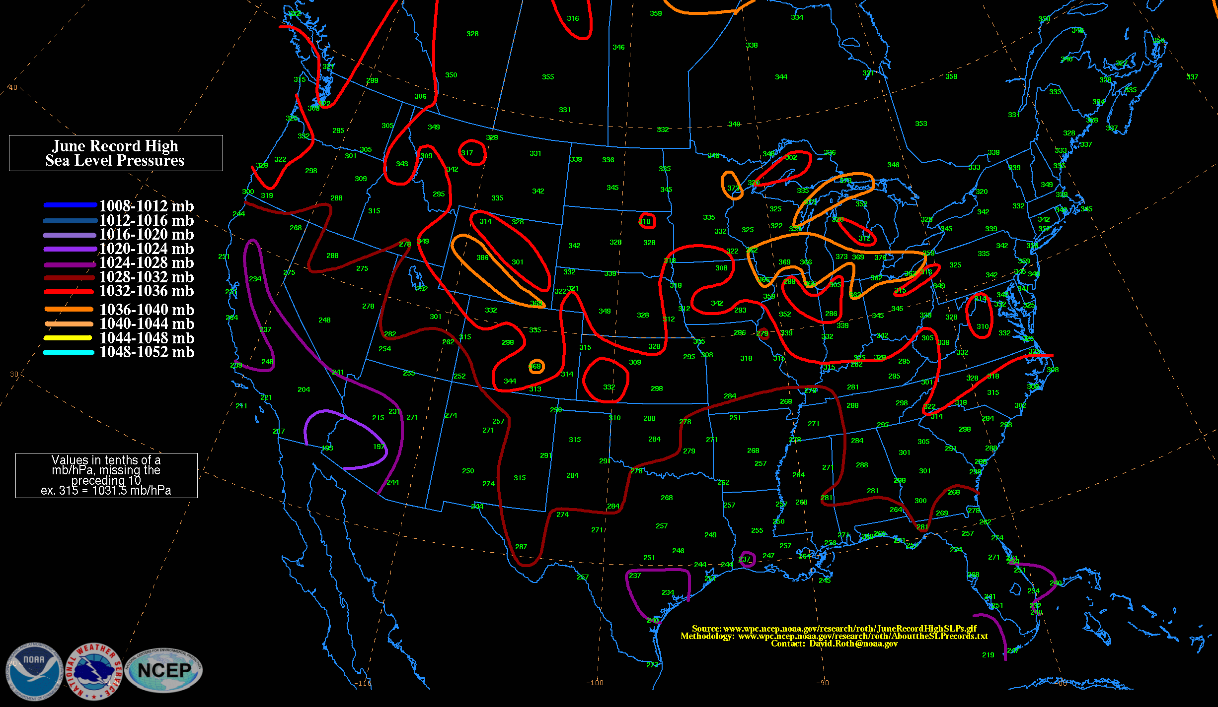
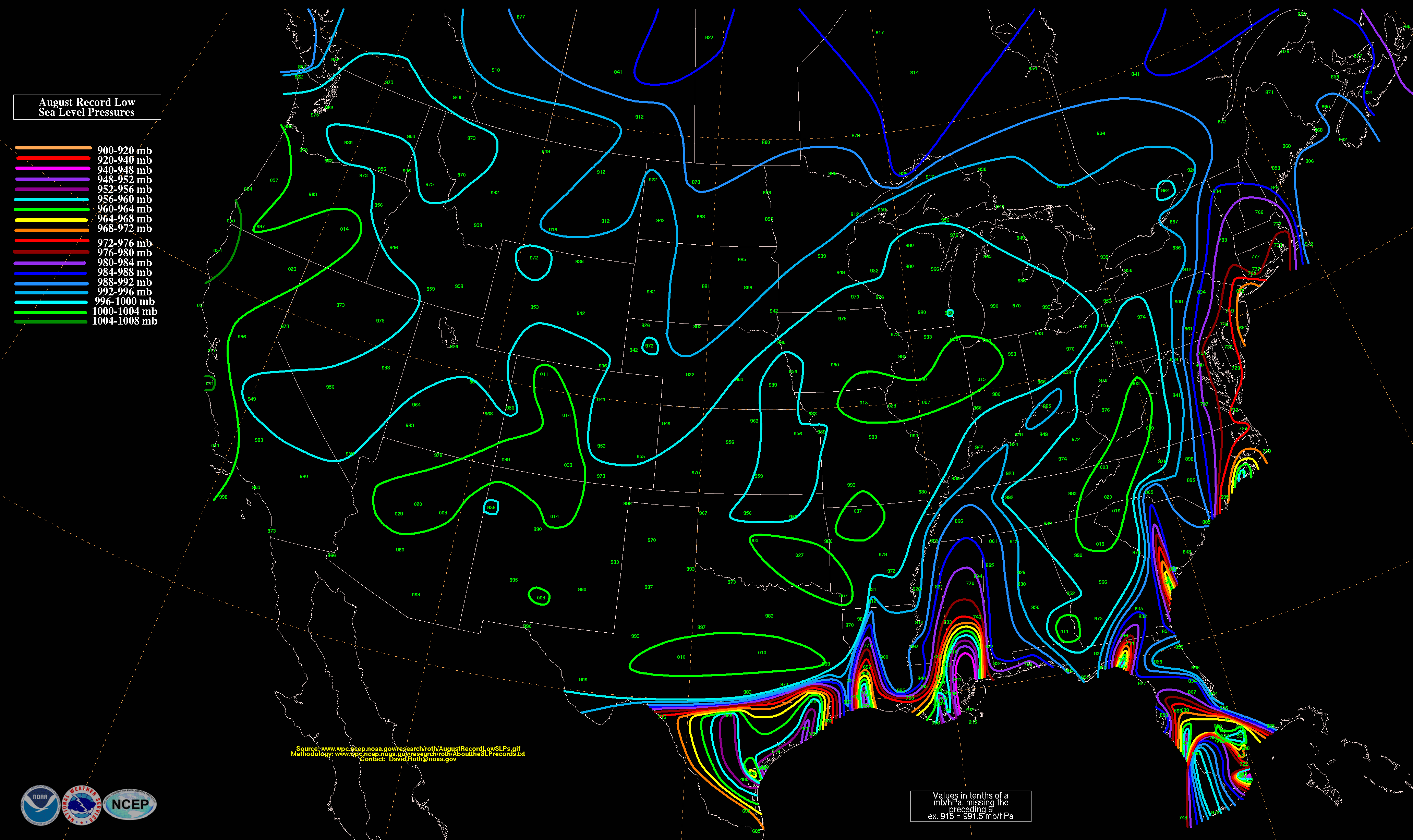
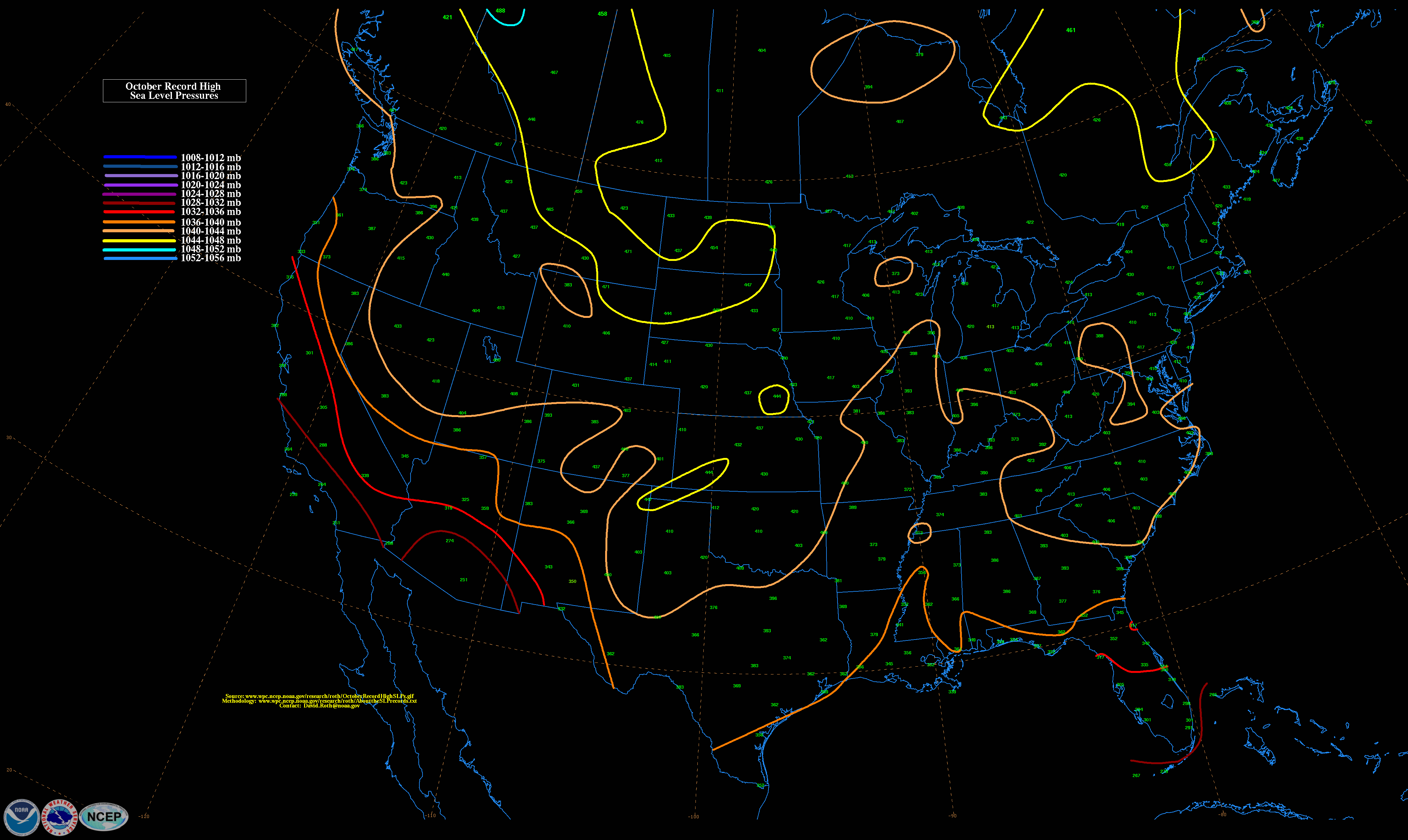
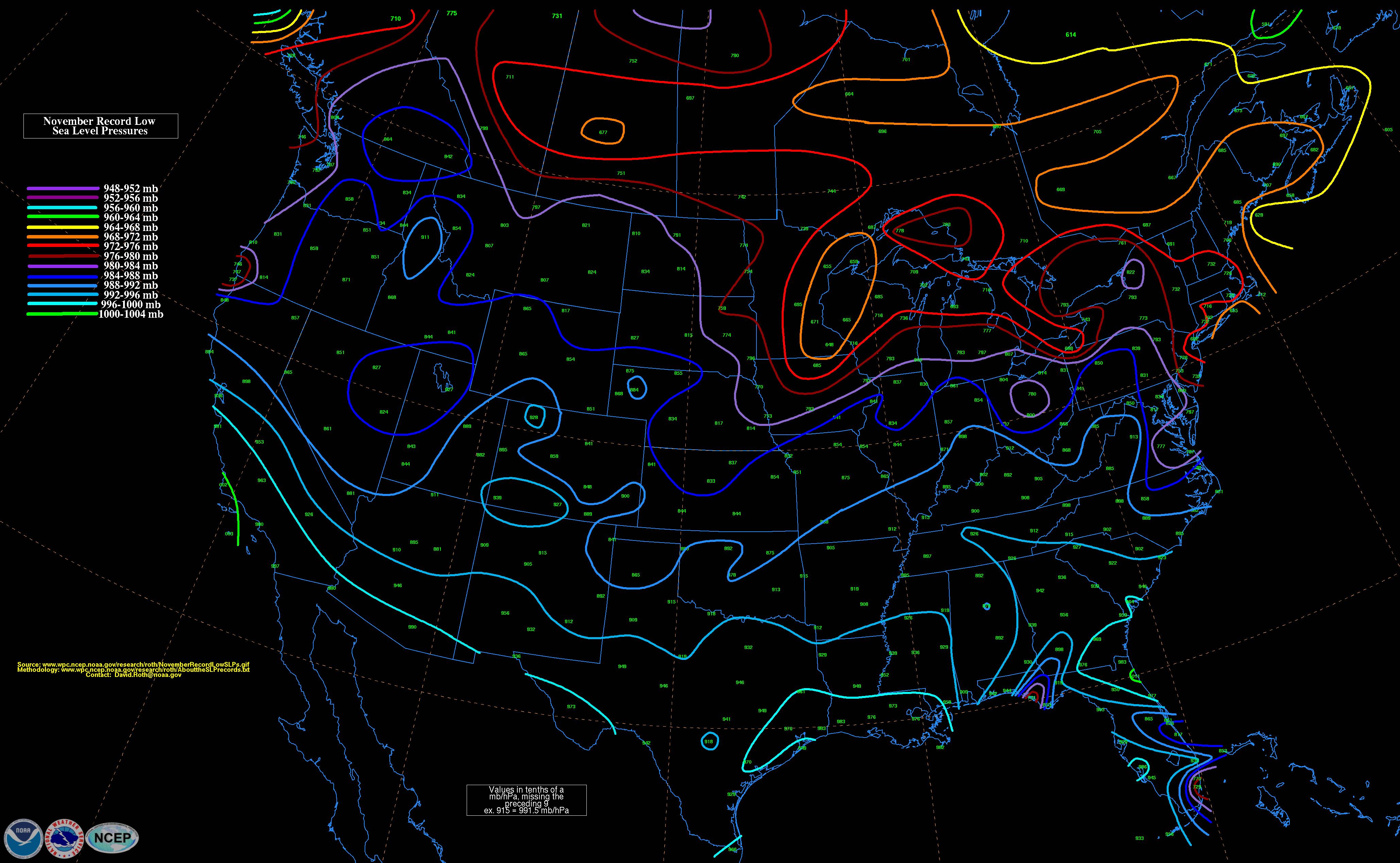
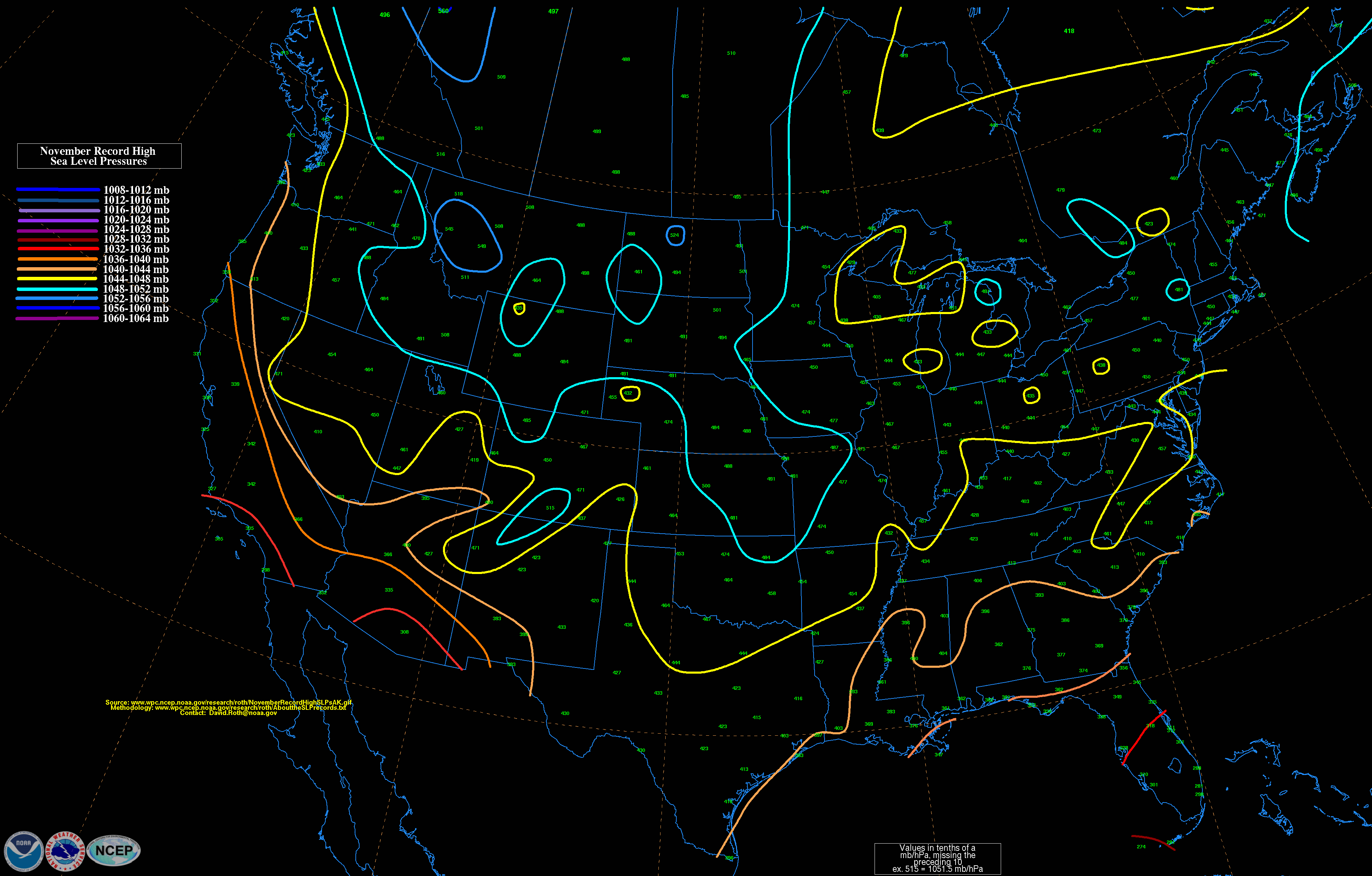
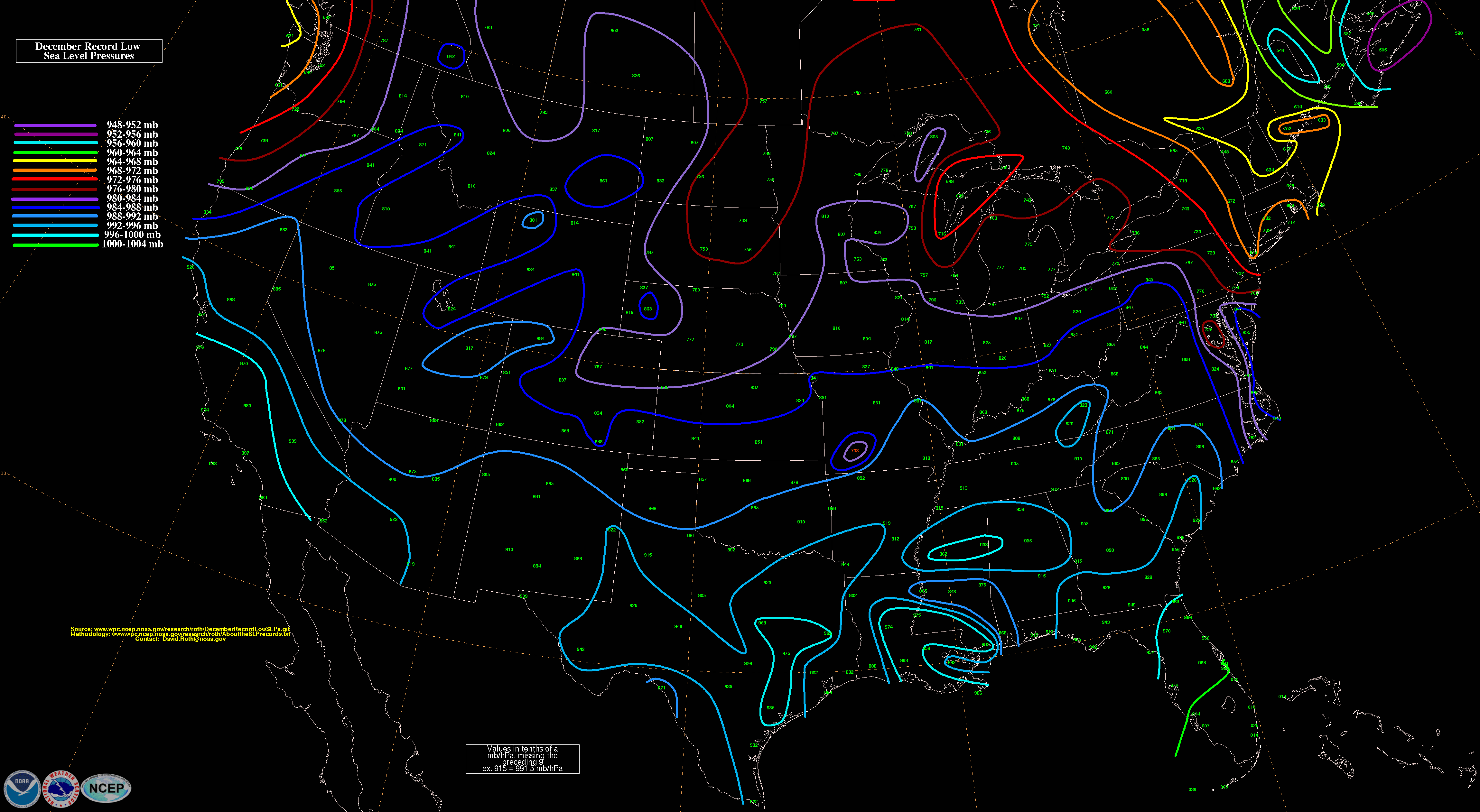
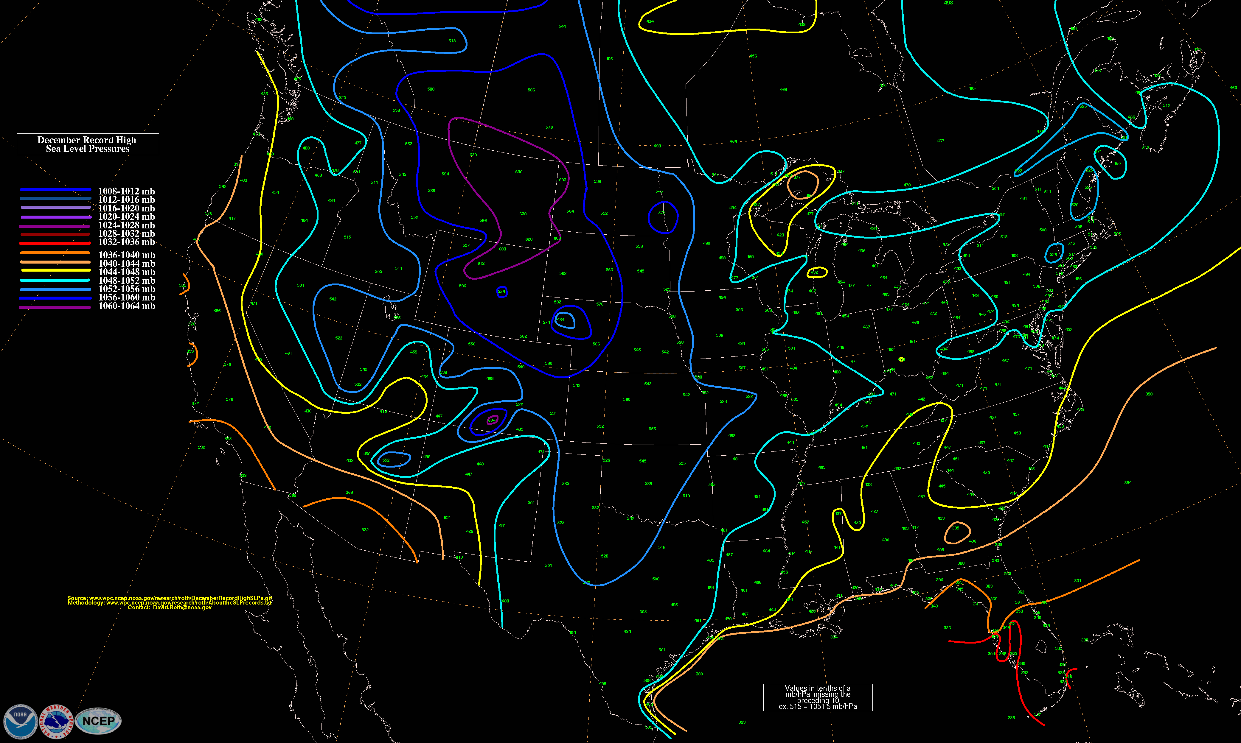
David Roth at the Weather Prediction Center is almost done with his compilation of maps which show high/low sea level pressure records per month for the contiguous United States. The image posted here is the map of September low-pressure records. These are pretty interesting as you can see the paths of hurricanes on several of them.
Full Index:
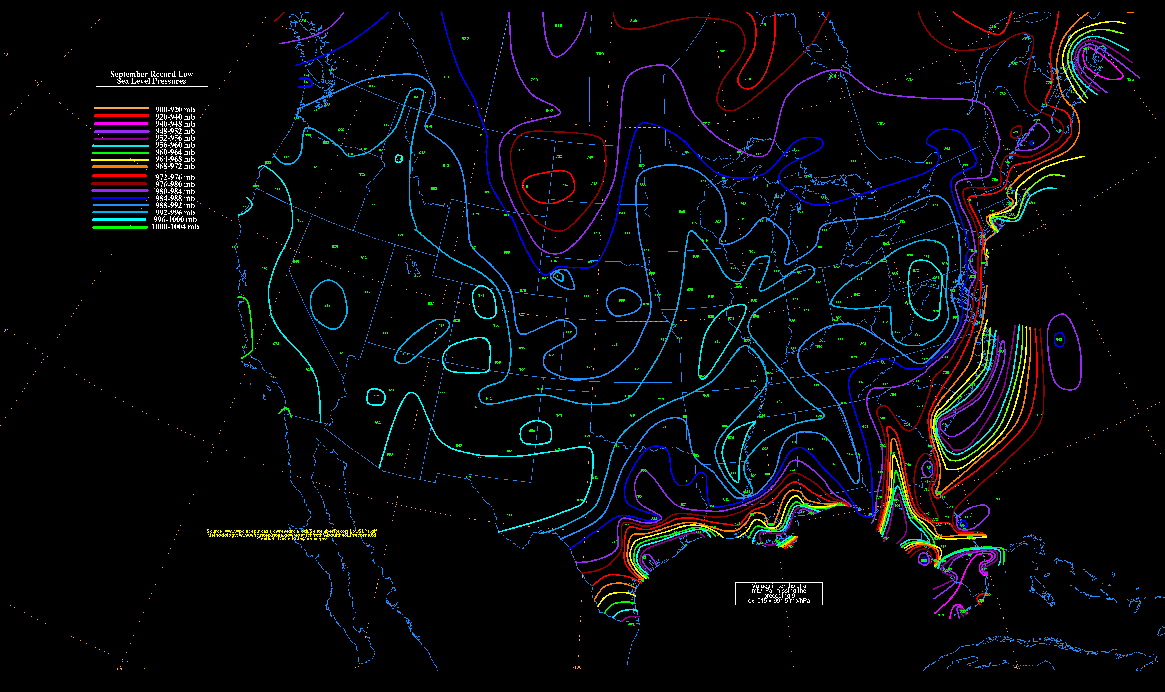 September record low surface level pressures for the contiguous US
0 likes
Treat my opinions with a grain of salt. For official information see your local weather service.
“It's tough to make predictions, especially about the future.”


