
ANOTHER DISTURBANCE THAT IS EXPECTED TO DEVELOP IN
EASTERN MICRONESIA WILL BRING ANOTHER ROUND OF ACTIVE WEATHER TO
CHUUK OVER THE WEEKEND...AND POSSIBLY TO YAP OR KOROR EARLY NEXT
WEEK.
2015 WPAC Season
Moderator: S2k Moderators
Forum rules

The posts in this forum are NOT official forecasts and should not be used as such. They are just the opinion of the poster and may or may not be backed by sound meteorological data. They are NOT endorsed by any professional institution or STORM2K. For official information, please refer to products from the National Hurricane Center and National Weather Service.
Re: 2015 WPAC Season
NWS on the second system...
0 likes
Remember, all of my post aren't official. For official warnings and discussions, Please refer to your local NWS products...
NWS for the Western Pacific
https://www.weather.gov/gum/
NWS for the Western Pacific
https://www.weather.gov/gum/
-
1900hurricane

- Category 5

- Posts: 6044
- Age: 32
- Joined: Fri Feb 06, 2015 12:04 pm
- Location: Houston, TX
- Contact:
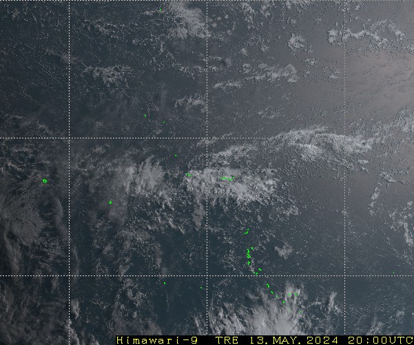
The convection over the western portion of Nino 4 looks like it has begun to coalesce into a coherent disturbance.
0 likes
Contract Meteorologist. TAMU & MSST. Fiercely authentic, one of a kind. We are all given free will, so choose a life meant to be lived. We are the Masters of our own Stories.
Opinions expressed are mine alone.
Follow me on Twitter at @1900hurricane : Read blogs at https://1900hurricane.wordpress.com/
Opinions expressed are mine alone.
Follow me on Twitter at @1900hurricane : Read blogs at https://1900hurricane.wordpress.com/
-
cycloneye

- Admin

- Posts: 139056
- Age: 67
- Joined: Thu Oct 10, 2002 10:54 am
- Location: San Juan, Puerto Rico
Re: 2015 WPAC Season
Do you have the link to that site of images?
0 likes
Visit the Caribbean-Central America Weather Thread where you can find at first post web cams,radars
and observations from Caribbean basin members Click Here
and observations from Caribbean basin members Click Here
-
1900hurricane
- Category 5
- Posts: 6044
- Age: 32
- Joined: Fri Feb 06, 2015 12:04 pm
- Location: Houston, TX
- Contact:
Yeah, sure, here it is. That particular image is "True Color."
0 likes
Contract Meteorologist. TAMU & MSST. Fiercely authentic, one of a kind. We are all given free will, so choose a life meant to be lived. We are the Masters of our own Stories.
Opinions expressed are mine alone.
Follow me on Twitter at @1900hurricane : Read blogs at https://1900hurricane.wordpress.com/
Opinions expressed are mine alone.
Follow me on Twitter at @1900hurricane : Read blogs at https://1900hurricane.wordpress.com/
-
cycloneye
- Admin
- Posts: 139056
- Age: 67
- Joined: Thu Oct 10, 2002 10:54 am
- Location: San Juan, Puerto Rico
Re:
1900hurricane wrote:Yeah, sure, here it is. That particular image is "True Color."
Is a great site that I bookmarked.
0 likes
Visit the Caribbean-Central America Weather Thread where you can find at first post web cams,radars
and observations from Caribbean basin members Click Here
and observations from Caribbean basin members Click Here
Re: 2015 WPAC Season

It's coming...
NWS
BOTH THE ECMWF AND NAVGEM ARE BULLISH WITH THE
DISTURBANCE EAST OF KOSRAE...TAKING IT TO THE SOUTH OF GUAM AS A
SIGNIFICANT SYSTEM LATE NEXT WEEKEND. WILL TAKE A WAIT AND SEE
ATTITUDE WITH RESPECT TO THIS WEATHER SCENARIO FOR NOW.
0 likes
Remember, all of my post aren't official. For official warnings and discussions, Please refer to your local NWS products...
NWS for the Western Pacific
https://www.weather.gov/gum/
NWS for the Western Pacific
https://www.weather.gov/gum/
Re: 2015 WPAC Season
NAVGEM previously develops the system to a TS south of Guam with a general westward track to Palau and Yap but no longer develops it in the latest 00Z run.
CMC does a double whammy takes Nepartak a bit north of where Melor makes landfall..over central Luzon, in a possible Fujiwhara.
EURO is weaker now takes a strong LPA/TD through Western Micronesia and Visayas.
CMC does a double whammy takes Nepartak a bit north of where Melor makes landfall..over central Luzon, in a possible Fujiwhara.
EURO is weaker now takes a strong LPA/TD through Western Micronesia and Visayas.
0 likes
Remember, all of my post aren't official. For official warnings and discussions, Please refer to your local NWS products...
NWS for the Western Pacific
https://www.weather.gov/gum/
NWS for the Western Pacific
https://www.weather.gov/gum/
-
1900hurricane
- Category 5
- Posts: 6044
- Age: 32
- Joined: Fri Feb 06, 2015 12:04 pm
- Location: Houston, TX
- Contact:
Yeah, I love that site. The images are fairly close to real time too, usually only 10-15 minutes off.
0 likes
Contract Meteorologist. TAMU & MSST. Fiercely authentic, one of a kind. We are all given free will, so choose a life meant to be lived. We are the Masters of our own Stories.
Opinions expressed are mine alone.
Follow me on Twitter at @1900hurricane : Read blogs at https://1900hurricane.wordpress.com/
Opinions expressed are mine alone.
Follow me on Twitter at @1900hurricane : Read blogs at https://1900hurricane.wordpress.com/
-
1900hurricane
- Category 5
- Posts: 6044
- Age: 32
- Joined: Fri Feb 06, 2015 12:04 pm
- Location: Houston, TX
- Contact:
Re:
RobWESTPACWX wrote:Also do want to note if we get a named storm in December it will be the first time in recorded history for one to occur every month.
Got it!
0 likes
Contract Meteorologist. TAMU & MSST. Fiercely authentic, one of a kind. We are all given free will, so choose a life meant to be lived. We are the Masters of our own Stories.
Opinions expressed are mine alone.
Follow me on Twitter at @1900hurricane : Read blogs at https://1900hurricane.wordpress.com/
Opinions expressed are mine alone.
Follow me on Twitter at @1900hurricane : Read blogs at https://1900hurricane.wordpress.com/
Re: 2015 WPAC Season
Looks like the second system in eastern Micronesia is loosing model support.
0 likes
Remember, all of my post aren't official. For official warnings and discussions, Please refer to your local NWS products...
NWS for the Western Pacific
https://www.weather.gov/gum/
NWS for the Western Pacific
https://www.weather.gov/gum/
Re: Re:
1900hurricane wrote:RobWESTPACWX wrote:Also do want to note if we get a named storm in December it will be the first time in recorded history for one to occur every month.
Got it!
Amazing!
Truly a year round record of any basin!
0 likes
Remember, all of my post aren't official. For official warnings and discussions, Please refer to your local NWS products...
NWS for the Western Pacific
https://www.weather.gov/gum/
NWS for the Western Pacific
https://www.weather.gov/gum/
Re: 2015 WPAC Season
Is a very large system that will likely take time to consolidate. That's why the models especially EURO and GFS aren't developing this plus add in the fact that the possibly cold surge that might affect Melor might prevent it's developement. Still a huge rainmake for the islands.

0 likes
Remember, all of my post aren't official. For official warnings and discussions, Please refer to your local NWS products...
NWS for the Western Pacific
https://www.weather.gov/gum/
NWS for the Western Pacific
https://www.weather.gov/gum/
Re: 2015 WPAC Season
0 likes
Remember, all of my post aren't official. For official warnings and discussions, Please refer to your local NWS products...
NWS for the Western Pacific
https://www.weather.gov/gum/
NWS for the Western Pacific
https://www.weather.gov/gum/
Re: 2015 WPAC Season
Truly impressive...Melor is now the 20th typhoon of the season. The most on record tying 2004...
http://www.storm2k.org/phpbb2/viewtopic.php?f=76&t=117741
http://www.storm2k.org/phpbb2/viewtopic.php?f=76&t=117741
0 likes
Remember, all of my post aren't official. For official warnings and discussions, Please refer to your local NWS products...
NWS for the Western Pacific
https://www.weather.gov/gum/
NWS for the Western Pacific
https://www.weather.gov/gum/
-
1900hurricane
- Category 5
- Posts: 6044
- Age: 32
- Joined: Fri Feb 06, 2015 12:04 pm
- Location: Houston, TX
- Contact:
Re: 2015 WPAC Season
euro6208 wrote:Truly impressive...Melor is now the 20th typhoon of the season. The most on record tying 2004...
http://www.storm2k.org/phpbb2/viewtopic.php?f=76&t=117741
By my count, we're at 21 typhoons (JTWC), which is still under 1997's 23. I also have 18 JMA typhoons, which is under the 20 from 1989. My numbers go back to 1977.
0 likes
Contract Meteorologist. TAMU & MSST. Fiercely authentic, one of a kind. We are all given free will, so choose a life meant to be lived. We are the Masters of our own Stories.
Opinions expressed are mine alone.
Follow me on Twitter at @1900hurricane : Read blogs at https://1900hurricane.wordpress.com/
Opinions expressed are mine alone.
Follow me on Twitter at @1900hurricane : Read blogs at https://1900hurricane.wordpress.com/
Re: 2015 WPAC Season
Looks like that's it for this season. Models keep the basin quiet until next month, when the 2016 season officially starts... 
0 likes
Remember, all of my post aren't official. For official warnings and discussions, Please refer to your local NWS products...
NWS for the Western Pacific
https://www.weather.gov/gum/
NWS for the Western Pacific
https://www.weather.gov/gum/
Re: 2015 WPAC Season

What a record breaking season.
With an ACE of 478.335, 2015 is 3rd place all time...
Last edited by euro6208 on Sun Dec 20, 2015 5:30 am, edited 2 times in total.
0 likes
Remember, all of my post aren't official. For official warnings and discussions, Please refer to your local NWS products...
NWS for the Western Pacific
https://www.weather.gov/gum/
NWS for the Western Pacific
https://www.weather.gov/gum/
Re: 2015 WPAC Season
Another record this season...Melor as a category 3+ made it the 16th typhoon to do so this season breaking the old record of 15 way back in 1965!
0 likes
Remember, all of my post aren't official. For official warnings and discussions, Please refer to your local NWS products...
NWS for the Western Pacific
https://www.weather.gov/gum/
NWS for the Western Pacific
https://www.weather.gov/gum/
Re: 2015 WPAC Season
Thanks to the WPAC...
This year broke the record for most Cat 4-5 in the Northern Hemisphere with 26 of them and about more than half of that occurring in the area with 14...
Previous record was 18 for both 1997 and 2004 in the NHEM...
This year broke the record for most Cat 4-5 in the Northern Hemisphere with 26 of them and about more than half of that occurring in the area with 14...
Previous record was 18 for both 1997 and 2004 in the NHEM...
0 likes
Remember, all of my post aren't official. For official warnings and discussions, Please refer to your local NWS products...
NWS for the Western Pacific
https://www.weather.gov/gum/
NWS for the Western Pacific
https://www.weather.gov/gum/
-
1900hurricane
- Category 5
- Posts: 6044
- Age: 32
- Joined: Fri Feb 06, 2015 12:04 pm
- Location: Houston, TX
- Contact:
0 likes
Contract Meteorologist. TAMU & MSST. Fiercely authentic, one of a kind. We are all given free will, so choose a life meant to be lived. We are the Masters of our own Stories.
Opinions expressed are mine alone.
Follow me on Twitter at @1900hurricane : Read blogs at https://1900hurricane.wordpress.com/
Opinions expressed are mine alone.
Follow me on Twitter at @1900hurricane : Read blogs at https://1900hurricane.wordpress.com/
Who is online
Users browsing this forum: Cpv17, duilaslol, Google Adsense [Bot], Landy, TheAustinMan and 82 guests