
00Z EURO again starting to hint of Champi, keeps it weak as it recurves east of the Marianas for now.
06Z also same track wise but stronger, 966 mb.
2015 WPAC Season
Moderator: S2k Moderators
Forum rules

The posts in this forum are NOT official forecasts and should not be used as such. They are just the opinion of the poster and may or may not be backed by sound meteorological data. They are NOT endorsed by any professional institution or STORM2K. For official information, please refer to products from the National Hurricane Center and National Weather Service.
Re: 2015 WPAC Season
0 likes
Remember, all of my post aren't official. For official warnings and discussions, Please refer to your local NWS products...
NWS for the Western Pacific
https://www.weather.gov/gum/
NWS for the Western Pacific
https://www.weather.gov/gum/
-
1900hurricane

- Category 5

- Posts: 6044
- Age: 32
- Joined: Fri Feb 06, 2015 12:04 pm
- Location: Houston, TX
- Contact:
91W and 92W are now both designated and probably close to classification. It wouldn't surprise me at all if at least one of them blows up into something big. Welcome to October in the WPac, the heart of super typhoon season.
0 likes
Contract Meteorologist. TAMU & MSST. Fiercely authentic, one of a kind. We are all given free will, so choose a life meant to be lived. We are the Masters of our own Stories.
Opinions expressed are mine alone.
Follow me on Twitter at @1900hurricane : Read blogs at https://1900hurricane.wordpress.com/
Opinions expressed are mine alone.
Follow me on Twitter at @1900hurricane : Read blogs at https://1900hurricane.wordpress.com/
Re: 2015 WPAC Season
0 likes
Remember, all of my post aren't official. For official warnings and discussions, Please refer to your local NWS products...
NWS for the Western Pacific
https://www.weather.gov/gum/
NWS for the Western Pacific
https://www.weather.gov/gum/
-
xtyphooncyclonex

- Category 5
- Posts: 3688
- Age: 22
- Joined: Sat Dec 08, 2012 9:07 am
- Location: Cebu City
- Contact:
Re: 2015 WPAC Season
euro6208 wrote:Even the most active typhoon season, 1964, was on full blown mode at this time.
2015 is losing although it did break many records.
But remember, 2015 is ahead of any other year at this point. To point out 2 potential typhoons (one other may be another monster) which could raise the ACE to further record levels.
Found this on Twitter tho
"Despite slightly below-avg ACE in NW Pac since 9/1, seasonal ACE is a record thru 10/11 (393), ahead of 1965 (384). -Phil Klotzbach"
0 likes
REMINDER: My opinions that I, or any other NON Pro-Met in this forum, are unofficial. Please do not take my opinions as an official forecast and warning. I am NOT a meteorologist. Following my forecasts blindly may lead to false alarm, danger and risk if official forecasts from agencies are ignored.
-
1900hurricane
- Category 5
- Posts: 6044
- Age: 32
- Joined: Fri Feb 06, 2015 12:04 pm
- Location: Houston, TX
- Contact:
We may need to watch the area around The Marshalls once again. Starting to see some early hints in guidance that something may want to try and form around there beginning in 3-4 days time.
0 likes
Contract Meteorologist. TAMU & MSST. Fiercely authentic, one of a kind. We are all given free will, so choose a life meant to be lived. We are the Masters of our own Stories.
Opinions expressed are mine alone.
Follow me on Twitter at @1900hurricane : Read blogs at https://1900hurricane.wordpress.com/
Opinions expressed are mine alone.
Follow me on Twitter at @1900hurricane : Read blogs at https://1900hurricane.wordpress.com/
Re: 2015 WPAC Season
Indeed a moderate chance of something forming out from the marshalls.

Interesting that the map doesn't show our twins.
Interesting that the map doesn't show our twins.
0 likes
Remember, all of my post aren't official. For official warnings and discussions, Please refer to your local NWS products...
NWS for the Western Pacific
https://www.weather.gov/gum/
NWS for the Western Pacific
https://www.weather.gov/gum/
-
1900hurricane
- Category 5
- Posts: 6044
- Age: 32
- Joined: Fri Feb 06, 2015 12:04 pm
- Location: Houston, TX
- Contact:
Koppu and Champi had already developed by the time that product was put out. There's no use in predicting something that has already occurred.
0 likes
Contract Meteorologist. TAMU & MSST. Fiercely authentic, one of a kind. We are all given free will, so choose a life meant to be lived. We are the Masters of our own Stories.
Opinions expressed are mine alone.
Follow me on Twitter at @1900hurricane : Read blogs at https://1900hurricane.wordpress.com/
Opinions expressed are mine alone.
Follow me on Twitter at @1900hurricane : Read blogs at https://1900hurricane.wordpress.com/
-
1900hurricane
- Category 5
- Posts: 6044
- Age: 32
- Joined: Fri Feb 06, 2015 12:04 pm
- Location: Houston, TX
- Contact:
Re:
1900hurricane wrote:We may need to watch the area around The Marshalls once again. Starting to see some early hints in guidance that something may want to try and form around there beginning in 3-4 days time.
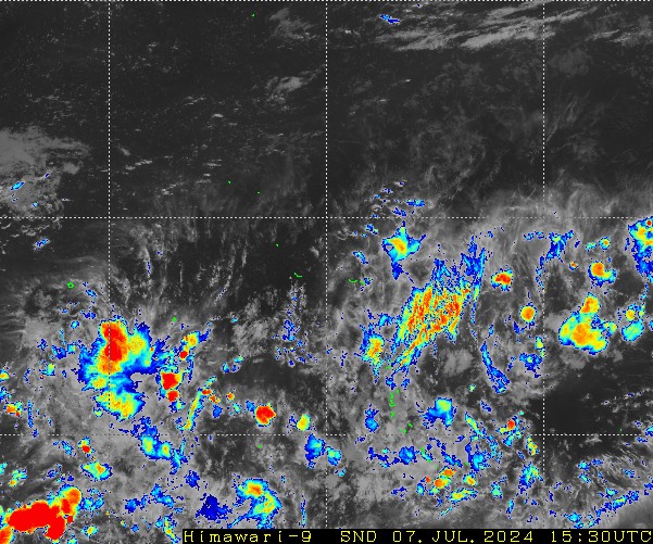
This disturbance very near the equator and dateline (looks about 2*N, 177*E or so to me at the moment) appears to be the disturbance some models are developing. The UKMET is the most aggressive of the global models in developing this into something, really getting the ball rolling in just a couple of days. Most other guidance is less optimistic about its future. For now at least, it looks decent and I wouldn't be surprised to see it tagged as an invest in the next day or two. It also looks like this is the Northern Hemisphere twin of 91P. The ongoing equatorial westerly wind burst is really helping the Pacific go ham right now.
0 likes
Contract Meteorologist. TAMU & MSST. Fiercely authentic, one of a kind. We are all given free will, so choose a life meant to be lived. We are the Masters of our own Stories.
Opinions expressed are mine alone.
Follow me on Twitter at @1900hurricane : Read blogs at https://1900hurricane.wordpress.com/
Opinions expressed are mine alone.
Follow me on Twitter at @1900hurricane : Read blogs at https://1900hurricane.wordpress.com/
Re: 2015 WPAC Season
0 likes
Remember, all of my post aren't official. For official warnings and discussions, Please refer to your local NWS products...
NWS for the Western Pacific
https://www.weather.gov/gum/
NWS for the Western Pacific
https://www.weather.gov/gum/
Re: 2015 WPAC Season
http://www.saipantribune.com/index.php/soudelor-reclassified-as-category-4/
Big news! Soudelor reclassified as Category 4.
Operationally had a category 2 typhoon...
http://www.storm2k.org/phpbb2/viewtopic.php?f=83&t=117385
Big news! Soudelor reclassified as Category 4.
Operationally had a category 2 typhoon...
From Category 2 prior to making landfall on Saipan in August, to being upgraded to Category 3 a month later, Typhoon Soudelor is now classified as a Category 4 tropical cyclone, based on assessments done by the National Weather Service in Guam and the University of Guam-Water and Environmental Research Institute.
The wind assessment was done by NWS Forecast Office Guam warning coordination meteorologist Charles Guard and WERI meteorologist Dr. Mark Lander.
http://www.storm2k.org/phpbb2/viewtopic.php?f=83&t=117385
Last edited by euro6208 on Wed Oct 14, 2015 11:57 pm, edited 2 times in total.
0 likes
Remember, all of my post aren't official. For official warnings and discussions, Please refer to your local NWS products...
NWS for the Western Pacific
https://www.weather.gov/gum/
NWS for the Western Pacific
https://www.weather.gov/gum/
Re: 2015 WPAC Season
Twit from Robert Speta:
2015 typhoon season.

Last time this happen was back in 1965, the most active season on record.
Incredible!
2015 typhoon season.
Last time this happen was back in 1965, the most active season on record.
Incredible!
0 likes
Remember, all of my post aren't official. For official warnings and discussions, Please refer to your local NWS products...
NWS for the Western Pacific
https://www.weather.gov/gum/
NWS for the Western Pacific
https://www.weather.gov/gum/
-
1900hurricane
- Category 5
- Posts: 6044
- Age: 32
- Joined: Fri Feb 06, 2015 12:04 pm
- Location: Houston, TX
- Contact:
Just going to leave this here. Tropopause heights and temps are just insane right now.

0 likes
Contract Meteorologist. TAMU & MSST. Fiercely authentic, one of a kind. We are all given free will, so choose a life meant to be lived. We are the Masters of our own Stories.
Opinions expressed are mine alone.
Follow me on Twitter at @1900hurricane : Read blogs at https://1900hurricane.wordpress.com/
Opinions expressed are mine alone.
Follow me on Twitter at @1900hurricane : Read blogs at https://1900hurricane.wordpress.com/
-
1900hurricane
- Category 5
- Posts: 6044
- Age: 32
- Joined: Fri Feb 06, 2015 12:04 pm
- Location: Houston, TX
- Contact:
Re: 2015 WPAC Season
euro6208 wrote:Twit from Robert Speta:
2015 typhoon season.
Last time this happen was back in 1965, the most active season on record.
Incredible!
The last month without the formation of a named storm was August 2014, which means we're now at 14 months running.
0 likes
Contract Meteorologist. TAMU & MSST. Fiercely authentic, one of a kind. We are all given free will, so choose a life meant to be lived. We are the Masters of our own Stories.
Opinions expressed are mine alone.
Follow me on Twitter at @1900hurricane : Read blogs at https://1900hurricane.wordpress.com/
Opinions expressed are mine alone.
Follow me on Twitter at @1900hurricane : Read blogs at https://1900hurricane.wordpress.com/
Re: 2015 WPAC Season
What a sorry sight to witness.
At this time in 1997, we have 2 cat 5 twins. 2015 not so much...
2015.

1997.

At this time in 1997, we have 2 cat 5 twins. 2015 not so much...
2015.
1997.
0 likes
Remember, all of my post aren't official. For official warnings and discussions, Please refer to your local NWS products...
NWS for the Western Pacific
https://www.weather.gov/gum/
NWS for the Western Pacific
https://www.weather.gov/gum/


Re: 2015 WPAC Season
I think we could foreseeably still have Cat 5 twins, or at least strong cat 4, before Koppu makes landfall.
0 likes

-
galaxy401

- Category 5
- Posts: 2299
- Age: 28
- Joined: Sat Aug 25, 2012 9:04 pm
- Location: Casa Grande, Arizona
Re: 2015 WPAC Season
euro6208 wrote:What a sorry sight to witness.
At this time in 1997, we have 2 cat 5 twins. 2015 not so much...
You're acting like the 1997 occurrence is a common thing. Not every twin storm will both be cat fives...Besides be glad if the western storm doesn't become a category 5 since that would mean more devastation for the Philippines.
0 likes
Got my eyes on moving right into Hurricane Alley: Florida.
-
xtyphooncyclonex
- Category 5
- Posts: 3688
- Age: 22
- Joined: Sat Dec 08, 2012 9:07 am
- Location: Cebu City
- Contact:
Re: 2015 WPAC Season
euro6208 wrote:What a sorry sight to witness.
At this time in 1997, we have 2 cat 5 twins. 2015 not so much...
And I'm assuming you want every storm to be a powerful one? So what! We'd have enough of roughly $9 billion of damage in this basin mostly in East Asia. It's inconsiderate to think of it. There's a lot of possibilities with these seasons and they give surprises every year. Don't expect this to act exactly like 1997. It's quite annoying btw because you compare and exaggerate almost every storm of the season with 1997 storms and get disappointed when they don't come up to your expectations bro... It's painful for their part to be bombarded with storms of this intensity, just because your place is "more prepared"
0 likes
REMINDER: My opinions that I, or any other NON Pro-Met in this forum, are unofficial. Please do not take my opinions as an official forecast and warning. I am NOT a meteorologist. Following my forecasts blindly may lead to false alarm, danger and risk if official forecasts from agencies are ignored.
-
1900hurricane
- Category 5
- Posts: 6044
- Age: 32
- Joined: Fri Feb 06, 2015 12:04 pm
- Location: Houston, TX
- Contact:
Re: 2015 WPAC Season
euro6208 wrote:What a sorry sight to witness.
At this time in 1997, we have 2 cat 5 twins. 2015 not so much...
2015.
1997.
Actually, at the time of your post, 1997 had a category 2 and a category 3. Ivan and Joan didn't go berserk until about 00Z October 17th.
0 likes
Contract Meteorologist. TAMU & MSST. Fiercely authentic, one of a kind. We are all given free will, so choose a life meant to be lived. We are the Masters of our own Stories.
Opinions expressed are mine alone.
Follow me on Twitter at @1900hurricane : Read blogs at https://1900hurricane.wordpress.com/
Opinions expressed are mine alone.
Follow me on Twitter at @1900hurricane : Read blogs at https://1900hurricane.wordpress.com/
-
1900hurricane
- Category 5
- Posts: 6044
- Age: 32
- Joined: Fri Feb 06, 2015 12:04 pm
- Location: Houston, TX
- Contact:
Following the current two storms and invest, it wouldn't surprise me if the WPac cools off for the next week or two. With Madden-Julian returning to become a player for the first time since this summer, higher than usual subsidence could rule the basin for a period. Following that though, we could be back in business.
0 likes
Contract Meteorologist. TAMU & MSST. Fiercely authentic, one of a kind. We are all given free will, so choose a life meant to be lived. We are the Masters of our own Stories.
Opinions expressed are mine alone.
Follow me on Twitter at @1900hurricane : Read blogs at https://1900hurricane.wordpress.com/
Opinions expressed are mine alone.
Follow me on Twitter at @1900hurricane : Read blogs at https://1900hurricane.wordpress.com/
Re: 2015 WPAC Season
I just got home from work and i am shock to read the comments about my post comparing this to Ivan and Joan back in 1997. Reading them, it seems like i wanted destruction and wrath across the region and where did anywhere in my post says it's because of my place which is more prepared and others are less unfortunate?
I was just comparing this time of year to 1997 when we had Ivan and Joan and Koppu and Champi this year. Both struggling when expectations are high in an el nino year.
I don't want destruction and death and to be honest, if you are a fanatic, you'd wish for more powerful typhoons to track.
Please take me lightly.
0 likes
Remember, all of my post aren't official. For official warnings and discussions, Please refer to your local NWS products...
NWS for the Western Pacific
https://www.weather.gov/gum/
NWS for the Western Pacific
https://www.weather.gov/gum/
Who is online
Users browsing this forum: tiger_deF and 199 guests