2015 indicators: Instability / SST's / MSLP / Steering / Sal
Moderator: S2k Moderators
Forum rules

The posts in this forum are NOT official forecasts and should not be used as such. They are just the opinion of the poster and may or may not be backed by sound meteorological data. They are NOT endorsed by any professional institution or STORM2K. For official information, please refer to products from the National Hurricane Center and National Weather Service.
-
WPBWeather

- S2K Supporter

- Posts: 535
- Age: 65
- Joined: Thu Jul 18, 2013 12:33 pm
Re: 2015 indicators: Instability / SST's / MSLP / Steering / Sal
0 likes

Re: 2015 indicators: Instability / SST's / MSLP / Steering / Sal
wxman57 wrote:MiamiensisWx wrote:wxman57 wrote:I don't believe there's any correlation between the direction of the first storm at landfall and future tracks. Ana was moving NW, not NNW at landfall. I measure 326.1 deg, which is still NW as NNW starts at 326.26 deg. What are the statistics for first storm movement at landfall? What years are included, what is the distribution of directions?
I used the official HURDAT database from 1851 to 2014. Thanks for correcting my estimate for Ana, but for my purposes, Ana still meets the criteria of a storm moving between west and north-northwest at landfall. As for years, I already mentioned the seasons that met my criteria. Regarding distribution of directions, how would that make a difference in my instance? Please clarify (and hopefully don't run away as soon as I ask).
I was just curious as to the statistics of movement at landfall for the first storm from 1851-2015. How many were moving W, WNW, NW, ...etc.? What's the distribution of directions?
As for my statement prior to the 2004 season:
"This is exactly the setup we had for the 1940s through the 1960s when Florida was absolutely pummeled by major hurricanes. And that's why I say to ignore the numbers forecast and look at the patterns. I think we'll be seeing less storms in the near future but more major hurricanes and a significantly increased risk of major hurricane landfalls, particularly in Florida."
I'd say that turned out quite well (bold part). About 1 in 3 major hurricanes of the past has made a U.S. landfall, making the current nearly 10-yr drought quite unusual. One would think that such a drought cannot continue much longer.
If we had thousands of years worth of hurricane data we could say the period from the 40's to the 60's was the norm.
WXman57 do you know of any sources like fossil evidence from the Florida Everglades that might add support to your speculation that long periods without hurricane activity haven't happened in the past?
Hurricane "droughts" may not exactly follow statistical modeling, for example a 10,000 year swing in Global warming/cooling might make the Atlantic inhospitable for hurricane development for a very long time.
0 likes
-
Bocadude85

- Category 5

- Posts: 2941
- Age: 37
- Joined: Mon Apr 18, 2005 2:20 pm
- Location: Honolulu,Hi
Re:
TheStormExpert wrote:The West Atlantic ridging MAY be somewhat stronger, BUT there is still a Semi-Permanent trough along the East Coast/Northeast U.S. As we head into the peak months of August, September, and October(especially September onward) we will more than likely see the Bermuda High break down and cave in quite a bit due to the troughs becoming more stronger with the change of season. This happens basically every year(with the exception of years like 2004 which are VERY rare IMO) and has allowed us to escape MANY MANY direct hits from hurricanes! Now if the peak was a month or two earlier this would be a WHOLE different story IMO and the U.S. would be notorious with hurricane hits.
All in all I expect this season to be no different, even if the steering pattern is different for now.
How can you possibly know what the steering pattern in September is going to be? The logic you are using makes no sense. Just because something happened last year does not mean it will unfold the exact same way this year. Mother Nature is very unpredictable.
0 likes
-
TheStormExpert

- Category 5
- Posts: 8487
- Age: 30
- Joined: Wed Feb 16, 2011 5:38 pm
- Location: Palm Beach Gardens, FL
Re: Re:
Bocadude85 wrote:TheStormExpert wrote:The West Atlantic ridging MAY be somewhat stronger, BUT there is still a Semi-Permanent trough along the East Coast/Northeast U.S. As we head into the peak months of August, September, and October(especially September onward) we will more than likely see the Bermuda High break down and cave in quite a bit due to the troughs becoming more stronger with the change of season. This happens basically every year(with the exception of years like 2004 which are VERY rare IMO) and has allowed us to escape MANY MANY direct hits from hurricanes! Now if the peak was a month or two earlier this would be a WHOLE different story IMO and the U.S. would be notorious with hurricane hits.
All in all I expect this season to be no different, even if the steering pattern is different for now.
How can you possibly know what the steering pattern in September is going to be? The logic you are using makes no sense. Just because something happened last year does not mean it will unfold the exact same way this year. Mother Nature is very unpredictable.
Wasn't saying that I know exactly what steering pattern will be like then, I just noticed that once we head towards the peak or beginning of September(which is only 2-3 weeks from the official start of Fall) you usually see troughs start to strengthen and dig deeper regularly due to the season change which IMO is probably why the U.S. always seems to be saved by the trough.
Now if the peak was pushed a month or two earlier the troughs would probably be not as strong and more riffing would be present which could and would probably lead to more U.S. impacts. Thankfully this isn't the case!
But every once in a while you will have a rare anomaly like what happened September 2004 where the ridge is very strong and has much more control. Even that season we saw a pretty decently strong trough in mid-August which can be thanked for why Charley turned towards Florida from the SW! That season the timing was all bad news for Florida from storms like Charley to Frances/Jeanne to even Ivan which went further west into the western Florida Panhandle.
One of these days a somewhat similar pattern at least will take place and allow something significant to hit Florida, whether it be from the SE/E or SW/S. Florida has one disadvantage that any other state along the U.S. East Coast and GoM doesn't have, we can get hit from two directions on both sides of the state!
That's why this 10 year Florida hurricane drought is so rare and can be worrisome. It can't last much longer IMO.
0 likes
The following post is NOT an official forecast and should not be used as such. It is just the opinion of the poster and may or may not be backed by sound meteorological data. It is NOT endorsed by storm2k.org.
-
Yellow Evan

- Professional-Met

- Posts: 15951
- Age: 25
- Joined: Fri Jul 15, 2011 12:48 pm
- Location: Henderson, Nevada/Honolulu, HI
- Contact:
I'm not sure the 10 year MH drought is pure luck. I think there's been some sort pattern change that favors more East Coast troughing now then ever before. Or maybe it's just that the ITCZ is more northerly and that there are more Cape Berde's and less homegrowns then ever before?
However, this pattern is not present yet. Regardless, however, good luck getting storms to form down in the MDR in super Nino years. Anything big must form in the Gulf or off the SE Coast.
However, this pattern is not present yet. Regardless, however, good luck getting storms to form down in the MDR in super Nino years. Anything big must form in the Gulf or off the SE Coast.
0 likes

Re: 2015 indicators: Instability / SST's / MSLP / Steering / Sal
Why are you guys keep referring all the way back to 2004 as the last year there was a strong Bermuda ridge, but what about 2007 & 2008?
2007 was that the Burmada ridge pattern if anything was too strong why the two MDR's MJ Hurricanes slammed into C.A. and or Mexico.
2008 also saw a strong Atlantic ridge pattern.
My point is that you don't have to go that far back.
2007 was that the Burmada ridge pattern if anything was too strong why the two MDR's MJ Hurricanes slammed into C.A. and or Mexico.
2008 also saw a strong Atlantic ridge pattern.
My point is that you don't have to go that far back.
0 likes
-
Andrew92

- S2K Supporter
- Posts: 3247
- Age: 40
- Joined: Mon Jun 16, 2003 12:35 am
- Location: Phoenix, Arizona
Re:
Yellow Evan wrote:I'm not sure the 10 year MH drought is pure luck. I think there's been some sort pattern change that favors more East Coast troughing now then ever before. Or maybe it's just that the ITCZ is more northerly and that there are more Cape Berde's and less homegrowns then ever before?
However, this pattern is not present yet. Regardless, however, good luck getting storms to form down in the MDR in super Nino years. Anything big must form in the Gulf or off the SE Coast.
Since 2006, there have been eight hurricanes hit the United States. That means in order to go a full decade-long period with less than ten hurricane hits in the United States, no more than one can hit this year. Seems like a decent proposition, since this is a traditional El Nino and only in the satellite era has there been one traditional El Nino season with more than one, 1986 (Bonnie and Charley). 2004, for those who bring it up, was not a traditional but a Modoki, central-based event instead, and produces different conditions from the traditional ones.
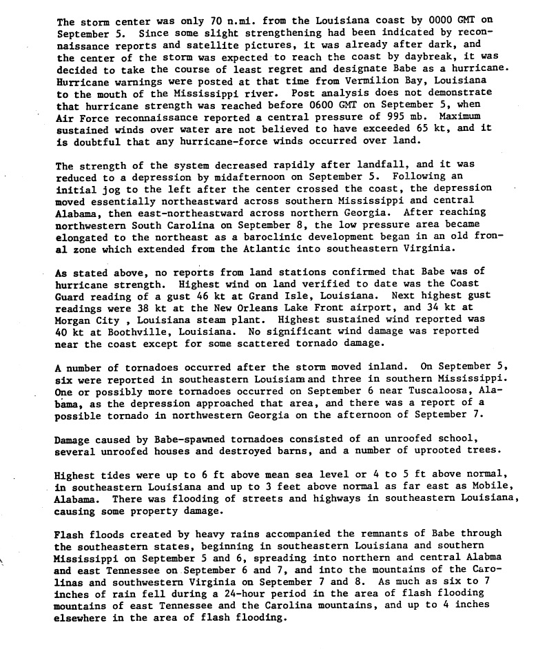
I've looked at all the hurricanes that have hit the United States since 1886, and only one other period rivals this one since 2006 for lack of landfalls: 1972-1984. During that period, 11 hurricanes hit, and that's if we are counting Babe in 1977 as there was doubt at the time of the Tropical Cyclone Report back then on its status as a hurricane. Read the first paragraph of the third page of the report here: http://www.nhc.noaa.gov/archive/storm_w ... elim03.gif
Of course, one can simply say that that was the inactive period for Atlantic hurricanes, and a busier period for the Eastern Pacific. But I'm not so sure it's that simple. For one thing, one needs to only look at 2008 as a season with three landfalls and 2010 as one of the busiest seasons in recent memory. For another, there have been other areas being impacted: Dean and Felix have been the most obvious Caribbean monsters, though Gustav and Ike caused plenty of problems in Haiti and Cuba as well, and Omar and Paloma were majors in that basin too. Tomas was a bad one for St. Vincent and Haiti. Sandy was also destructive for Cuba and Haiti well before it did what it did to the United States. And along with Dean, Mexico was pounded by Alex and Karl in 2010 - and has received non-major hits from Lorenzo in 2007, I think Dolly in 2008 (though landfall was north of the border, I believe it did produce some sustained hurricane winds in Matamoros), and though not a hurricane at landfall, severe floods from Ingrid in 2013 (though admittedly coupled with even worse Manuel). Even Bermuda and Canada have taken their hits, such as Earl and Igor in 2010, and Gonzalo last year.
So while the United States has been relatively spared (though still bruised by some storms like Ike and Sandy) since 2006, other areas have not been. Was it like this between 1972-1984, you ask? In a word, yes. The Caribbean saw powerful Carmen plow into the Yucatan and deadly Fifi deluge Honduras in 1974, along with Eloise lashing Puerto Rico with punishing floods, Greta a near repeat of Fifi in 1978, David being one of Dominica's and the Dominican Republic's worst hurricanes ever, and Allen lashing several islands while somehow never making landfall on one. The mainland of Mexico's Gulf coast wasn't spared either: Caroline plowed in just south of the border in 1975 and Anita did likewise in 1977, both as major hurricanes - though the only other non-major hurricane I could find that is close to the main Gulf coast of Mexico is Brenda in 1973, on the Bay of Campeche coast. And Bermuda and Canada got their hits too: Faye in 1975 for Bermuda, and Blanche in 1975 and Evelyn in 1977 for Canada.
I think a lot of it is just that steering and timing have not lined up well in the past decade for the hurricanes to reach the United States as powerhouses. They are occurring elsewhere, and that was the case in the 1970s and early 1980s too.
-Andrew92
0 likes
-
ninel conde
- Category 5
- Posts: 1245
- Joined: Mon Aug 04, 2008 2:18 pm
Re: Re:
Bocadude85 wrote:TheStormExpert wrote:The West Atlantic ridging MAY be somewhat stronger, BUT there is still a Semi-Permanent trough along the East Coast/Northeast U.S. As we head into the peak months of August, September, and October(especially September onward) we will more than likely see the Bermuda High break down and cave in quite a bit due to the troughs becoming more stronger with the change of season. This happens basically every year(with the exception of years like 2004 which are VERY rare IMO) and has allowed us to escape MANY MANY direct hits from hurricanes! Now if the peak was a month or two earlier this would be a WHOLE different story IMO and the U.S. would be notorious with hurricane hits.
All in all I expect this season to be no different, even if the steering pattern is different for now.
How can you possibly know what the steering pattern in September is going to be? The logic you are using makes no sense. Just because something happened last year does not mean it will unfold the exact same way this year. Mother Nature is very unpredictable.
The pattern the last several years has been uber hostile in sept. I am very confident of a huge east coast trof in sept and once again an early end to a slow cane season.
0 likes
The posts in this forum are NOT official forecast and should not be used as such. They are just the opinion of the poster and may or may not be backed by sound meteorological data. They are NOT endorsed by any professional institution or storm2k.org. For official information, please refer to the NHC and NWS products.
^Ninel,
Are you saying you're expecting WNW upper flow to dominate near the peak naming the east coast?
Are you saying you're expecting WNW upper flow to dominate near the peak naming the east coast?
0 likes
Personal Forecast Disclaimer:
The posts in this forum are NOT official forecasts and should not be used as such. They are just the opinion of the poster and may or may not be backed by sound meteorological data. They are NOT endorsed by any professional institution or storm2k.org. For official information, please refer to the NHC and NWS products.
The posts in this forum are NOT official forecasts and should not be used as such. They are just the opinion of the poster and may or may not be backed by sound meteorological data. They are NOT endorsed by any professional institution or storm2k.org. For official information, please refer to the NHC and NWS products.
-
Bocadude85
- Category 5
- Posts: 2941
- Age: 37
- Joined: Mon Apr 18, 2005 2:20 pm
- Location: Honolulu,Hi
Re: Re:
ninel conde wrote:Bocadude85 wrote:TheStormExpert wrote:The West Atlantic ridging MAY be somewhat stronger, BUT there is still a Semi-Permanent trough along the East Coast/Northeast U.S. As we head into the peak months of August, September, and October(especially September onward) we will more than likely see the Bermuda High break down and cave in quite a bit due to the troughs becoming more stronger with the change of season. This happens basically every year(with the exception of years like 2004 which are VERY rare IMO) and has allowed us to escape MANY MANY direct hits from hurricanes! Now if the peak was a month or two earlier this would be a WHOLE different story IMO and the U.S. would be notorious with hurricane hits.
All in all I expect this season to be no different, even if the steering pattern is different for now.
How can you possibly know what the steering pattern in September is going to be? The logic you are using makes no sense. Just because something happened last year does not mean it will unfold the exact same way this year. Mother Nature is very unpredictable.
The pattern the last several years has been uber hostile in sept. I am very confident of a huge east coast trof in sept and once again an early end to a slow cane season.
There is always a east coast trough at some point in September. How can you know for sure that there will be no ridging at all during the months of August or September to guide anything that does form westward? All it takes is one storm to get trapped under a ridging pattern and encounter favorable conditions and suddenly that slow season becomes very memorable. 1965 is a good example of this, only 6 storms formed that year and yet it went down as one of the costliest hurricane seasons of that time. Same can be said of 1992. I am not saying that is what will happen this year, but you do have to acknowledge that it is a possibility.
0 likes
-
ScottNAtlanta

- Category 5
- Posts: 1998
- Joined: Sat May 25, 2013 3:11 pm
- Location: Atlanta, GA
Re: Re:
Andrew92 wrote:Yellow Evan wrote:I'm not sure the 10 year MH drought is pure luck. I think there's been some sort pattern change that favors more East Coast troughing now then ever before. Or maybe it's just that the ITCZ is more northerly and that there are more Cape Berde's and less homegrowns then ever before?
However, this pattern is not present yet. Regardless, however, good luck getting storms to form down in the MDR in super Nino years. Anything big must form in the Gulf or off the SE Coast.
Since 2006, there have been eight hurricanes hit the United States. That means in order to go a full decade-long period with less than ten hurricane hits in the United States, no more than one can hit this year. Seems like a decent proposition, since this is a traditional El Nino and only in the satellite era has there been one traditional El Nino season with more than one, 1986 (Bonnie and Charley). 2004, for those who bring it up, was not a traditional but a Modoki, central-based event instead, and produces different conditions from the traditional ones.
I've looked at all the hurricanes that have hit the United States since 1886, and only one other period rivals this one since 2006 for lack of landfalls: 1972-1984. During that period, 11 hurricanes hit, and that's if we are counting Babe in 1977 as there was doubt at the time of the Tropical Cyclone Report back then on its status as a hurricane. Read the first paragraph of the third page of the report here: http://www.nhc.noaa.gov/archive/storm_w ... elim03.gif
Of course, one can simply say that that was the inactive period for Atlantic hurricanes, and a busier period for the Eastern Pacific. But I'm not so sure it's that simple. For one thing, one needs to only look at 2008 as a season with three landfalls and 2010 as one of the busiest seasons in recent memory. For another, there have been other areas being impacted: Dean and Felix have been the most obvious Caribbean monsters, though Gustav and Ike caused plenty of problems in Haiti and Cuba as well, and Omar and Paloma were majors in that basin too. Tomas was a bad one for St. Vincent and Haiti. Sandy was also destructive for Cuba and Haiti well before it did what it did to the United States. And along with Dean, Mexico was pounded by Alex and Karl in 2010 - and has received non-major hits from Lorenzo in 2007, I think Dolly in 2008 (though landfall was north of the border, I believe it did produce some sustained hurricane winds in Matamoros), and though not a hurricane at landfall, severe floods from Ingrid in 2013 (though admittedly coupled with even worse Manuel). Even Bermuda and Canada have taken their hits, such as Earl and Igor in 2010, and Gonzalo last year.
So while the United States has been relatively spared (though still bruised by some storms like Ike and Sandy) since 2006, other areas have not been. Was it like this between 1972-1984, you ask? In a word, yes. The Caribbean saw powerful Carmen plow into the Yucatan and deadly Fifi deluge Honduras in 1974, along with Eloise lashing Puerto Rico with punishing floods, Greta a near repeat of Fifi in 1978, David being one of Dominica's and the Dominican Republic's worst hurricanes ever, and Allen lashing several islands while somehow never making landfall on one. The mainland of Mexico's Gulf coast wasn't spared either: Caroline plowed in just south of the border in 1975 and Anita did likewise in 1977, both as major hurricanes - though the only other non-major hurricane I could find that is close to the main Gulf coast of Mexico is Brenda in 1973, on the Bay of Campeche coast. And Bermuda and Canada got their hits too: Faye in 1975 for Bermuda, and Blanche in 1975 and Evelyn in 1977 for Canada.
I think a lot of it is just that steering and timing have not lined up well in the past decade for the hurricanes to reach the United States as powerhouses. They are occurring elsewhere, and that was the case in the 1970s and early 1980s too.
-Andrew92
Didnt Eloise hit the gulf coast?
0 likes
The posts in this forum are NOT official forecast and should not be used as such. They are just the opinion of the poster and may or may not be backed by sound meteorological data. They are NOT endorsed by any professional institution or storm2k.org. For official information, please refer to the NHC and NWS products.
-
CYCLONE MIKE
- Category 5
- Posts: 2183
- Joined: Tue Aug 31, 2004 6:04 pm
- Location: Gonzales, LA
Re: 2015 indicators: Instability / SST's / MSLP / Steering / Sal
The pattern the last several years has been uber hostile in sept. I am very confident of a huge east coast trof in sept and once again an early end to a slow cane season.
I agree. Sure there will be a few favorable days mixed in here and there but for the majority expect conditions and tracks just the same as the last several years, horrible and anything that does manage to form near or east of the Caribbean will go up and out.
0 likes
-
Hybridstorm_November2001

- S2K Supporter
- Posts: 2802
- Joined: Sat Aug 21, 2004 2:50 pm
- Location: SW New Brunswick, Canada
- Contact:
Re: 2015 indicators: Instability / SST's / MSLP / Steering / Sal
CYCLONE MIKE wrote:
The pattern the last several years has been uber hostile in sept. I am very confident of a huge east coast trof in sept and once again an early end to a slow cane season.
I agree. Sure there will be a few favorable days mixed in here and there but for the majority expect conditions and tracks just the same as the last several years, horrible and anything that does manage to form near or east of the Caribbean will go up and out.
I agree. I would be extremely surprised if a major hurricane impacts any area of Mainland North America this year, outside of the Pacific coasts of Mexico and/or less likely Central America.
The posts in this forum are NOT official forecast and should not be used as such. They are just the opinion of the poster and may or may not be backed by sound meteorological data. They are NOT endorsed by any professional institution or storm2k.org. For official information, please refer to the NHC and NWS products
0 likes
-
WPBWeather
- S2K Supporter
- Posts: 535
- Age: 65
- Joined: Thu Jul 18, 2013 12:33 pm
Re: 2015 indicators: Instability / SST's / MSLP / Steering / Sal
Your opinions have been noted. Any data to support them?
Hybridstorm_November2001 wrote:CYCLONE MIKE wrote:
The pattern the last several years has been uber hostile in sept. I am very confident of a huge east coast trof in sept and once again an early end to a slow cane season.
I agree. Sure there will be a few favorable days mixed in here and there but for the majority expect conditions and tracks just the same as the last several years, horrible and anything that does manage to form near or east of the Caribbean will go up and out.
I agree. I would be extremely surprised if a major hurricane impacts any area of Mainland North America this year, outside of the Pacific coasts of Mexico and/or less likely Central America.
The posts in this forum are NOT official forecast and should not be used as such. They are just the opinion of the poster and may or may not be backed by sound meteorological data. They are NOT endorsed by any professional institution or storm2k.org. For official information, please refer to the NHC and NWS products
0 likes

Re: 2015 indicators: Instability / SST's / MSLP / Steering / Sal
I'm fairly confident that at least one or more additional tropical storms or hurricanes WILL threaten the U.S. this season. My general guess is that such storms would likely be generally "smallish" in area or size, with the exception of any late September development near the Bahamas or October hurricane developing in the Caribbean (either which potentially could be larger in size). I think it probably goes without saying but, such a threat would likely be a general approach from the South. Sure, we may welI have only 5 or 6 named storms this entire year. Of those, perhaps only a couple become hurricanes. Sounds pretty benign, huh? Well, until I see 26° C SST's throughout the W. Atlantic, and positively know that the Western Atlantic basin will not contain ANY 300 mile wide patch of ocean having at minimum of 4-8 days of generally favorable conditions...., than I for one am certainly not writing off this season.
I think that most of us here with any greater than average level of knowledge on this topic, will largely agree that this Atlantic season is likely to be less active and weaker than normal. That said, I'm not looking at the maps each day in amazement or surprise at how unfavorable overall conditions in the tropics are. Instead, I'm trying to peer out at those few days during transitional pattern changes, or at the potential enhancement of more optimal atmospheric conditions caused by the MJO. Because, when it's all said & done...I'm confident enough to bet that this season doesn't end today.
I think that most of us here with any greater than average level of knowledge on this topic, will largely agree that this Atlantic season is likely to be less active and weaker than normal. That said, I'm not looking at the maps each day in amazement or surprise at how unfavorable overall conditions in the tropics are. Instead, I'm trying to peer out at those few days during transitional pattern changes, or at the potential enhancement of more optimal atmospheric conditions caused by the MJO. Because, when it's all said & done...I'm confident enough to bet that this season doesn't end today.
0 likes
Personal Forecast Disclaimer:
The posts in this forum are NOT official forecast and should not be used as such. They are just the opinion of the poster and may or may not be backed by sound meteorological data. They are NOT endorsed by any professional institution or storm2k.org. For official information, please refer to the NHC and NWS products.
The posts in this forum are NOT official forecast and should not be used as such. They are just the opinion of the poster and may or may not be backed by sound meteorological data. They are NOT endorsed by any professional institution or storm2k.org. For official information, please refer to the NHC and NWS products.
-
ninel conde
- Category 5
- Posts: 1245
- Joined: Mon Aug 04, 2008 2:18 pm
Re: 2015 indicators: Instability / SST's / MSLP / Steering / Sal
Hybridstorm_November2001 wrote:CYCLONE MIKE wrote:
The pattern the last several years has been uber hostile in sept. I am very confident of a huge east coast trof in sept and once again an early end to a slow cane season.
I agree. Sure there will be a few favorable days mixed in here and there but for the majority expect conditions and tracks just the same as the last several years, horrible and anything that does manage to form near or east of the Caribbean will go up and out.
I agree. I would be extremely surprised if a major hurricane impacts any area of Mainland North America this year, outside of the Pacific coasts of Mexico and/or less likely Central America.
The posts in this forum are NOT official forecast and should not be used as such. They are just the opinion of the poster and may or may not be backed by sound meteorological data. They are NOT endorsed by any professional institution or storm2k.org. For official information, please refer to the NHC and NWS products
Barring a shocking development the non major streak starting in 2006 should continue.
0 likes
The posts in this forum are NOT official forecast and should not be used as such. They are just the opinion of the poster and may or may not be backed by sound meteorological data. They are NOT endorsed by any professional institution or storm2k.org. For official information, please refer to the NHC and NWS products.
-
ninel conde
- Category 5
- Posts: 1245
- Joined: Mon Aug 04, 2008 2:18 pm
Re:
LarryWx wrote:^Ninel,
Are you saying you're expecting WNW upper flow to dominate near the peak naming the east coast?
It already is dominating. wave after wave after wave after wave of rain riding down from the wnw ruining yet another summer.
0 likes
The posts in this forum are NOT official forecast and should not be used as such. They are just the opinion of the poster and may or may not be backed by sound meteorological data. They are NOT endorsed by any professional institution or storm2k.org. For official information, please refer to the NHC and NWS products.
Re: Re:
MiamiensisWx wrote:LarryWx wrote:^Ninel,
Are you saying you're expecting WNW upper flow to dominate near the peak naming the east coast?
What do you personally expect, based on your data, insofar as tracks are concerned this year?
I have yet to analyze the data that closely to determine expected tracks but the number
should be limited that originate in the MDR. Also, the overall number should end up below average.
Regardless, it only takes one in the wrong place at the wrong time to make it a bad season.
0 likes
Personal Forecast Disclaimer:
The posts in this forum are NOT official forecasts and should not be used as such. They are just the opinion of the poster and may or may not be backed by sound meteorological data. They are NOT endorsed by any professional institution or storm2k.org. For official information, please refer to the NHC and NWS products.
The posts in this forum are NOT official forecasts and should not be used as such. They are just the opinion of the poster and may or may not be backed by sound meteorological data. They are NOT endorsed by any professional institution or storm2k.org. For official information, please refer to the NHC and NWS products.