#691 Postby Hammy » Tue Sep 01, 2015 12:21 am
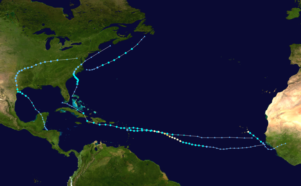
I will make a comment about Erika and the trough, I think that was just one of those storms that for whatever reason failed to consolidate into a single dominant circulation even when it was in favorable conditions, and we've had storms like that in both quiet and active seasons (Isaac and Ernesto in 2012 being good recent examples). Had Erika consolidated sooner, while it was in favorable conditions, it would likely have been able to strengthen somewhat more than it did, probably enough to pass the islands and make it to more favorable conditions, as both of 2012's low-level messes were further south and had more water to work with.
Back to the models: WRF-ARW develops Erika's remnants into a small Claudette-2009 type storm over the next day or two, possibly in the 45-50kt range, but quickly weakens it as it approaches land likely due to the small size. The NMM variant takes it northwest, under more shear, and doesn't develop much. None of the global models develop anything more from it though I imagine should it follow the ARW solution, it would be too small for them to properly resolve, similar to Danny.
0 likes
The above post is not official and should not be used as such. It is the opinion of the poster and may or may not be backed by sound meteorological data. It is not endorsed by any professional institution or storm2k.org. For official information, please refer to the NHC and NWS products.


 somewhere in the Southeast Conus/E. Gulf before its all said and done.