Comparing SST Anomalies

This is the general tropical discussion area. Anyone can take their shot at predicting a storms path.

Moderator: S2k Moderators

Forum rules

The posts in this forum are NOT official forecasts and should not be used as such. They are just the opinion of the poster and may or may not be backed by sound meteorological data. They are NOT endorsed by any professional institution or STORM2K. For official information, please refer to products from the National Hurricane Center and National Weather Service.

Help Support Storm2K
Message
Author
tstorm98
Tropical Wave
Tropical Wave
Posts: 8
Joined: Wed Jun 24, 2015 12:18 pm
Location: Central California Coast

Comparing SST Anomalies

#1 Postby tstorm98 » Thu Jul 16, 2015 6:23 pm

July 16th, 2009: Moderate El Nino developing which later morph to a Modoki El Nino. Image
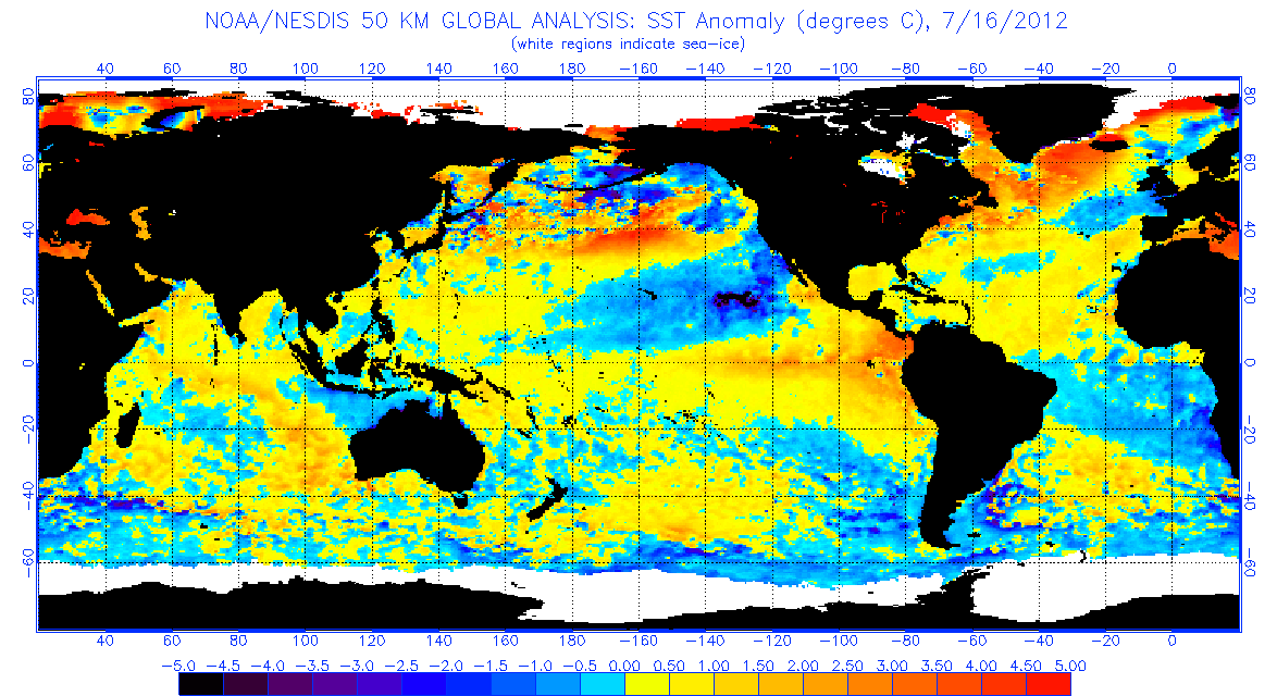
July 16th, 2012: False El Nino in Summer which fizzled out quick due to -pdo, lack of atmosphereic response and weak kelvin waves. Image
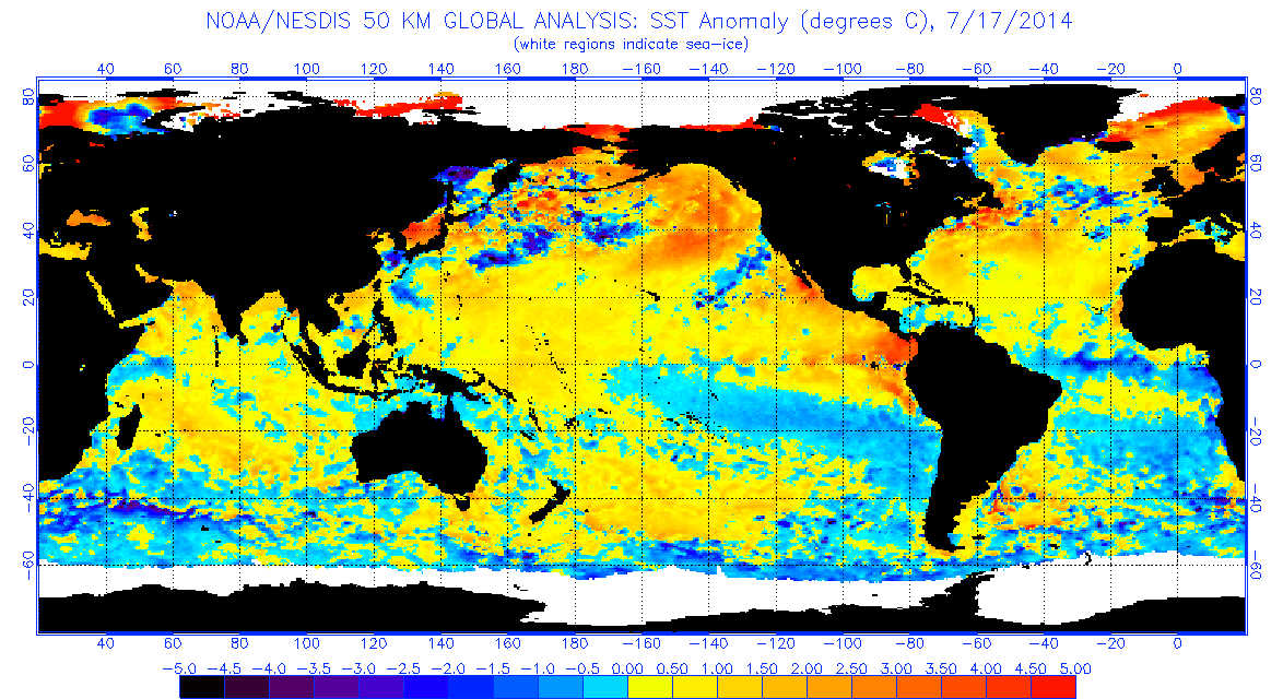
July 17th, 2014: Very strong Kelvin waves in spring fizzled out by summer, strong easterlies and lack of atmospheric response. El nino didn't start until September 2014. (Debatable)
Image
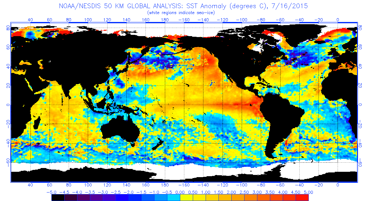
July 16th, 2015: Strong El Nino strengthening to a super El Nino, Record MJO, Very strong westerlies, Atmosphere cooperating, Western Pacific cooler than normal, Strong +pdo, Extremly active Pacific Hurricane and Typhoon season, dead quiet Atlantic (so far), Record rains in Texas and the Midwest. Image
Last edited by tstorm98 on Thu Jul 16, 2015 6:31 pm, edited 1 time in total.
0 likes   

Return to “Talkin' Tropics”

Who is online

Users browsing this forum: duilaslol, Iceresistance and 214 guests