North Central GOM

This is the general tropical discussion area. Anyone can take their shot at predicting a storms path.

Moderator: S2k Moderators

Forum rules

The posts in this forum are NOT official forecasts and should not be used as such. They are just the opinion of the poster and may or may not be backed by sound meteorological data. They are NOT endorsed by any professional institution or STORM2K. For official information, please refer to products from the National Hurricane Center and National Weather Service.

Help Support Storm2K
Message
Author
User avatar
tropicwatch
Category 5
Category 5
Posts: 3205
Age: 60
Joined: Sat Jun 02, 2007 10:01 am
Location: Panama City Florida
Contact:

North Central GOM

#1 Postby tropicwatch » Sun Aug 09, 2015 5:16 pm

Vorticity and convection increasing and shear decreasing in the area. Maybe worth watching.

Image

Image

Image
0 likes   
Tropicwatch


Agnes 72', Eloise 75, Elena 85', Kate 85', Charley 86', Florence 88', Beryl 94', Dean 95', Erin 95', Opal 95', Earl 98', Georges 98', Ivan 2004', Arlene 2005', Dennis 2005', Ida 2009' Debby 2012' Irma 2017' Michael 2018'

NCSTORMMAN

#2 Postby NCSTORMMAN » Sun Aug 09, 2015 5:53 pm

No model support at all correct?
0 likes   

rockyman
Category 5
Category 5
Posts: 1967
Joined: Thu Jun 26, 2003 12:24 pm
Location: Dauphin Island, AL

Re: North Central GOM

#3 Postby rockyman » Sun Aug 09, 2015 6:11 pm

The 18z GFS has weak low pressure hanging around the north central Gulf Coast for the next few days.

http://www.tropicaltidbits.com/analysis ... s=0&ypos=0
0 likes   

User avatar
xcool22
Category 1
Category 1
Posts: 311
Age: 42
Joined: Mon Oct 05, 2009 3:06 pm
Location: slidell la
Contact:

#4 Postby xcool22 » Sun Aug 09, 2015 6:50 pm

0 likes   
SCOTT

User avatar
northjaxpro
S2K Supporter
S2K Supporter
Posts: 8900
Joined: Mon Sep 27, 2010 11:21 am
Location: Jacksonville, FL

#5 Postby northjaxpro » Sun Aug 09, 2015 9:08 pm

One thing to monitor is that the Heat ridge that has been parked over Texas recently is forecast to retreat westward later this week. Should that happen, the eastern edge of the ridge will erode, which may allow for a southerly return flow across the Gulf Coast region in a couple of days. It is something to watch, but nothing alarming in the coming days expected of course.
0 likes   
NEVER, EVER SAY NEVER in the tropics and weather in general, and most importantly, with life itself!!

________________________________________________________________________________________

Fay 2008 Beryl 2012 Debby 2012 Colin 2016 Hermine 2016 Julia 2016 Matthew 2016 Irma 2017 Dorian 2019

Sanibel
Category 5
Category 5
Posts: 10348
Joined: Mon Aug 30, 2004 11:06 pm
Location: Offshore SW Florida

Re: North Central GOM

#6 Postby Sanibel » Fri Aug 14, 2015 11:04 am

The season is so bad nobody is even bothering to mention the GOM convection.
0 likes   

User avatar
tropicwatch
Category 5
Category 5
Posts: 3205
Age: 60
Joined: Sat Jun 02, 2007 10:01 am
Location: Panama City Florida
Contact:

#7 Postby tropicwatch » Fri Aug 14, 2015 11:30 am

There is a week surface low in the gulf but no model support.
0 likes   
Tropicwatch


Agnes 72', Eloise 75, Elena 85', Kate 85', Charley 86', Florence 88', Beryl 94', Dean 95', Erin 95', Opal 95', Earl 98', Georges 98', Ivan 2004', Arlene 2005', Dennis 2005', Ida 2009' Debby 2012' Irma 2017' Michael 2018'

Stormcenter
S2K Supporter
S2K Supporter
Posts: 6617
Joined: Wed Sep 03, 2003 11:27 am
Location: Houston, TX

#8 Postby Stormcenter » Fri Aug 14, 2015 11:33 am

The area is actually located in the NE GOM but expected to drift westward. It's August and an area that should be watched model support or not. IMO

http://www.ssd.noaa.gov/goes/east/gmex/flash-vis.html
0 likes   

User avatar
tropicwatch
Category 5
Category 5
Posts: 3205
Age: 60
Joined: Sat Jun 02, 2007 10:01 am
Location: Panama City Florida
Contact:

Re:

#9 Postby tropicwatch » Fri Aug 14, 2015 11:38 am

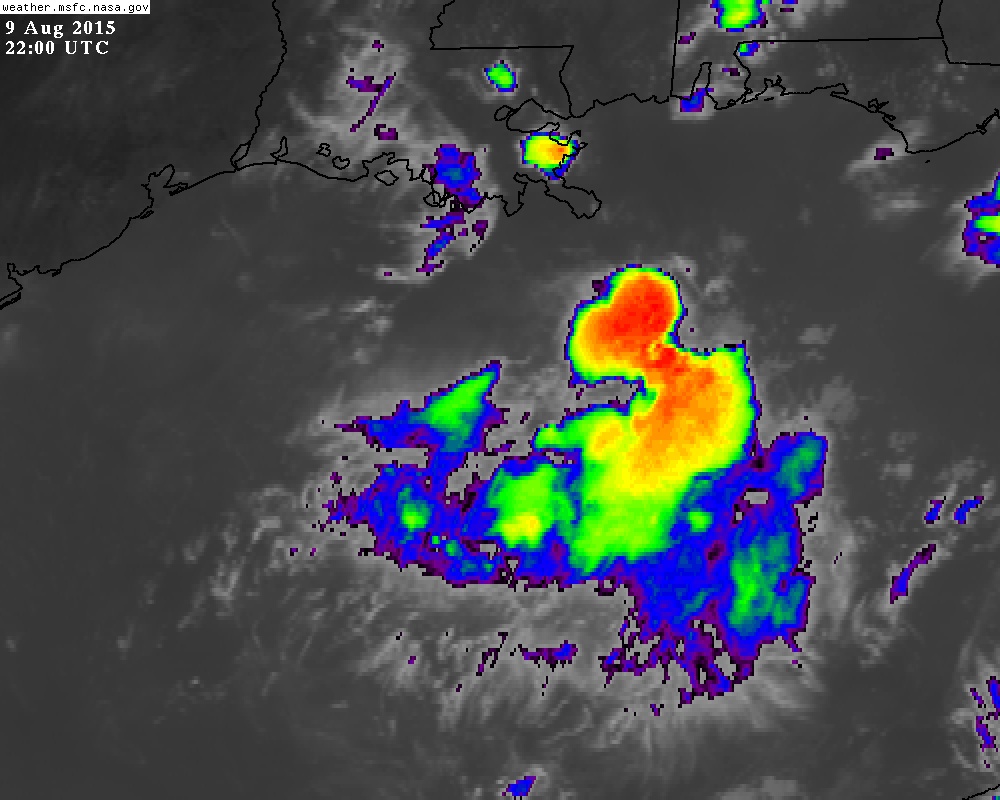
Stormcenter wrote:The area is actually located in the NE GOM but expected to drift westward. It's August and an area that should be watched model support or not. IMO

http://www.ssd.noaa.gov/goes/east/gmex/flash-vis.html


So true!
Last edited by tropicwatch on Fri Aug 14, 2015 2:35 pm, edited 1 time in total.
0 likes   
Tropicwatch


Agnes 72', Eloise 75, Elena 85', Kate 85', Charley 86', Florence 88', Beryl 94', Dean 95', Erin 95', Opal 95', Earl 98', Georges 98', Ivan 2004', Arlene 2005', Dennis 2005', Ida 2009' Debby 2012' Irma 2017' Michael 2018'

CrazyC83
Professional-Met
Professional-Met
Posts: 33393
Joined: Tue Mar 07, 2006 11:57 pm
Location: Deep South, for the first time!

#10 Postby CrazyC83 » Fri Aug 14, 2015 12:14 pm

I'd say it has a better chance than anything in the MDR. At least conditions in the Gulf aren't inhospitable...
0 likes   

Stormcenter
S2K Supporter
S2K Supporter
Posts: 6617
Joined: Wed Sep 03, 2003 11:27 am
Location: Houston, TX

#11 Postby Stormcenter » Fri Aug 14, 2015 12:41 pm

Something definitely spinning there.

http://weather.rap.ucar.edu/satellite/d ... uration=10
0 likes   

User avatar
La Breeze
Tropical Storm
Tropical Storm
Posts: 160
Joined: Sun Jul 26, 2015 3:21 am
Location: Vermilion Parish, LA

Re:

#12 Postby La Breeze » Sat Aug 15, 2015 2:03 am

CrazyC83 wrote:I'd say it has a better chance than anything in the MDR. At least conditions in the Gulf aren't inhospitable...

What are the SST's out in the northern GOM at this time? I'm sure that the water has had time to heat up quite nicely too.
0 likes   
Not a professional forecast by any means.
Audrey'57, Hilda'64, Betsy '65, Edith'71, Carmen'74, Danny'85, Juan'85, Andrew'92, Iniki'92 (while on vacation in Kauai), Lili'02, Rita'05, Humberto'07, Gustav'08, Ike'08, Isaac'12, Monsoonal Depression'16, Harvey'17, Barry'19, Laura'20, Delta'20, Ida'21.

User avatar
TheStormExpert
Category 5
Category 5
Posts: 8487
Age: 30
Joined: Wed Feb 16, 2011 5:38 pm
Location: Palm Beach Gardens, FL

Re: Re:

#13 Postby TheStormExpert » Sat Aug 15, 2015 3:58 am

La Breeze wrote:
CrazyC83 wrote:I'd say it has a better chance than anything in the MDR. At least conditions in the Gulf aren't inhospitable...

What are the SST's out in the northern GOM at this time? I'm sure that the water has had time to heat up quite nicely too.

Gulf of Mexico SST's are plenty warm, as usual. It's the shear that is the real problem for anything trying to get going.

Image
0 likes   
The following post is NOT an official forecast and should not be used as such. It is just the opinion of the poster and may or may not be backed by sound meteorological data. It is NOT endorsed by storm2k.org.

User avatar
tropicwatch
Category 5
Category 5
Posts: 3205
Age: 60
Joined: Sat Jun 02, 2007 10:01 am
Location: Panama City Florida
Contact:

#14 Postby tropicwatch » Sat Aug 15, 2015 8:56 am

0 likes   
Tropicwatch


Agnes 72', Eloise 75, Elena 85', Kate 85', Charley 86', Florence 88', Beryl 94', Dean 95', Erin 95', Opal 95', Earl 98', Georges 98', Ivan 2004', Arlene 2005', Dennis 2005', Ida 2009' Debby 2012' Irma 2017' Michael 2018'

Ntxw
Storm2k Moderator
Storm2k Moderator
Posts: 21494
Joined: Wed Oct 21, 2009 6:34 pm
Location: DFW, Texas

#15 Postby Ntxw » Sat Aug 15, 2015 9:04 am

Shear is 20-30+ knots along the northern gulf coast. Pockets of weaker shear to the south but net overall is higher and expected to increase in the coming days. The atmosphere is the ultimate dictator if something forms, not so much SST's as they are always warm this time of year for many more weeks, as increased shear will rip from the gulf to the Caribbean and out into the open Atlantic at least for the next 5-7 days.

Image
0 likes   
The above post and any post by Ntxw is NOT an official forecast and should not be used as such. It is just the opinion of the poster and may or may not be backed by sound meteorological data. It is NOT endorsed by any professional institution including Storm2k. For official information, please refer to NWS products.

  Help support Storm2K!
Help Support Storm2K

User avatar
KatDaddy
Category 5
Category 5
Posts: 2815
Joined: Mon Oct 21, 2002 6:23 pm
Location: League City, Texas

Re: North Central GOM

#16 Postby KatDaddy » Sat Aug 15, 2015 9:05 am

Something to watch over the next week. Lots of heat content in the GOM and bursts of convection from day to day. If the shear decreases there could be some oppurtunity for some development. For now I will set back and watch.
0 likes   
The following post is NOT an official forecast and should not be used as such. It is just the opinion of the poster and may or may not be backed by sound meteorological data. It is NOT endorsed by any professional institution including storm2k.org For Official Information please refer to the NHC and NWS products.

User avatar
TheStormExpert
Category 5
Category 5
Posts: 8487
Age: 30
Joined: Wed Feb 16, 2011 5:38 pm
Location: Palm Beach Gardens, FL

Re:

#17 Postby TheStormExpert » Sat Aug 15, 2015 9:09 am

Ntxw wrote:Shear is 20-30+ knots along the northern gulf coast. Pockets of weaker shear to the south but net overall is higher and expected to increase in the coming days. The atmosphere is the ultimate dictator if something forms, not so much SST's as they are always warm this time of year for many more weeks.

What has been causing all this relentless shear in the GoM, and off the U.S. East Coast?
0 likes   
The following post is NOT an official forecast and should not be used as such. It is just the opinion of the poster and may or may not be backed by sound meteorological data. It is NOT endorsed by storm2k.org.

Ntxw
Storm2k Moderator
Storm2k Moderator
Posts: 21494
Joined: Wed Oct 21, 2009 6:34 pm
Location: DFW, Texas

Re: Re:

#18 Postby Ntxw » Sat Aug 15, 2015 9:15 am

TheStormExpert wrote:
Ntxw wrote:Shear is 20-30+ knots along the northern gulf coast. Pockets of weaker shear to the south but net overall is higher and expected to increase in the coming days. The atmosphere is the ultimate dictator if something forms, not so much SST's as they are always warm this time of year for many more weeks.

What has been causing all this relentless shear in the GoM, and off the U.S. East Coast?


I'm not certain, ridge over the southern conus definitely plays a role. Higher pressures doesn't help waves. I'm not all that sure the gulf has even been that inhospitable with a lot of convection over the past couple of weeks. But remember it takes very good conditions to spin up tropical cyclones, so average (10-20knots) of shear etc isn't going to cut it.
0 likes   
The above post and any post by Ntxw is NOT an official forecast and should not be used as such. It is just the opinion of the poster and may or may not be backed by sound meteorological data. It is NOT endorsed by any professional institution including Storm2k. For official information, please refer to NWS products.


  Help support Storm2K!

Help Support Storm2K


User avatar
TheStormExpert
Category 5
Category 5
Posts: 8487
Age: 30
Joined: Wed Feb 16, 2011 5:38 pm
Location: Palm Beach Gardens, FL

Re: Re:

#19 Postby TheStormExpert » Sat Aug 15, 2015 9:29 am

Ntxw wrote:
TheStormExpert wrote:
Ntxw wrote:Shear is 20-30+ knots along the northern gulf coast. Pockets of weaker shear to the south but net overall is higher and expected to increase in the coming days. The atmosphere is the ultimate dictator if something forms, not so much SST's as they are always warm this time of year for many more weeks.

What has been causing all this relentless shear in the GoM, and off the U.S. East Coast?


I'm not certain, ridge over the southern conus definitely plays a role. Higher pressures doesn't help waves. I'm not all that sure the gulf has even been that inhospitable with a lot of convection over the past couple of weeks. But remember it takes very good conditions to spin up tropical cyclones, so average (10-20knots) of shear etc isn't going to cut it.

There have been a few good opportunities for Tropical Development over the past several weeks, but the shear just wouldn't allow development.

Any break in shear for a few days at least could allow for something to possibly form, IF there is even a disturbance present at the time.
0 likes   
The following post is NOT an official forecast and should not be used as such. It is just the opinion of the poster and may or may not be backed by sound meteorological data. It is NOT endorsed by storm2k.org.

Ntxw
Storm2k Moderator
Storm2k Moderator
Posts: 21494
Joined: Wed Oct 21, 2009 6:34 pm
Location: DFW, Texas

Re: Re:

#20 Postby Ntxw » Sat Aug 15, 2015 9:34 am

TheStormExpert wrote:There have been a few good opportunities for Tropical Development over the past several weeks, but the shear just wouldn't allow development.

Any break in shear for a few days at least could allow for something to possibly form, IF there is even a disturbance present at the time.


I'd like to see a consolidated MCS, something organized roll off the land to trust potential better chance or if a wave can survive the Caribbean and get to the gulf (if that is even possible). Too much has it been strung out, spin a weak low here, weak low there, frontal boundary, none of it is bundled enough to organize too much of a mess.
0 likes   
The above post and any post by Ntxw is NOT an official forecast and should not be used as such. It is just the opinion of the poster and may or may not be backed by sound meteorological data. It is NOT endorsed by any professional institution including Storm2k. For official information, please refer to NWS products.


  Help support Storm2K!

Help Support Storm2K


Return to “Talkin' Tropics”

Who is online

Users browsing this forum: Google Adsense [Bot], Homie J, Stormybajan, TheAustinMan and 110 guests