
Mid level westerly shear seems to be current deterrent to any organization with this tropical wave at this moment, you can see the low level vorticity continuing to move west while the convection is staying put if not being pushed to the SE by mid level winds.
With not even the most aggressive model showing any development I would not worry about this disturbance other than bringing much needed rains to P.R. & Virgin Islands today.
Disturbed area north of Hispaniola and Puerto Rico
Moderator: S2k Moderators
Forum rules

The posts in this forum are NOT official forecasts and should not be used as such. They are just the opinion of the poster and may or may not be backed by sound meteorological data. They are NOT endorsed by any professional institution or STORM2K. For official information, please refer to products from the National Hurricane Center and National Weather Service.
-
floridasun78
- Category 5

- Posts: 3755
- Joined: Sun May 17, 2009 10:16 pm
- Location: miami fl
Re: Disturbed area north of Hispaniola and Puerto Rico
rolltide wrote:If this holds together things could get very interesting when it reaches the southern Bahamas. Storms have been known to form rapidly in that area.
This post is NOT an official forecast and should not be used as such. It is just the opinion of the poster and may or may not be backed by sound meteorological data. It is NOT endorsed by storm2k.org.
like Katina baby vision before become monster in gulf. it form quick into hurr before hitting south fl as cat 1 in nw Bahamas by grand bahama i remember that very well
0 likes
-
tolakram
- Admin

- Posts: 19165
- Age: 60
- Joined: Sun Aug 27, 2006 8:23 pm
- Location: Florence, KY (name is Mark)
Re: Disturbed area north of Hispaniola and Puerto Rico
0 likes
M a r k
- - - - -
Join us in chat: Storm2K Chatroom Invite. Android and IOS apps also available.
The posts in this forum are NOT official forecasts and should not be used as such. Posts are NOT endorsed by any professional institution or STORM2K.org. For official information and forecasts, please refer to NHC and NWS products.

Re: Disturbed area north of Hispaniola and Puerto Rico
How is the shear once the system reaches the Southern Bahamas?
0 likes
-
tolakram
- Admin
- Posts: 19165
- Age: 60
- Joined: Sun Aug 27, 2006 8:23 pm
- Location: Florence, KY (name is Mark)
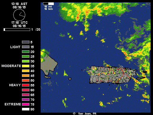
Some much needed rain for PR.
saved radar loop
saved radar loop
0 likes
M a r k
- - - - -
Join us in chat: Storm2K Chatroom Invite. Android and IOS apps also available.
The posts in this forum are NOT official forecasts and should not be used as such. Posts are NOT endorsed by any professional institution or STORM2K.org. For official information and forecasts, please refer to NHC and NWS products.
- - - - -
Join us in chat: Storm2K Chatroom Invite. Android and IOS apps also available.
The posts in this forum are NOT official forecasts and should not be used as such. Posts are NOT endorsed by any professional institution or STORM2K.org. For official information and forecasts, please refer to NHC and NWS products.

Re: Disturbed area north of Hispaniola and Puerto Rico
This area was a well formed wave for several days before encountering the influence of the TUT.
With high pressure building off the southeast CONUS the shear will relax soon.
I was going to post about it earlier but I figured everyone expected the TUT and dry environment to cap any chances for development.
If there was an organizing surface low there would be model support for development.
With high pressure building off the southeast CONUS the shear will relax soon.
I was going to post about it earlier but I figured everyone expected the TUT and dry environment to cap any chances for development.
If there was an organizing surface low there would be model support for development.
0 likes
-
northjaxpro

- S2K Supporter

- Posts: 8900
- Joined: Mon Sep 27, 2010 11:21 am
- Location: Jacksonville, FL
Re: Disturbed area north of Hispaniola and Puerto Rico
boca wrote:How is the shear once the system reaches the Southern Bahamas?
I posted the latest shear analysis posted on thr previous page and shear drops off considerably in the area immediayely west and northwest of the system in the vicinity of the Bahamas and just east of there. There is a chance that should this area stay intact the next day or so, it can get into that environment of lower shear. Just something to watch. Models not latching on yet, but I would not be surprised if they start doing so if this wave holds together as it moves westward.
0 likes
NEVER, EVER SAY NEVER in the tropics and weather in general, and most importantly, with life itself!!
________________________________________________________________________________________
Fay 2008 Beryl 2012 Debby 2012 Colin 2016 Hermine 2016 Julia 2016 Matthew 2016 Irma 2017 Dorian 2019
________________________________________________________________________________________
Fay 2008 Beryl 2012 Debby 2012 Colin 2016 Hermine 2016 Julia 2016 Matthew 2016 Irma 2017 Dorian 2019
-
gatorcane

- S2K Supporter
- Posts: 23499
- Age: 46
- Joined: Sun Mar 13, 2005 3:54 pm
- Location: Boca Raton, FL
Yeah and another thing to point out is that look at 96L. A few days ago basically no model but the GFS even showed the hint of anything (and lesser extent NAVGEM). Now look where we are at. Models are not the holy grail when it comes to the tropics. Even the models sometimes have to play catchup! 
Convection looks good (saved loop below) but can it maintain or will it be poofed by this time tomorrow?

Convection looks good (saved loop below) but can it maintain or will it be poofed by this time tomorrow?
0 likes

-
NCSTORMMAN
Re: Disturbed area north of Hispaniola and Puerto Rico
The center is actually to the northwest of the convection near Puerto Rico and seems to be firing new convection there. Less shear in that area as well let us see if it can hold on.
0 likes
-
tropicwatch

- Category 5
- Posts: 3205
- Age: 60
- Joined: Sat Jun 02, 2007 10:01 am
- Location: Panama City Florida
- Contact:
This area might get a honorable mention by the NHC in the next TWO.
0 likes
Tropicwatch
Agnes 72', Eloise 75, Elena 85', Kate 85', Charley 86', Florence 88', Beryl 94', Dean 95', Erin 95', Opal 95', Earl 98', Georges 98', Ivan 2004', Arlene 2005', Dennis 2005', Ida 2009' Debby 2012' Irma 2017' Michael 2018'
Agnes 72', Eloise 75, Elena 85', Kate 85', Charley 86', Florence 88', Beryl 94', Dean 95', Erin 95', Opal 95', Earl 98', Georges 98', Ivan 2004', Arlene 2005', Dennis 2005', Ida 2009' Debby 2012' Irma 2017' Michael 2018'
Re: Disturbed area north of Hispaniola and Puerto Rico
I still don't see anything close to organizing, wave axis continues to move west while the convection is staying behind, the convection will collapse soon.
0 likes
-
northjaxpro
- S2K Supporter
- Posts: 8900
- Joined: Mon Sep 27, 2010 11:21 am
- Location: Jacksonville, FL
Re: Disturbed area north of Hispaniola and Puerto Rico
NDG wrote:I still don't see anything close to organizing, wave axis continues to move west while the convection is staying behind, the convection will collapse soon.
The key thing will be the next day or so. The vorticity at 850 mb or what remains of it as it tracks west will be crucial. If convection can refire next 24-36 hours as it heads into a better environment, then that will be the time to start taking notice imo.
0 likes
NEVER, EVER SAY NEVER in the tropics and weather in general, and most importantly, with life itself!!
________________________________________________________________________________________
Fay 2008 Beryl 2012 Debby 2012 Colin 2016 Hermine 2016 Julia 2016 Matthew 2016 Irma 2017 Dorian 2019
________________________________________________________________________________________
Fay 2008 Beryl 2012 Debby 2012 Colin 2016 Hermine 2016 Julia 2016 Matthew 2016 Irma 2017 Dorian 2019
Re: Disturbed area north of Hispaniola and Puerto Rico
Yet another ULL over the h85 vorticity, not much development in the near future for this disturbance.
http://www.ssd.noaa.gov/goes/east/tatl/wv-animated.gif
http://www.ssd.noaa.gov/goes/east/tatl/wv-animated.gif
0 likes
-
CYCLONE MIKE
- Category 5
- Posts: 2183
- Joined: Tue Aug 31, 2004 6:04 pm
- Location: Gonzales, LA
Re: Disturbed area north of Hispaniola and Puerto Rico
NDG wrote:I still don't see anything close to organizing, wave axis continues to move west while the convection is staying behind, the convection will collapse soon.
Right on cue. Another ull digging in from the north as well. At least Puerto Rico is getting some rain.
0 likes
-
NCSTORMMAN
Who is online
Users browsing this forum: duilaslol and 105 guests