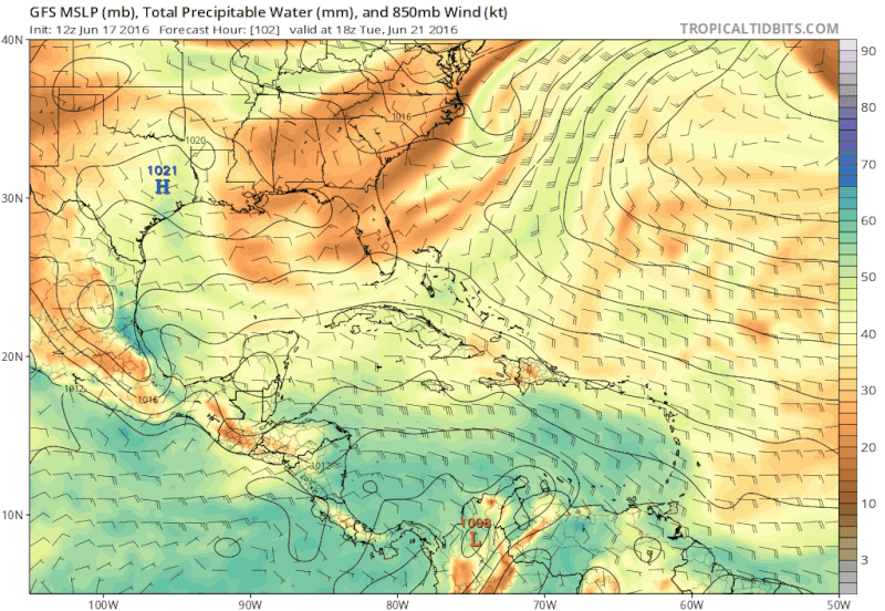
There has been a very marked increase in convective activity down across the central and south central portions of the Caribbean Sea. There is nothing organized at this time, but looking at the satellite imagery, there is a deep moisture pool deriving down all the way into the EPAC, extending through the Central Caribbean northeast all the way into The Bahamas.
It has the look possibly of another monsoonal gyre developing. I think it could be something to watch the next few days.
Disturbed weather across Western & NW Caribbean - (Invest 95L is up)
Moderator: S2k Moderators
Forum rules

The posts in this forum are NOT official forecasts and should not be used as such. They are just the opinion of the poster and may or may not be backed by sound meteorological data. They are NOT endorsed by any professional institution or STORM2K. For official information, please refer to products from the National Hurricane Center and National Weather Service.
-
northjaxpro

- S2K Supporter

- Posts: 8900
- Joined: Mon Sep 27, 2010 11:21 am
- Location: Jacksonville, FL
Disturbed weather across Western & NW Caribbean - (Invest 95L is up)
Last edited by northjaxpro on Wed Jun 22, 2016 7:43 pm, edited 2 times in total.
0 likes
NEVER, EVER SAY NEVER in the tropics and weather in general, and most importantly, with life itself!!
________________________________________________________________________________________
Fay 2008 Beryl 2012 Debby 2012 Colin 2016 Hermine 2016 Julia 2016 Matthew 2016 Irma 2017 Dorian 2019
________________________________________________________________________________________
Fay 2008 Beryl 2012 Debby 2012 Colin 2016 Hermine 2016 Julia 2016 Matthew 2016 Irma 2017 Dorian 2019
-
weathaguyry

- Category 5

- Posts: 1272
- Age: 20
- Joined: Wed Jun 15, 2016 5:16 am
- Location: Long Island, NY
Re: Disturbed weather across Central Caribbean

0 likes
My posts are only my opinions and NOT official forecasts. For official forecasts, consult the National Hurricane Center or the National Weather Service.
Irene 11', Sandy 12', Fay 20’, Isaias 20’, Elsa 21’, Henri 21’, Ida 21’
Irene 11', Sandy 12', Fay 20’, Isaias 20’, Elsa 21’, Henri 21’, Ida 21’
-
AJC3

- Admin

- Posts: 3869
- Age: 60
- Joined: Tue Aug 31, 2004 7:04 pm
- Location: West Melbourne, Florida
- Contact:
Re: Disturbed weather across Central Caribbean
northjaxpro wrote:There has been a very marked increase in convective activity down across the central and south central portions of the Caribbean Sea. There is nothing organized at this time, but looking at the satellite imagery, there is a deep moisture pool deriving down all the way into the EPAC, extending through the Central Caribbean northeast all the way into The Bahamas.
It has the look possibly of another monsoonal gyre developing. I think it could be something to watch the next few days.
I noticed what appeared to be a small vortex along the T-wave axis down near 12-13N and 80W moving pretty quickly toward the west. I haven't looked at any model data for the EPAC in several days (sorry - lol), but given the position of the monsoon trough axis on the EPAC side, I'd suspect this might be a candidate for development into the first EPAC TC of the season once the wave axis reaches that side. Any model support for it over in the EPAC at all?
0 likes
Re: Disturbed weather across Central Caribbean
AJC3 wrote:northjaxpro wrote:There has been a very marked increase in convective activity down across the central and south central portions of the Caribbean Sea. There is nothing organized at this time, but looking at the satellite imagery, there is a deep moisture pool deriving down all the way into the EPAC, extending through the Central Caribbean northeast all the way into The Bahamas.
It has the look possibly of another monsoonal gyre developing. I think it could be something to watch the next few days.
I noticed what appeared to be a small vortex along the T-wave axis down near 12-13N and 80W moving pretty quickly toward the west. I haven't looked at any model data for the EPAC in several days (sorry - lol), but given the position of the monsoon trough axis on the EPAC side, I'd suspect this might be a candidate for development into the first EPAC TC of the season once the wave axis reaches that side. Any model support for it over in the EPAC at all?
The Euro has (or at least was) trying to develop something, but I think it was with an area already along the monsoon trough in the EPAC. GFS had nothing last I checked.
However, the CMC has 4 or 5 storms next week, so this is probably one of them.
0 likes
-
northjaxpro
- S2K Supporter
- Posts: 8900
- Joined: Mon Sep 27, 2010 11:21 am
- Location: Jacksonville, FL
Re: Disturbed weather across Central Caribbean
0 likes
NEVER, EVER SAY NEVER in the tropics and weather in general, and most importantly, with life itself!!
________________________________________________________________________________________
Fay 2008 Beryl 2012 Debby 2012 Colin 2016 Hermine 2016 Julia 2016 Matthew 2016 Irma 2017 Dorian 2019
________________________________________________________________________________________
Fay 2008 Beryl 2012 Debby 2012 Colin 2016 Hermine 2016 Julia 2016 Matthew 2016 Irma 2017 Dorian 2019
-
floridasun78
- Category 5
- Posts: 3755
- Joined: Sun May 17, 2009 10:16 pm
- Location: miami fl
-
northjaxpro
- S2K Supporter
- Posts: 8900
- Joined: Mon Sep 27, 2010 11:21 am
- Location: Jacksonville, FL
Re: Disturbed weather across Central Caribbean
The tropical wave across the Central Caribbean extends down to the monsoonal trough axis from the EPAC across Panama. WPC/TAFB are indicating pressures in and around the Southwest Caribbean to be around 1012mb. As always with monsoonal troughs, in time we may see small, multiple vortices spin up, but unlikely to see any one area consolidate until the wave axis moves west into the Eastern Pacific, provided if it can sta intact and vigorous, which would likely happen by the latter part of this week.
0 likes
NEVER, EVER SAY NEVER in the tropics and weather in general, and most importantly, with life itself!!
________________________________________________________________________________________
Fay 2008 Beryl 2012 Debby 2012 Colin 2016 Hermine 2016 Julia 2016 Matthew 2016 Irma 2017 Dorian 2019
________________________________________________________________________________________
Fay 2008 Beryl 2012 Debby 2012 Colin 2016 Hermine 2016 Julia 2016 Matthew 2016 Irma 2017 Dorian 2019

Re: Disturbed weather across Central Caribbean
This is the tropical wave that the GFS was developing late last week for this weekend and to track towards the gulf coast. At that time the GFS & Euro were forecasting a weakness across the southern US that was to draw this tropical wave NW towards the GOM, but since the weakness is instead being replaced by building ridge, this tropical wave is going to track westward across C.A. into the EPAC.
0 likes
-
northjaxpro
- S2K Supporter
- Posts: 8900
- Joined: Mon Sep 27, 2010 11:21 am
- Location: Jacksonville, FL
Re: Disturbed weather across Central Caribbean
0 likes
NEVER, EVER SAY NEVER in the tropics and weather in general, and most importantly, with life itself!!
________________________________________________________________________________________
Fay 2008 Beryl 2012 Debby 2012 Colin 2016 Hermine 2016 Julia 2016 Matthew 2016 Irma 2017 Dorian 2019
________________________________________________________________________________________
Fay 2008 Beryl 2012 Debby 2012 Colin 2016 Hermine 2016 Julia 2016 Matthew 2016 Irma 2017 Dorian 2019
-
Kingarabian

- S2K Supporter
- Posts: 15432
- Joined: Sat Aug 08, 2009 3:06 am
- Location: Honolulu, Hawaii
Re: Disturbed weather across Central Caribbean
00z GFS not showing development.
0 likes
RIP Kobe Bryant
-
tropicwatch

- Category 5
- Posts: 3205
- Age: 60
- Joined: Sat Jun 02, 2007 10:01 am
- Location: Panama City Florida
- Contact:
Re: Disturbed weather across Western & SW Caribbean
Looks like some of the moisture is trying to go more towards the nw Caribbean then C.A.

0 likes
Tropicwatch
Agnes 72', Eloise 75, Elena 85', Kate 85', Charley 86', Florence 88', Beryl 94', Dean 95', Erin 95', Opal 95', Earl 98', Georges 98', Ivan 2004', Arlene 2005', Dennis 2005', Ida 2009' Debby 2012' Irma 2017' Michael 2018'
Agnes 72', Eloise 75, Elena 85', Kate 85', Charley 86', Florence 88', Beryl 94', Dean 95', Erin 95', Opal 95', Earl 98', Georges 98', Ivan 2004', Arlene 2005', Dennis 2005', Ida 2009' Debby 2012' Irma 2017' Michael 2018'


Re: Disturbed weather across Western & SW Caribbean
It's got plenty of strong convection associated with the wave, and is being ventilated by the westward moving TUTT. If this moves far enough north or activity continues to develop on the north end, this may be something to look at. The next 24 hours will tell the tale imo. At any rate something to look at.
0 likes
Anything I post is my personal opinion and should not used for any type of planning or lifesaving reasons. Please refer to National Weather Service forecasts.

Re: Disturbed weather across Western & SW Caribbean
If the convection near 16N, 81W persists the models might develop it for our next invest.
Often the convection dies out after the shear from the TUTT stops providing lift.
With the TUTT migrating west there would be favorable conditions in that area soon.
Often the convection dies out after the shear from the TUTT stops providing lift.
With the TUTT migrating west there would be favorable conditions in that area soon.
0 likes
Re: Disturbed weather across Western & SW Caribbean
Well, it looks fairly impressive to me. I'm keeping an eye on it, model support or not 
0 likes
Re: Disturbed weather across Western & SW Caribbean
Looks like a typical westward moving tropical wave experiencing shear from the SW.
The low level Axis looks near -83W to me at 3PM.
Models must think the Shear from that TUTT will continue and prevent development?
The low level Axis looks near -83W to me at 3PM.
Models must think the Shear from that TUTT will continue and prevent development?
0 likes
-
wxman57

- Moderator-Pro Met

- Posts: 22480
- Age: 66
- Joined: Sat Jun 21, 2003 8:06 pm
- Location: Houston, TX (southwest)
Re: Disturbed weather across Western & SW Caribbean
I see a tropical wave interacting with an upper low (over BoC). Such interactions often result in the flare-up of squalls, as we're seeing. However, there is no model support for development, and it doesn't look very impressive (to me). I'm not concerned about development there - yet. Maybe late next week...
0 likes
Re: Disturbed weather across Western & SW Caribbean
Actually the last few frames of visible satellite show just a bit of a spin in the middle of the mess, probably from an MCV. I still find it a bit interesting.
0 likes

Re: Disturbed weather across Western & SW Caribbean
Some ens runs indercating what looks to be a possible gulf surge at the end of this month.
0 likes
Re: Disturbed weather across Western & SW Caribbean
I see a mid level vorticity but nothing but a wave trough at the surface.
Maybe a sign of what is to come over the next few months for the Caribbean and GOM.
Maybe a sign of what is to come over the next few months for the Caribbean and GOM.
0 likes
-
northjaxpro
- S2K Supporter
- Posts: 8900
- Joined: Mon Sep 27, 2010 11:21 am
- Location: Jacksonville, FL
Re: Disturbed weather across Western & SW Caribbean
One thing I have noticed today is that the TUTT has progressed steadily westward today. Well, the main portion of the tropical wave axis cuts right though Central America south into the Eastern Pacific. It is moving west with the building ridge to the north. This is one of the chief reasons why the models are not jumping on board with any development with this current feature because the axis will move on out into the EPAC by this weekend. Now, I think it may have a chance to develop out in the EPAC by next week.
Next week is the time to watch the Caribbean. Either the GFS is going to come out smelling like a rose of showing a tropical cyclone developing down there, which that model has consistently been doing since last weekend. The other end of the equation is that if nothing comes of it, some of you will be chomping at the bit to ridicule the model. We will see how it shakes down in the coming days.
Next week is the time to watch the Caribbean. Either the GFS is going to come out smelling like a rose of showing a tropical cyclone developing down there, which that model has consistently been doing since last weekend. The other end of the equation is that if nothing comes of it, some of you will be chomping at the bit to ridicule the model. We will see how it shakes down in the coming days.
0 likes
NEVER, EVER SAY NEVER in the tropics and weather in general, and most importantly, with life itself!!
________________________________________________________________________________________
Fay 2008 Beryl 2012 Debby 2012 Colin 2016 Hermine 2016 Julia 2016 Matthew 2016 Irma 2017 Dorian 2019
________________________________________________________________________________________
Fay 2008 Beryl 2012 Debby 2012 Colin 2016 Hermine 2016 Julia 2016 Matthew 2016 Irma 2017 Dorian 2019
Who is online
Users browsing this forum: duilaslol, Google [Bot], Google Adsense [Bot], Sciencerocks and 107 guests