TW between Hispaniola and Bermuda

This is the general tropical discussion area. Anyone can take their shot at predicting a storms path.

Moderator: S2k Moderators

Forum rules

The posts in this forum are NOT official forecasts and should not be used as such. They are just the opinion of the poster and may or may not be backed by sound meteorological data. They are NOT endorsed by any professional institution or STORM2K. For official information, please refer to products from the National Hurricane Center and National Weather Service.

Help Support Storm2K
Message
Author
User avatar
NDG
S2K Supporter
S2K Supporter
Posts: 14933
Joined: Sun Jul 09, 2006 10:14 pm
Location: Orlando, FL

TW between Hispaniola and Bermuda

#1 Postby NDG » Thu Aug 18, 2016 11:31 am

This tropical wave looks interesting to me this morning, it has developed a weak broad circulation. No model support for much development, surface pressures are high but have fallen 2-3 mb during the past 24 hrs as indicated by a buoy in this area. UL winds are not the best and forecasted not to improve much if any.
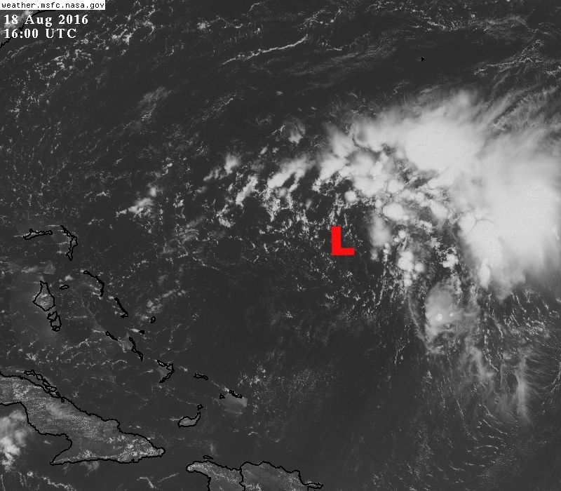
Another thing working against development is that there's some dry air just to the south and over the broad circulation developing. Just something to keep an eye on, IMO.
http://www.ndbc.noaa.gov/station_page.php?station=41046

Image
1 likes   

User avatar
Nimbus
Category 5
Category 5
Posts: 4928
Joined: Mon Jul 19, 2004 10:54 am

Re: TW between Hispaniola and Bermuda

#2 Postby Nimbus » Thu Aug 18, 2016 8:04 pm

Since its under an anticyclone I'm assuming there is some low pressure at the surface causing the convection?
0 likes   

User avatar
NDG
S2K Supporter
S2K Supporter
Posts: 14933
Joined: Sun Jul 09, 2006 10:14 pm
Location: Orlando, FL

Re: TW between Hispaniola and Bermuda

#3 Postby NDG » Thu Aug 18, 2016 8:12 pm

Nimbus wrote:Since its under an anticyclone I'm assuming there is some low pressure at the surface causing the convection?


Not quiet, there's really no surface convergence, convection is mainly due to its proximity to the TUTT west of it, surface trough is well west of the convection tonight, broad surface low is not as defined as earlier this morning.
0 likes   

User avatar
northjaxpro
S2K Supporter
S2K Supporter
Posts: 8900
Joined: Mon Sep 27, 2010 11:21 am
Location: Jacksonville, FL

Re: TW between Hispaniola and Bermuda

#4 Postby northjaxpro » Fri Aug 19, 2016 5:35 pm

I checked the 500 mb, 700 mb and 850 mb vorticity and each show a strung out area of vorticity, although this convective area has been persistent for the past couple of days. As NDG pointed out, dry air is very evident to the south and that may help explain primarily why the models are not developing this at this time. It is definitely an area to keep a watchful eye, especiall if it continues to persist, but nothng in the next few days.
0 likes   
NEVER, EVER SAY NEVER in the tropics and weather in general, and most importantly, with life itself!!

________________________________________________________________________________________

Fay 2008 Beryl 2012 Debby 2012 Colin 2016 Hermine 2016 Julia 2016 Matthew 2016 Irma 2017 Dorian 2019


Return to “Talkin' Tropics”

Who is online

Users browsing this forum: bird, duilaslol, KirbyDude25 and 51 guests