tarheelprogrammer wrote:Hammy wrote:tarheelprogrammer wrote:Models are all trending away from a system in the G.O.M. It could just be a very quiet June. As the ECMWF washes out the wave it was developing. ECMWF showing high pressures across the Atlantic in the long range as well.
This tells me we're basically flying blind like we were the last few seasons--the models just seem worse and worse with the phantom storms every update.
Agree with you 100%. However, the fact that the models all seem to agree on a set up with 5 or 6 days, and then change it so drastically run to run is not a good sign. They do pick up on areas of concern, but they still lack the ability to tell you the direct path a storm will take at that time frame. However, a BOC coastal hugger is most likely the scenario that will pan out. It has happened a lot more frequently in recent years if I am remembering correctly. Even though conditions seem good in the long range for some reason the models are washing out the waves even when they get to the western part of the basin. It is early in the year though, and even though I do believe June stays quiet that doesn't mean the season will be quiet.
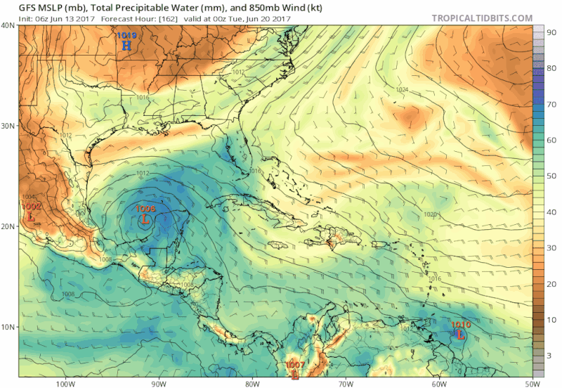
While the operational runs for both the GFS and Euro have spun up various low centers and sent them sprawling around the BOC and Gulf, the general pattern of a large, gyre-like area of lowering pressures around the Yucatan has been consistently shown for days by both models (the operational and ensembles). That hasn't changed. At all. As srainhoutx so aptly wrote, these large gyre-like areas are slow to develop (IF they develop) and models frequently struggle this far out (timewise) with identifying actual centers of low pressure which may develop into something more.
I would caution against any assumptions at this point.