

2017 WPAC Season
Moderator: S2k Moderators
Forum rules

The posts in this forum are NOT official forecasts and should not be used as such. They are just the opinion of the poster and may or may not be backed by sound meteorological data. They are NOT endorsed by any professional institution or STORM2K. For official information, please refer to products from the National Hurricane Center and National Weather Service.
Re: 2017 WPAC Season
1 likes
Remember, all of my post aren't official. For official warnings and discussions, Please refer to your local NWS products...
NWS for the Western Pacific
https://www.weather.gov/gum/
NWS for the Western Pacific
https://www.weather.gov/gum/
Re: 2017 WPAC Season
NWS sees more activity nearer to the Marianas.
Now that we are entering the heart of the time of year we see the most tropical activity, we do have a fair shot of seeing some form of tropical cyclone affecting the Marianas. As of late, all the recent TCs have formed over us and developed to the west. Should the monsoon develop more and farther east, then we'd see an increased chance of stronger activity near us. The trades have mostly sputtered and that does leave the region more susceptible to development.
0 likes
Remember, all of my post aren't official. For official warnings and discussions, Please refer to your local NWS products...
NWS for the Western Pacific
https://www.weather.gov/gum/
NWS for the Western Pacific
https://www.weather.gov/gum/
-
1900hurricane

- Category 5

- Posts: 6044
- Age: 32
- Joined: Fri Feb 06, 2015 12:04 pm
- Location: Houston, TX
- Contact:
Re: 2017 WPAC Season
As of 00Z, we have now passed 1999's record low ACE. Can't finish in last place now!
1 likes
Contract Meteorologist. TAMU & MSST. Fiercely authentic, one of a kind. We are all given free will, so choose a life meant to be lived. We are the Masters of our own Stories.
Opinions expressed are mine alone.
Follow me on Twitter at @1900hurricane : Read blogs at https://1900hurricane.wordpress.com/
Opinions expressed are mine alone.
Follow me on Twitter at @1900hurricane : Read blogs at https://1900hurricane.wordpress.com/
Re: 2017 WPAC Season
Wow just checked in the models. The top models NAVGEM, EURO, and GFS doesn't develop anything until the rest of the month especially the GFS. The WPAC might actually lose for the 4th time in world history in terms of ACE?
1 likes
Remember, all of my post aren't official. For official warnings and discussions, Please refer to your local NWS products...
NWS for the Western Pacific
https://www.weather.gov/gum/
NWS for the Western Pacific
https://www.weather.gov/gum/
Re: 2017 WPAC Season
The WPAC is just extremely favorable right now out of all basins. The atmosphere is just keeping it in check.


1 likes
Remember, all of my post aren't official. For official warnings and discussions, Please refer to your local NWS products...
NWS for the Western Pacific
https://www.weather.gov/gum/
NWS for the Western Pacific
https://www.weather.gov/gum/
Re: 2017 WPAC Season

0 likes
Remember, all of my post aren't official. For official warnings and discussions, Please refer to your local NWS products...
NWS for the Western Pacific
https://www.weather.gov/gum/
NWS for the Western Pacific
https://www.weather.gov/gum/
Re: 2017 WPAC Season
Digital-TC-Chaser wrote::uarrow: humm 20-26 low lat storm with mjo enhancement ?
Yup. This will be interesting.

0 likes
Remember, all of my post aren't official. For official warnings and discussions, Please refer to your local NWS products...
NWS for the Western Pacific
https://www.weather.gov/gum/
NWS for the Western Pacific
https://www.weather.gov/gum/
-
mrbagyo

- Category 5
- Posts: 3614
- Age: 31
- Joined: Thu Apr 12, 2012 9:18 am
- Location: 14.13N 120.98E
- Contact:
Re: 2017 WPAC Season
The area near Kosrae / Pohnpei looks interesting IMO.
Let's see if it will hold on in the next couple of days.
It's time to watch for every cloud cluster that will form in the lower lats. We're already in the Ber Months - with Super October just around the corner.
0 likes
The posts in this forum are NOT official forecast and should not be used as such. They are just the opinion of the poster and may or may not be backed by sound meteorological data. They are NOT endorsed by any professional institution or storm2k.org. For official information, please refer to RSMC, NHC and NWS products.
Re: 2017 WPAC Season
mrbagyo wrote:The area near Kosrae / Pohnpei looks interesting IMO.
Let's see if it will hold on in the next couple of days.
It's time to watch for every cloud cluster that will form in the lower lats. We're already in the Ber Months - with Super October just around the corner.
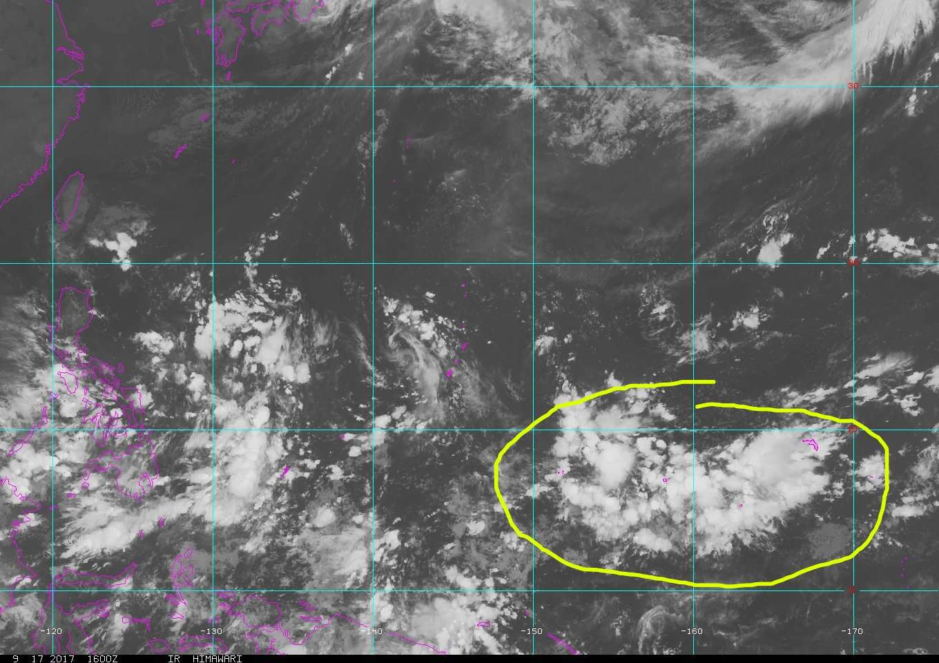
A surface trough extends northeastward from south of Chuuk at 1N152E
to a weak circulation north of Majuro at 11N172E. An upper-level
trough is also in the vicinity north of 10N. Divergent winds south of
the upper trough will continue to enhance widespread convection near
the surface trough across Chuuk and Pohnpei thru Tuesday, and across
Kosrae until later this evening. Despite being south of the
circulation, diffluent flow aloft will keep a few thunderstorms
near Majuro thru tonight.
Models are not very keen on this.
0 likes
Remember, all of my post aren't official. For official warnings and discussions, Please refer to your local NWS products...
NWS for the Western Pacific
https://www.weather.gov/gum/
NWS for the Western Pacific
https://www.weather.gov/gum/
Re: 2017 WPAC Season
The GFS and NAVGEM has a TS around the 23rd to 25th period in the SCS. GFS brings it to Vietnam (Peaks at 996 mb  ) while NAVGEM takes it to Hong Kong.
0 likes
Remember, all of my post aren't official. For official warnings and discussions, Please refer to your local NWS products...
NWS for the Western Pacific
https://www.weather.gov/gum/
NWS for the Western Pacific
https://www.weather.gov/gum/
Re: 2017 WPAC Season
Super long range GFS has a developing TC traversing the Philippine Sea in the first week of October.
0 likes
Remember, all of my post aren't official. For official warnings and discussions, Please refer to your local NWS products...
NWS for the Western Pacific
https://www.weather.gov/gum/
NWS for the Western Pacific
https://www.weather.gov/gum/
Re: 2017 WPAC Season
euro6208 wrote:The GFS and NAVGEM has a TS around the 23rd to 25th period in the SCS. GFS brings it to Vietnam (Peaks at 996 mb
EURO now on board with development.
0 likes
Remember, all of my post aren't official. For official warnings and discussions, Please refer to your local NWS products...
NWS for the Western Pacific
https://www.weather.gov/gum/
NWS for the Western Pacific
https://www.weather.gov/gum/
Re: 2017 WPAC Season
Although the models continues to spin up a weak system in the SCS, the GFS drops the long range system. WOW.
Maybe the rest of this month might be quiet?
The WPAC has got to slow down sometimes.
Maybe the rest of this month might be quiet?
The WPAC has got to slow down sometimes.
0 likes
Remember, all of my post aren't official. For official warnings and discussions, Please refer to your local NWS products...
NWS for the Western Pacific
https://www.weather.gov/gum/
NWS for the Western Pacific
https://www.weather.gov/gum/
Re: 2017 WPAC Season

0 likes
Remember, all of my post aren't official. For official warnings and discussions, Please refer to your local NWS products...
NWS for the Western Pacific
https://www.weather.gov/gum/
NWS for the Western Pacific
https://www.weather.gov/gum/
-
mrbagyo
- Category 5
- Posts: 3614
- Age: 31
- Joined: Thu Apr 12, 2012 9:18 am
- Location: 14.13N 120.98E
- Contact:
Re: 2017 WPAC Season
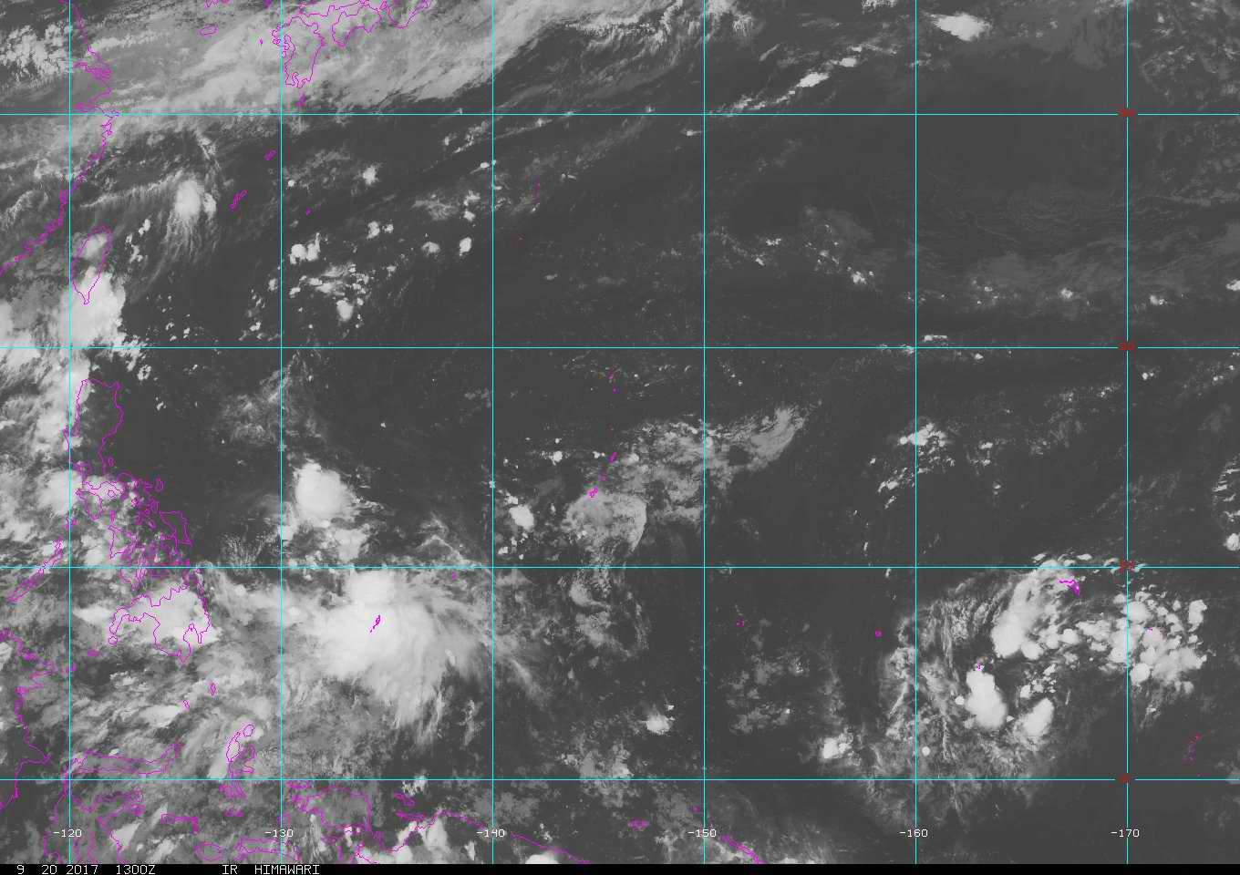
Two potential new invest - one near Palau, the other one near the Marshall Islands (I like the look of the more eastern disturbance).
Guidance are very quiet in WPAC right now - I wont be surprised if two just vanish - gone with the winds hehe
The inactivity of WPAC is very La Nina-ish though I'm still expecting one or two monster to form in Oct to Nov though - I think both will likely be Philippine threat.
(I dont know if Haima was the "Zeb" or "Megi" of last year - a year after the strong Nino in 15'. Maybe the real Post El Nino monster is yet to come - just delayed by 2 years...)
1 likes
The posts in this forum are NOT official forecast and should not be used as such. They are just the opinion of the poster and may or may not be backed by sound meteorological data. They are NOT endorsed by any professional institution or storm2k.org. For official information, please refer to RSMC, NHC and NWS products.
-
1900hurricane
- Category 5
- Posts: 6044
- Age: 32
- Joined: Fri Feb 06, 2015 12:04 pm
- Location: Houston, TX
- Contact:
Re: 2017 WPAC Season
Second year La Ninas have been shutting down the WPac early the last few occurrences. 1999, 2008, and 2011 all had about 20 units of ACE or less for the October-December timeframe. Consequently, those years had less than 200 cumulative ACE (with 1999 being the lowest in WPac history). I'm not sure this year will fit that pattern with the first year La Nina being very weak and this one just emerging, but it's something to watch for.
0 likes
Contract Meteorologist. TAMU & MSST. Fiercely authentic, one of a kind. We are all given free will, so choose a life meant to be lived. We are the Masters of our own Stories.
Opinions expressed are mine alone.
Follow me on Twitter at @1900hurricane : Read blogs at https://1900hurricane.wordpress.com/
Opinions expressed are mine alone.
Follow me on Twitter at @1900hurricane : Read blogs at https://1900hurricane.wordpress.com/
Re: 2017 WPAC Season
Models looking very quiet the rest of the month and pass the first week of October. It's like the beast went into a dormant rest. Let's see what the future holds.
0 likes
Remember, all of my post aren't official. For official warnings and discussions, Please refer to your local NWS products...
NWS for the Western Pacific
https://www.weather.gov/gum/
NWS for the Western Pacific
https://www.weather.gov/gum/
Re: 2017 WPAC Season
NWS also sees this struggling WPAC with nothing to wake it up. WIll the MJO and Kelvin Wave or some other forces change it?
Right now we're not expecting much of a change. Often, we see the monsoon pattern develop that interrupts the trade-wind flow for several weeks at a time, and then the trades settle back in briefly before another round of the monsoon. What would really kick off tropical cyclone development in the WPac would be more consistent westerlies along the equator, but we haven't really seen much of that this season yet. Most of the flow from the SHem has been from the SE and contributing to large clusters of showers/thunderstorms across Micronesia.
As we get later in the year and have been able to assess the seasonal and hemispheric patterns as a whole, we'll have a much better idea, but we do see years where some sectors see much more activity than others. Many times, on a 1000s of miles scale, we see broader areas more favorable to rising air / widespread convection and then 1000s of mi away, broad areas of fair weather / sinking motions. On a smaller, more regional, scale, sometimes just not all layers of the atmosphere have locked in together. We've had a lot of upper-lows lately in the region, and sometimes, the longer-lived ones can induce a surface circulation that develops, but they can also cause other thriving disturbances to weaken based on unfavorable juxtaposition of the different features.
Looking at some accumulating seasonal stats, we're just a hair above normal for the # of named storms for this time of year, HOWEVER, on the number of days that the WPac has seen hurricanes and major hurricanes, we're lagging quite a bit, meaning, that while we're pretty average on the # of storms, they've all been weaker, failing to sustain strong intensities. That could either be related to their location of development and intensification, or also favorability (or lack of) of the atmospheric motions. Many of the TCs that developed in the past couple months have developed farther to the north and west of us, which greatly reduced their time in the favorably warm tropical waters south of 15N.
Last edited by euro6208 on Thu Sep 21, 2017 9:11 am, edited 2 times in total.
0 likes
Remember, all of my post aren't official. For official warnings and discussions, Please refer to your local NWS products...
NWS for the Western Pacific
https://www.weather.gov/gum/
NWS for the Western Pacific
https://www.weather.gov/gum/
Re: 2017 WPAC Season

0 likes
Remember, all of my post aren't official. For official warnings and discussions, Please refer to your local NWS products...
NWS for the Western Pacific
https://www.weather.gov/gum/
NWS for the Western Pacific
https://www.weather.gov/gum/
Who is online
Users browsing this forum: No registered users and 91 guests