2017 indicators: SST's / MSLP / SAL / Steering / Instability

This is the general tropical discussion area. Anyone can take their shot at predicting a storms path.

Moderator: S2k Moderators

Forum rules

The posts in this forum are NOT official forecasts and should not be used as such. They are just the opinion of the poster and may or may not be backed by sound meteorological data. They are NOT endorsed by any professional institution or STORM2K. For official information, please refer to products from the National Hurricane Center and National Weather Service.

Help Support Storm2K
Message
Author
User avatar
TropicalAnalystwx13
Category 5
Category 5
Posts: 2109
Age: 26
Joined: Tue Jul 19, 2011 8:20 pm
Location: Wilmington, NC
Contact:

Re: 2017 indicators: SST's / MSLP / SAL / Steering / Instability

#741 Postby TropicalAnalystwx13 » Sun Jul 16, 2017 3:24 pm

Hammy wrote::uarrow: The rain in the Caribbean has dried up which tells me most of the activity north of there is trough-induced and not tropical activity, and the GoM and Caribbean have also all but dried up as the runs go on.

Yeah, but that's not a new development. The analogs and recent conditions continue to support an active season east of the islands, with a preferred track into the western Atlantic north of the Greater Antilles. The Caribbean and Gulf may not get as much activity (that doesn't mean we won't have some though).
0 likes   

JPmia
S2K Supporter
S2K Supporter
Posts: 1070
Joined: Thu Jun 03, 2004 11:01 pm
Location: Fort Lauderdale, FL

Re: 2017 indicators: SST's / MSLP / SAL / Steering / Instability

#742 Postby JPmia » Sun Jul 16, 2017 3:52 pm

TropicalAnalystwx13 wrote:
Hammy wrote::uarrow: The rain in the Caribbean has dried up which tells me most of the activity north of there is trough-induced and not tropical activity, and the GoM and Caribbean have also all but dried up as the runs go on.

Yeah, but that's not a new development. The analogs and recent conditions continue to support an active season east of the islands, with a preferred track into the western Atlantic north of the Greater Antilles. The Caribbean and Gulf may not get as much activity (that doesn't mean we won't have some though).


Curious to know what analogs you're referring to.. From the Tropical Tidbits site?
0 likes   

User avatar
tarheelprogrammer
S2K Supporter
S2K Supporter
Posts: 1793
Joined: Mon Mar 28, 2016 9:25 pm
Location: Raleigh, NC area (Garner, NC)

Re: 2017 indicators: SST's / MSLP / SAL / Steering / Instability

#743 Postby tarheelprogrammer » Sun Jul 16, 2017 4:27 pm

Wind Shear seems to be on the increase, and it is plentiful across the Atlantic. It seems to be thanks to TUTTS, Pacific activity, ULLS, and other factors. How bad was it last season at this time? Anyone have an image to compare? I couldn't find one.

Image
0 likes   
My posts are not official forecasts. They are just my opinion and may or may not be backed by sound meteorological data. They are NOT endorsed by any professional institution or storm2k.org. For official information, please refer to the NHC and NWS products.

WeatherHoon
Tropical Storm
Tropical Storm
Posts: 131
Joined: Sat Oct 01, 2016 6:12 am

Re: 2017 indicators: SST's / MSLP / SAL / Steering / Instability

#744 Postby WeatherHoon » Sun Jul 16, 2017 4:46 pm

Too lazy to dig, but off the top of my head, I think conditions were practically the same, if not a little worse during July of last year. Also, we went through the entire month without any systems.
1 likes   

User avatar
Bocadude85
Category 5
Category 5
Posts: 2941
Age: 37
Joined: Mon Apr 18, 2005 2:20 pm
Location: Honolulu,Hi

Re: 2017 indicators: SST's / MSLP / SAL / Steering / Instability

#745 Postby Bocadude85 » Sun Jul 16, 2017 5:10 pm

Hammy wrote::uarrow: The rain in the Caribbean has dried up which tells me most of the activity north of there is trough-induced and not tropical activity, and the GoM and Caribbean have also all but dried up as the runs go on.


I am not sure what you are looking at but CFS is forecasting an active MDR.
0 likes   

User avatar
Hammy
Category 5
Category 5
Posts: 5594
Age: 40
Joined: Fri May 25, 2012 5:25 pm
Contact:

Re: 2017 indicators: SST's / MSLP / SAL / Steering / Instability

#746 Postby Hammy » Sun Jul 16, 2017 5:43 pm

Bocadude85 wrote:
Hammy wrote::uarrow: The rain in the Caribbean has dried up which tells me most of the activity north of there is trough-induced and not tropical activity, and the GoM and Caribbean have also all but dried up as the runs go on.


I am not sure what you are looking at but CFS is forecasting an active MDR.


I was talking more about the western Atlantic basin.
0 likes   
The above post is not official and should not be used as such. It is the opinion of the poster and may or may not be backed by sound meteorological data. It is not endorsed by any professional institution or storm2k.org. For official information, please refer to the NHC and NWS products.

User avatar
TheStormExpert
Category 5
Category 5
Posts: 8487
Age: 30
Joined: Wed Feb 16, 2011 5:38 pm
Location: Palm Beach Gardens, FL

Re: 2017 indicators: SST's / MSLP / SAL / Steering / Instability

#747 Postby TheStormExpert » Sun Jul 16, 2017 6:23 pm

TropicalAnalystwx13 wrote:
Hammy wrote::uarrow: The rain in the Caribbean has dried up which tells me most of the activity north of there is trough-induced and not tropical activity, and the GoM and Caribbean have also all but dried up as the runs go on.

Yeah, but that's not a new development. The analogs and recent conditions continue to support an active season east of the islands, with a preferred track into the western Atlantic north of the Greater Antilles. The Caribbean and Gulf may not get as much activity (that doesn't mean we won't have some though).

So what happened to the Caribbean and Gulf of Mexico being favorable and active?
1 likes   
The following post is NOT an official forecast and should not be used as such. It is just the opinion of the poster and may or may not be backed by sound meteorological data. It is NOT endorsed by storm2k.org.

Ntxw
Storm2k Moderator
Storm2k Moderator
Posts: 21501
Joined: Wed Oct 21, 2009 6:34 pm
Location: DFW, Texas

Re: 2017 indicators: SST's / MSLP / SAL / Steering / Instability

#748 Postby Ntxw » Sun Jul 16, 2017 6:29 pm

tarheelprogrammer wrote:Wind Shear seems to be on the increase, and it is plentiful across the Atlantic. It seems to be thanks to TUTTS, Pacific activity, ULLS, and other factors. How bad was it last season at this time? Anyone have an image to compare? I couldn't find one.

http://i.imgur.com/V7OOrly.jpg


Last year and this year are two different animals. Global patterns were different. As the La Nina got stronger, conditions across the Atlantic got better and better it was a matter of time before it got going. There was great consensus across the board of an active season at the time.
1 likes   
The above post and any post by Ntxw is NOT an official forecast and should not be used as such. It is just the opinion of the poster and may or may not be backed by sound meteorological data. It is NOT endorsed by any professional institution including Storm2k. For official information, please refer to NWS products.

  Help support Storm2K!
Help Support Storm2K

User avatar
tarheelprogrammer
S2K Supporter
S2K Supporter
Posts: 1793
Joined: Mon Mar 28, 2016 9:25 pm
Location: Raleigh, NC area (Garner, NC)

Re: 2017 indicators: SST's / MSLP / SAL / Steering / Instability

#749 Postby tarheelprogrammer » Sun Jul 16, 2017 6:58 pm

Ntxw wrote:
tarheelprogrammer wrote:Wind Shear seems to be on the increase, and it is plentiful across the Atlantic. It seems to be thanks to TUTTS, Pacific activity, ULLS, and other factors. How bad was it last season at this time? Anyone have an image to compare? I couldn't find one.

http://i.imgur.com/V7OOrly.jpg


Last year and this year are two different animals. Global patterns were different. As the La Nina got stronger, conditions across the Atlantic got better and better it was a matter of time before it got going. There was great consensus across the board of an active season at the time.


I was just curious. It seems like there is more shear than usual across the Caribbean, and MDR. Along with SAL, at least in recent years there.
0 likes   
My posts are not official forecasts. They are just my opinion and may or may not be backed by sound meteorological data. They are NOT endorsed by any professional institution or storm2k.org. For official information, please refer to the NHC and NWS products.

User avatar
TheStormExpert
Category 5
Category 5
Posts: 8487
Age: 30
Joined: Wed Feb 16, 2011 5:38 pm
Location: Palm Beach Gardens, FL

Re: 2017 indicators: SST's / MSLP / SAL / Steering / Instability

#750 Postby TheStormExpert » Sun Jul 16, 2017 7:25 pm

Who knows maybe this season will bust in a way similar to 2013. If conditions haven't improved within the next 2-4 weeks then I'll start worrying some.
2 likes   
The following post is NOT an official forecast and should not be used as such. It is just the opinion of the poster and may or may not be backed by sound meteorological data. It is NOT endorsed by storm2k.org.

User avatar
TropicalAnalystwx13
Category 5
Category 5
Posts: 2109
Age: 26
Joined: Tue Jul 19, 2011 8:20 pm
Location: Wilmington, NC
Contact:

Re: 2017 indicators: SST's / MSLP / SAL / Steering / Instability

#751 Postby TropicalAnalystwx13 » Sun Jul 16, 2017 7:32 pm

JPmia wrote:
TropicalAnalystwx13 wrote:
Hammy wrote::uarrow: The rain in the Caribbean has dried up which tells me most of the activity north of there is trough-induced and not tropical activity, and the GoM and Caribbean have also all but dried up as the runs go on.

Yeah, but that's not a new development. The analogs and recent conditions continue to support an active season east of the islands, with a preferred track into the western Atlantic north of the Greater Antilles. The Caribbean and Gulf may not get as much activity (that doesn't mean we won't have some though).


Curious to know what analogs you're referring to.. From the Tropical Tidbits site?

Yes.
0 likes   

User avatar
CyclonicFury
Category 5
Category 5
Posts: 1975
Age: 25
Joined: Sun Jul 02, 2017 12:32 pm
Location: NC
Contact:

Re: 2017 indicators: SST's / MSLP / SAL / Steering / Instability

#752 Postby CyclonicFury » Sun Jul 16, 2017 7:35 pm

TheStormExpert wrote:Who knows maybe this season will bust in a way similar to 2013. If conditions haven't improved within the next 2-4 weeks then I'll start worrying some.

Maybe it won't be as active as expected but anything close to a true 2013 repeat is highly unlikely. It was the first season since 1968 without a storm exceeding category 1 intensity. Shear seems to be near normal in the Caribbean and below normal in the MDR so what we're seeing out there right now is nothing unusual for the month of July.
http://www.ssd.noaa.gov/PS/TROP/TCFP/da ... t_VSHD.gif
http://www.ssd.noaa.gov/PS/TROP/TCFP/da ... r_VSHD.gif
1 likes   
NCSU B.S. in Meteorology Class of 2021. Tropical weather blogger at http://www.cyclonicfury.com. My forecasts and thoughts are NOT official, for official forecasts please consult the National Hurricane Center.

User avatar
Hammy
Category 5
Category 5
Posts: 5594
Age: 40
Joined: Fri May 25, 2012 5:25 pm
Contact:

Re: 2017 indicators: SST's / MSLP / SAL / Steering / Instability

#753 Postby Hammy » Sun Jul 16, 2017 7:43 pm

TheStormExpert wrote:Who knows maybe this season will bust in a way similar to 2013. If conditions haven't improved within the next 2-4 weeks then I'll start worrying some.


2013 had completely unique circumstances (the ocean circulation weakening) and significantly cooler/wetter weather in the Southeast, as well as linear west to east shear and massive dry air in the Atlantic, all as a result. The setup is vastly different this year. I'm not certain enough to call it a quiet or active season this year, but we definitely won't see a 2013 repeat unless we start seeing other indicators go that way.

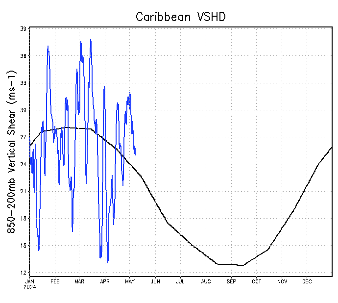
tarheelprogrammer wrote:It seems like there is more shear than usual across the Caribbean, and MDR. Along with SAL, at least in recent years there.

I'm not sure who pointed it out but African dust this year is the lowest since either 2010 or 2005. Conditions tend to worsen during July, so we're pretty much seeing what we'd normally see in July so far--in the last four decades, 60% of seasons had no storms in the first three weeks of July.

The problem this year is that we're essentially in Nino-neutral conditions, so we don't have any strong indicators one way or the other. It could very well end up being an average season in the end.
4 likes   
The above post is not official and should not be used as such. It is the opinion of the poster and may or may not be backed by sound meteorological data. It is not endorsed by any professional institution or storm2k.org. For official information, please refer to the NHC and NWS products.

User avatar
Steve
S2K Supporter
S2K Supporter
Posts: 8606
Joined: Sat Apr 05, 2003 11:41 pm
Location: Not a state-caster

Re: 2017 indicators: SST's / MSLP / SAL / Steering / Instability

#754 Postby Steve » Sun Jul 16, 2017 8:55 pm

TheStormExpert wrote:
TropicalAnalystwx13 wrote:
Hammy wrote::uarrow: The rain in the Caribbean has dried up which tells me most of the activity north of there is trough-induced and not tropical activity, and the GoM and Caribbean have also all but dried up as the runs go on.

Yeah, but that's not a new development. The analogs and recent conditions continue to support an active season east of the islands, with a preferred track into the western Atlantic north of the Greater Antilles. The Caribbean and Gulf may not get as much activity (that doesn't mean we won't have some though).

So what happened to the Caribbean and Gulf of Mexico being favorable and active?


I don't know about the Eastern or Central Caribbean so much, but expect 3-4 named storms in the WC and GoM this season. Also, expect some SE/Mid-Atlantic/NE threats as well. It's mid-July, and other than an odd storm or two or some random KW or super favorable MJO in the interim, we're 6-7 weeks out. What I find the most concerning about this season is the Atlantic High. That's like a conveyor belt we haven't seen in a long, long time. If it stays strong or even weakens a little but pulses, everything in the western side of the basin is aimed at the North American Continent. We could see some scatter-shot storms - like 2 or 3 in succession when things are active - if the high doesn't subside that much. It's actually kind of a scary setup with the sea surface temperatures running mostly above and the pressure patterns. Obviously we have to wait to see what happens.
0 likes   

User avatar
chaser1
S2K Supporter
S2K Supporter
Posts: 4681
Age: 63
Joined: Sat Oct 15, 2005 5:59 pm
Location: Longwood, Fl

Re: 2017 indicators: SST's / MSLP / SAL / Steering / Instability

#755 Postby chaser1 » Mon Jul 17, 2017 4:14 am

:uarrow: :uarrow: :uarrow: :uarrow: :uarrow: :uarrow: :uarrow:
..... what he said :wink: :clap:
2 likes   
Personal Forecast Disclaimer:
The posts in this forum are NOT official forecast and should not be used as such. They are just the opinion of the poster and may or may not be backed by sound meteorological data. They are NOT endorsed by any professional institution or storm2k.org. For official information, please refer to the NHC and NWS products.


User avatar
NDG
S2K Supporter
S2K Supporter
Posts: 14933
Joined: Sun Jul 09, 2006 10:14 pm
Location: Orlando, FL

Re: 2017 indicators: SST's / MSLP / SAL / Steering / Instability

#756 Postby NDG » Mon Jul 17, 2017 7:11 am

Is only mid July, and to tell you the truth a few days ago I didn't think we were going to see an invest pop up in the Atlantic MDR until at least late July. I think the next 4-6 weeks or so we are going to deal with relatively weak short lived systems but with a way more active Atlantic MDR compared to last year, once the SAL calms down like it usually does later in August and September. The Caribbean will stay highly shear until ENSO goes into a more neutral state and the EPAC becomes less active, should happen later in late August or in September.
I think late August into October will be fairly active across the Basin. IMO.
2 likes   

JPmia
S2K Supporter
S2K Supporter
Posts: 1070
Joined: Thu Jun 03, 2004 11:01 pm
Location: Fort Lauderdale, FL

Re: 2017 indicators: SST's / MSLP / SAL / Steering / Instability

#757 Postby JPmia » Mon Jul 17, 2017 10:10 am

Steve wrote:
TheStormExpert wrote:
TropicalAnalystwx13 wrote:Yeah, but that's not a new development. The analogs and recent conditions continue to support an active season east of the islands, with a preferred track into the western Atlantic north of the Greater Antilles. The Caribbean and Gulf may not get as much activity (that doesn't mean we won't have some though).

So what happened to the Caribbean and Gulf of Mexico being favorable and active?


I don't know about the Eastern or Central Caribbean so much, but expect 3-4 named storms in the WC and GoM this season. Also, expect some SE/Mid-Atlantic/NE threats as well. It's mid-July, and other than an odd storm or two or some random KW or super favorable MJO in the interim, we're 6-7 weeks out. What I find the most concerning about this season is the Atlantic High. That's like a conveyor belt we haven't seen in a long, long time. If it stays strong or even weakens a little but pulses, everything in the western side of the basin is aimed at the North American Continent. We could see some scatter-shot storms - like 2 or 3 in succession when things are active - if the high doesn't subside that much. It's actually kind of a scary setup with the sea surface temperatures running mostly above and the pressure patterns. Obviously we have to wait to see what happens.


The analogs that are mentioned (2004, etc) and the high set up could present a straight shot to the western Atlantic with a highly favorable MDR. The year of the Cabo Verde storms? We shall see.
1 likes   

User avatar
Steve
S2K Supporter
S2K Supporter
Posts: 8606
Joined: Sat Apr 05, 2003 11:41 pm
Location: Not a state-caster

Re: 2017 indicators: SST's / MSLP / SAL / Steering / Instability

#758 Postby Steve » Mon Jul 17, 2017 12:26 pm

Yeah JP. That's the scary part. Things evolve in the tropics as you know, so what things look like right now aren't necessarily what they will look like later. In 2005 (which isn't that much of an analog thrown around that I've seen), you had reinforcing highs that kept coming down from Canada and moving Eastward off the NC Coast (centered about there anyway) that were a little longer north/south than they were east/west. It just kept reinforcing high pressure in the Atlantic, and as a result, we had a crazy amount of high-impact storms. I think there were 12 or 13 total named storms that affected North America in some fashion (Cindy, Dennis, Katrina and Rita in my world). I could be wrong, but I think that's also the last year where the US Coast was hit by a major. Joe Bastardi thinks that trend will end this year and is on record multiple times in saying that he thinks the U.S. Coast will be hit by a major this year. But I haven't seen even him use 2005 as an analog. 2004 may be better. And though some forecasters have sort of ignored Florida as a landfall hotspot, that didn't make any sense to me considering what happened that year with the (at least) 5 Florida landfalls - Bonnie, Charley, Frances, Ivan and Jeanne.

The (axis of the) ridge that year, at least based on the tracks of many of the western storms, looks like it was narrower N/S than it was E/W and closer to the US Coast than nudging into it as far as 2005's ridging was.

Again, I'm not calling for alarm and saying this is going to be like 2004 or 2005. I have no idea. But if we do have a strong ridge that has a western perimeter-edge near, along or even nosing into the US Coast, it could be a wild one.
1 likes   

User avatar
gatorcane
S2K Supporter
S2K Supporter
Posts: 23499
Age: 46
Joined: Sun Mar 13, 2005 3:54 pm
Location: Boca Raton, FL

Re: 2017 indicators: SST's / MSLP / SAL / Steering / Instability

#759 Postby gatorcane » Mon Jul 17, 2017 3:55 pm

If this is only mid July what is August and September going to bring? :eek: :double:

Image
1 likes   

User avatar
Hammy
Category 5
Category 5
Posts: 5594
Age: 40
Joined: Fri May 25, 2012 5:25 pm
Contact:

Re: 2017 indicators: SST's / MSLP / SAL / Steering / Instability

#760 Postby Hammy » Mon Jul 17, 2017 5:08 pm

:uarrow: Anyone else notice the small LLC west of Cabo Verde on this loop? This whole setup seems more like something out of the WPAC monsoonal troughs than anything that's normally seen in the Atlantic.
1 likes   
The above post is not official and should not be used as such. It is the opinion of the poster and may or may not be backed by sound meteorological data. It is not endorsed by any professional institution or storm2k.org. For official information, please refer to the NHC and NWS products.


Return to “Talkin' Tropics”

Who is online

Users browsing this forum: Chris90, duilaslol, Google [Bot], Stormybajan and 191 guests