TheStormExpert wrote:Yellow Evan wrote:People seem to call for homegrowns every year and never verify. Given the more favorable AMO, a weaker Azores high seems more likely. Regardless, I'm starting to get very bullish on the season, although if the costal nino setup returns, an inactive season is still possible.
Yeah it's been like this for years now where we think it will be a big homegrown/in-close development year and it underperforms in that category.
I also recall many(including I) expecting the GoM to be quite the hotspot last season but failed to occur despite seeing that tropical low that evolved over the Gulf Coast states back in August that would've been a whole different story if it was located several hundred miles south in the GoM.
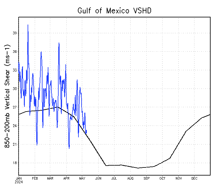
Yeap, windshear has not been favorable during most of the season the last few years across the GOM.