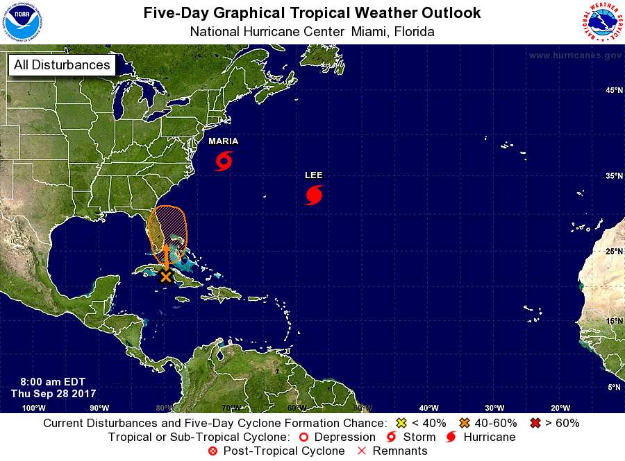
Area from NW Caribbean across Cuba to the Bahamas (now INVEST 99L)
Moderator: S2k Moderators
Forum rules

The posts in this forum are NOT official forecasts and should not be used as such. They are just the opinion of the poster and may or may not be backed by sound meteorological data. They are NOT endorsed by any professional institution or STORM2K. For official information, please refer to products from the National Hurricane Center and National Weather Service.
-
floridasun78
- Category 5

- Posts: 3755
- Joined: Sun May 17, 2009 10:16 pm
- Location: miami fl
Re: Disturbed Weather in the Western Caribbean/Bay of Campeche
i got feeling this likely see only rain system maybe td most i see alot shear in area unless drop quick
0 likes
-
AJC3

- Admin

- Posts: 3872
- Age: 60
- Joined: Tue Aug 31, 2004 7:04 pm
- Location: West Melbourne, Florida
- Contact:
Re: Disturbance off Florida Coast
The synoptic setup brings back to mind Invest 93L, a hybrid low that developed near the northern Bahamas the morning of October 9, 2011, then moved north and northwest, moving onshore that evening near Cape Canaveral. It produced sustained winds in the 50 to 60 MPH range with gusts of 70-80MPH+ in Brevard and Volusia Counties, on its northern and western sides, especially around and offshore the Cape. Granted, there are differences, the main one being that the Florida east coast was buffeted by strong easterlies for days prior to the onset of the event, however, like in 2011, the genesis of this low will be baroclinic (non-tropical), given the position of the H25 low west of Florida, and the resultant jet forcing that will be occurring on it's eastern flank over the next 2-3 days.
93L thread from 2011...
viewtopic.php?t=112053
93L thread from 2011...
viewtopic.php?t=112053
1 likes

-
northjaxpro

- S2K Supporter

- Posts: 8900
- Joined: Mon Sep 27, 2010 11:21 am
- Location: Jacksonville, FL
Re: Disturbance off Florida Coast
joey wrote: NHC now at 20/40
Yeah, I actually thought the percentages would have been a bit higher by NHC given the model support.
Latest 0Z GFS run shows the system a bit stronger, as the Low Pressure develops first near Cape Canaveral around 6Z Saturday morning, then moves north parallel the Florida East Coast, then moves northeast to about 100 miles east of Jacksonville by 18Z Sunday afternoon at 1002 mb, which would definitely support a moderate strength TS or STS in this situation. The Low /Hybrid then moves back westward, making landfall on Jacksonville Beach by 0Z Sunday evening.
2 takeaways from the 0Z GFS run:
a. The system is a bit stronger and farthest north and east on this run, before High Pressure traps the feature and steers it back to the west during the day Sunday.
b. The front will be arriving from the north just as the Low Pressure area moves northeast off the NE Florida coast. It will be interesting to see if this will be a fully tropical system or will it be sub-tropical in nature.
Either way, looks to be a wet and windy day Sunday into Sunday evening here across the Jacksonville area and Northeast Florida.
More later.....
0 likes
NEVER, EVER SAY NEVER in the tropics and weather in general, and most importantly, with life itself!!
________________________________________________________________________________________
Fay 2008 Beryl 2012 Debby 2012 Colin 2016 Hermine 2016 Julia 2016 Matthew 2016 Irma 2017 Dorian 2019
________________________________________________________________________________________
Fay 2008 Beryl 2012 Debby 2012 Colin 2016 Hermine 2016 Julia 2016 Matthew 2016 Irma 2017 Dorian 2019


Re: Disturbed Weather in the Western Caribbean/Bay of Campeche
Tropical Cyclone Formation Probability


0 likes

-
gatorcane

- S2K Supporter
- Posts: 23499
- Age: 46
- Joined: Sun Mar 13, 2005 3:54 pm
- Location: Boca Raton, FL
Re: Disturbed Weather in the Western Caribbean/Bay of Campeche
Looks like overall the overnight models have shifted more east with the long-range development out of the NW Caribbean which would be closer to climo for October. Looking at specific tracks this far out is less useful than looking at the ensemble forecasts and trends.
For example most of the 06Z GFS ensembles are in the NW Caribbean south of Cuba heading north:

While the EPS (Euro ensembles) are similar heading north:

For example most of the 06Z GFS ensembles are in the NW Caribbean south of Cuba heading north:
While the EPS (Euro ensembles) are similar heading north:
1 likes
-
SouthDadeFish

- Professional-Met

- Posts: 2835
- Joined: Thu Sep 23, 2010 2:54 pm
- Location: Miami, FL
- Contact:
Re: Disturbed Weather in the Western Caribbean/Bay of Campeche
joey wrote:nhc now at 20/40
The NHC is currently highlighting a separate disturbance than the one being described in this thread. The disturbance the NHC is mentioning may form as a result of interaction with an upper-level low, while the disturbance in this thread will potentially form from a monsoonal gyre in a time frame beyond five days.
0 likes
-
tropicwatch

- Category 5
- Posts: 3205
- Age: 60
- Joined: Sat Jun 02, 2007 10:01 am
- Location: Panama City Florida
- Contact:
Re: Disturbed Weather in the Western Caribbean/Bay of Campeche
The Bay of Campeche disturbance and the western Caribbean disturbance are two separate area's of interest. Why are they together on one board?
0 likes
Tropicwatch
Agnes 72', Eloise 75, Elena 85', Kate 85', Charley 86', Florence 88', Beryl 94', Dean 95', Erin 95', Opal 95', Earl 98', Georges 98', Ivan 2004', Arlene 2005', Dennis 2005', Ida 2009' Debby 2012' Irma 2017' Michael 2018'
Agnes 72', Eloise 75, Elena 85', Kate 85', Charley 86', Florence 88', Beryl 94', Dean 95', Erin 95', Opal 95', Earl 98', Georges 98', Ivan 2004', Arlene 2005', Dennis 2005', Ida 2009' Debby 2012' Irma 2017' Michael 2018'
-
gatorcane
- S2K Supporter
- Posts: 23499
- Age: 46
- Joined: Sun Mar 13, 2005 3:54 pm
- Location: Boca Raton, FL
Re: Disturbed Weather in the Western Caribbean/Bay of Campeche
Furthermore the catalyst for development appears to be the tropical wave over the Southern Lesser Antilles. You can see it flaring up this morning. This wave should move through the Caribbean and into the Western Caribbean over the next 5 days. Once in the Western Caribbean, development chances increase:

Last edited by gatorcane on Thu Sep 28, 2017 8:52 am, edited 1 time in total.
0 likes

Re: Disturbed Weather in the Western Caribbean/Bay of Campeche
The THCP is off the charts this year. Compare that to pre Wilma. The only good news might be if it struggles because of how broad the Gyre is being modeled but if it consolidates watch out.
Current:

Pre-Wilma Oct 16 2015

Current:
Pre-Wilma Oct 16 2015
0 likes
The following post is NOT an official forecast and should not be used as such. It is just the opinion of the poster and may or may not be backed by sound meteorological data. It is NOT endorsed by any professional institution including storm2k.org For Official Information please refer to the NHC and NWS products.
-
wxman57

- Moderator-Pro Met

- Posts: 22482
- Age: 66
- Joined: Sat Jun 21, 2003 8:06 pm
- Location: Houston, TX (southwest)
Re: Disturbance off Florida Coast
There isn't much doubt that some kind of low will develop. The NHC is pretty much estimating the chances that they will call it a depression/storm.
By the way, why are there two threads on this feature? This is the same feature that the NHC has identified in the NW Caribbean.
By the way, why are there two threads on this feature? This is the same feature that the NHC has identified in the NW Caribbean.
1 likes
-
tropicwatch
- Category 5
- Posts: 3205
- Age: 60
- Joined: Sat Jun 02, 2007 10:01 am
- Location: Panama City Florida
- Contact:
Re: Disturbance off Florida Coast
There should be a separate thread for the BOC. Instead of the combination of the two thread. imo
0 likes
Tropicwatch
Agnes 72', Eloise 75, Elena 85', Kate 85', Charley 86', Florence 88', Beryl 94', Dean 95', Erin 95', Opal 95', Earl 98', Georges 98', Ivan 2004', Arlene 2005', Dennis 2005', Ida 2009' Debby 2012' Irma 2017' Michael 2018'
Agnes 72', Eloise 75, Elena 85', Kate 85', Charley 86', Florence 88', Beryl 94', Dean 95', Erin 95', Opal 95', Earl 98', Georges 98', Ivan 2004', Arlene 2005', Dennis 2005', Ida 2009' Debby 2012' Irma 2017' Michael 2018'
-
Pearl River

- S2K Supporter
- Posts: 825
- Age: 65
- Joined: Fri Dec 09, 2005 6:07 pm
- Location: SELa
Re: Disturbed Weather in the Western Caribbean/Bay of Campeche
This from Slidell in this morning's AFD:
After Wednesday next week the models really struggle with how to
handle activity in the Gulf and Caribbean. As mentioned in previous
discussion we will continue to monitor the tropics with numerous
models suggesting the possibility of something trying to develop.
This is still more than 7 days out and nothing is even remotely
close to developing right now but I`m bringing this up because if
something does late next week it will be more home grown and thus
less lead time. /CAB/
0 likes
-
tolakram
- Admin
- Posts: 19165
- Age: 60
- Joined: Sun Aug 27, 2006 8:23 pm
- Location: Florence, KY (name is Mark)
Re: Disturbance off Florida Coast
GFS

0 likes
M a r k
- - - - -
Join us in chat: Storm2K Chatroom Invite. Android and IOS apps also available.
The posts in this forum are NOT official forecasts and should not be used as such. Posts are NOT endorsed by any professional institution or STORM2K.org. For official information and forecasts, please refer to NHC and NWS products.
-
wxman57
- Moderator-Pro Met
- Posts: 22482
- Age: 66
- Joined: Sat Jun 21, 2003 8:06 pm
- Location: Houston, TX (southwest)
Re: Disturbance off Florida Coast
tolakram wrote:panamatropicwatch wrote:There should be a separate thread for the BOC. Instead of the combination of the two thread. imo
The other thread is locked, there's nothing there other than a long range model prediction IMO. In the short term, the disturbed weather appears to be what the GFS models to move north over Cuba and near Florida.
I was thinking that THIS was the thread that should be locked, as it is discussing the feature in the NW Caribbean as it moves to east of Florida this weekend. The disturbance is currently in the NW Caribbean not east of Florida.
0 likes
-
Dean4Storms
- S2K Supporter
- Posts: 6355
- Age: 61
- Joined: Sun Aug 31, 2003 1:01 pm
- Location: Miramar Bch. FL
Re: Disturbance off Florida Coast
The ECM nor most of its Ensembles are all that excited about this system so the GFS is mostly on its own here with the depth of development.
The ECM EPS seems to be more excited with the NW Carib. then into the Gulf at a later date 4th thru 10th.
The ECM EPS seems to be more excited with the NW Carib. then into the Gulf at a later date 4th thru 10th.
0 likes

Who is online
Users browsing this forum: Beef Stew, cycloneye, Google Adsense [Bot], KirbyDude25, LarryWx, RomP and 212 guests