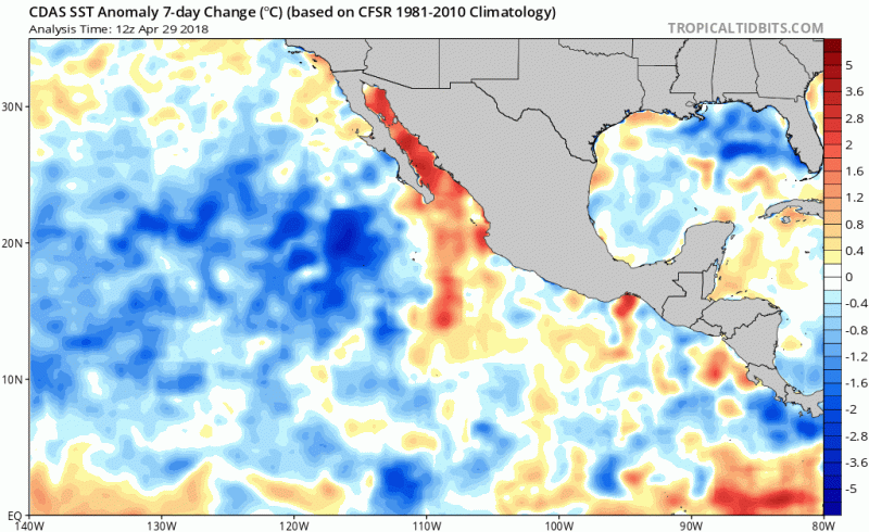
NotSparta wrote:Tropical Tidbits SST analysis shows cooling of EPAC west of 110W, though with warming ENSO region
[img]https://uploads.disquscdn.com/images/5008ce9e145491c685a2e9a5e61502ce74566d3b3c8902cc0ca1eda905a5f854.png?w=800&h[img]
I wouldn't worry about EPAC temperatures. SST's will always support a hurricane all the way up to Baja California. If looking for prohibitive EPAC development factors, I would look at to see if there is sinking motion and higher than normal shear.
In the EPAC's case, the MDR for this basin technically extends all the way deep into south central America where the SST's are always boiling. So african waves that don't develop in the Atlantic and make it to the EPAC have very little resistance. The reason why we carefully analyze the MDR SST's in the Atlantic, is because the tropical waves emerging off western Africa need the waters to be warm so they can develop and have a fighting chance to become legit storms. Else they remain weak since they also deal with dry air and shear thus running into SA or CA.