2018 Tropics: Global Model Runs Discussion (Out to day 16)

This is the general tropical discussion area. Anyone can take their shot at predicting a storms path.

Moderator: S2k Moderators

Forum rules

The posts in this forum are NOT official forecasts and should not be used as such. They are just the opinion of the poster and may or may not be backed by sound meteorological data. They are NOT endorsed by any professional institution or STORM2K. For official information, please refer to products from the National Hurricane Center and National Weather Service.

Help Support Storm2K
Message
Author
User avatar
Dylan
Professional-Met
Professional-Met
Posts: 337
Age: 29
Joined: Mon May 31, 2010 9:50 am
Location: New Orleans, LA

Re: 2018 Tropics: Global Model Runs Discussion (Out to day 16)

#1241 Postby Dylan » Fri Aug 03, 2018 10:46 am

TheStormExpert wrote:The only way it’ll survive is if it comes off Africa at 10N or south and stays at that low latitude until 50W. That’s asking for a lot though since these waves have seem to be coming off Africa above 10N.


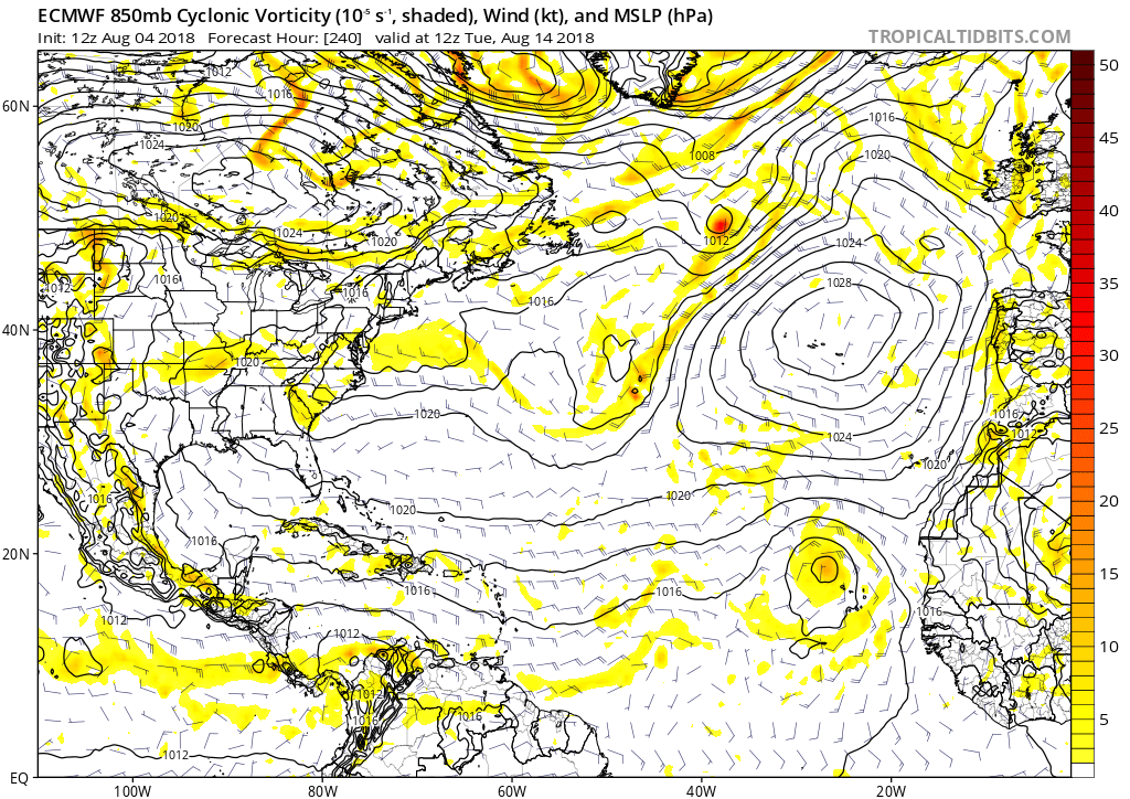
Latest control run of the European Weeklies kills it.

Looking beyond that, the European Weeklies control run shows the Cape Verde hurricane season getting going in early September. Two separate storms, and both are fish.
2 likes   
Georges('98), Allison('01), Isidore('02), Lili('02), Frances('04) Ivan('04), Cindy('05), Katrina('05), Rita('05), Gustav('08), Isaac('12), Matthew('16), Harvey('17), Irma('17), Nate ('17), Ida ('21).

User avatar
NDG
S2K Supporter
S2K Supporter
Posts: 14933
Joined: Sun Jul 09, 2006 10:14 pm
Location: Orlando, FL

Re: 2018 Tropics: Global Model Runs Discussion (Out to day 16)

#1242 Postby NDG » Fri Aug 03, 2018 12:10 pm

:uarrow: Hard for me to believe the Euro showing development near or just north of the C.V. Islands with such cool SSTs, and for them to become fish with such a strong Atlantic mid level ridge so far this summer that does not want to weaken any time soon, if the strong TWs do not develop near the C.V. Islands.

Image
1 likes   

User avatar
cycloneye
Admin
Admin
Posts: 139048
Age: 67
Joined: Thu Oct 10, 2002 10:54 am
Location: San Juan, Puerto Rico

Re: 2018 Tropics: Global Model Runs Discussion (Out to day 16)

#1243 Postby cycloneye » Fri Aug 03, 2018 12:34 pm

@MJVentrice
The GFS is forecasting some impressive African easterly waves to spin up over Africa, though weaken them once they emerge out over the tropical Atlantic. The AEW weakening is a result due to large-scale subsidence over the Atlantic + cooler than average sea-surface temperature.


 https://twitter.com/MJVentrice/status/1025339553190694912


3 likes   
Visit the Caribbean-Central America Weather Thread where you can find at first post web cams,radars
and observations from Caribbean basin members Click Here

User avatar
AdamFirst
S2K Supporter
S2K Supporter
Posts: 2487
Age: 34
Joined: Thu Aug 14, 2008 10:54 am
Location: Port Saint Lucie, FL

Re: 2018 Tropics: Global Model Runs Discussion (Out to day 16)

#1244 Postby AdamFirst » Sat Aug 04, 2018 7:39 am

Euro continuing to show a large wave emerging north of the CVI.

Image
0 likes   
Dolphins Marlins Canes Golden Panthers HEAT
Andrew 1992 - Irene 1999 - Frances 2004 - Jeanne 2004 - Wilma 2005 - Fay 2008 - Isaac 2012 - Matthew 2016 - Irma 2017 - Dorian 2019 - Ian 2022 - Nicole 2022

User avatar
TheStormExpert
Category 5
Category 5
Posts: 8487
Age: 30
Joined: Wed Feb 16, 2011 5:38 pm
Location: Palm Beach Gardens, FL

Re: 2018 Tropics: Global Model Runs Discussion (Out to day 16)

#1245 Postby TheStormExpert » Sat Aug 04, 2018 7:43 am

:uarrow: It continues to push it back for one and with the cold sst's in place that will kill it off pretty quickly so all in all, not happening.
1 likes   
The following post is NOT an official forecast and should not be used as such. It is just the opinion of the poster and may or may not be backed by sound meteorological data. It is NOT endorsed by storm2k.org.

User avatar
wxGuy
Tropical Storm
Tropical Storm
Posts: 104
Joined: Thu Jun 14, 2018 1:50 pm

Re: 2018 Tropics: Global Model Runs Discussion (Out to day 16)

#1246 Postby wxGuy » Sat Aug 04, 2018 9:29 am

Image
I wouldn't say they are super cool so I wouldn't rule out a chance of development just yet. Aug 15th is right around the corner :wink:
1 likes   

tolakram
Admin
Admin
Posts: 19165
Age: 60
Joined: Sun Aug 27, 2006 8:23 pm
Location: Florence, KY (name is Mark)

Re: 2018 Tropics: Global Model Runs Discussion (Out to day 16)

#1247 Postby tolakram » Sat Aug 04, 2018 11:55 am

0 likes   
M a r k
- - - - -
Join us in chat: Storm2K Chatroom Invite. Android and IOS apps also available.

The posts in this forum are NOT official forecasts and should not be used as such. Posts are NOT endorsed by any professional institution or STORM2K.org. For official information and forecasts, please refer to NHC and NWS products.

User avatar
Hammy
Category 5
Category 5
Posts: 5594
Age: 40
Joined: Fri May 25, 2012 5:25 pm
Contact:

Re: 2018 Tropics: Global Model Runs Discussion (Out to day 16)

#1248 Postby Hammy » Sat Aug 04, 2018 12:16 pm

TheStormExpert wrote::uarrow: It continues to push it back for one and with the cold sst's in place that will kill it off pretty quickly so all in all, not happening.


Keep in mind the Euro only shows 24 hour intervals, so if there's something there at day 10 that doesn't form until that point it's going to get pushed back a bit for a few runs.
1 likes   
The above post is not official and should not be used as such. It is the opinion of the poster and may or may not be backed by sound meteorological data. It is not endorsed by any professional institution or storm2k.org. For official information, please refer to the NHC and NWS products.

User avatar
CyclonicFury
Category 5
Category 5
Posts: 1973
Age: 25
Joined: Sun Jul 02, 2017 12:32 pm
Location: NC
Contact:

Re: 2018 Tropics: Global Model Runs Discussion (Out to day 16)

#1249 Postby CyclonicFury » Sat Aug 04, 2018 12:19 pm

TheStormExpert wrote::uarrow: It continues to push it back for one and with the cold sst's in place that will kill it off pretty quickly so all in all, not happening.

Something I have noticed with models is they often initially show tropical waves moving off Africa farther north than they actually come off.
0 likes   
NCSU B.S. in Meteorology Class of 2021. Tropical weather blogger at http://www.cyclonicfury.com. My forecasts and thoughts are NOT official, for official forecasts please consult the National Hurricane Center.

User avatar
gatorcane
S2K Supporter
S2K Supporter
Posts: 23499
Age: 46
Joined: Sun Mar 13, 2005 3:54 pm
Location: Boca Raton, FL

Re: 2018 Tropics: Global Model Runs Discussion (Out to day 16)

#1250 Postby gatorcane » Sat Aug 04, 2018 2:13 pm

12Z Euro at 240 hours shows the strongest wave so far this season to emerge off of Africa:

Image
0 likes   

User avatar
TheStormExpert
Category 5
Category 5
Posts: 8487
Age: 30
Joined: Wed Feb 16, 2011 5:38 pm
Location: Palm Beach Gardens, FL

Re: 2018 Tropics: Global Model Runs Discussion (Out to day 16)

#1251 Postby TheStormExpert » Sat Aug 04, 2018 2:26 pm

wxGuy wrote:Image
I wouldn't say they are super cool so I wouldn't rule out a chance of development just yet. Aug 15th is right around the corner :wink:

Super cool or not they certainly won't support tropical development around the Cape Verde Islands. Anything North and East of that blue line I drew will not develop likely.

Image
1 likes   
The following post is NOT an official forecast and should not be used as such. It is just the opinion of the poster and may or may not be backed by sound meteorological data. It is NOT endorsed by storm2k.org.

PSUHiker31
Tropical Storm
Tropical Storm
Posts: 114
Joined: Tue Oct 03, 2017 2:36 pm

Re: 2018 Tropics: Global Model Runs Discussion (Out to day 16)

#1252 Postby PSUHiker31 » Sat Aug 04, 2018 2:34 pm

Hammy wrote:
TheStormExpert wrote::uarrow: It continues to push it back for one and with the cold sst's in place that will kill it off pretty quickly so all in all, not happening.


Keep in mind the Euro only shows 24 hour intervals, so if there's something there at day 10 that doesn't form until that point it's going to get pushed back a bit for a few runs.


Incorrect. The Euro has 6 hour forecasts.
1 likes   

MJGarrison
Tropical Storm
Tropical Storm
Posts: 128
Joined: Wed Aug 30, 2017 7:26 pm

Re: 2018 Tropics: Global Model Runs Discussion (Out to day 16)

#1253 Postby MJGarrison » Sat Aug 04, 2018 3:33 pm

PSUHiker31 wrote:
Hammy wrote:
TheStormExpert wrote::uarrow: It continues to push it back for one and with the cold sst's in place that will kill it off pretty quickly so all in all, not happening.


Keep in mind the Euro only shows 24 hour intervals, so if there's something there at day 10 that doesn't form until that point it's going to get pushed back a bit for a few runs.


Incorrect. The Euro has 6 hour forecasts.


If you’re using tropical tidbits which many of us do since it’s free, it only shows 24 hr resolution out at 10 days.


Sent from my iPhone using Tapatalk
3 likes   

User avatar
blp
Category 5
Category 5
Posts: 2805
Age: 45
Joined: Thu Sep 09, 2004 7:51 pm
Location: Miami, FL
Contact:

Re: 2018 Tropics: Global Model Runs Discussion (Out to day 16)

#1254 Postby blp » Sat Aug 04, 2018 5:35 pm

gatorcane wrote:12Z Euro at 240 hours shows the strongest wave so far this season to emerge off of Africa:

[]https://s22.postimg.cc/p0qprmp69/ecmwf_uv850_vort_atl_11.png[/img]


Looks impressive indeed. If it can tap into that ITCZ moisture it might be able to sustain itself longer. I am still impressed this is showing up on the Euro which tends to underpredict these types of waves early in the season.

Image
1 likes   
The following post is NOT an official forecast and should not be used as such. It is just the opinion of the poster and may or may not be backed by sound meteorological data. It is NOT endorsed by any professional institution including storm2k.org For Official Information please refer to the NHC and NWS products.

User avatar
Hurricaneman
Category 5
Category 5
Posts: 7280
Age: 43
Joined: Tue Aug 31, 2004 3:24 pm
Location: central florida

Re: 2018 Tropics: Global Model Runs Discussion (Out to day 16)

#1255 Postby Hurricaneman » Sat Aug 04, 2018 6:52 pm

blp wrote:
gatorcane wrote:12Z Euro at 240 hours shows the strongest wave so far this season to emerge off of Africa:

[]https://s22.postimg.cc/p0qprmp69/ecmwf_uv850_vort_atl_11.png[/img]


Looks impressive indeed. If it can tap into that ITCZ moisture it might be able to sustain itself longer. I am still impressed this is showing up on the Euro which tends to underpredict these types of waves early in the season.

Image


The thing is all models are showing this wave, even if in water cooler than optimum for tropical systems if something like this can keep vorticity and even shallow convection this could be a problem farther west as the models show ridging in a way that could be a problem for North America in the long run as models tend to have waves exit Africa too far north and sometimes to the magnitude of as much as 5 degrees too far north
1 likes   

storm4u
Category 2
Category 2
Posts: 651
Joined: Wed Aug 11, 2004 7:26 am
Location: agawam, ma
Contact:

Re: 2018 Tropics: Global Model Runs Discussion (Out to day 16)

#1256 Postby storm4u » Sun Aug 05, 2018 10:03 am

MJGarrison wrote:
PSUHiker31 wrote:
Hammy wrote:
Keep in mind the Euro only shows 24 hour intervals, so if there's something there at day 10 that doesn't form until that point it's going to get pushed back a bit for a few runs.


Incorrect. The Euro has 6 hour forecasts.


If you’re using tropical tidbits which many of us do since it’s free, it only shows 24 hr resolution out at 10 days.


Sent from my iPhone using Tapatalk


You can use weather.us it's free and has it in 6 hour intervals!!!
0 likes   

storm4u
Category 2
Category 2
Posts: 651
Joined: Wed Aug 11, 2004 7:26 am
Location: agawam, ma
Contact:

Re: 2018 Tropics: Global Model Runs Discussion (Out to day 16)

#1257 Postby storm4u » Sun Aug 05, 2018 10:07 am

Weather.us even has euro ensemble tracks it's awesome
0 likes   

User avatar
Kingarabian
S2K Supporter
S2K Supporter
Posts: 15434
Joined: Sat Aug 08, 2009 3:06 am
Location: Honolulu, Hawaii

Re: 2018 Tropics: Global Model Runs Discussion (Out to day 16)

#1258 Postby Kingarabian » Sun Aug 05, 2018 2:31 pm

2 likes   
RIP Kobe Bryant

User avatar
Hurricaneman
Category 5
Category 5
Posts: 7280
Age: 43
Joined: Tue Aug 31, 2004 3:24 pm
Location: central florida

Re: 2018 Tropics: Global Model Runs Discussion (Out to day 16)

#1259 Postby Hurricaneman » Sun Aug 05, 2018 11:15 pm

The models seem to be showing a pattern change towards more active around the 15th and I think things will take off at or just after the 20th so we’ll see
0 likes   

USTropics
Category 5
Category 5
Posts: 2409
Joined: Sun Aug 12, 2007 3:45 am
Location: Florida State University

Re: 2018 Tropics: Global Model Runs Discussion (Out to day 16)

#1260 Postby USTropics » Mon Aug 06, 2018 2:16 am

The 00z global models continue to show a robust AEW entering the EATL in about 7-8 days:
Image

Dry air and relatively low SST's, especially given the more northern latitude it will be departing at, could be a lethal combo:

Image

Image
0 likes   


Return to “Talkin' Tropics”

Who is online

Users browsing this forum: Beef Stew, Chris90, Lizzytiz1, SFLcane, zzzh and 120 guests