
Sent from my iPhone using Tapatalk
Moderator: S2k Moderators


gatorcane wrote:The 12Z GFS ensembles in the super long-range continue to be bullish and centered over the Western Caribbean. How the run ends below with a majority of ensembles members moving a hurricane slowly north:

WeatherEmperor wrote:The 12z Canadian develops a storm in the Epac but leaves a developing 1008mb low spinning in the extreme SW Caribbean right at the end of the run at 240hrs. Is this what the GFS tries to develop in the super long range?
https://uploads.tapatalk-cdn.com/20180917/797dc28dc5313895043864aaef8cd1f1.png
Sent from my iPhone using Tapatalk


Hurricaneman wrote:Looks like the 12zeuro has come aboard with the Western Caribbean so the time to watch is the last few days of the month into early October


Hurricaneman wrote:Looks like the 12zeuro has come aboard with the Western Caribbean so the time to watch is the last few days of the month into early October

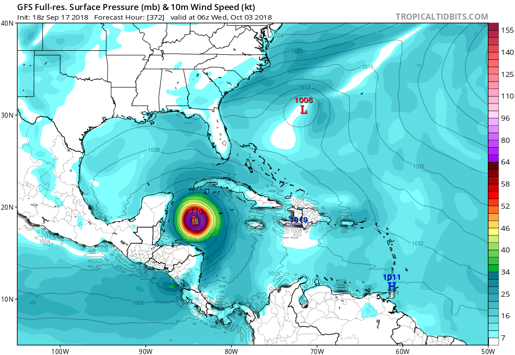
gatorcane wrote:GFS with a major hurricane in the Western Caribbean in the long-range:
https://i.postimg.cc/Kvyj6Qvt/gfs_pres_wind_watl_52.png
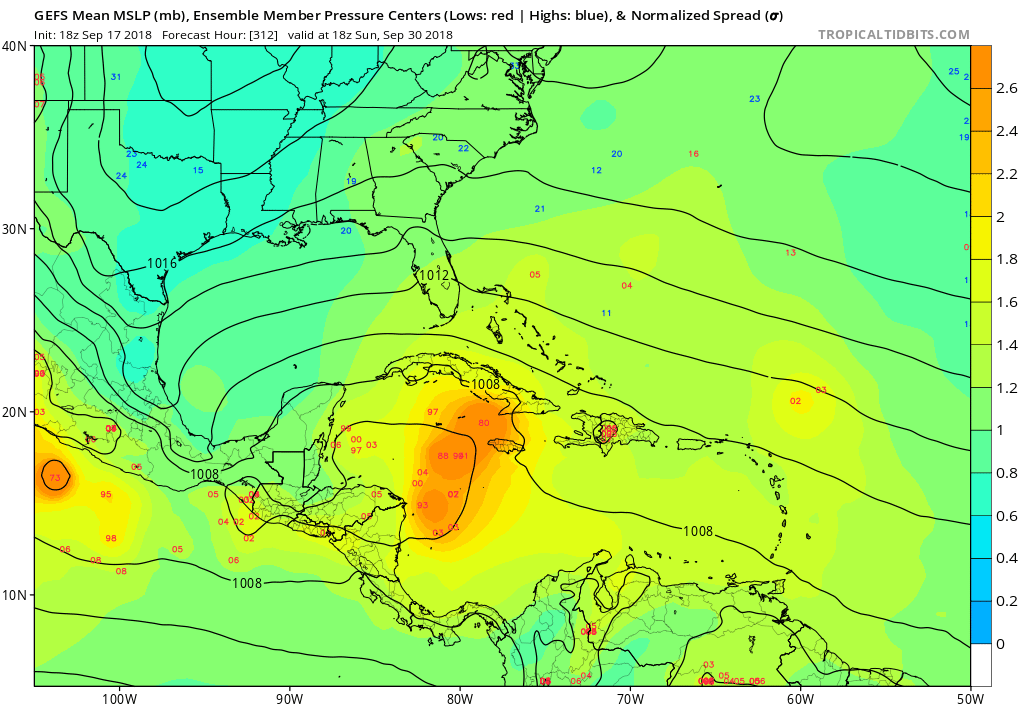
blp wrote:18z GefS very bullish still. Need to keep an eye on this one.

blp wrote:Interesting EPS seems to be favoring C. Carribean and W. Carribean today even a few members reaching Florida. Yesterday it was in the Epac primarily.
https://image.ibb.co/jmXr6e/eps_mslp_rings_carib_348.png
Hurricaneman wrote:gatorcane wrote:GFS with a major hurricane in the Western Caribbean in the long-range:
https://i.postimg.cc/Kvyj6Qvt/gfs_pres_wind_watl_52.png
Its trying to pull a Wilma on the GFS if you account for truncation. If something that strong happens the Western Caribbean is the place to do it unfortunately

Abdullah wrote:Is this to-be West Caribbean Storm going to be related to Ex-Isaac in any way?
gatorcane wrote:Hurricaneman wrote:gatorcane wrote:GFS with a major hurricane in the Western Caribbean in the long-range:
https://i.postimg.cc/Kvyj6Qvt/gfs_pres_wind_watl_52.png
Its trying to pull a Wilma on the GFS if you account for truncation. If something that strong happens the Western Caribbean is the place to do it unfortunately
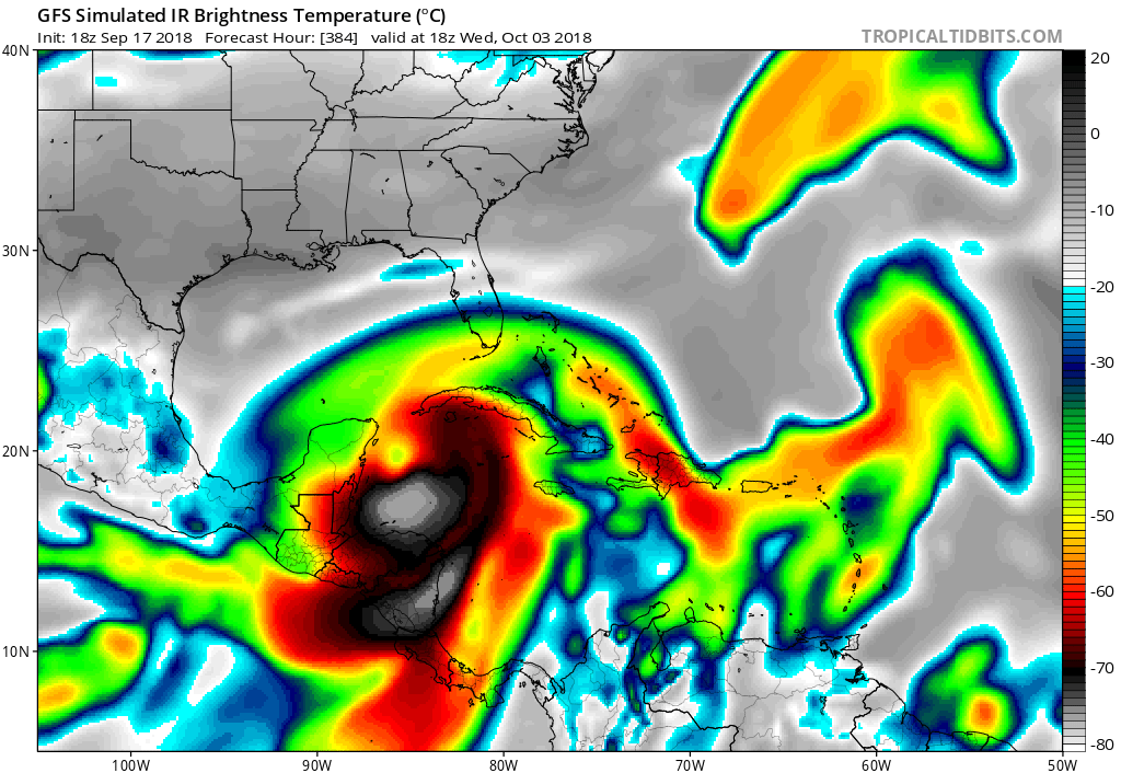
Classic Western Caribbean October monster on simulated IR...thankfully 384 hours out:
But it could be a large storm if it develops, the model expands it as it pulls out of the NW Caribbean:
https://i.postimg.cc/bvkTL36d/gfs_ir_watl_53.png
Users browsing this forum: cycloneye, Dean_175, Google Adsense [Bot], KirbyDude25 and 192 guests


