Eric Webb wrote:cycloneye wrote:Interesting thread on Twitter by Eric Webb.
@webberweather
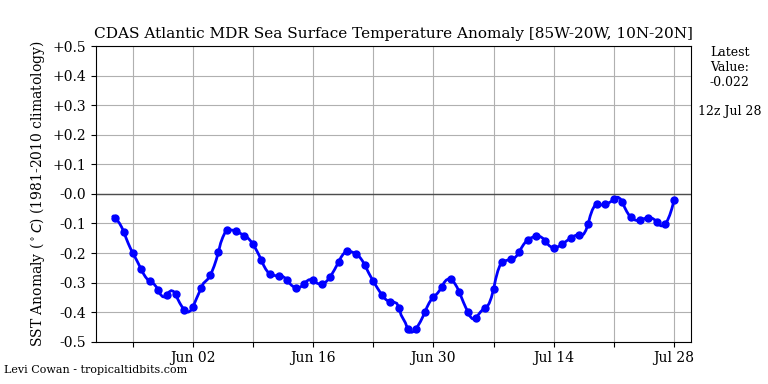
Atlantic MDR may be cold now, but if the EPS monthly verifies w/ a quasi-stationary relaxed trade regime, the Atlantic MDR would warm up a lot going into Aug/Sep, putting some seasonal forecasts in trouble. This also has ENSO implications: a warmer Atlantic resists oncoming Ninos
https://twitter.com/webberweather/status/1015592309109370882
https://twitter.com/webberweather/status/1015592511996215297
@webberweather
We're clearly starting to move away from the pattern that made the Atlantic cold in the first place, just goes to show how difficult seasonal forecasting is. Even if the MDR warms a lot it doesn't automatically favor a very active season however given the subtropics are also warm
https://twitter.com/webberweather/status/1015593879821692928
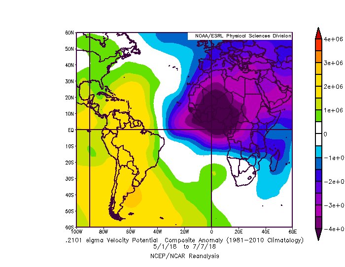
Now keep in mind this is only showing the Equatorial Atlantic, I'm not entirely sure what the trades look like specifically in the 10-20N belt over the tropical Atlantic but this reduction in trades near the Equator has also coincided w/ the Atlantic warming over the past few weeks or so, it seems like we're going to keep this up going forward. It's a much different pattern than the one that led to the -AMO SST configuration over the Atlantic MDR.
I found a 10-20N plot on Michael Ventrice's site, based on the GFS. Looks like an underlying slightly slower than normal trade state, but it looks pretty contaminated by passing tropical waves.