Eastern Gulf of Mexico Area of Interest

This is the general tropical discussion area. Anyone can take their shot at predicting a storms path.

Moderator: S2k Moderators

Forum rules

The posts in this forum are NOT official forecasts and should not be used as such. They are just the opinion of the poster and may or may not be backed by sound meteorological data. They are NOT endorsed by any professional institution or STORM2K. For official information, please refer to products from the National Hurricane Center and National Weather Service.

Help Support Storm2K
Message
Author
jlauderdal
S2K Supporter
S2K Supporter
Posts: 6771
Joined: Wed May 19, 2004 5:46 am
Location: NE Fort Lauderdale
Contact:

Re: Gulf of Mexico: Possible development Sub-Tropical or Tropical Low

#61 Postby jlauderdal » Mon May 14, 2018 4:20 am

USTropics wrote:00z GFS has a bit more consolidation of vorticity this run through 12 hours compared to it's previous runs, similar to the 12z run of the ECMWF at the same time frame:

00z GFS:
Image

12z ECMWF:
Image


2.91 so far, rain was slow to get going as the mid level was very stubborn and didn't precip start until yesterday afternoon, have rotation in the everglades this morning palm beach county//looking for 6 by friday here, today not looking as wet but maybe we can get some breaks to destabilize more than expected
1 likes   

User avatar
northjaxpro
S2K Supporter
S2K Supporter
Posts: 8900
Joined: Mon Sep 27, 2010 11:21 am
Location: Jacksonville, FL

Re: Gulf of Mexico: Possible development Sub-Tropical or Tropical Low

#62 Postby northjaxpro » Mon May 14, 2018 4:32 am

2.a.m. TWD from NHC has position of broad 1012 mb surface Low near 24N and 85.5W in the Southeast Gulf of Mexico.
0 likes   
NEVER, EVER SAY NEVER in the tropics and weather in general, and most importantly, with life itself!!

________________________________________________________________________________________

Fay 2008 Beryl 2012 Debby 2012 Colin 2016 Hermine 2016 Julia 2016 Matthew 2016 Irma 2017 Dorian 2019

BobHarlem
Category 5
Category 5
Posts: 1665
Joined: Thu Oct 20, 2005 6:11 pm

Re: Gulf of Mexico: Possible development Sub-Tropical or Tropical Low

#63 Postby BobHarlem » Mon May 14, 2018 6:15 am

This system is spinning up some Tornadoes in Palm Beach county this morning, and drifting a bit north into Martin county also so it wouldn't surprise me for more of Florida to see the short lived tornadoes common to these types of storms.
0 likes   

User avatar
NDG
S2K Supporter
S2K Supporter
Posts: 14933
Joined: Sun Jul 09, 2006 10:14 pm
Location: Orlando, FL

Re: Gulf of Mexico: Possible development Sub-Tropical or Tropical Low

#64 Postby NDG » Mon May 14, 2018 6:20 am

:uarrow: Yeah, I've been watching some of those cells come onshore showing rotation this morning.
0 likes   

User avatar
TheStormExpert
Category 5
Category 5
Posts: 8487
Age: 30
Joined: Wed Feb 16, 2011 5:38 pm
Location: Palm Beach Gardens, FL

Re: Gulf of Mexico: Possible development Sub-Tropical or Tropical Low

#65 Postby TheStormExpert » Mon May 14, 2018 6:20 am

Overnight Euro run came in weak again but these tornado warned cells here in Palm Beach and Martin counties are a reminder that whether it gets classified or not the effects will be the same.
0 likes   
The following post is NOT an official forecast and should not be used as such. It is just the opinion of the poster and may or may not be backed by sound meteorological data. It is NOT endorsed by storm2k.org.

User avatar
Nimbus
Category 5
Category 5
Posts: 4928
Joined: Mon Jul 19, 2004 10:54 am

Re: Gulf of Mexico: Possible development Sub-Tropical or Tropical Low

#66 Postby Nimbus » Mon May 14, 2018 6:48 am

Radar echoes show some vorticity centered off the west coast near Ft Myers but that is over 20,000 feet. Buoy 42003 is showing surface pressures near 1012.5 with background near pressure of 1015.

My 1 km visual imagery is stuck on January 8th, anyone have a gulf link that updates?
0 likes   

User avatar
TheStormExpert
Category 5
Category 5
Posts: 8487
Age: 30
Joined: Wed Feb 16, 2011 5:38 pm
Location: Palm Beach Gardens, FL

Re: Gulf of Mexico: Possible development Sub-Tropical or Tropical Low

#67 Postby TheStormExpert » Mon May 14, 2018 6:49 am

0 likes   
The following post is NOT an official forecast and should not be used as such. It is just the opinion of the poster and may or may not be backed by sound meteorological data. It is NOT endorsed by storm2k.org.

User avatar
crownweather
S2K Supporter
S2K Supporter
Posts: 575
Age: 49
Joined: Sat Aug 12, 2006 9:21 am
Location: Sturbridge, Massachusetts
Contact:

Re: Gulf of Mexico: Possible development Sub-Tropical or Tropical Low

#68 Postby crownweather » Mon May 14, 2018 8:22 am

Nimbus wrote:Radar echoes show some vorticity centered off the west coast near Ft Myers but that is over 20,000 feet. Buoy 42003 is showing surface pressures near 1012.5 with background near pressure of 1015.

My 1 km visual imagery is stuck on January 8th, anyone have a gulf link that updates?


NOAA/NESDIS is the "replacement" for SSD satellite imagery. Link: https://www.star.nesdis.noaa.gov/GOES/index.php. They currently do have a "floater" on the Gulf system at https://www.star.nesdis.noaa.gov/GOES/GOES16_MESO.php?lat=26N&lon=85W.

Another site that I've used a lot for satellite imagery lately is Weathernerds. Link is http://www.weathernerds.org/satellite/.
4 likes   
Rob Lightbown
Crown Weather Services
https://crownweather.com

User avatar
chaser1
S2K Supporter
S2K Supporter
Posts: 4680
Age: 63
Joined: Sat Oct 15, 2005 5:59 pm
Location: Longwood, Fl

Re: Gulf of Mexico: Possible development Sub-Tropical or Tropical Low

#69 Postby chaser1 » Mon May 14, 2018 9:02 am

crownweather wrote:
Nimbus wrote:Radar echoes show some vorticity centered off the west coast near Ft Myers but that is over 20,000 feet. Buoy 42003 is showing surface pressures near 1012.5 with background near pressure of 1015.

My 1 km visual imagery is stuck on January 8th, anyone have a gulf link that updates?


NOAA/NESDIS is the "replacement" for SSD satellite imagery. Link: https://www.star.nesdis.noaa.gov/GOES/index.php. They currently do have a "floater" on the Gulf system at https://www.star.nesdis.noaa.gov/GOES/GOES16_MESO.php?lat=26N&lon=85W.

Another site that I've used a lot for satellite imagery lately is Weathernerds. Link is http://www.weathernerds.org/satellite/.


Hey Rob, I like that site link from WeatherNerds! One I've used quite a bit is the Nasa site (https://weather.msfc.nasa.gov/GOES/). It's a .5KM that's interactive, and I find it the fastest to update. Was showing latest image at 13:52 while other sites were at 13:30 or earlier (not that a few minutes really matter that much lol).
0 likes   
Personal Forecast Disclaimer:
The posts in this forum are NOT official forecast and should not be used as such. They are just the opinion of the poster and may or may not be backed by sound meteorological data. They are NOT endorsed by any professional institution or storm2k.org. For official information, please refer to the NHC and NWS products.


Dean4Storms
S2K Supporter
S2K Supporter
Posts: 6355
Age: 61
Joined: Sun Aug 31, 2003 1:01 pm
Location: Miramar Bch. FL

Re: Gulf of Mexico: Possible development Sub-Tropical or Tropical Low

#70 Postby Dean4Storms » Mon May 14, 2018 9:17 am

1 likes   

User avatar
cycloneye
Admin
Admin
Posts: 139025
Age: 67
Joined: Thu Oct 10, 2002 10:54 am
Location: San Juan, Puerto Rico

Re: Gulf of Mexico: Possible development Sub-Tropical or Tropical Low

#71 Postby cycloneye » Mon May 14, 2018 10:32 am

For the record as it was not posted.

Special Tropical Weather Outlook
NWS National Hurricane Center Miami FL
935 AM EDT Mon May 14 2018

For the North Atlantic...Caribbean Sea and the Gulf of Mexico:

1. A large area of cloudiness, showers, and thunderstorms extending
from the eastern Gulf of Mexico across much of the Florida Peninsula
is associated with a broad surface low pressure area interacting
with an upper-level low. This system could acquire some subtropical
or tropical characteristics while it moves slowly northward across
the eastern Gulf of Mexico during the next few days. Regardless of
subtropical or tropical cyclone formation, this system will enhance
rainfall across portions of Florida and the northeastern Gulf Coast
during the next few days. For more information on this system,
please see products issued by your local weather office. The next
Special Tropical Weather Outlook on this system will be issued by 4
PM EDT today.
* Formation chance through 48 hours...low...30 percent.
* Formation chance through 5 days...medium...40 percent.

Forecaster Pasch
1 likes   
Visit the Caribbean-Central America Weather Thread where you can find at first post web cams,radars
and observations from Caribbean basin members Click Here

User avatar
tropicwatch
Category 5
Category 5
Posts: 3205
Age: 60
Joined: Sat Jun 02, 2007 10:01 am
Location: Panama City Florida
Contact:

Re: Gulf of Mexico: Possible development Sub-Tropical or Tropical Low

#72 Postby tropicwatch » Mon May 14, 2018 10:35 am

I like the geo true color. The circulation is definitely more evident this morning.

Image
3 likes   
Tropicwatch


Agnes 72', Eloise 75, Elena 85', Kate 85', Charley 86', Florence 88', Beryl 94', Dean 95', Erin 95', Opal 95', Earl 98', Georges 98', Ivan 2004', Arlene 2005', Dennis 2005', Ida 2009' Debby 2012' Irma 2017' Michael 2018'

OuterBanker
S2K Supporter
S2K Supporter
Posts: 1704
Joined: Wed Feb 26, 2003 10:53 am
Location: Nags Head, NC
Contact:

Re: Gulf of Mexico: Possible development Sub-Tropical or Tropical Low

#73 Postby OuterBanker » Mon May 14, 2018 10:44 am

Typical amorphous early season right weighted storm. No worries except for the rain. If this had formed off the Fl east coast the sun would shine everywhere. But, unfortunately it looks to track up the Appalachians which means everything east of the mountains this week will get soaked. Of concern will be the pattern. It looks like we will have a prolonged wet period here in the southeast.
Of lighter fare is the GFS 360. The horrorcane (written by Wes Creaven and Stephen Speilberg) is still there. And still at 360 three days later, it must have entered some kind of time warp. Great fun for wishcasters. 8-)
0 likes   

Sanibel
Category 5
Category 5
Posts: 10348
Joined: Mon Aug 30, 2004 11:06 pm
Location: Offshore SW Florida

Re: Gulf of Mexico: Possible development Sub-Tropical or Tropical Low

#74 Postby Sanibel » Mon May 14, 2018 10:45 am

Cloudy here and raining...3rd day in a row like something is forming...
0 likes   

User avatar
tropicwatch
Category 5
Category 5
Posts: 3205
Age: 60
Joined: Sat Jun 02, 2007 10:01 am
Location: Panama City Florida
Contact:

Gulf of Mexico: Possible development Sub-Tropical or Tropical Low -Recon

#75 Postby tropicwatch » Mon May 14, 2018 10:54 am

000
NOUS42 KNHC 141525
REPRPD
WEATHER RECONNAISSANCE FLIGHTS
CARCAH, NATIONAL HURRICANE CENTER, MIAMI, FL.
1130 AM EDT MON 14 MAY 2018
SUBJECT: TROPICAL CYCLONE PLAN OF THE DAY (TCPOD)
VALID 15/1100Z TO 16/1100Z MAY 2018
TCPOD NUMBER.....18-001

I. ATLANTIC REQUIREMENTS
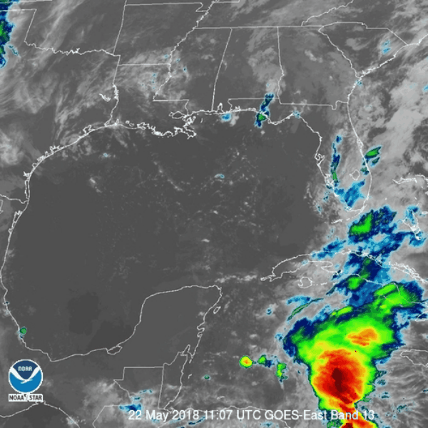
1. SUSPECT SYSTEM (NE GULF OF MEXICO)
FLIGHT ONE - TEAL 71 FLIGHT TWO - TEAL 72
A. 15/1800Z A. 16/1130Z
B. AFXXX 01AAA INVEST B. AFXXX 0201A CYCLONE
C. 15/1600Z C. 16/0900Z
D. 28.0N 85.0W D. 29.0N 87.0W
E. 15/1730Z TO 15/2200Z E. 16/1100Z TO 16/1430Z
F. SFC TO 10,000 FT F. SFC TO 10,000 FT
G. RESOURCES PERMITTING G. RESOURCES PERMITTING

2. OUTLOOK FOR SUCCEEDING DAY: CONTINUE 12-HRLY FIXES IF SYSTEM
DEVELOPS AND REMAINS A THREAT, RESOURCES PERMITTING.
3. REMARKS: THIS IS A SPECIAL TCPOD. DAILY TCPODS WILL
CONTINUE TO BE ISSUED WHILE AIRCRAFT RECONNAISSANCE MISSIONS
ARE BEING CONSIDERED OR TASKED FOR THIS SYSTEM.

II. PACIFIC REQUIREMENTS
1. NEGATIVE RECONNAISSANCE REQUIREMENTS.
2. OUTLOOK FOR SUCCEEDING DAY.....NEGATIVE.

$$
SEF

NNNN
1 likes   
Tropicwatch


Agnes 72', Eloise 75, Elena 85', Kate 85', Charley 86', Florence 88', Beryl 94', Dean 95', Erin 95', Opal 95', Earl 98', Georges 98', Ivan 2004', Arlene 2005', Dennis 2005', Ida 2009' Debby 2012' Irma 2017' Michael 2018'

User avatar
cycloneye
Admin
Admin
Posts: 139025
Age: 67
Joined: Thu Oct 10, 2002 10:54 am
Location: San Juan, Puerto Rico

Re: Gulf of Mexico: Possible development Sub-Tropical or Tropical Low

#76 Postby cycloneye » Mon May 14, 2018 10:56 am

@pppapin
15z 14 May update: Radar suggests a new llvl vortex may be developing from the overnight convection offshore Tampa. In the meantime, plenty of heavy rainfall over #Florida today associated w/ the disturbance over the Gulf of Mexico.


 https://twitter.com/pppapin/status/996052434110709760


1 likes   
Visit the Caribbean-Central America Weather Thread where you can find at first post web cams,radars
and observations from Caribbean basin members Click Here

psyclone
S2K Supporter
S2K Supporter
Posts: 4487
Joined: Wed Aug 24, 2005 9:04 pm
Location: palm harbor fl

Re: Gulf of Mexico: Possible development Sub-Tropical or Tropical Low

#77 Postby psyclone » Mon May 14, 2018 11:00 am

I was out at the beach yesterday (Clearwater area) and one thing I noticed is just how cool the water felt..certainly a change from recent years. we are usually 80 or so by mid May. I checked some obs when I got home and sure enough we're lagging at this point with upper 70's...even a 75 reading at Venice....even the Keys were still under 80. This is likely the benefit of a nice Spring with breezy, low dewpoint weather.
0 likes   

User avatar
cycloneye
Admin
Admin
Posts: 139025
Age: 67
Joined: Thu Oct 10, 2002 10:54 am
Location: San Juan, Puerto Rico

Re: Gulf of Mexico: Possible development Sub-Tropical or Tropical Low -Recon

#78 Postby cycloneye » Mon May 14, 2018 11:02 am

Moved to this forum as it will be part of the Invest 90L threads.
1 likes   
Visit the Caribbean-Central America Weather Thread where you can find at first post web cams,radars
and observations from Caribbean basin members Click Here

User avatar
cycloneye
Admin
Admin
Posts: 139025
Age: 67
Joined: Thu Oct 10, 2002 10:54 am
Location: San Juan, Puerto Rico

Re: Gulf of Mexico: Possible development Sub-Tropical or Tropical Low

#79 Postby cycloneye » Mon May 14, 2018 11:08 am

panamatropicwatch,moved the recon thread to Active Storms forum as it will be part of the 90L threads.
1 likes   
Visit the Caribbean-Central America Weather Thread where you can find at first post web cams,radars
and observations from Caribbean basin members Click Here

User avatar
gatorcane
S2K Supporter
S2K Supporter
Posts: 23499
Age: 46
Joined: Sun Mar 13, 2005 3:54 pm
Location: Boca Raton, FL

Re: Gulf of Mexico: Possible development Sub-Tropical or Tropical Low

#80 Postby gatorcane » Mon May 14, 2018 11:16 am

CMC coming in more bullish down to 1000MB before landfall:

Image
0 likes   


Return to “Talkin' Tropics”

Who is online

Users browsing this forum: USTropics and 108 guests