Edit: Changed title to Western Caribbean as the focus will be there as the models are showing.

Moderator: S2k Moderators


boca wrote:https://www.star.nesdis.noaa.gov/GOES/GOES16_sector_band.php?sector=taw&band=13&length=24
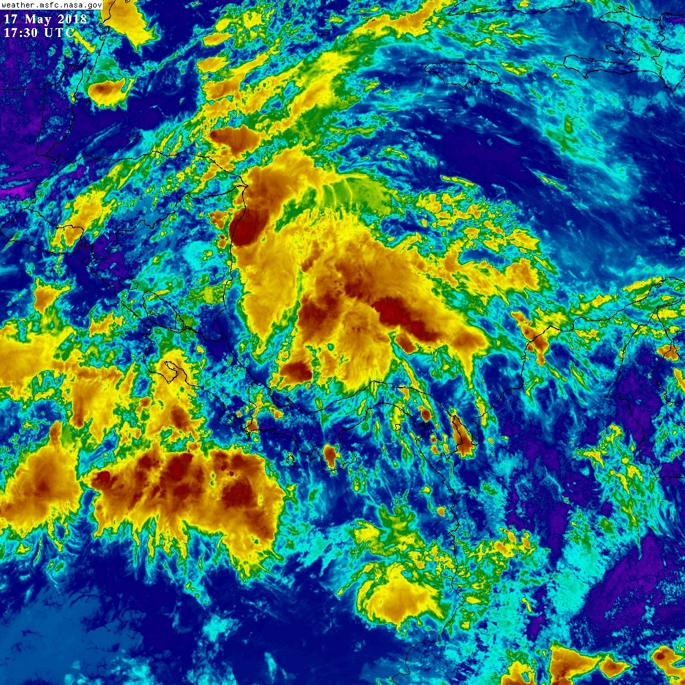
It look hostile down there at the moment.


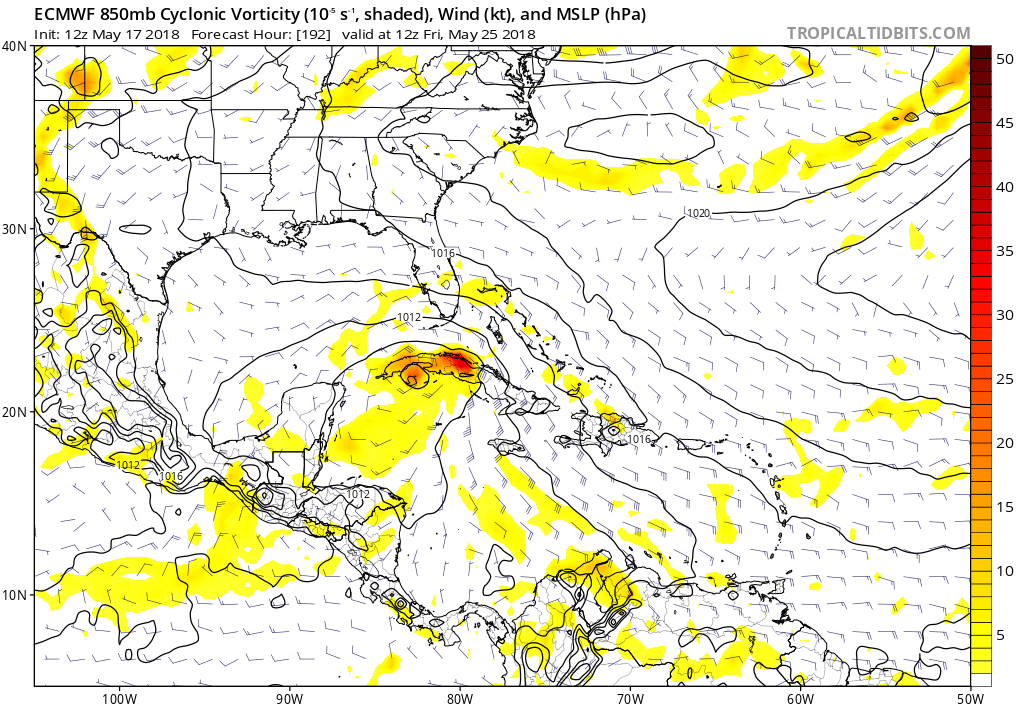
HurricaneFrances04 wrote:I don't see anything impressive on the GFS. Looks like a typical early season disorganized tropical storm. Nothing to get excited about.


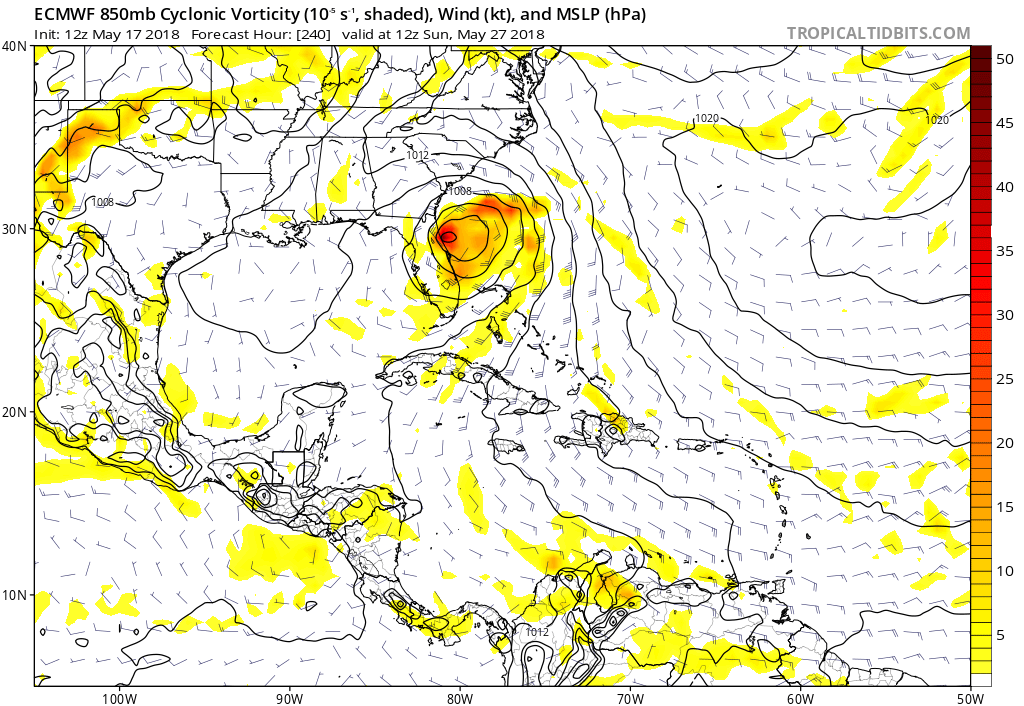
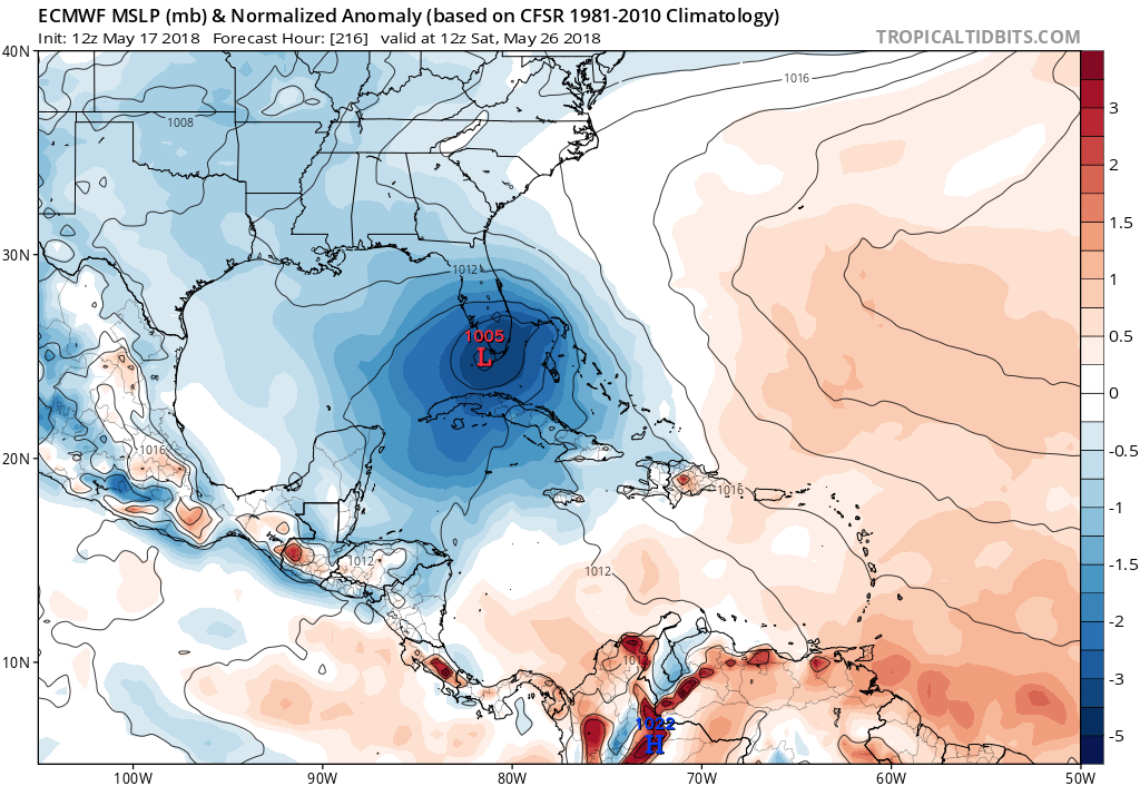
Alyono wrote:EC does not exactly look all that tropical
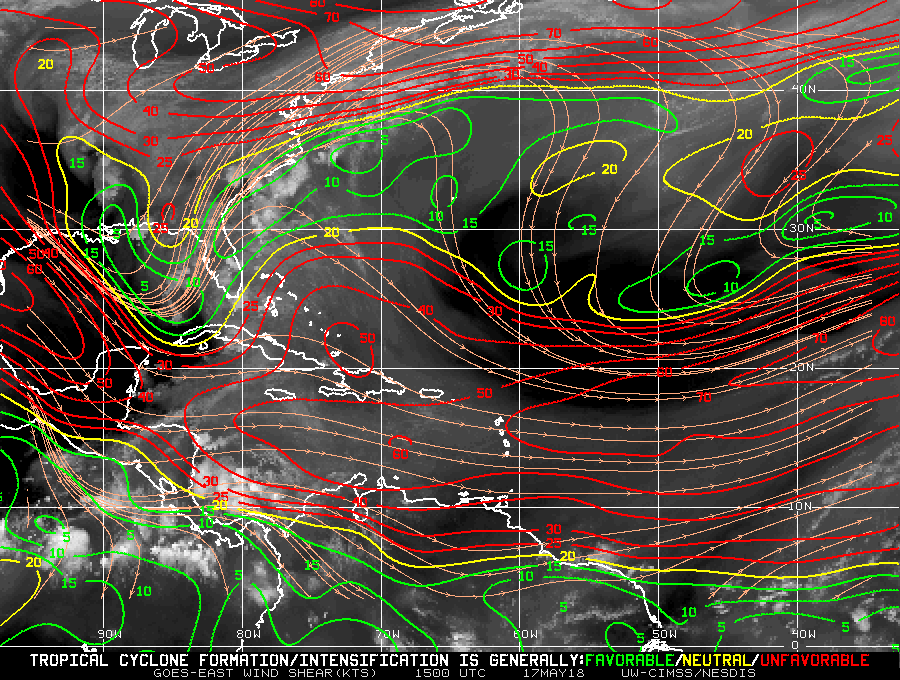
stormlover2013 wrote:only thing I am looking at is the upper level pattern and how strong the ridge is and etc...